Stanley Carrs
Wood, Forest in Norfolk South Norfolk
England
Stanley Carrs
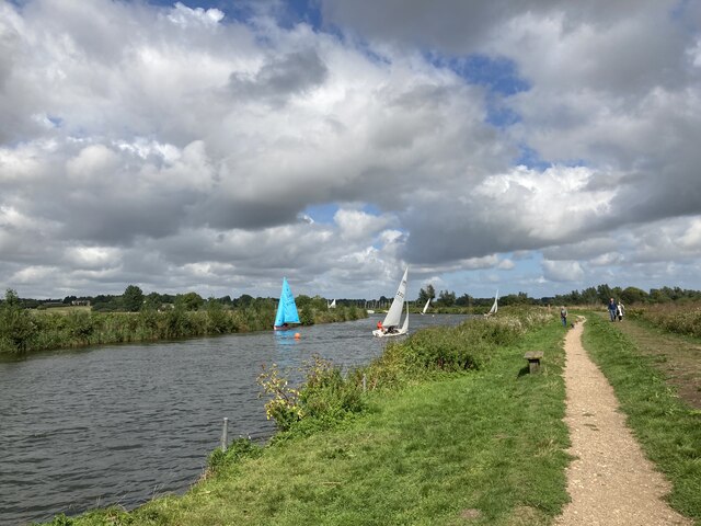
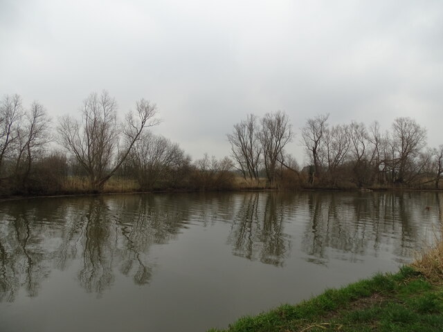
Stanley Carrs, Norfolk, also known as Wood or Forest, is a picturesque area located in the eastern part of England. It is nestled within the county of Norfolk, renowned for its natural beauty and tranquil surroundings. Stanley Carrs is a haven for nature enthusiasts, offering a diverse range of woodlands and forests that cover a considerable expanse of the region.
The woodlands of Stanley Carrs showcase a rich variety of flora and fauna, with ancient trees, wildflowers, and moss-covered forest floors creating a magical atmosphere. The area is home to a wide array of wildlife, including deer, squirrels, owls, and various bird species. It provides a sanctuary for these creatures, offering a peaceful habitat away from the hustle and bustle of urban life.
Visitors to Stanley Carrs can explore numerous walking trails and hiking routes that wind through the woodlands, allowing them to immerse themselves in the natural beauty of the area. These paths often lead to hidden clearings and scenic viewpoints, where one can marvel at panoramic vistas of the forested landscape.
Stanley Carrs is a popular destination for outdoor activities such as camping, picnicking, and birdwatching. The peaceful ambiance and untouched wilderness make it an ideal spot for those seeking solace in nature. Additionally, the woodlands provide valuable educational opportunities, as they serve as living classrooms for school groups and nature enthusiasts interested in learning about the local ecosystem.
In summary, Stanley Carrs, Norfolk, is a magnificent wood and forest area that offers a captivating experience for visitors. With its enchanting woodlands, diverse wildlife, and serene atmosphere, it is a true gem for nature lovers and those looking to escape the noise of city life.
If you have any feedback on the listing, please let us know in the comments section below.
Stanley Carrs Images
Images are sourced within 2km of 52.47936/1.5855595 or Grid Reference TM4392. Thanks to Geograph Open Source API. All images are credited.


Stanley Carrs is located at Grid Ref: TM4392 (Lat: 52.47936, Lng: 1.5855595)
Administrative County: Norfolk
District: South Norfolk
Police Authority: Norfolk
What 3 Words
///casual.flush.whimpered. Near Beccles, Suffolk
Nearby Locations
Related Wikis

Stanley and Alder Carrs, Aldeby
Stanley and Alder Carrs, Aldeby is a 42.7-hectare (106-acre) biological Site of Special Scientific Interest east of Gillingham in Norfolk. It is part of...

Aldeby
Aldeby is a village and civil parish in the English county of Norfolk. It is bounded to the south by the River Waveney, on the other side of which is Suffolk...

Toft Monks
Toft Monks is a village and parish in Norfolk, England. It is located on the border of Norfolk and Suffolk about eleven miles southwest of Great Yarmouth...
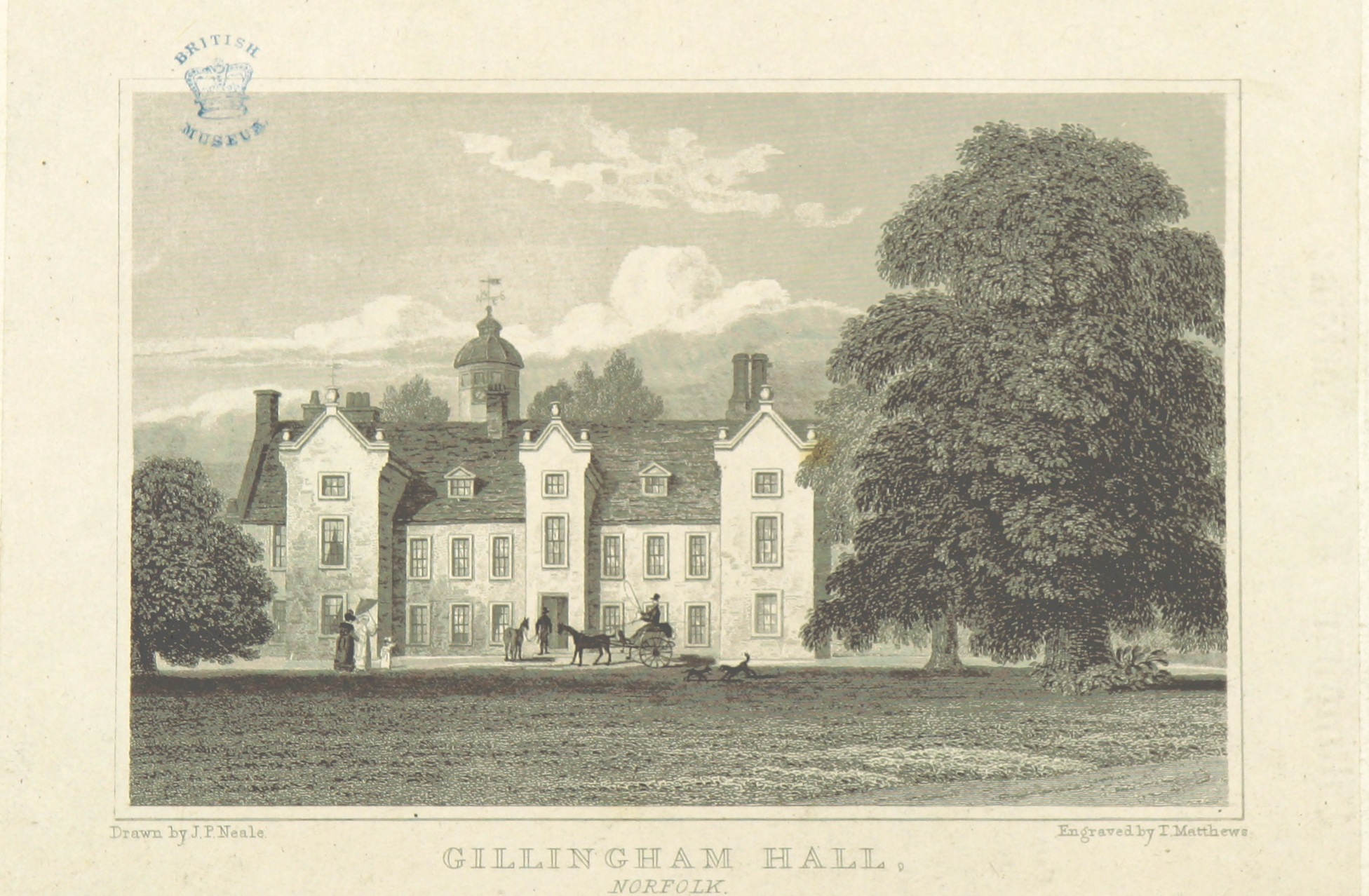
Gillingham Hall
Gillingham Hall is a Jacobean manor house in the village of Gillingham, Norfolk, England. It is a Grade II* Listed Building.The house has 10-bedrooms and...
Nearby Amenities
Located within 500m of 52.47936,1.5855595Have you been to Stanley Carrs?
Leave your review of Stanley Carrs below (or comments, questions and feedback).