Ash Plantation

Wood, Forest in Suffolk East Suffolk

England

Ash Plantation

Old barn on a sunny spring day An old farm barn, reflected in the pond on a bright spring morning.
Old barn on a sunny spring day Credit: Tim Royall

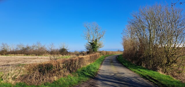
Ash Plantation is a picturesque woodland located in Suffolk, England. Covering an area of approximately 100 acres, it is a popular destination for nature enthusiasts and outdoor adventurers alike. The plantation is primarily made up of ash trees, which give the woodland its name.

The trees in Ash Plantation are tall and majestic, providing a dense canopy that creates a serene and shaded atmosphere. The forest floor is covered in a thick carpet of moss and ferns, adding to the enchanting ambiance of the woodland. The plantation boasts a diverse ecosystem, supporting a wide range of flora and fauna.

Visitors to Ash Plantation can enjoy leisurely walks along the well-maintained trails that wind through the woodland. These trails offer stunning views of the surrounding countryside, with glimpses of rolling hills and meandering streams. The plantation is also home to several species of birds, making it a paradise for birdwatchers.

In addition to its natural beauty, Ash Plantation offers various recreational activities. There are designated picnic areas where visitors can enjoy a meal amidst the tranquillity of the woodland. The plantation also features a children's playground, providing entertainment for younger visitors.

Ash Plantation is open to the public year-round, allowing visitors to experience the changing seasons and the different colors and scents that come with each one. It is a peaceful haven, offering an escape from the hustle and bustle of everyday life. Whether it be for a leisurely stroll, a family picnic, or a birdwatching expedition, Ash Plantation is a must-visit destination for anyone seeking a connection with nature in Suffolk.

If you have any feedback on the listing, please let us know in the comments section below.

Ash Plantation Images

Images are sourced within 2km of 52.298318/1.554339 or Grid Reference TM4272. Thanks to Geograph Open Source API. All images are credited.

Old barn on a sunny spring day An old farm barn, reflected in the pond on a bright spring morning.
Old barn on a sunny spring day
An old farm barn, reflected in the pond on a bright spring morning.
Thorington, St Peter's church The benchmark is cut into a left cornerstone of the church porch and access.
Thorington, St Peter's church
The benchmark is cut into a left cornerstone of the church porch and access.
Thorington, St Peter's church There is a benchmark cut into a left cornerstone of the church porch and access.
Thorington, St Peter's church
There is a benchmark cut into a left cornerstone of the church porch and access.
St. Peter's Church, Thorington <span class="nowrap"><a title="https://historicengland.org.uk/listing/the-list/list-entry/1030681?section=official-list-entry" rel="nofollow ugc noopener" href="https://historicengland.org.uk/listing/the-list/list-entry/1030681?section=official-list-entry">Link</a><img style="margin-left:2px;" alt="External link" title="External link - shift click to open in new window" src="https://s1.geograph.org.uk/img/external.png" width="10" height="10"/></span>
St. Peter's Church, Thorington
View south-west off the A144
View northwards near Hill Farm
Lane north of Darsham
Lane east of Lymball's Farm
Footbridge And Path Footbridge and footpath near to Thorington, Suffolk.
Footbridge And Path
Footbridge and footpath near to Thorington, Suffolk.
Footpath Guide Post A choice of ways, footpath guide post near to Thorington, Suffolk.
Footpath Guide Post
A choice of ways, footpath guide post near to Thorington, Suffolk.
Pond And Sunshine Small pond in a field near to Thorington, Suffolk.
Pond And Sunshine
Small pond in a field near to Thorington, Suffolk.
Footpath Footpath and footpath sign near to Thorington, Suffolk.
Footpath
Footpath and footpath sign near to Thorington, Suffolk.
Derelict Cottages Derelict cottages near to Thorington, Suffolk.
Derelict Cottages
Derelict cottages near to Thorington, Suffolk.
Field And Path Looking north with footpath and field near to Thorington, Suffolk.
Field And Path
Looking north with footpath and field near to Thorington, Suffolk.
St Peter Thorington The village church of St Peter, Thorington, Suffolk for info on the church see <span class="nowrap"><a title="http://www.suffolkchurches.co.uk/thorington.htm" rel="nofollow ugc noopener" href="http://www.suffolkchurches.co.uk/thorington.htm">Link</a><img style="margin-left:2px;" alt="External link" title="External link - shift click to open in new window" src="https://s1.geograph.org.uk/img/external.png" width="10" height="10"/></span>. For other views of the church see <a title="https://www.geograph.org.uk/photo/4754036" href="https://www.geograph.org.uk/photo/4754036">Link</a> <a title="https://www.geograph.org.uk/photo/4754041" href="https://www.geograph.org.uk/photo/4754041">Link</a> <a title="https://www.geograph.org.uk/photo/4754043" href="https://www.geograph.org.uk/photo/4754043">Link</a>
St Peter Thorington
The village church of St Peter, Thorington, Suffolk for info on the church see LinkExternal link. For other views of the church see Link Link Link
View From The Porch View from the porch of St Peter, Thorington, Suffolk.  For other views of the church see <a title="https://www.geograph.org.uk/photo/4754031" href="https://www.geograph.org.uk/photo/4754031">Link</a>  <a title="https://www.geograph.org.uk/photo/4754041" href="https://www.geograph.org.uk/photo/4754041">Link</a> <a title="https://www.geograph.org.uk/photo/4754043" href="https://www.geograph.org.uk/photo/4754043">Link</a>
View From The Porch
View from the porch of St Peter, Thorington, Suffolk. For other views of the church see Link Link Link
Morning Sun Pulpit and sunlight at St Peter, Thorington, Suffolk.  For other views of the church see <a title="https://www.geograph.org.uk/photo/4754031" href="https://www.geograph.org.uk/photo/4754031">Link</a> <a title="https://www.geograph.org.uk/photo/4754036" href="https://www.geograph.org.uk/photo/4754036">Link</a>  <a title="https://www.geograph.org.uk/photo/4754043" href="https://www.geograph.org.uk/photo/4754043">Link</a>
Morning Sun
Pulpit and sunlight at St Peter, Thorington, Suffolk. For other views of the church see Link Link Link
War Memorial War memorial in the village church of St Peter, Thorington, Suffolk.  For other views of the church see <a title="https://www.geograph.org.uk/photo/4754031" href="https://www.geograph.org.uk/photo/4754031">Link</a> <a title="https://www.geograph.org.uk/photo/4754036" href="https://www.geograph.org.uk/photo/4754036">Link</a> <a title="https://www.geograph.org.uk/photo/4754041" href="https://www.geograph.org.uk/photo/4754041">Link</a> <a title="https://www.geograph.org.uk/photo/4754031" href="https://www.geograph.org.uk/photo/4754031">Link</a> <a title="https://www.geograph.org.uk/photo/4754036" href="https://www.geograph.org.uk/photo/4754036">Link</a> <a title="https://www.geograph.org.uk/photo/4754041" href="https://www.geograph.org.uk/photo/4754041">Link</a>
War Memorial
War memorial in the village church of St Peter, Thorington, Suffolk. For other views of the church see Link Link Link Link Link Link
Show me another place!

Ash Plantation is located at Grid Ref: TM4272 (Lat: 52.298318, Lng: 1.554339)

Administrative County: Suffolk

District: East Suffolk

Police Authority: Suffolk

What 3 Words

///aspect.outlooks.unguarded. Near Halesworth, Suffolk

Related Wikis

Church Farm Marshes

Church Farm Marshes is a 56 hectare nature reserve in Thorington in Suffolk. It is managed by the Suffolk Wildlife Trust. This site has areas of marshland...

Thorington

Thorington is a village and a civil parish in the hundred of Blything, in the East Suffolk district of the English county of Suffolk. It is located around...

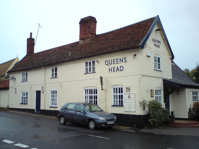
Queen's Head, Bramfield

The Queen's Head is a pub in Bramfield, Suffolk, England. The pub was formerly known as the "Skeltons". It is a Grade II listed building, which dates back...

Darsham

Darsham is a village in Suffolk, England. It is located approximately 4 miles (6 km) north east of Saxmundham. The village is bypassed by the A12 and...

Have you been to Ash Plantation?

Leave your review of Ash Plantation below (or comments, questions and feedback).