Broom Covert

Wood, Forest in Suffolk East Suffolk

England

Broom Covert

Gedgrave Broom pit A pit showing exposure of Red Crag and Corallean Crag which explains the colour of many a local farm and forest track.
Gedgrave Broom pit Credit: Simon Leatherdale

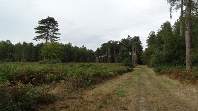
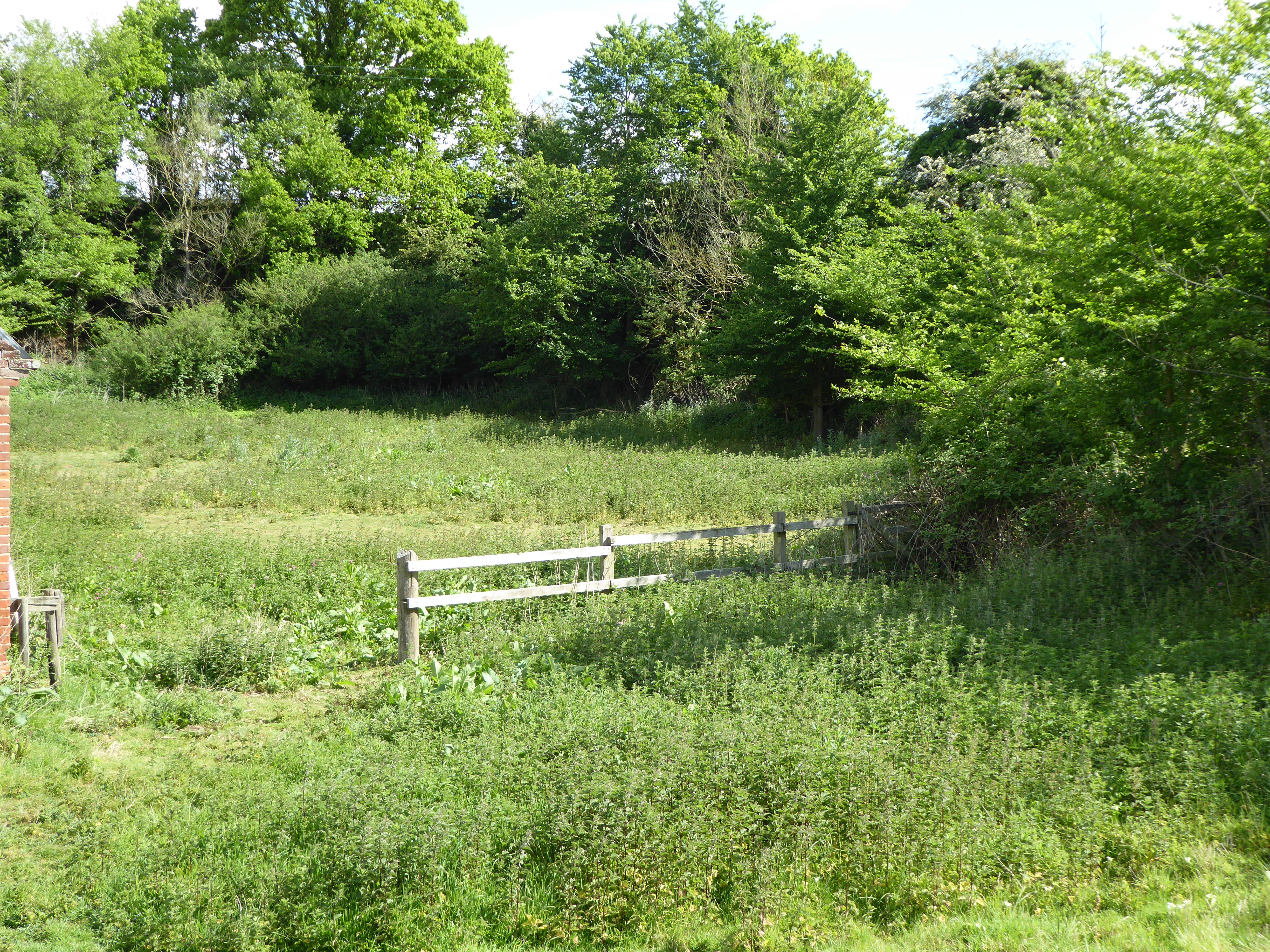
Broom Covert is a picturesque wood located in the county of Suffolk, England. Situated near the village of Broom, it covers an area of approximately 20 acres and is part of a larger forested area in the region. The wood is characterized by its dense canopy of predominantly oak trees, interspersed with other native species such as birch, beech, and ash, creating a rich and diverse ecosystem.

The forest floor of Broom Covert is adorned with an array of wildflowers, including bluebells, primroses, and wood anemones, which create a vibrant carpet of color during the spring months. It is also home to various species of fungi, mosses, and lichens, adding to its ecological diversity.

The wood is a haven for wildlife, providing habitat for a wide range of animals. Visitors may be lucky enough to spot deer, foxes, badgers, and a variety of bird species, including woodpeckers, owls, and thrushes. The tranquil environment and abundance of natural resources make Broom Covert an ideal location for both resident and migratory birds, attracting birdwatchers throughout the year.

Broom Covert is a popular destination for nature enthusiasts and walkers, who can explore the woodland via a network of well-maintained footpaths. The wood offers a peaceful and serene setting, allowing visitors to immerse themselves in the beauty of nature and enjoy the tranquility of their surroundings.

Overall, Broom Covert is a charming woodland retreat, offering a glimpse into the natural wonders of Suffolk's countryside and providing a sanctuary for both flora and fauna.

If you have any feedback on the listing, please let us know in the comments section below.

Broom Covert Images

Images are sourced within 2km of 52.1112/1.5006066 or Grid Reference TM3951. Thanks to Geograph Open Source API. All images are credited.

Gedgrave Broom pit A pit showing exposure of Red Crag and Corallean Crag which explains the colour of many a local farm and forest track.
Gedgrave Broom pit
A pit showing exposure of Red Crag and Corallean Crag which explains the colour of many a local farm and forest track.
Chequers, Sudbourne This imposing house stands on the Snape - Orford road south of Sudbourne village.
Chequers, Sudbourne
This imposing house stands on the Snape - Orford road south of Sudbourne village.
Sudbourne Park The area around Sudbourne was used for tank training in the second world war, with the officers housed in Sudbourne Hall and the soldiers in the park under canvas.
Sudbourne Park
The area around Sudbourne was used for tank training in the second world war, with the officers housed in Sudbourne Hall and the soldiers in the park under canvas.
Housing estate!!! Housing estate!!! for pigs near Orford Suffolk.
Housing estate!!!
Housing estate!!! for pigs near Orford Suffolk.
Smoky House
Smoky House
Zero contour This area of farmland and forestry is on the "0" contour, consequently vulnerable if the sea walls breach.
Zero contour
This area of farmland and forestry is on the "0" contour, consequently vulnerable if the sea walls breach.
Looking towards Sudbourne church from Five Cross Ways
The Lodge at Sudbourne Hall gates on the B1084
Planting potatoes at Sudbourne
Sudbourne Hall, Sudbourne, Suffolk
St Peter's Church The low sun of a winter afternoon brings out the warm colour of the unbuttressed tower, one of only two in England built of coralline crag - the other is at nearby Wantisden in <a href="https://www.geograph.org.uk/gridref/TM3653">TM3653</a>.  The fossiliferous crag, quarried in the pit just north of the church, was laid down in narrow beds when Britain was still joined to the European continent and Chillesford lay on a tributary of the Rhine. <span class="nowrap"><a title="http://www.suffolkchurches.co.uk/chillesford.html" rel="nofollow ugc noopener" href="http://www.suffolkchurches.co.uk/chillesford.html">Link</a><img style="margin-left:2px;" alt="External link" title="External link - shift click to open in new window" src="https://s1.geograph.org.uk/img/external.png" width="10" height="10"/></span>
St Peter's Church
The low sun of a winter afternoon brings out the warm colour of the unbuttressed tower, one of only two in England built of coralline crag - the other is at nearby Wantisden in TM3653. The fossiliferous crag, quarried in the pit just north of the church, was laid down in narrow beds when Britain was still joined to the European continent and Chillesford lay on a tributary of the Rhine. LinkExternal link
Interior of St Peter's Church The very narrow chancel arch, originally Norman but altered in the 15th century and again  by Victorian restorers, is flanked by curious cusped openings and boards with the Lord's Prayer, Creed and Commandments, and surmounted by the miniature royal arms of Victoria in plaster.  The modern east window <a title="https://www.geograph.org.uk/photo/4814054" href="https://www.geograph.org.uk/photo/4814054">Link</a> is the most striking feature of the chancel, with the matching altar frontal by Isobel Clover beneath. <span class="nowrap"><a title="http://www.suffolkchurches.co.uk/chillesford.html" rel="nofollow ugc noopener" href="http://www.suffolkchurches.co.uk/chillesford.html">Link</a><img style="margin-left:2px;" alt="External link" title="External link - shift click to open in new window" src="https://s1.geograph.org.uk/img/external.png" width="10" height="10"/></span>
Interior of St Peter's Church
The very narrow chancel arch, originally Norman but altered in the 15th century and again by Victorian restorers, is flanked by curious cusped openings and boards with the Lord's Prayer, Creed and Commandments, and surmounted by the miniature royal arms of Victoria in plaster. The modern east window Link is the most striking feature of the chancel, with the matching altar frontal by Isobel Clover beneath. LinkExternal link
Christ in Majesty The modern east window of St Peter's Church was designed in 1990 by Surinder Warboys of Mellis to replace its predecessor by Charles Alexander Gibbs dating from 1865,  described by Pevsner as "terrible" and destroyed (apparently by a deranged axeman) in 1987. Some of the tracery from the old window was however reused in the north side of the nave.
Christ in Majesty
The modern east window of St Peter's Church was designed in 1990 by Surinder Warboys of Mellis to replace its predecessor by Charles Alexander Gibbs dating from 1865, described by Pevsner as "terrible" and destroyed (apparently by a deranged axeman) in 1987. Some of the tracery from the old window was however reused in the north side of the nave.
It is I - be not afraid 19th-century stained glass in the west window of St Peter's Church, showing Christ calming the tempest. "AMDG et in memoriam Charles Grayson Pickthall, Ellen Louisa Pickthall".
It is I - be not afraid
19th-century stained glass in the west window of St Peter's Church, showing Christ calming the tempest. "AMDG et in memoriam Charles Grayson Pickthall, Ellen Louisa Pickthall".
Butley Mills next to Minor Road Butley river runs behind the Mill.
Butley Mills next to Minor Road
Butley river runs behind the Mill.
Chillesford -  B1084 Main Road through Village
Chillesford - B1084 Main Road through Village
On the Suffolk Coast Path - track through Tunstall Forest
St Peter's church, Chillesford
Show me another place!

Broom Covert is located at Grid Ref: TM3951 (Lat: 52.1112, Lng: 1.5006066)

Administrative County: Suffolk

District: East Suffolk

Police Authority: Suffolk

What 3 Words

///elders.initiated.crumples. Near Rendlesham, Suffolk

Related Wikis

Sudbourne Park Pit

Sudbourne Park Pit is a 1.1-hectare (2.7-acre) geological Site of Special Scientific Interest between Orford and Chillesford in Suffolk. It is a Geological...

Alde–Ore Estuary

Alde–Ore Estuary is a 2,534 hectare biological and geological Site of Special Scientific Interest which stretches along the Suffolk coast between Aldeburgh...
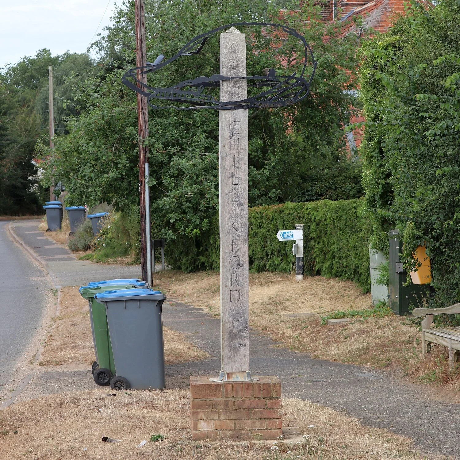
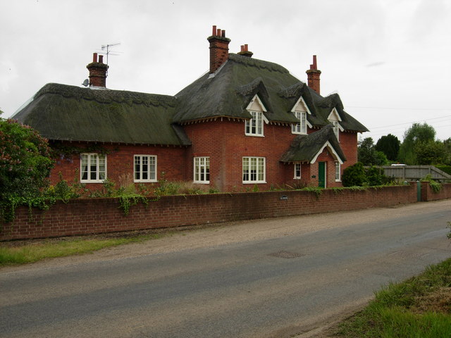
Chillesford

Chillesford is a village and civil parish in the East Suffolk district, in the English county of Suffolk. It is located on the B1084 road which runs east...

Chillesford Church Pit

Chillesford Church Pit is a 1.1-hectare (2.7-acre) geological Site of Special Scientific Interest in Chillesford, south of Saxmundham in Suffolk. It is...

Nearby Amenities

Located within 500m of 52.1112,1.5006066
Broom Covert
Place: locality
Lat/Long: 52.1119347/1.4985073
Power: pole
Lat/Long: 52.1111679/1.4975014
Power: pole
Lat/Long: 52.1118062/1.4964312
Power: pole
Lat/Long: 52.1124354/1.4954656
Power: pole
Lat/Long: 52.1131454/1.494323
The data included in this document is from www.openstreetmap.org. The data is made available under ODbL.

Have you been to Broom Covert?

Leave your review of Broom Covert below (or comments, questions and feedback).