Frost Row

Settlement in Norfolk South Norfolk

England

Frost Row

Woodrising: Field with a growing crop
Woodrising: Field with a growing crop Credit: Michael Garlick

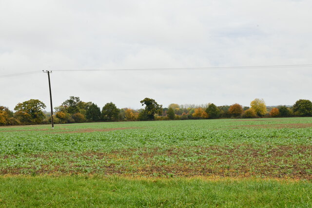
Frost Row is a small village located in the county of Norfolk, England. Situated approximately 12 miles south-east of the city of Norwich, it falls within the district of South Norfolk. The village is surrounded by picturesque countryside, with rolling hills and lush green fields that add to its charm.

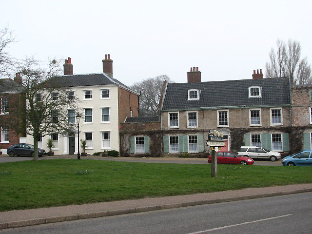
Frost Row is known for its quaint and peaceful atmosphere, making it an ideal place for those seeking a tranquil rural lifestyle. The village is home to a close-knit community of residents who take pride in maintaining their surroundings. The houses in Frost Row predominantly reflect traditional English architecture, with many of them being centuries-old cottages that have been carefully preserved.

Although small in size, Frost Row offers a range of amenities to cater to the needs of its residents. These include a local pub, a village hall, and a primary school. The village also benefits from being in close proximity to the nearby town of Diss, which provides additional shopping and leisure facilities.

Nature enthusiasts will appreciate Frost Row's proximity to various outdoor attractions. The village is surrounded by beautiful nature reserves, including the Waveney Valley and the Norfolk Broads, both of which offer opportunities for hiking, boating, and birdwatching.

Overall, Frost Row is a charming and idyllic village that provides a tranquil and peaceful setting for its residents. With its stunning countryside, strong community spirit, and convenient location, it offers an appealing lifestyle option for those seeking a slower pace of life in the heart of rural Norfolk.

If you have any feedback on the listing, please let us know in the comments section below.

Frost Row Images

Images are sourced within 2km of 52.580415/0.96965807 or Grid Reference TG0102. Thanks to Geograph Open Source API. All images are credited.

Woodrising: Field with a growing crop
The grave of Edmund 1st Baron Ironside at Hingham Field Marshal William Edmund Ironside, 1st Baron Ironside of Archangel and of Ironside, was born on 6 May 1880 in Edinburgh, died on 22 September 1959 in London, lived at Morley Old Hall Morley St. Peter, near Wymondham, Norfolk and is buried here in Hingham cemetery in South Norfolk. 
After serving in the South African War, he commanded Allied forces in WW1 in northern Russia (1918) and later in northern Persia (1920). He subsequently commanded forces in India (1928–31) and in the Middle East. At the beginning of WW2, Ironside was chief of the imperial general staff (1939–40). He was promoted to field marshal in 1940 and commanded the British Home Defence Forces.
The grave of Edmund 1st Baron Ironside at Hingham
Field Marshal William Edmund Ironside, 1st Baron Ironside of Archangel and of Ironside, was born on 6 May 1880 in Edinburgh, died on 22 September 1959 in London, lived at Morley Old Hall Morley St. Peter, near Wymondham, Norfolk and is buried here in Hingham cemetery in South Norfolk. After serving in the South African War, he commanded Allied forces in WW1 in northern Russia (1918) and later in northern Persia (1920). He subsequently commanded forces in India (1928–31) and in the Middle East. At the beginning of WW2, Ironside was chief of the imperial general staff (1939–40). He was promoted to field marshal in 1940 and commanded the British Home Defence Forces.
452nd Bomb Group Memorial For more information about this group which during WW2 was based at Deopham Green see > <a title="https://www.geograph.org.uk/article/RAF-Deopham-Green---USAAF-Station-142" href="https://www.geograph.org.uk/article/RAF-Deopham-Green---USAAF-Station-142">Link</a>.
452nd Bomb Group Memorial
For more information about this group which during WW2 was based at Deopham Green see > Link.
Edmund 1st Baron Ironside (gravestone) Field Marshal William Edmund Ironside, 1st Baron Ironside of Archangel and of Ironside, was born on 6 May 1880 in Edinburgh, died on 22 September 1959 in London, lived at Morley Old Hall (located between Deopham Green and Attleborough), and is buried in Hingham cemetery in South Norfolk.  After serving in the South African War, he commanded Allied forces in WW1 in northern Russia (1918) and later in northern Persia (1920). He subsequently commanded forces in India (1928–31) and in the Middle East. At the beginning of WW2, Ironside was chief of the imperial general staff (1939–40).  He was promoted to field marshal in 1940 and commanded the British Home Defence Forces.
Edmund 1st Baron Ironside (gravestone)
Field Marshal William Edmund Ironside, 1st Baron Ironside of Archangel and of Ironside, was born on 6 May 1880 in Edinburgh, died on 22 September 1959 in London, lived at Morley Old Hall (located between Deopham Green and Attleborough), and is buried in Hingham cemetery in South Norfolk. After serving in the South African War, he commanded Allied forces in WW1 in northern Russia (1918) and later in northern Persia (1920). He subsequently commanded forces in India (1928–31) and in the Middle East. At the beginning of WW2, Ironside was chief of the imperial general staff (1939–40). He was promoted to field marshal in 1940 and commanded the British Home Defence Forces.
The church of St Andrew in Hingham - churchyard An very unusual boat-shaped gravestone. For a view of the church see > <a title="https://www.geograph.org.uk/photo/704417" href="https://www.geograph.org.uk/photo/704417">Link</a>.
The church of St Andrew in Hingham - churchyard
An very unusual boat-shaped gravestone. For a view of the church see > Link.
The church of St Andrew in Hingham - churchyard Mid-18th century headstone decorated with the head of a carved angel. For a view of the church see > <a title="https://www.geograph.org.uk/photo/704417" href="https://www.geograph.org.uk/photo/704417">Link</a>.
The church of St Andrew in Hingham - churchyard
Mid-18th century headstone decorated with the head of a carved angel. For a view of the church see > Link.
The church of St Andrew in Hingham - churchyard A late 18th century headstone south of the church. For a view of the church see > <a title="https://www.geograph.org.uk/photo/704417" href="https://www.geograph.org.uk/photo/704417">Link</a>.
The church of St Andrew in Hingham - churchyard
A late 18th century headstone south of the church. For a view of the church see > Link.
The church of St Andrew in Hingham - churchyard Early 19th century headstone with an interesting and unusual decoration > <a title="https://www.geograph.org.uk/photo/5190253" href="https://www.geograph.org.uk/photo/5190253">Link</a>. For a view of the church see > <a title="https://www.geograph.org.uk/photo/704417" href="https://www.geograph.org.uk/photo/704417">Link</a>.
The church of St Andrew in Hingham - churchyard
Early 19th century headstone with an interesting and unusual decoration > Link. For a view of the church see > Link.
The church of St Andrew in Hingham - churchyard Unusual decoration on an early 19th century headstone > <a title="https://www.geograph.org.uk/photo/5190252" href="https://www.geograph.org.uk/photo/5190252">Link</a> east of the church. For a view of the church see > <a title="https://www.geograph.org.uk/photo/704417" href="https://www.geograph.org.uk/photo/704417">Link</a>.
The church of St Andrew in Hingham - churchyard
Unusual decoration on an early 19th century headstone > Link east of the church. For a view of the church see > Link.
The church of St Andrew in Hingham East window.
The church of St Andrew in Hingham
East window.
The church of St Andrew in Hingham - east window The upper lights. For a full view of this window see > <a title="https://www.geograph.org.uk/photo/5190257" href="https://www.geograph.org.uk/photo/5190257">Link</a>. For an external view of the church see > <a title="https://www.geograph.org.uk/photo/704417" href="https://www.geograph.org.uk/photo/704417">Link</a>.
The church of St Andrew in Hingham - east window
The upper lights. For a full view of this window see > Link. For an external view of the church see > Link.
The church of St Andrew in Hingham - east window For a full view of this window see > <a title="https://www.geograph.org.uk/photo/5190257" href="https://www.geograph.org.uk/photo/5190257">Link</a>. For an external view of the church see > <a title="https://www.geograph.org.uk/photo/704417" href="https://www.geograph.org.uk/photo/704417">Link</a>.
The church of St Andrew in Hingham - east window
For a full view of this window see > Link. For an external view of the church see > Link.
Show me another place!

Frost Row is located at Grid Ref: TG0102 (Lat: 52.580415, Lng: 0.96965807)

Administrative County: Norfolk

District: South Norfolk

Police Authority: Norfolk

What 3 Words

///legend.mixers.consults. Near Hingham, Norfolk

Nearby Locations

Frost Row

Related Wikis

Hingham, Norfolk

Hingham is a market town and civil parish in mid-Norfolk, England. The civil parish covers an area of 14.98 km2 (5.78 sq mi) and had a population of 2...

Sea Mere, Hingham

Sea Mere, Hingham is a 36.3-hectare (90-acre) biological Site of Special Scientific Interest close to the town of Hingham in Norfolk.The site has a natural...
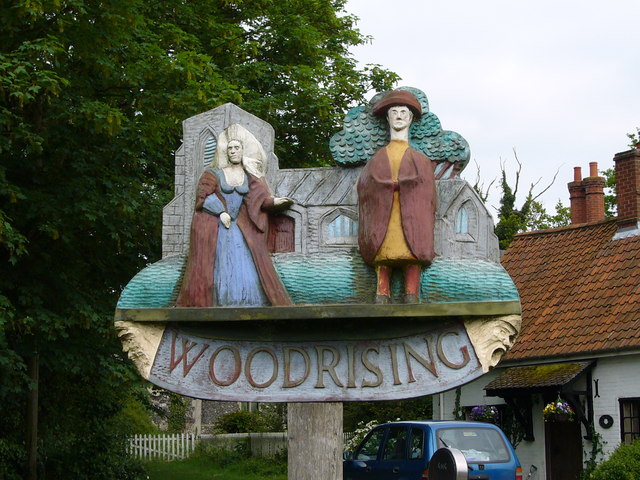
Woodrising, Norfolk

Woodrising is a village and former civil parish, now in the parish of Cranworth, in the Breckland district, in the county of Norfolk, England. The village...

Scoulton Mere

Scoulton Mere is a 34.2-hectare (85-acre) biological Site of Special Scientific Interest west of Wymondham in Norfolk.The principal ecological interest...

Little Ellingham

Little Ellingham is a village and civil parish in the English county of Norfolk. The village is 4.6 miles (7.4 km) north-west of Attleborough, 2 miles...

Scoulton

Scoulton is a small village and civil parish in the county of Norfolk, England, situated 16 miles (26 km) west of the city of Norwich and 21 miles (34...

RAF Deopham Green

Royal Air Force Deopham Green or more simply RAF Deopham Green is a former Royal Air Force station located near Deopham Green 2 miles (3.2 km) north of...

Hardingham

Hardingham is a civil parish in the English county of Norfolk. It covers an area of 4 square miles (9.78 km) with a population of 274 in 110 households...

Nearby Amenities

Located within 500m of 52.580415,0.96965807
Bus Stop
Greenacre Road, adj
Naptan AtcoCode: 2900H317
Naptan Bearing: E
Naptan CommonName: Greenacre Road
Naptan Indicator: adj
Naptan Landmark: Greenacre Road
Naptan Locality: Hingham
Naptan NaptanCode: nfoawmgw
Naptan Street: Watton Road
Naptan Verified: no
Source: naptan_import
Lat/Long: 52.5806814/0.9761833
Bus Stop
Greenacre Road, opp
Naptan AtcoCode: 2900H318
Naptan Bearing: W
Naptan CommonName: Greenacre Road
Naptan Indicator: opp
Naptan Landmark: Greenacre Road
Naptan Locality: Hingham
Naptan NaptanCode: nfoawmja
Naptan Street: Watton Road
Naptan Verified: no
Source: naptan_import
Lat/Long: 52.5805288/0.9765272
Frost Row
Place: hamlet
Lat/Long: 52.580093/0.9652072
Rectory Farm
Phone: +44 7919530982
Tourism: camp_site
Lat/Long: 52.5781497/0.9689013
Power: pole
Source: Bing
Lat/Long: 52.5774117/0.9678555
Post Box
Collection Times: Mo-Fr 09:00; Sa 07:00
Operator: Royal Mail
Operator Wikidata: Q638098
Post Box Mounting: pier
Post Box Type: lamp
Ref: NR9 969D
Royal Cypher: EIIR
Royal Cypher Wikidata: Q33102113
Lat/Long: 52.5810461/0.9768834
Traffic Calming: hump
Lat/Long: 52.5820326/0.9754258
Traffic Calming: hump
Lat/Long: 52.58157/0.9751915
Traffic Calming: hump
Lat/Long: 52.5810498/0.9750542
Generator Method: photovoltaic
Generator Output Electricity: yes
Generator Source: solar
Generator Type: solar_photovoltaic_panel
Location: roof
Power: generator
Lat/Long: 52.581502/0.9754926
Generator Method: photovoltaic
Generator Output Electricity: yes
Generator Source: solar
Generator Type: solar_photovoltaic_panel
Location: roof
Power: generator
Lat/Long: 52.5816357/0.9761095
Generator Method: photovoltaic
Generator Output Electricity: yes
Generator Source: solar
Generator Type: solar_photovoltaic_panel
Location: roof
Power: generator
Lat/Long: 52.5815941/0.9762691
Generator Method: photovoltaic
Generator Output Electricity: yes
Generator Source: solar
Generator Type: solar_photovoltaic_panel
Location: roof
Power: generator
Lat/Long: 52.5816039/0.9764837
Generator Method: photovoltaic
Generator Output Electricity: yes
Generator Source: solar
Generator Type: solar_photovoltaic_panel
Location: roof
Power: generator
Lat/Long: 52.5812136/0.9762074
Generator Method: photovoltaic
Generator Output Electricity: yes
Generator Source: solar
Generator Type: solar_photovoltaic_panel
Location: roof
Power: generator
Lat/Long: 52.5812535/0.976316
Generator Method: photovoltaic
Generator Output Electricity: yes
Generator Source: solar
Generator Type: solar_photovoltaic_panel
Location: roof
Power: generator
Lat/Long: 52.5804068/0.9763201
Generator Method: photovoltaic
Generator Output Electricity: yes
Generator Source: solar
Generator Type: solar_photovoltaic_panel
Location: roof
Power: generator
Lat/Long: 52.5809605/0.9742749
Colour: red
Marker: post
Utility: gas
Lat/Long: 52.5804055/0.9684183
Colour: red and white
Marker: aerial
Material: plastic
Utility: gas
Lat/Long: 52.5803349/0.9683379
Colour: red
Marker: yes
Material: concrete
Utility: gas
Lat/Long: 52.5808339/0.9687747
Marker: aerial
Material: plastic
Utility: gas
Lat/Long: 52.5809312/0.968863
The data included in this document is from www.openstreetmap.org. The data is made available under ODbL.

Have you been to Frost Row?

Leave your review of Frost Row below (or comments, questions and feedback).