Carpenter's Shop Meadow Plantation

Wood, Forest in Norfolk South Norfolk

England

Carpenter's Shop Meadow Plantation

Ellingham watermill The first known reference to the mill was about 1200 
Under Hovis, flour milling ceased in 1949 and the mill was converted to a provender mill, taking over the animal feed business from Earsham Mill. The mill finally closed down in 196.
Ellingham and Earsham are the only two mills on the Waveney that are officially in Norfolk.
Ellingham watermill Credit: Adrian S Pye

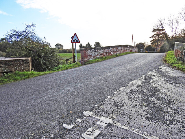
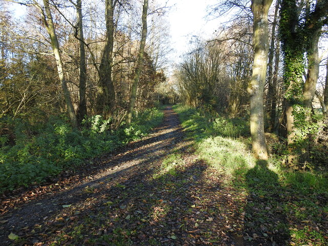
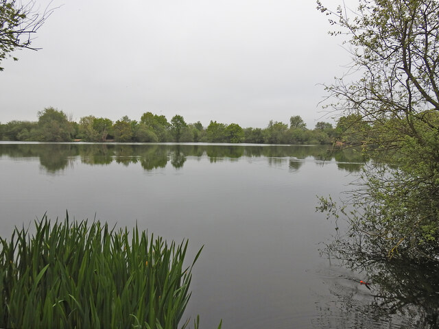
Carpenter's Shop Meadow Plantation is a unique and picturesque woodland located in Norfolk, England. This enchanting woodland covers an area of approximately 50 acres and is often referred to as a hidden gem within the region. The plantation is known for its stunning collection of trees, including oak, beech, and birch, which create a diverse and vibrant forest landscape.

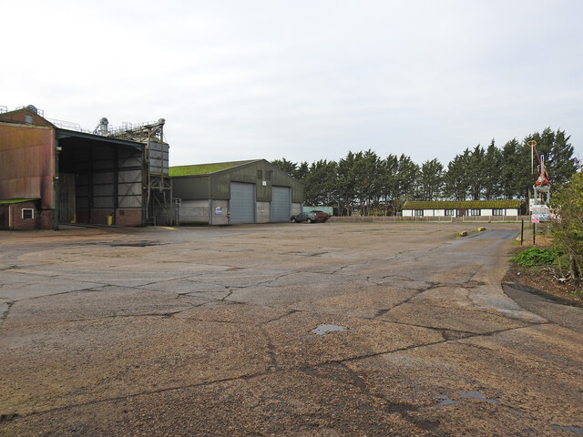
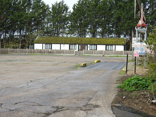
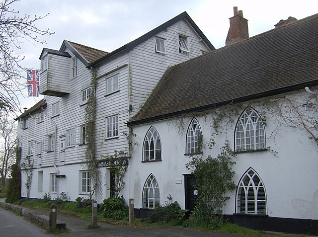
The plantation gets its name from the historic carpenter's shop that once stood on the site many years ago. Today, the carpenter's shop has been beautifully restored and serves as a visitor center, providing information about the plantation's history and offering guided tours for nature enthusiasts.

Carpenter's Shop Meadow Plantation is a haven for wildlife, attracting a wide variety of bird species such as woodpeckers, owls, and songbirds. It also provides a habitat for numerous mammals like deer, foxes, and rabbits. The plantation's meadow area is particularly remarkable, boasting a colorful display of wildflowers during the spring and summer months.

Visitors to Carpenter's Shop Meadow Plantation can explore the numerous walking trails that wind through the woodland, offering breathtaking views of the surrounding countryside. The plantation also features picnic areas and benches, allowing visitors to relax and immerse themselves in the tranquility of nature.

Overall, Carpenter's Shop Meadow Plantation offers a unique opportunity to experience the beauty and serenity of Norfolk's woodlands. Whether you are a nature lover, a history enthusiast, or simply seeking a peaceful retreat, this plantation is sure to captivate and inspire all who visit.

If you have any feedback on the listing, please let us know in the comments section below.

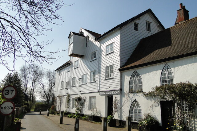
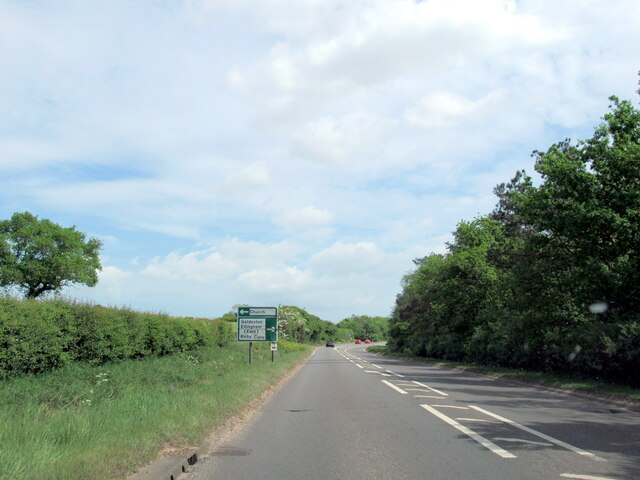
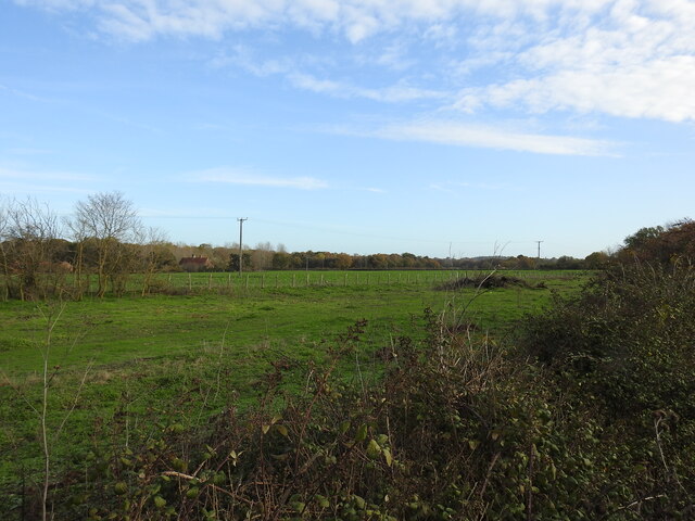
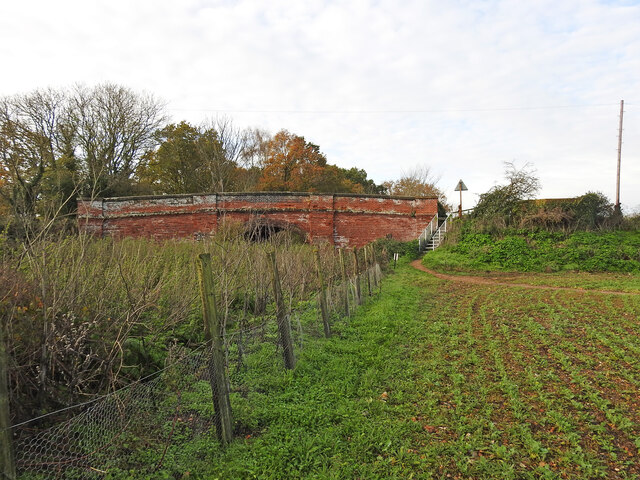
Carpenter's Shop Meadow Plantation Images

Images are sourced within 2km of 52.482677/1.4708593 or Grid Reference TM3592. Thanks to Geograph Open Source API. All images are credited.

Ellingham watermill The first known reference to the mill was about 1200 
Under Hovis, flour milling ceased in 1949 and the mill was converted to a provender mill, taking over the animal feed business from Earsham Mill. The mill finally closed down in 196.
Ellingham and Earsham are the only two mills on the Waveney that are officially in Norfolk.
Ellingham watermill
The first known reference to the mill was about 1200 Under Hovis, flour milling ceased in 1949 and the mill was converted to a provender mill, taking over the animal feed business from Earsham Mill. The mill finally closed down in 196. Ellingham and Earsham are the only two mills on the Waveney that are officially in Norfolk.
A143 east approaching sign for Ellingham East and West
A143 east near turning for Kirby Cane
Gate keeper's cottage on Braces Lane crossing The crossing, designated the number 84, is now a private dwelling house. The track crossed the road this side of the house. A small extension has been added to the east end but the building is much as it was in a much simplified Italianate style.
Gate keeper's cottage on Braces Lane crossing
The crossing, designated the number 84, is now a private dwelling house. The track crossed the road this side of the house. A small extension has been added to the east end but the building is much as it was in a much simplified Italianate style.
Fence posts delineate the course of the former railway line Beccles is a station on the Ipswich to Lowestoft line and had a branch line to Great Yarmouth which opened in 1859 and another to Norwich both via the Haddiscoe Junction.
At the Tivetshall end was the junction between the Waveney Valley Railway and the Eastern Union Railway, enabling passengers and freight to travel all over the country.
Fence posts delineate the course of the former railway line
Beccles is a station on the Ipswich to Lowestoft line and had a branch line to Great Yarmouth which opened in 1859 and another to Norwich both via the Haddiscoe Junction. At the Tivetshall end was the junction between the Waveney Valley Railway and the Eastern Union Railway, enabling passengers and freight to travel all over the country.
Church Road bridge from the east The bridge is designated the number 1197 and carries Church Road Ellingham over the line. The bridge is constructed entirely from red brick apart from concrete coping on the parapets. Beneath the bridge are six blind relieving arches, three on each side, these are normally quite shallow and were used to reduce the weight of and to save on material costs rather than create a shelter from passing trains.
To the right of the bridge is a hexagonal WW2 pillbox placed to protect the line and prevent its use by the enemy if an invasion were to take place. <a title="https://www.geograph.org.uk/photo/4431825" href="https://www.geograph.org.uk/photo/4431825">Link</a>
Church Road bridge from the east
The bridge is designated the number 1197 and carries Church Road Ellingham over the line. The bridge is constructed entirely from red brick apart from concrete coping on the parapets. Beneath the bridge are six blind relieving arches, three on each side, these are normally quite shallow and were used to reduce the weight of and to save on material costs rather than create a shelter from passing trains. To the right of the bridge is a hexagonal WW2 pillbox placed to protect the line and prevent its use by the enemy if an invasion were to take place. Link
Church Road bridge, Ellingham The pillbox can be seen left of the bridge
Church Road bridge, Ellingham
The pillbox can be seen left of the bridge
The former Ellingham Railway station house An extension to the front has not altered the fact this is an Italianate style station house as built by the Waveney Valley Railway in the 19th century with the usual Station Master's accommodation above.
The station which is 15¼ miles down-line from Tivetshall, was minimalist, having a goods yard with a 400 feet of siding, but with no goods shed apart from a disused coach acting as a parcels store standing on the 310 feet long platform. An infrequently used level crossing (designated No, 81) on the down side of the station was controlled by the signal box and operated by the signalman.
The former Ellingham Railway station house
An extension to the front has not altered the fact this is an Italianate style station house as built by the Waveney Valley Railway in the 19th century with the usual Station Master's accommodation above. The station which is 15¼ miles down-line from Tivetshall, was minimalist, having a goods yard with a 400 feet of siding, but with no goods shed apart from a disused coach acting as a parcels store standing on the 310 feet long platform. An infrequently used level crossing (designated No, 81) on the down side of the station was controlled by the signal box and operated by the signalman.
The former USAAF fuel depot at Ellingham The fuel depot was administered by the USAAF for the various airfields in the vicinity, primarily Bungay (aka Flixton), Holton, Hardwick, Thorpe Abbotts and Eye.
The depot was fed by rail with two additional loop sidings to the north of the depot now under woodland but still outlined on the current OS maps. It was during six months between 1943 and 1944 that there were 148 additional trains delivering aviation fuel to the depot. The depot consisted of four 12 metre diameter, cylindrical tanks with associated buildings and four pumps, filling points for the bowsers working out of the depot. 
Dispatch riders delivered requisitions, and the fuel delivered the same day.
The fuel was unloaded from the railway wagons and delivered into the depot via an underground pipe beneath the road. 
Its use continued for a while after the war until the late 1960s. By 1988 it had been demolished and a grain store erected on the site. Three of the original buildings remain extant including an above ground air raid shelter across the road from the depot.
The former USAAF fuel depot at Ellingham
The fuel depot was administered by the USAAF for the various airfields in the vicinity, primarily Bungay (aka Flixton), Holton, Hardwick, Thorpe Abbotts and Eye. The depot was fed by rail with two additional loop sidings to the north of the depot now under woodland but still outlined on the current OS maps. It was during six months between 1943 and 1944 that there were 148 additional trains delivering aviation fuel to the depot. The depot consisted of four 12 metre diameter, cylindrical tanks with associated buildings and four pumps, filling points for the bowsers working out of the depot. Dispatch riders delivered requisitions, and the fuel delivered the same day. The fuel was unloaded from the railway wagons and delivered into the depot via an underground pipe beneath the road. Its use continued for a while after the war until the late 1960s. By 1988 it had been demolished and a grain store erected on the site. Three of the original buildings remain extant including an above ground air raid shelter across the road from the depot.
Offices at the former USAAF fuel depot at Ellingham The fuel depot was administered by the USAAF for the various airfields in the vicinity, primarily Bungay (aka Flixton), Holton, Hardwick, Thorpe Abbotts and Eye.
The depot was fed by rail with two additional loop sidings to the north of the depot now under woodland but still outlined on the current OS maps. It was during six months between 1943 and 1944 that there were 148 additional trains delivering aviation fuel to the depot. The depot consisted of four 12 metre diameter, cylindrical tanks with associated buildings and four pumps, filling points for the bowsers working out of the depot. 
Dispatch riders delivered requisitions, and the fuel delivered the same day.
The fuel was unloaded from the railway wagons and delivered into the depot via an underground pipe beneath the road. 
Its use continued for a while after the war until the late 1960s. By 1988 it had been demolished and a grain store erected on the site. Three of the original buildings remain extant including an above ground air raid shelter across the road from the depot.
Offices at the former USAAF fuel depot at Ellingham
The fuel depot was administered by the USAAF for the various airfields in the vicinity, primarily Bungay (aka Flixton), Holton, Hardwick, Thorpe Abbotts and Eye. The depot was fed by rail with two additional loop sidings to the north of the depot now under woodland but still outlined on the current OS maps. It was during six months between 1943 and 1944 that there were 148 additional trains delivering aviation fuel to the depot. The depot consisted of four 12 metre diameter, cylindrical tanks with associated buildings and four pumps, filling points for the bowsers working out of the depot. Dispatch riders delivered requisitions, and the fuel delivered the same day. The fuel was unloaded from the railway wagons and delivered into the depot via an underground pipe beneath the road. Its use continued for a while after the war until the late 1960s. By 1988 it had been demolished and a grain store erected on the site. Three of the original buildings remain extant including an above ground air raid shelter across the road from the depot.
The site of the Old Station Road former railway crossing The road, now named Old Station Road was constructed out of necessity when the building of the Ellingham Station cut the existing roads which divided the village. When the bridge was eventually constructed, the road remained although it is no longer as vital as it once was, with Ellingham Mill and the church separated from the more populated part of the village by the railway line.
The site of the Old Station Road former railway crossing
The road, now named Old Station Road was constructed out of necessity when the building of the Ellingham Station cut the existing roads which divided the village. When the bridge was eventually constructed, the road remained although it is no longer as vital as it once was, with Ellingham Mill and the church separated from the more populated part of the village by the railway line.
Footpath created on the former Broome Marshes Looking east in the area of Broome Marshes. The road here runs parallel to the footpath.
Footpath created on the former Broome Marshes
Looking east in the area of Broome Marshes. The road here runs parallel to the footpath.
On the rail track-bed at Broome looking east Beccles is a station on the Ipswich to Lowestoft line and had a branch line to Great Yarmouth which opened in 1859 and another to Norwich both via the Haddiscoe Junction.
At the Tivetshall end was the junction between the Waveney Valley Railway and the Eastern Union Railway, enabling passengers and freight to travel all over the country.
On the rail track-bed at Broome looking east
Beccles is a station on the Ipswich to Lowestoft line and had a branch line to Great Yarmouth which opened in 1859 and another to Norwich both via the Haddiscoe Junction. At the Tivetshall end was the junction between the Waveney Valley Railway and the Eastern Union Railway, enabling passengers and freight to travel all over the country.
Re-routed culvert running beneath the former railway track The drainage channel has been diverted to cross the track at 90 degrees instead of its natural less acute angle.
Re-routed culvert running beneath the former railway track
The drainage channel has been diverted to cross the track at 90 degrees instead of its natural less acute angle.
Path on the old railway line looking south-west The path is south of the A143 before the track crosses to the north side of the road
Path on the old railway line looking south-west
The path is south of the A143 before the track crosses to the north side of the road
Broome Headworks The boreholes extends deep into the earth beneath these headworks extracting water from deep in the Waveney Valley.
Broome Headworks
The boreholes extends deep into the earth beneath these headworks extracting water from deep in the Waveney Valley.
Broome, St Michael
Broome, St Michael
Former pit on Broome Heath Broome Heath Pit is a three-acre geological Site of Special Scientific Interest east of Ditchingham, Norfolk. It is also regarded as a Geological Conservation Review site and part of Broome Heath Local Nature Reserve.
A popular fishing lake containing huge carp: <span class="nowrap"><a title="http://broomepitsfishinglakes.co.uk/" rel="nofollow ugc noopener" href="http://broomepitsfishinglakes.co.uk/">Link</a><img style="margin-left:2px;" alt="External link" title="External link - shift click to open in new window" src="https://s1.geograph.org.uk/img/external.png" width="10" height="10"/></span>
Former pit on Broome Heath
Broome Heath Pit is a three-acre geological Site of Special Scientific Interest east of Ditchingham, Norfolk. It is also regarded as a Geological Conservation Review site and part of Broome Heath Local Nature Reserve. A popular fishing lake containing huge carp: LinkExternal link
Show me another place!

Carpenter's Shop Meadow Plantation is located at Grid Ref: TM3592 (Lat: 52.482677, Lng: 1.4708593)

Administrative County: Norfolk

District: South Norfolk

Police Authority: Norfolk

What 3 Words

///direction.torso.rigs. Near Ditchingham, Norfolk

Related Wikis

Ellingham, Norfolk

Ellingham is a village and civil parish in the English county of Norfolk. The village is located 2.3 miles (3.7 km) north-east of Bungay and 13 miles...

Ellingham railway station

Ellingham is a former railway station in Ellingham, Norfolk. It was opened in 1863 as part of the Waveney Valley Line between Tivetshall and Beccles, Suffolk...

Broome Heath Pit

Broome Heath Pit is a 1.2-hectare (3.0-acre) geological Site of Special Scientific Interest east of Ditchingham in Norfolk. It is a Geological Conservation...

Broome, Norfolk

Broome is a village and civil parish in the English county of Norfolk. It is situated on the north bank of the River Waveney, which forms the border with...

Nearby Amenities

Located within 500m of 52.482677,1.4708593
Bus Stop
BT Box, adj
Alt Name: Ellingham- old A143 Smithy
Bus: yes
Naptan AltCommonName: Ellingham- old A143 Smithy
Naptan AtcoCode: 2900E041
Naptan Bearing: E
Naptan BusStopType: CUS
Naptan CommonName: BT Box
Naptan Indicator: adj
Naptan Landmark: BT Box
Naptan Locality: Ellingham
Naptan NaptanCode: nfoapatj
Naptan Street: Yarmouth Road
Naptan Verified: no
Public Transport: platform
Source: naptan_import
Lat/Long: 52.4783611/1.4724741
Passing Place
Lat/Long: 52.478878/1.4695989
Passing Place
Lat/Long: 52.4796774/1.468887
Barrier: bollard
Bicycle: yes
Foot: yes
Horse: yes
Material: wood
Lat/Long: 52.4788788/1.4745949
Barrier: stile
Foot: yes
Material: wood
Stile: stepover
Lat/Long: 52.482751/1.4642996
Give Way
Lat/Long: 52.4840269/1.4638744
Give Way
Lat/Long: 52.4845099/1.4652079
Give Way
Lat/Long: 52.4843925/1.4651178
The data included in this document is from www.openstreetmap.org. The data is made available under ODbL.

Have you been to Carpenter's Shop Meadow Plantation?

Leave your review of Carpenter's Shop Meadow Plantation below (or comments, questions and feedback).