Clay Hole
Wood, Forest in Norfolk Broadland
England
Clay Hole

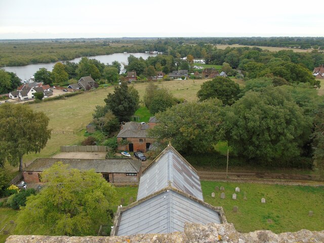
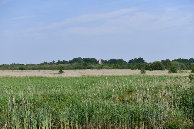
Clay Hole in Norfolk, England, is a picturesque woodland located in the heart of the county. Spread across a vast area, it is known for its dense forest and beautiful clay pits that dot the landscape. The woodland is situated near the village of Wood and is a popular destination for nature enthusiasts and hikers alike.
The forest of Clay Hole boasts a rich variety of flora and fauna. Towering trees, such as oak and beech, dominate the scene, offering a stunning canopy that provides shelter to a diverse range of wildlife. The forest floor is covered with a thick carpet of ferns, moss, and wildflowers, creating a vibrant and colorful environment.
One of the main attractions of Clay Hole is its clay pits. These large depressions in the land were formed through natural erosion processes, and over time, they have become picturesque ponds. These clay pits are home to an array of aquatic plants and animals, including various species of ducks, frogs, and dragonflies. The tranquil atmosphere of these ponds provides a haven for birdwatchers and photographers.
Visitors to Clay Hole can enjoy a range of activities, from leisurely walks along the forest trails to birdwatching and wildlife spotting. The woodland is also popular with families, who can take advantage of the picnic areas and designated camping spots available.
In conclusion, Clay Hole in Norfolk is a charming woodland retreat, offering visitors a slice of natural beauty. With its dense forest, clay pits, and diverse wildlife, it is a haven for nature lovers and a must-visit destination for those seeking tranquility amidst Norfolk's scenic countryside.
If you have any feedback on the listing, please let us know in the comments section below.
Clay Hole Images
Images are sourced within 2km of 52.672845/1.4813849 or Grid Reference TG3514. Thanks to Geograph Open Source API. All images are credited.


Clay Hole is located at Grid Ref: TG3514 (Lat: 52.672845, Lng: 1.4813849)
Administrative County: Norfolk
District: Broadland
Police Authority: Norfolk
What 3 Words
///curve.jaunts.walked. Near Horning, Norfolk
Nearby Locations
Related Wikis
Ranworth
Ranworth is a village in Norfolk, England in The Broads, adjacent to Malthouse Broad and Ranworth Broad. It is located in the civil parish of Woodbastwick...

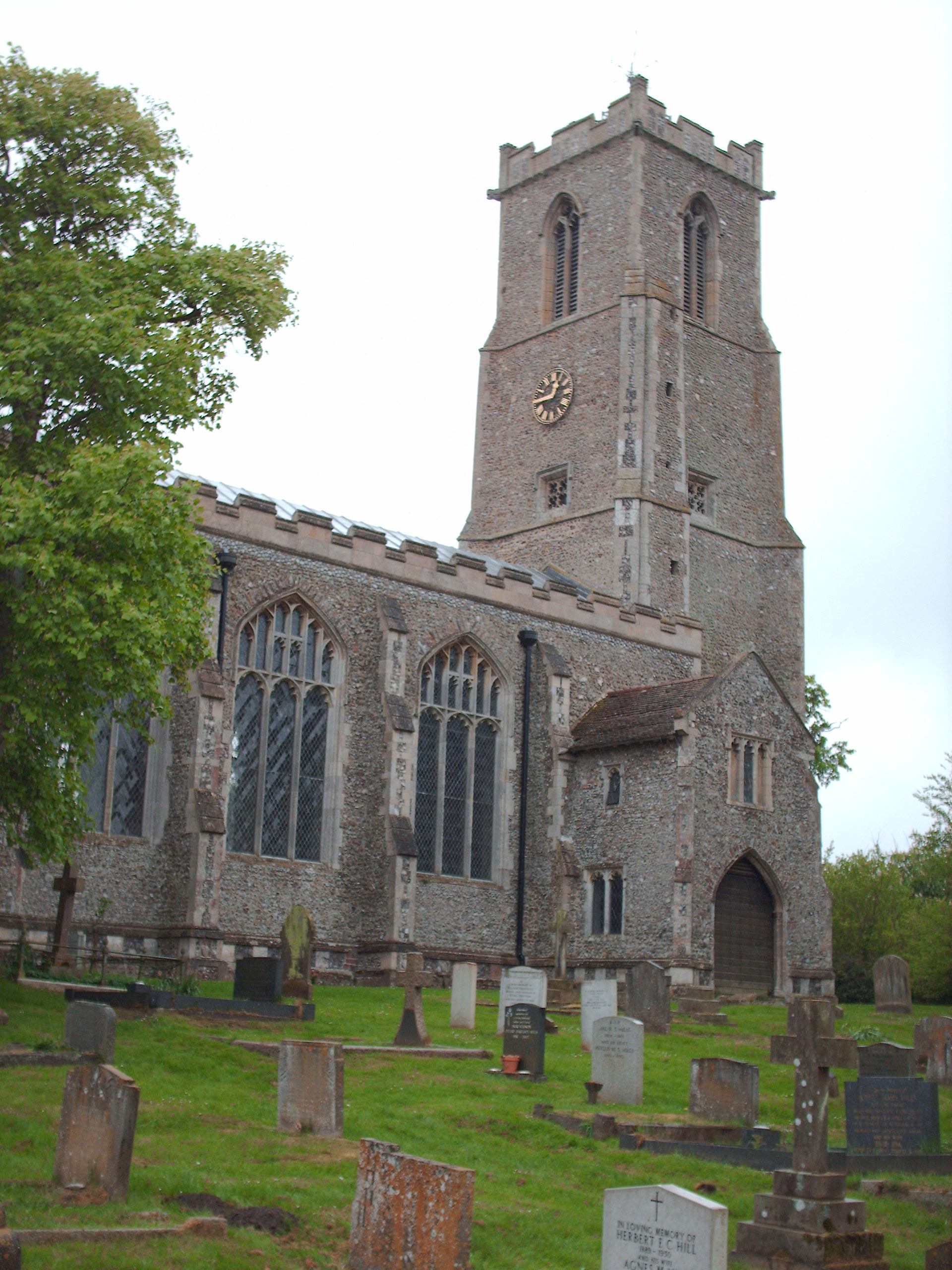
Church of St Helen, Ranworth
The Church of St Helen, Ranworth, Norfolk is a church of medieval origins notable for its collection of church paintings. Known as "the cathedral of The...

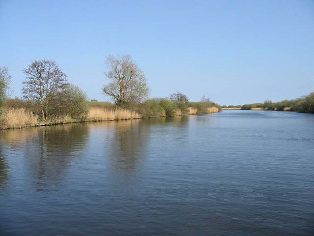
Malthouse Broad
Malthouse Broad is a broad (i.e., lake) at Ranworth in the Norfolk Broads. The "Helen of Ranworth" is a traditional reedlighter, a boat that carried away...

Ranworth Broad
Ranworth Broad is a 136-hectare (340-acre) nature reserve on the Norfolk Broads north-east of Norwich in Norfolk, United Kingdom. It is managed by the...
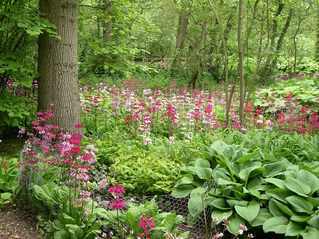
Fairhaven Woodland and Water Garden
Fairhaven Woodland and Water Garden, Norfolk, England, is a registered charity, comprising 131 acres (0.53 km2) of ancient woodland, woodland garden and...

South Walsham
South Walsham is a village and civil parish in the English county of Norfolk. It covers an area of 11.43 km2 (4.41 sq mi) and had a population of 738 in...

South Walsham Fen
South Walsham Fen is a 1.4-hectare (3.5-acre) Local Nature Reserve west of South Walsham in Norfolk. It is owned and managed by Norfolk County Council...
Bure Broads and Marshes
Bure Broads and Marshes is a 741.1-hectare (1,831-acre) biological Site of Special Scientific Interest north-east of Norwich in Norfolk. Most of it is...
Nearby Amenities
Located within 500m of 52.672845,1.4813849Have you been to Clay Hole?
Leave your review of Clay Hole below (or comments, questions and feedback).