Beech Grove

Wood, Forest in Norfolk North Norfolk

England

Beech Grove

Barton Broad - Gayes Staithe 1980
Barton Broad - Gayes Staithe 1980 Credit: Roy Hughes

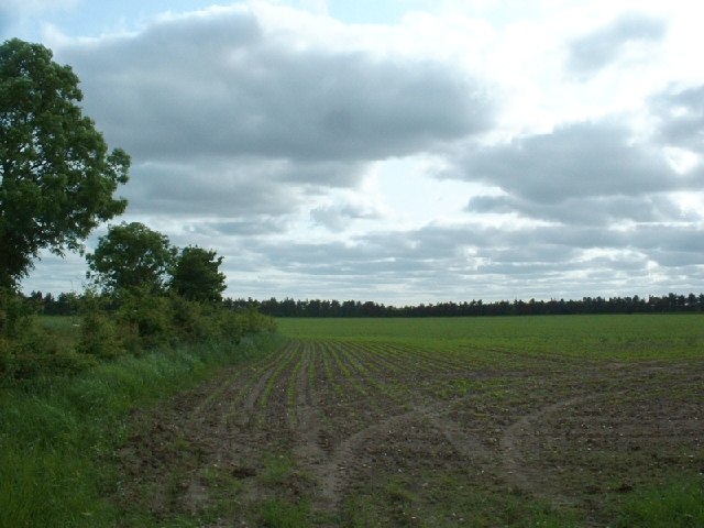
Beech Grove, Norfolk (Wood, Forest) is an enchanting and picturesque natural landscape located in the county of Norfolk, England. Covering an area of approximately 100 acres, this ancient woodland is a hidden gem renowned for its diverse flora and fauna, making it a haven for nature lovers and outdoor enthusiasts alike.

The woodland is predominantly made up of majestic beech trees, which provide a stunning backdrop throughout the year. In spring, the forest floor is adorned with a vibrant carpet of bluebells, creating a breathtaking sight for visitors. During autumn, the trees transform into a kaleidoscope of warm hues, offering a magical ambiance for those exploring the area.

Beech Grove is not only known for its scenic beauty but also for its rich biodiversity. The forest is home to a wide range of wildlife, including deer, foxes, badgers, and numerous bird species. Nature enthusiasts can enjoy birdwatching or try to spot some of the woodland creatures that call this place their home.

The woodland also offers a variety of walking trails, allowing visitors to fully immerse themselves in its natural wonders. These trails cater to different levels of difficulty, ensuring there is something for everyone. Whether you prefer a leisurely stroll or a more challenging hike, Beech Grove has it all.

Furthermore, the forest is equipped with picnic areas and benches, providing the perfect setting for a tranquil outdoor lunch or a peaceful moment of relaxation surrounded by nature.

Overall, Beech Grove, Norfolk (Wood, Forest) is a true gem in the heart of Norfolk, offering a serene and captivating experience for all who visit.

If you have any feedback on the listing, please let us know in the comments section below.
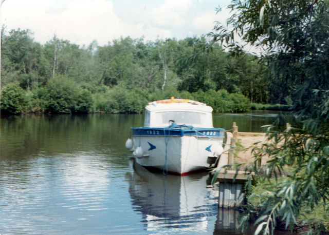
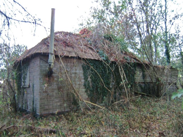
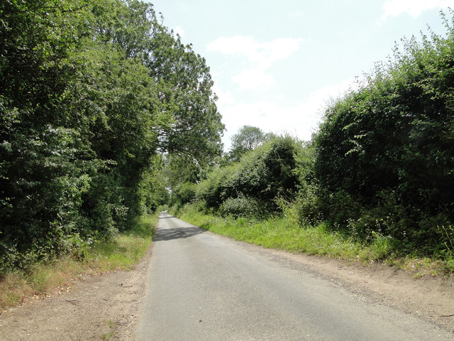
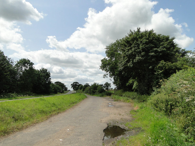
Beech Grove Images

Images are sourced within 2km of 52.73548/1.4577219 or Grid Reference TG3320. Thanks to Geograph Open Source API. All images are credited.

Barton Broad - Gayes Staithe 1980
The Old Saddlery At the road-junction in the village of Neatishead.
The Old Saddlery
At the road-junction in the village of Neatishead.
The White Horse Inn, Neatishead
The Street, Neatishead The White Horse Inn <a href="https://www.geograph.org.uk/photo/3329186">TG3421 : The White Horse Inn, Neatishead</a> is on the left, with the Old Saddlery <a href="https://www.geograph.org.uk/photo/3329184">TG3420 : The Old Saddlery</a> to the right.
The Street, Neatishead
The White Horse Inn TG3421 : The White Horse Inn, Neatishead is on the left, with the Old Saddlery TG3420 : The Old Saddlery to the right.
Car park for Barton Broad There is a boardwalk through the marshy area at the southern edge of Barton Broad, reached by a footpath across fields from the car park.
Car park for Barton Broad
There is a boardwalk through the marshy area at the southern edge of Barton Broad, reached by a footpath across fields from the car park.
Little house in the wood Derelict cottage near Barton Broad car park.
Little house in the wood
Derelict cottage near Barton Broad car park.
Neatishead village sign Village signs are typically placed along the principal road or in a prominent location such as a village green or close by the church. The design often depicts a particularly feature of the village or a scene from its history, heritage, or culture. They are typically made of wood or metal or a combination of both, the designs are often made by the local community.
Although they do appear in villages and towns all over the country they are more prominent in East Anglia than elsewhere in the country.
Neatishead village sign
Village signs are typically placed along the principal road or in a prominent location such as a village green or close by the church. The design often depicts a particularly feature of the village or a scene from its history, heritage, or culture. They are typically made of wood or metal or a combination of both, the designs are often made by the local community. Although they do appear in villages and towns all over the country they are more prominent in East Anglia than elsewhere in the country.
Beeston Hall This fine country house is attributed to the architect William Wilkins of Norwich. It was built in 1786 for Jacob Preston near the site of an older mansion which was torn down.  The surrounding park, now largely given over to farming, is believed to have been laid out at around the same time. 

In the 1940s, Beeston Hall was owned by Sir Thomas Preston, O.B.E (1886-1976), 6th baronet, who spent most of his time  overseas. As a young man, he went on mining expeditions in northern Siberia prospecting for gold and he later joined the Diplomatic Service. He was British Consul in Ekaterinburg at the time of the murder in 1918 by the Bolsheviks of Tsar Nicholas II and the Russian Imperial family.  Sir Thomas was succeeded by his eldest son, Sir Ronald Douglas Hildebrand Preston, 7th Baronet, who served as a Major in the Intelligence Corps and later worked for Reuters and The Times as a foreign correspondent. He was also a member of the SOE (Special Operations Executive, a covert military organisation).

From 1940 to 1942, Beeston Hall housed the Norfolk Auxiliary Units' administrative headquarters and it was here where Captain Nigel Oxenden [later Major Nigel Oxenden MC] and his staff were based.  Although the Hall is surrounded by extensive park and farmland, no training exercises appear to have been held at Beeston.  

At present, the estate is known as the Beeston Hall Arabian Stud. 

(Picture taken by kind permission of the owner.)
Beeston Hall
This fine country house is attributed to the architect William Wilkins of Norwich. It was built in 1786 for Jacob Preston near the site of an older mansion which was torn down. The surrounding park, now largely given over to farming, is believed to have been laid out at around the same time. In the 1940s, Beeston Hall was owned by Sir Thomas Preston, O.B.E (1886-1976), 6th baronet, who spent most of his time overseas. As a young man, he went on mining expeditions in northern Siberia prospecting for gold and he later joined the Diplomatic Service. He was British Consul in Ekaterinburg at the time of the murder in 1918 by the Bolsheviks of Tsar Nicholas II and the Russian Imperial family. Sir Thomas was succeeded by his eldest son, Sir Ronald Douglas Hildebrand Preston, 7th Baronet, who served as a Major in the Intelligence Corps and later worked for Reuters and The Times as a foreign correspondent. He was also a member of the SOE (Special Operations Executive, a covert military organisation). From 1940 to 1942, Beeston Hall housed the Norfolk Auxiliary Units' administrative headquarters and it was here where Captain Nigel Oxenden [later Major Nigel Oxenden MC] and his staff were based. Although the Hall is surrounded by extensive park and farmland, no training exercises appear to have been held at Beeston. At present, the estate is known as the Beeston Hall Arabian Stud. (Picture taken by kind permission of the owner.)
Passing Places on a narrow country road .... near Shoulder of Mutton Plantation
Passing Places on a narrow country road
.... near Shoulder of Mutton Plantation
A layby on the A1151 which was once the old carriageway
 RA at Gay’s Staithe RA (solar powered boat) runs pleasure pleasure trips on Barton Broad from Gay’s Staithe
RA at Gay’s Staithe
RA (solar powered boat) runs pleasure pleasure trips on Barton Broad from Gay’s Staithe
Neatishead village sign Many Norfolk villages have these lovely ornate signs.  Neatishead is North of Wroxham.
Neatishead village sign
Many Norfolk villages have these lovely ornate signs. Neatishead is North of Wroxham.
Field near Neatishead A field near Neatishead
Field near Neatishead
A field near Neatishead
Boats moored near Neatishead A backwater off the Norfolk Broads known as Neatishead Staithe.
Boats moored near Neatishead
A backwater off the Norfolk Broads known as Neatishead Staithe.
A countryside church at Threehammer Common A countryside church at Threehammer Common
A countryside church at Threehammer Common
A disused windmill near Neatishead A disused windmill near Neatishead
A disused windmill near Neatishead
Show me another place!

Beech Grove is located at Grid Ref: TG3320 (Lat: 52.73548, Lng: 1.4577219)

Administrative County: Norfolk

District: North Norfolk

Police Authority: Norfolk

What 3 Words

///guilty.practical.inhabited. Near Horning, Norfolk

Related Wikis

Neatishead

Neatishead ( NEET-stəd) is a village and civil parish in the English county of Norfolk. The village is situated some 20 km (12 mi) north-east of the city...

St Michael and All Angels Church, Barton Turf

St Michael and All Angels is the Church of England parish church of Barton Turf in the county of Norfolk in England. See Inside here. It stands about a...

Hoveton Hall

Hoveton Hall in the parish of Hoveton in Norfolk is a Regency-style country house made of gault brick with a slate roof. It was built between 1809 and...

Barton Turf

Barton Turf is a village and civil parish in the English county of Norfolk. It is 20 km north-east of the city of Norwich, on the northwestern edge of...

Nearby Amenities

Located within 500m of 52.73548,1.4577219
Give Way
Lat/Long: 52.7331978/1.4583719
The data included in this document is from www.openstreetmap.org. The data is made available under ODbL.

Have you been to Beech Grove?

Leave your review of Beech Grove below (or comments, questions and feedback).