Giants Wood

Wood, Forest in Norfolk South Norfolk

England

Giants Wood

Church of St Peter and St Paul, Bergh Apton <span class="nowrap"><a title="https://historicengland.org.uk/listing/the-list/list-entry/1373078?section=official-list-entry" rel="nofollow ugc noopener" href="https://historicengland.org.uk/listing/the-list/list-entry/1373078?section=official-list-entry">Link</a><img style="margin-left:2px;" alt="External link" title="External link - shift click to open in new window" src="https://s1.geograph.org.uk/img/external.png" width="10" height="10"/></span>
Church of St Peter and St Paul, Bergh Apton Credit: Sandy Gerrard

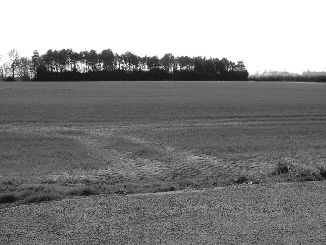
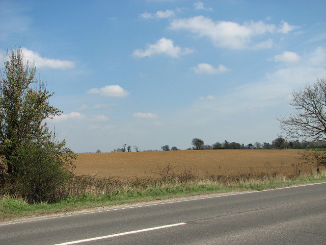
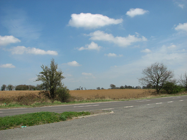
Giants Wood, located in Norfolk, England, is a picturesque and ancient woodland that covers an area of approximately 100 acres. Situated near the village of Upwell, this woodland is renowned for its natural beauty and rich biodiversity. It is considered a significant conservation area due to its rare and protected species.

The wood is characterized by a mix of deciduous and coniferous trees, including oak, beech, pine, and birch. The diverse range of trees provides a stunning display of colors throughout the seasons, attracting visitors from all over. The woodland floor is covered with a variety of plant species, such as bluebells, wild garlic, and ferns, adding to its enchanting atmosphere.

Giants Wood is home to numerous wildlife species, including some rare and endangered ones. It provides a habitat for various birds, such as woodpeckers, nightingales, and tawny owls. Mammals like deer, foxes, and badgers can also be spotted within the woodland, adding to its natural allure.

The wood offers several walking trails and paths, allowing visitors to explore its beauty at their own pace. These trails are well-maintained and suitable for all levels of hikers. Moreover, Giants Wood provides a peaceful and tranquil setting, making it a popular spot for nature lovers, photographers, and families seeking a peaceful day out.

Overall, Giants Wood in Norfolk is a captivating and biodiverse woodland that provides a rich natural habitat for various species. Its scenic beauty, combined with its ecological significance, makes it an ideal destination for those seeking a serene and immersive experience in nature.

If you have any feedback on the listing, please let us know in the comments section below.

Giants Wood Images

Images are sourced within 2km of 52.558956/1.4214833 or Grid Reference TG3201. Thanks to Geograph Open Source API. All images are credited.

Church of St Peter and St Paul, Bergh Apton <span class="nowrap"><a title="https://historicengland.org.uk/listing/the-list/list-entry/1373078?section=official-list-entry" rel="nofollow ugc noopener" href="https://historicengland.org.uk/listing/the-list/list-entry/1373078?section=official-list-entry">Link</a><img style="margin-left:2px;" alt="External link" title="External link - shift click to open in new window" src="https://s1.geograph.org.uk/img/external.png" width="10" height="10"/></span>
Church of St Peter and St Paul, Bergh Apton
Church of St Ethelbert, Thurton <span class="nowrap"><a title="https://historicengland.org.uk/listing/the-list/list-entry/1050637?section=official-list-entry" rel="nofollow ugc noopener" href="https://historicengland.org.uk/listing/the-list/list-entry/1050637?section=official-list-entry">Link</a><img style="margin-left:2px;" alt="External link" title="External link - shift click to open in new window" src="https://s1.geograph.org.uk/img/external.png" width="10" height="10"/></span>
Church of St Ethelbert, Thurton
14-16 Church Road, Bergh Apton One of several distinctive and thoughtful council housing projects by Herbert Tayler & David Green for Loddon District Council. Built 1951-56 - the year of completion is picked out in white brick on the end wall. Grade II listed.
14-16 Church Road, Bergh Apton
One of several distinctive and thoughtful council housing projects by Herbert Tayler & David Green for Loddon District Council. Built 1951-56 - the year of completion is picked out in white brick on the end wall. Grade II listed.
St John the Baptist, Hellington A flat day, see <a href="https://www.geograph.org.uk/photo/90327">TG3103 : St John the Baptist, Hellington</a>

The church is now redundant and under care of the churches conservation trust. Its signposted off the A146 (like Hales) because it; along with Ashby St Mary have magnificent Norman doorways. Possibly carved by the same hand. 

The porch is a subject that still causes debate because it is unusual. The tower is Norman flint rubble construction, part of the chancel seems to be been rebuilt in brick (not in this view). The churchyard is wildlife friendly, being overgrown but in a nice way.
St John the Baptist, Hellington
A flat day, see TG3103 : St John the Baptist, Hellington The church is now redundant and under care of the churches conservation trust. Its signposted off the A146 (like Hales) because it; along with Ashby St Mary have magnificent Norman doorways. Possibly carved by the same hand. The porch is a subject that still causes debate because it is unusual. The tower is Norman flint rubble construction, part of the chancel seems to be been rebuilt in brick (not in this view). The churchyard is wildlife friendly, being overgrown but in a nice way.
St John the Baptist, Hellington Impressive carving on the southern doorway, there is another less well endowed door (blocked) on the northern side. 

A flat day, see <a href="https://www.geograph.org.uk/photo/90327">TG3103 : St John the Baptist, Hellington</a>

The church is now redundant and under care of the churches conservation trust. Its signposted off the A146 (like Hales) because it; along with Ashby St Mary have magnificent Norman doorways. Possibly carved by the same hand. 

The porch is a subject that still causes debate because it is unusual. The tower is Norman flint rubble construction, part of the chancel seems to be been rebuilt in brick (not in this view). The churchyard is wildlife friendly, being overgrown but in a nice way.
St John the Baptist, Hellington
Impressive carving on the southern doorway, there is another less well endowed door (blocked) on the northern side. A flat day, see TG3103 : St John the Baptist, Hellington The church is now redundant and under care of the churches conservation trust. Its signposted off the A146 (like Hales) because it; along with Ashby St Mary have magnificent Norman doorways. Possibly carved by the same hand. The porch is a subject that still causes debate because it is unusual. The tower is Norman flint rubble construction, part of the chancel seems to be been rebuilt in brick (not in this view). The churchyard is wildlife friendly, being overgrown but in a nice way.
Norfolk Farmland South Norfolk, much is like this around here.
Norfolk Farmland
South Norfolk, much is like this around here.
New signpost at Hellington Corner It replaced the old post seen here > <a title="https://www.geograph.org.uk/photo/1314503" href="https://www.geograph.org.uk/photo/1314503">Link</a>. The crow sitting in the grass advertises the "Celebrating Arts in the Broads" festival: Rockland St. Mary and Surlingham villages, for the first time, are organising a celebration of their Broads' ecological diversity and local artistic abilities.
New signpost at Hellington Corner
It replaced the old post seen here > Link. The crow sitting in the grass advertises the "Celebrating Arts in the Broads" festival: Rockland St. Mary and Surlingham villages, for the first time, are organising a celebration of their Broads' ecological diversity and local artistic abilities.
Norman Doorway - Ashby St Mary The church was possibly the site of a Roman station, later a Saxon church then a Norman. The Norman nave can be seen with this magnificent doorway carved from French limestone. The porch is Tudor in age.
Norman Doorway - Ashby St Mary
The church was possibly the site of a Roman station, later a Saxon church then a Norman. The Norman nave can be seen with this magnificent doorway carved from French limestone. The porch is Tudor in age.
Strip woodland south of the A146 road
Layby on the A146 road
Fields north of the A146 road
Shrubs beside the A146 road
View across the A146 road
Field path leading from Low Common Rd Thurton towards Ferry Rd, Norfolk
Field path running NE from Low Common Rd, Thurton
Bergh Apton (Beorh Apetune) Village sign On The Street at the junction with Church Road
Bergh Apton (Beorh Apetune) Village sign
On The Street at the junction with Church Road
Bergh Apton (Beorh Apetune) Village sign On The Street at the junction with Church Road
(Close up)
Bergh Apton (Beorh Apetune) Village sign
On The Street at the junction with Church Road (Close up)
Show me another place!

Giants Wood is located at Grid Ref: TG3201 (Lat: 52.558956, Lng: 1.4214833)

Administrative County: Norfolk

District: South Norfolk

Police Authority: Norfolk

What 3 Words

///endings.prune.patching. Near Brooke, Norfolk

Nearby Locations

Giants Wood Mill Common

Related Wikis

Thurton

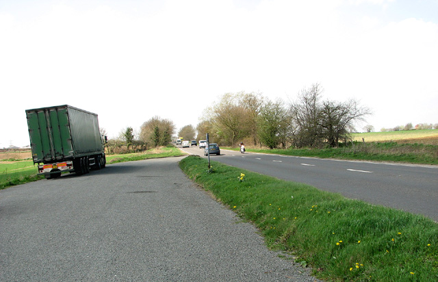
Thurton is a village in South Norfolk lying 8½ miles (13½ km) south-east of Norwich on the A146 Norwich to Lowestoft road between Framingham Pigot and...
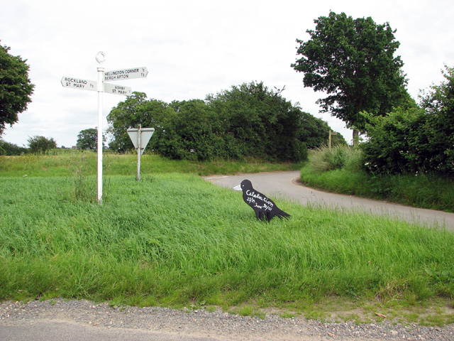
Bergh Apton

Bergh Apton is a village and civil parish in the South Norfolk district of Norfolk, England, 7 miles (11 km) south-east of Norwich just south of the A146...

Ashby St Mary

Ashby St Mary, historically Ascebei, is a small village and civil parish in the English county of Norfolk. The civil parish has an area of 2.03 square...

Bergh Apton Anglo-Saxon cemetery

Bergh Apton Anglo-Saxon cemetery is a late-5th to late-6th century Anglo-Saxon burial site discovered at Bergh Apton, Norfolk. The site was excavated in...

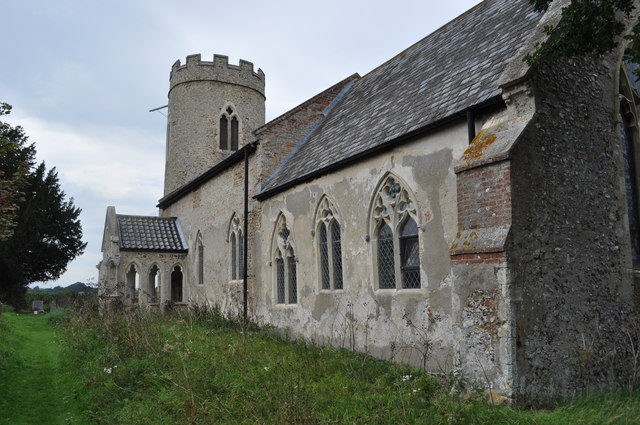
St John the Baptist's Church, Hellington

St John the Baptist's Church is a redundant Anglican church standing to the south of the village of Hellington, Norfolk, England. It is recorded in the...

Carleton St Peter

Carleton St Peter is a hamlet and civil parish in South Norfolk approximately 8+1⁄2 miles (13.7 km) south-east of Norwich. There is no village centre but...

Hellington

Hellington is a hamlet and civil parish in the South Norfolk district of the county of Norfolk, England. In the 2001 census, it contained 24 households...

Holverston

Holverston is a civil parish in the county of Norfolk, England ¾ mile (1¼ km) southeast of Rockland St. Mary. It includes the 16th century Holverston Hall...

Related Videos

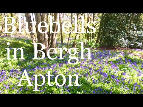
Bluebell spotting in Bergh Apton woods

In this video I take a stroll through the church plantation in the Norfolk village of Bergh Apton in search of bluebells. I also wander ...

Johns whistle stop tour of the new Chet Valley winery at Bergh Apton

Owner and winemaker John Hemmant gives a whistle stop tour of his vineyard and winery and also shows the Vine House which ...

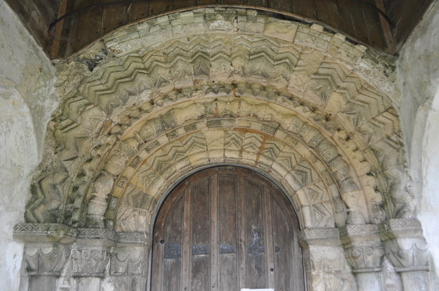
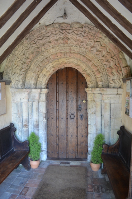
Ashby St Mary Church

This Norman church features a very fine doorway and a 15C tower.
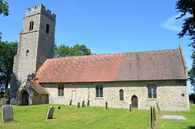
Bergh Apton Church

Extensive 19th century restoration has left a unique building with its double transepts, chancel taller than the nave and a large ...

Nearby Amenities

Located within 500m of 52.558956,1.4214833
Power: tower
Ref: PM 40
Lat/Long: 52.55821/1.415949
Power: tower
Ref: PM 39
Lat/Long: 52.556036/1.418856
Bus Stop
Prospect Place, adj
Naptan AtcoCode: 2900B252
Naptan Bearing: NW
Naptan CommonName: Prospect Place
Naptan Indicator: adj
Naptan Locality: Thurton
Naptan NaptanCode: nfoadwdp
Naptan Street: Norwich Road
Shelter: no
Source: naptan_import;survey
Lat/Long: 52.5621839/1.4237734
Bus Stop
Prospect Place, opp
Bench: no
Check Date Shelter: 2022-08-30
Naptan AtcoCode: 2900B253
Naptan Bearing: SE
Naptan BusStopType: CUS
Naptan CommonName: Prospect Place
Naptan Indicator: opp
Naptan Landmark: Prospect Place
Naptan Locality: Thurton
Naptan NaptanCode: nfoadwdt
Naptan ShortCommonName: Prospect Pl
Naptan Street: Norwich Road
Shelter: no
Source: naptan_import;survey
Lat/Long: 52.5616421/1.4248024
Thurton
Man Made: village_sign
Material: metal
Lat/Long: 52.5604433/1.4269941
Colour: yellow
Marker: post
Material: plastic
Utility: gas
Lat/Long: 52.5633042/1.4231845
Colour: yellow
Marker: post
Material: concrete
Utility: gas
Lat/Long: 52.5605892/1.4268509
Colour: yellow
Marker: post
Material: concrete
Utility: gas
Lat/Long: 52.5603519/1.4267194
Colour: red and white
Marker: aerial
Material: plastic
Utility: gas
Lat/Long: 52.5606037/1.4268728
Communication Mobile Phone: yes
Man Made: mast
Material: metal
Operator: O2-UK;Vodafone UK
Tower Construction: freestanding
Tower Type: communication
Lat/Long: 52.5594486/1.42863
The data included in this document is from www.openstreetmap.org. The data is made available under ODbL.

Have you been to Giants Wood?

Leave your review of Giants Wood below (or comments, questions and feedback).