Hospital Plantation
Wood, Forest in Norfolk Broadland
England
Hospital Plantation

Hospital Plantation is a picturesque woodland area located in Norfolk, England. Covering a vast expanse, it is known for its dense foliage, towering trees, and diverse plant life. The plantation is situated in close proximity to the historic market town of Norwich, making it easily accessible to both locals and tourists alike.
The woodland is aptly named for its historical association with the nearby Norfolk and Norwich Hospital, which was established in the late 18th century. In the past, the plantation provided a serene and tranquil setting for patients, serving as a therapeutic environment for their recovery. Today, it continues to offer solace and respite for visitors seeking an escape from the hustle and bustle of daily life.
Hospital Plantation boasts an impressive variety of tree species, including oak, beech, and birch, which contribute to the area's rich biodiversity. The forest floor is a tapestry of vibrant wildflowers and ferns, creating a beautiful and enchanting atmosphere. Birdsong can often be heard echoing through the trees, as the plantation provides a habitat for a plethora of bird species.
The woodland is a popular spot for outdoor enthusiasts, offering numerous walking trails and nature paths for visitors to explore. Whether it is a leisurely stroll or a more challenging hike, there is something for everyone to enjoy. The plantation's natural beauty also makes it a favored location for photography enthusiasts, who are eager to capture its serene landscapes and unique flora and fauna.
In conclusion, Hospital Plantation in Norfolk is a captivating woodland area that combines natural beauty with historical significance. Its lush greenery, diverse plant life, and tranquil ambiance make it a must-visit destination for nature lovers and those seeking a peaceful retreat.
If you have any feedback on the listing, please let us know in the comments section below.
Hospital Plantation Images
Images are sourced within 2km of 52.670568/1.3981587 or Grid Reference TG2913. Thanks to Geograph Open Source API. All images are credited.


Hospital Plantation is located at Grid Ref: TG2913 (Lat: 52.670568, Lng: 1.3981587)
Administrative County: Norfolk
District: Broadland
Police Authority: Norfolk
What 3 Words
///birdcage.tell.result. Near Rackheath, Norfolk
Nearby Locations
Related Wikis
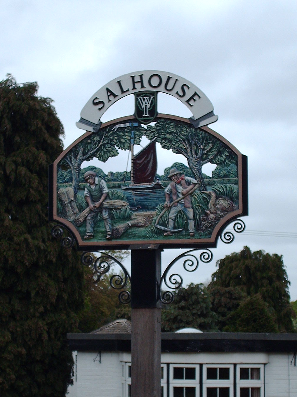
Salhouse
Salhouse is a village and civil parish in the Broads in the English county of Norfolk. It lies south of the River Bure and Salhouse Broad, about 10 kilometres...
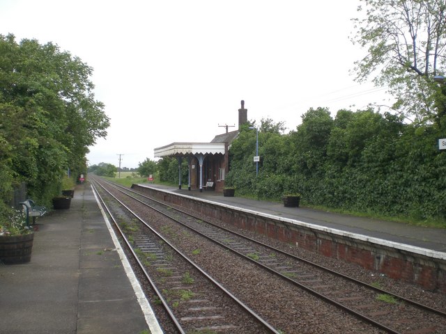
Salhouse railway station
Salhouse railway station is on the Bittern Line in Norfolk, England, serving the village of Salhouse. It is the next station along the line from Norwich...

Rackheath Eco-town
The Rackheath Eco-town is a proposal for just over 5,000 houses to be built in the Rackheath area, in Norfolk, within a mile of The Broads National Park...
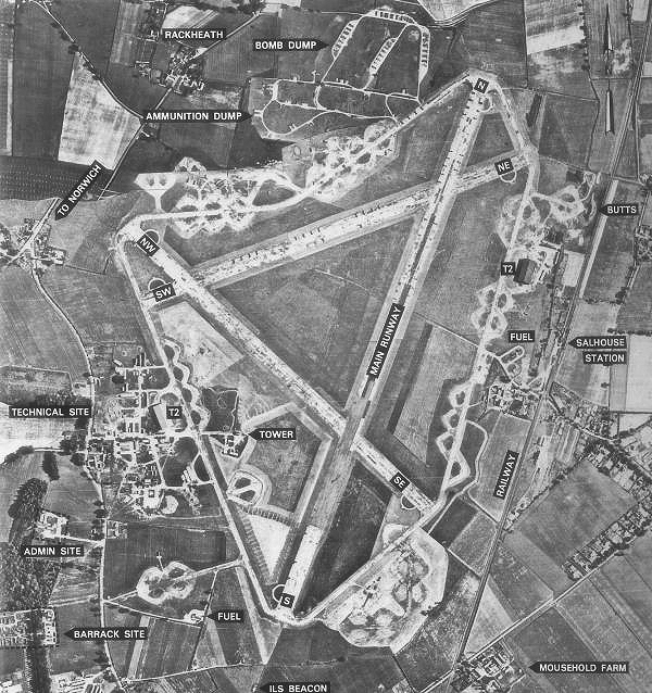
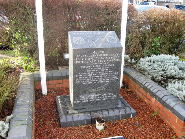
RAF Rackheath
Royal Air Force Rackheath, more commonly known as RAF Rackheath, is a former Royal Air Force station located near the village of Rackheath, approximately...
Milestones Hospital
Milestones Hospital [ˈmaɪlstəʊnz ˈhɒspɪtl] is a 10-bed mental hospital for women at Catfield, Norfolk. Milestones is owned by the Atarrah Project Ltd....
Rackheath
Rackheath is a village and civil parish in the English county of Norfolk, and is roughly 6 miles (9.7 km) north-east of Norwich city centre. It covers...

Norwich Northern Distributor Road
The Norwich Northern Distributor Road, now officially named the Broadland Northway (but also known as the NDR) is a 12.4 mi (20.0 km) dual-carriageway...

Great and Little Plumstead
Great and Little Plumstead is a civil parish in the English county of Norfolk consisting of the villages of Great Plumstead, Little Plumstead and Thorpe...
Nearby Amenities
Located within 500m of 52.670568,1.3981587Have you been to Hospital Plantation?
Leave your review of Hospital Plantation below (or comments, questions and feedback).