Dixie Spinney

Wood, Forest in Norfolk South Norfolk

England

Dixie Spinney

Denton: Denton Road
Denton: Denton Road Credit: Michael Garlick

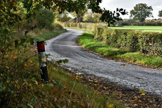
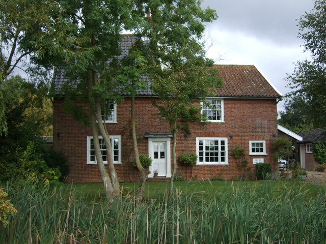
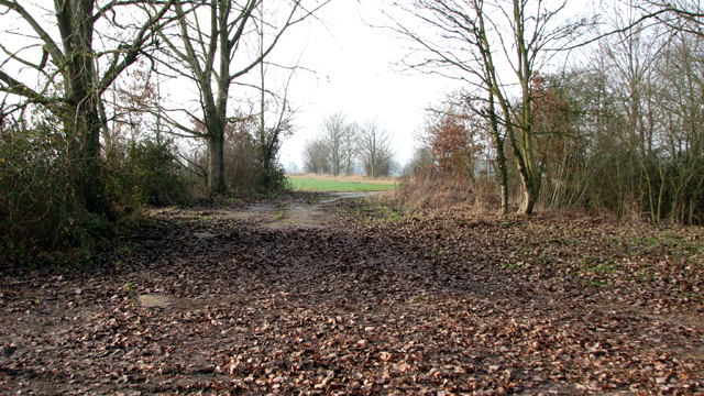
Dixie Spinney is a picturesque woodland located in Norfolk, England. Nestled amidst the serene Norfolk countryside, this enchanting forest stretches across an area of approximately 200 acres, offering visitors a tranquil escape from the hustle and bustle of city life.

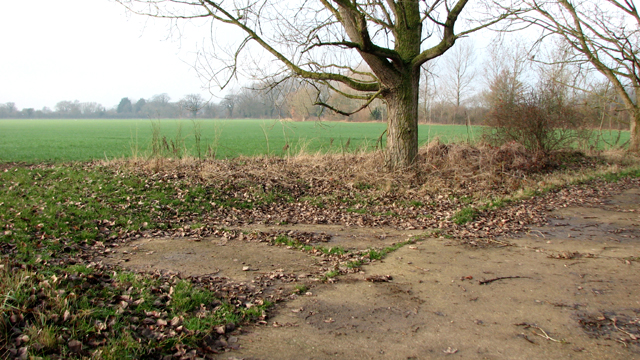
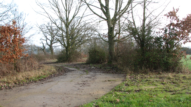
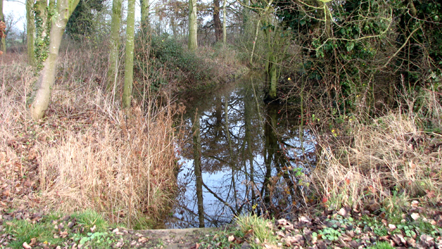
The woodland is primarily composed of a mix of deciduous and coniferous trees, including oak, beech, pine, and spruce. These trees create a dense canopy, providing shade and shelter for a variety of wildlife that call Dixie Spinney their home. Visitors to the forest can expect to spot an array of birds, such as woodpeckers, owls, and finches, as well as small mammals like squirrels and rabbits.

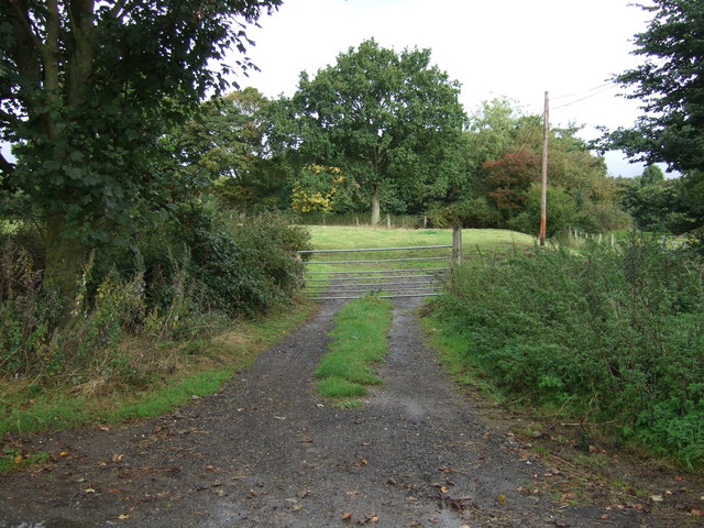
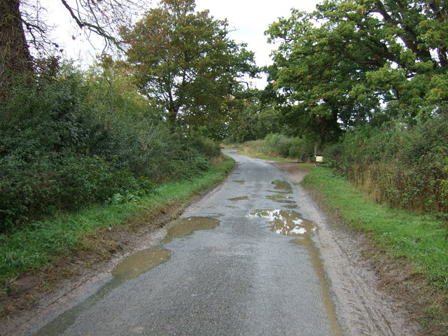
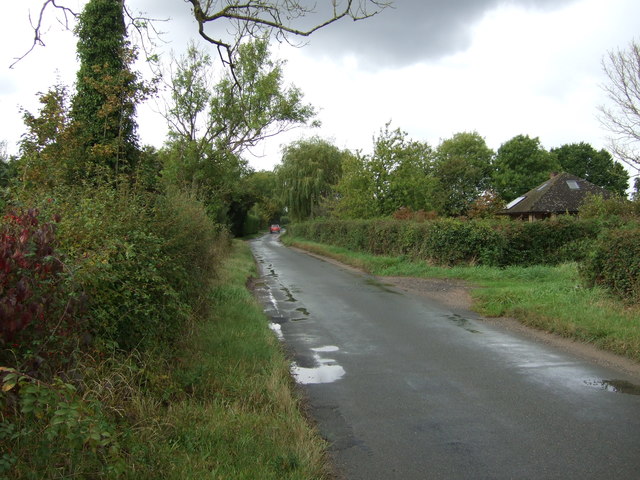
Dixie Spinney boasts a network of well-maintained trails that wind through the forest, allowing visitors to explore its natural beauty at their own pace. These trails are suitable for both casual walkers and more experienced hikers, with options ranging from short, leisurely strolls to longer, more challenging routes. Along these paths, hikers can discover hidden gems such as babbling brooks, wildflowers, and ancient trees that have stood the test of time.

The woodland is open to the public year-round, and visitors are encouraged to respect the natural environment. There are designated picnic areas where families and friends can enjoy a leisurely lunch amidst the peaceful surroundings. Additionally, the forest provides a popular spot for nature enthusiasts, photographers, and artists seeking inspiration from its scenic vistas and vibrant flora and fauna.

Overall, Dixie Spinney in Norfolk is a true haven for nature lovers, offering a serene retreat where one can immerse themselves in the beauty of the great outdoors.

If you have any feedback on the listing, please let us know in the comments section below.

Dixie Spinney Images

Images are sourced within 2km of 52.465501/1.3814155 or Grid Reference TM2990. Thanks to Geograph Open Source API. All images are credited.

Denton: Denton Road
Denton: Denton Road
Denton: Denton Road
Denton: Denton Road
Earsham Hall: Car parking area
Crop field off Denton Road
Denton Road Heading north west.
Denton Road
Heading north west.
Field entrance off Denton Road
Heading west on Denton Road
Crop field and hedgerow Off Denton Road.
Crop field and hedgerow
Off Denton Road.
Farmhouse, Denton Road Farm
Farm buildings, Denton Road Farm
Denton Road Heading north west near Denton Road Farm.
Denton Road
Heading north west near Denton Road Farm.
Flat farmland near Wood Farm Off Norwich Road.
Flat farmland near Wood Farm
Off Norwich Road.
Norwich Road Heading south west near Wood Farm.
Norwich Road
Heading south west near Wood Farm.
The Old Kings Head  Former public house on Norwich Road.
The Old Kings Head
Former public house on Norwich Road.
Bomb storage area beside Denton Road This old concreted track forms a loop beside which overgrown hardstandings can still be seen. The track and hardstandings date from WW2 when a large area in the vicinity of Earsham Hall was used as a bomb store by the United States Army Air Force, known as the Earsham Forward Ammunition Depot, Station 545.  Bombs were  stored in a number of woods and also beside several of the roads in the area, including Hall Road, Denton Road, Pheasants Walk, Five Acre Lane, Long Gate Lane,  Hogg Lane and this loop. Earsham Hall was the headquarters and the camp was situated in the grounds. Bombs were brought there by railway > <a title="https://www.geograph.org.uk/photo/1597129" href="https://www.geograph.org.uk/photo/1597129">Link</a> and then transported on lorries to airfields all over East Anglia.

Two storage areas are documented to have been located alongside Denton Road, one  on a grass verge on the southern edge of Earsham Park and another area of similar size was situated a short distance further  east near where  Hogg Lane emerges on Denton Road.   HE (high explosive) ammunition was stored beside the road near Whitehouse Farm and there was also a hardstanding for the storage of incendiaries. For more information go to > <a title="https://www.geograph.org.uk/article/Earsham-Forward-Ammunition-Depot--AAF-Station-545" href="https://www.geograph.org.uk/article/Earsham-Forward-Ammunition-Depot--AAF-Station-545">Link</a>.
Bomb storage area beside Denton Road
This old concreted track forms a loop beside which overgrown hardstandings can still be seen. The track and hardstandings date from WW2 when a large area in the vicinity of Earsham Hall was used as a bomb store by the United States Army Air Force, known as the Earsham Forward Ammunition Depot, Station 545. Bombs were stored in a number of woods and also beside several of the roads in the area, including Hall Road, Denton Road, Pheasants Walk, Five Acre Lane, Long Gate Lane, Hogg Lane and this loop. Earsham Hall was the headquarters and the camp was situated in the grounds. Bombs were brought there by railway > Link and then transported on lorries to airfields all over East Anglia. Two storage areas are documented to have been located alongside Denton Road, one on a grass verge on the southern edge of Earsham Park and another area of similar size was situated a short distance further east near where Hogg Lane emerges on Denton Road. HE (high explosive) ammunition was stored beside the road near Whitehouse Farm and there was also a hardstanding for the storage of incendiaries. For more information go to > Link.
Bomb storage area near Earsham Hall This old concreted track forms a loop beside which overgrown hardstandings can still be seen. The track and hardstandings date from WW2 when a large area in the vicinity of Earsham Hall was used as a bomb store by the United States Army Air Force, known as the Earsham Forward Ammunition Depot, Station 545.  Bombs were  stored in a number of woods and also beside several of the roads in the area, including Hall Road, Denton Road, Pheasants Walk, Five Acre Lane, Long Gate Lane,  Hogg Lane and this loop. Earsham Hall was the headquarters and the camp was situated in the grounds. Bombs were brought there by railway > <a title="https://www.geograph.org.uk/photo/1597129" href="https://www.geograph.org.uk/photo/1597129">Link</a> and then transported on lorries to airfields all over East Anglia.

Two storage areas are documented to have been located alongside Denton Road, one  on a grass verge on the southern edge of Earsham Park and another area of similar size was situated a short distance further  east near where  Hogg Lane emerges on Denton Road.   HE (high explosive) ammunition was stored beside the road near Whitehouse Farm and there was also a hardstanding for the storage of incendiaries. For more information go to > <a title="https://www.geograph.org.uk/article/Earsham-Forward-Ammunition-Depot--AAF-Station-545" href="https://www.geograph.org.uk/article/Earsham-Forward-Ammunition-Depot--AAF-Station-545">Link</a>.
Bomb storage area near Earsham Hall
This old concreted track forms a loop beside which overgrown hardstandings can still be seen. The track and hardstandings date from WW2 when a large area in the vicinity of Earsham Hall was used as a bomb store by the United States Army Air Force, known as the Earsham Forward Ammunition Depot, Station 545. Bombs were stored in a number of woods and also beside several of the roads in the area, including Hall Road, Denton Road, Pheasants Walk, Five Acre Lane, Long Gate Lane, Hogg Lane and this loop. Earsham Hall was the headquarters and the camp was situated in the grounds. Bombs were brought there by railway > Link and then transported on lorries to airfields all over East Anglia. Two storage areas are documented to have been located alongside Denton Road, one on a grass verge on the southern edge of Earsham Park and another area of similar size was situated a short distance further east near where Hogg Lane emerges on Denton Road. HE (high explosive) ammunition was stored beside the road near Whitehouse Farm and there was also a hardstanding for the storage of incendiaries. For more information go to > Link.
Ditch beside Denton Road
Old concreted road This old concreted track forms a loop beside which overgrown hardstandings can still be seen. The track and hardstandings date from WW2 when a large area in the vicinity of Earsham Hall was used as a bomb store by the United States Army Air Force, known as the Earsham Forward Ammunition Depot, Station 545.  Bombs were  stored in a number of woods and also beside several of the roads in the area, including Hall Road, Denton Road, Pheasants Walk, Five Acre Lane, Long Gate Lane,  Hogg Lane and this loop. Earsham Hall was the headquarters and the camp was situated in the grounds. Bombs were brought there by railway > <a title="https://www.geograph.org.uk/photo/1597129" href="https://www.geograph.org.uk/photo/1597129">Link</a> and then transported on lorries to airfields all over East Anglia.

Two storage areas are documented to have been located alongside Denton Road, one  on a grass verge on the southern edge of Earsham Park and another area of similar size was situated a short distance further  east near where  Hogg Lane emerges on Denton Road.   HE (high explosive) ammunition was stored beside the road near Whitehouse Farm and there was also a hardstanding for the storage of incendiaries. For more information go to > <a title="https://www.geograph.org.uk/article/Earsham-Forward-Ammunition-Depot--AAF-Station-545" href="https://www.geograph.org.uk/article/Earsham-Forward-Ammunition-Depot--AAF-Station-545">Link</a>.
Old concreted road
This old concreted track forms a loop beside which overgrown hardstandings can still be seen. The track and hardstandings date from WW2 when a large area in the vicinity of Earsham Hall was used as a bomb store by the United States Army Air Force, known as the Earsham Forward Ammunition Depot, Station 545. Bombs were stored in a number of woods and also beside several of the roads in the area, including Hall Road, Denton Road, Pheasants Walk, Five Acre Lane, Long Gate Lane, Hogg Lane and this loop. Earsham Hall was the headquarters and the camp was situated in the grounds. Bombs were brought there by railway > Link and then transported on lorries to airfields all over East Anglia. Two storage areas are documented to have been located alongside Denton Road, one on a grass verge on the southern edge of Earsham Park and another area of similar size was situated a short distance further east near where Hogg Lane emerges on Denton Road. HE (high explosive) ammunition was stored beside the road near Whitehouse Farm and there was also a hardstanding for the storage of incendiaries. For more information go to > Link.
Show me another place!

Dixie Spinney is located at Grid Ref: TM2990 (Lat: 52.465501, Lng: 1.3814155)

Administrative County: Norfolk

District: South Norfolk

Police Authority: Norfolk

What 3 Words

///talked.capers.qualifier. Near Bungay, Suffolk

Related Wikis

Sexton Wood

Sexton Wood is a 40-hectare (99-acre) biological Site of Special Scientific Interest north-west of Ditchingham in Norfolk. It is a Nature Conservation...

Bedingham Green

Bedingham Green is a hamlet in Norfolk, England. == References ==

Bedingham

Bedingham is a village and civil parish in the South Norfolk district of Norfolk, England, about 11 miles (18 km) south of Norwich. According to the 2001...

Earsham railway station

Earsham was a railway station in Earsham, Norfolk, England. It was located on the Waveney Valley Line which connected Beccles with the Great Eastern Main...

Bath Hills

Bath Hills is a 12.2-hectare (30-acre) Local Nature Reserve west of Ditchingham in Norfolk. It is owned by South Norfolk District Council and managed...

Denton, Norfolk

Denton is a village and civil parish in the English county of Norfolk. Denton is located 3.8 miles north-east of Harleston and 13 miles south of Norwich...

Earsham

Earsham is a village and civil parish in the English county of Norfolk. Earsham is located 1.7 kilometres (1.1 mi) west of its postal town of Bungay and...
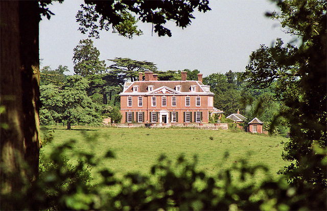
Ditchingham Hall

Ditchingham Hall is an English country house, near the village of Ditchingham in south Norfolk, England, which is set in about 2,000 acres (810 ha) of...

Nearby Amenities

Located within 500m of 52.465501,1.3814155
Access: agricultural
Barrier: swing_gate
Bicycle: no
Foot: yes
Note: Gap to side for pedestrians
Lat/Long: 52.4676566/1.37968
The data included in this document is from www.openstreetmap.org. The data is made available under ODbL.

Have you been to Dixie Spinney?

Leave your review of Dixie Spinney below (or comments, questions and feedback).