Singledge Wood

Wood, Forest in Kent Dover

England

Singledge Wood

The Winding House, Singledge Lane The Winding House is a spectacular restoration of an old Kent coal heritage building, where weddings are held  
<span class="nowrap"><a title="https://www.akentishceremony.com/venues/the-winding-house/" rel="nofollow ugc noopener" href="https://www.akentishceremony.com/venues/the-winding-house/">Link</a><img style="margin-left:2px;" alt="External link" title="External link - shift click to open in new window" src="https://s1.geograph.org.uk/img/external.png" width="10" height="10"/></span>
The Winding House, Singledge Lane Credit: John Baker

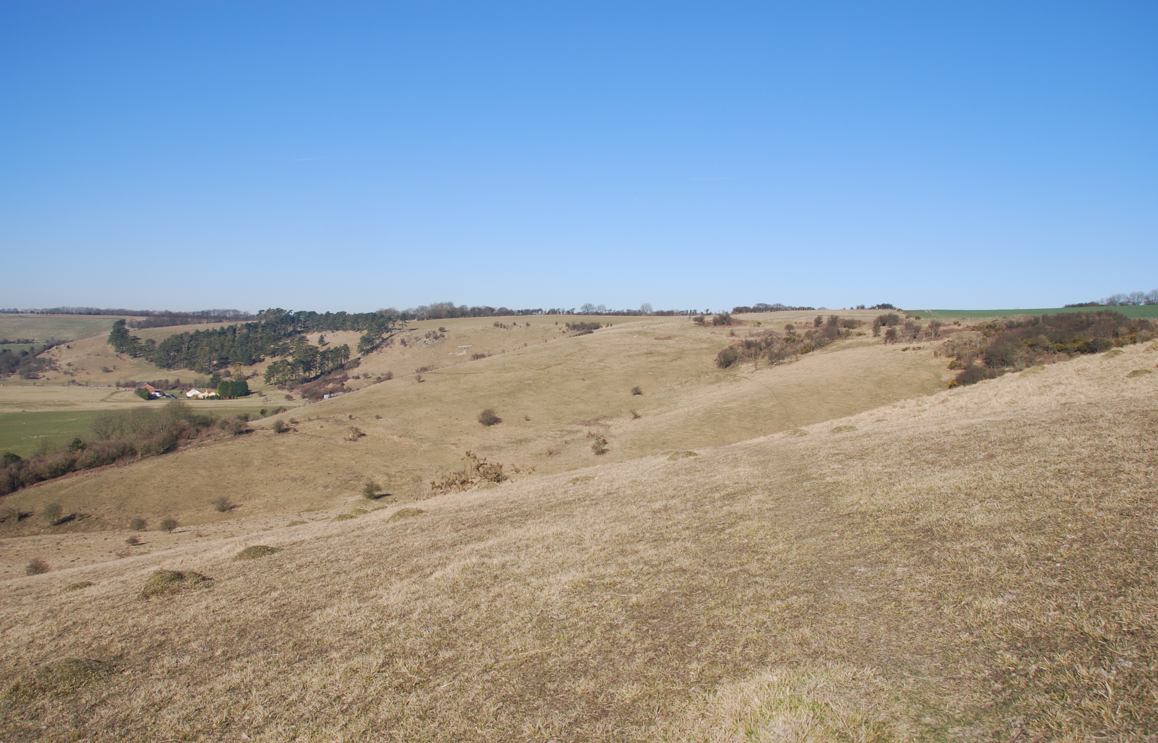
Singledge Wood is a beautiful woodland located in the county of Kent, England. Covering an area of approximately 100 acres, it is situated within the High Weald Area of Outstanding Natural Beauty. The wood is primarily composed of oak and beech trees, creating a dense and lush forest environment.

The wood is famous for its rich biodiversity, providing a home to a wide range of plant and animal species. The forest floor is carpeted with a variety of wildflowers, including bluebells, primroses, and wood anemones, creating a vibrant and colorful display during the spring months. The mature trees provide a habitat for numerous bird species, such as woodpeckers, owls, and warblers, making it a popular destination for birdwatchers.

Singledge Wood offers several picturesque walking paths and trails, allowing visitors to explore the beauty of the woodland. These paths wind through the trees, offering glimpses of the surrounding countryside and providing a tranquil and peaceful experience. There are also picnic areas and benches scattered throughout the wood, offering visitors the opportunity to relax and enjoy the natural surroundings.

Managed by the local council, Singledge Wood is well-maintained and cared for, ensuring its long-term preservation and enjoyment for future generations. It is a popular destination for nature enthusiasts, families, and individuals seeking a peaceful escape from the hustle and bustle of everyday life.

Overall, Singledge Wood in Kent is a stunning woodland that offers a diverse range of natural beauty, flora, and fauna. Its peaceful atmosphere and well-maintained trails make it an ideal location for leisurely walks and nature appreciation.

If you have any feedback on the listing, please let us know in the comments section below.

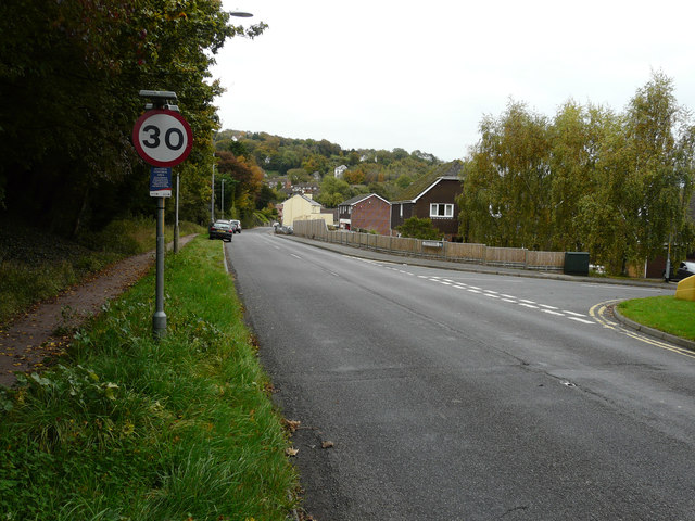
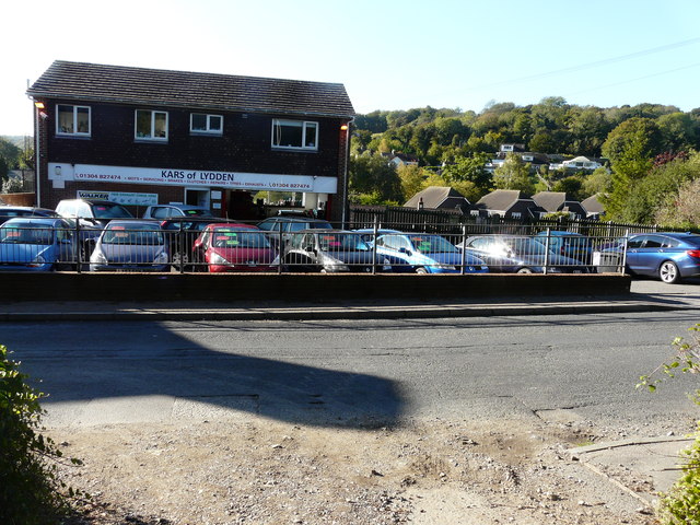
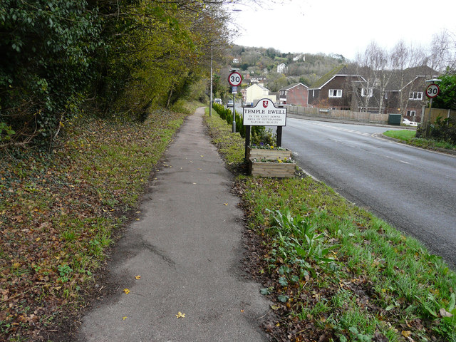
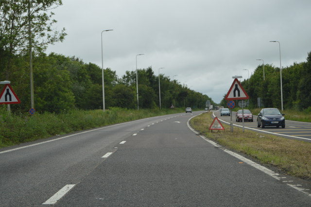
Singledge Wood Images

Images are sourced within 2km of 51.170676/1.2748864 or Grid Reference TR2946. Thanks to Geograph Open Source API. All images are credited.

The Winding House, Singledge Lane The Winding House is a spectacular restoration of an old Kent coal heritage building, where weddings are held  
<span class="nowrap"><a title="https://www.akentishceremony.com/venues/the-winding-house/" rel="nofollow ugc noopener" href="https://www.akentishceremony.com/venues/the-winding-house/">Link</a><img style="margin-left:2px;" alt="External link" title="External link - shift click to open in new window" src="https://s1.geograph.org.uk/img/external.png" width="10" height="10"/></span>
The Winding House, Singledge Lane
The Winding House is a spectacular restoration of an old Kent coal heritage building, where weddings are held LinkExternal link
The Pines, Forge Lane Planning permission has been granted by Dover District Council under application number DOV/19/01536 for the “erection of single storey side extension, detached double garage, front porch, existing garage conversion, 2 dormers, 1 roof-light to front elevation, alterations to existing lean-to/garage roof, vehicular access and associated parking (existing rear extension to be demolished)”.
The Pines, Forge Lane
Planning permission has been granted by Dover District Council under application number DOV/19/01536 for the “erection of single storey side extension, detached double garage, front porch, existing garage conversion, 2 dormers, 1 roof-light to front elevation, alterations to existing lean-to/garage roof, vehicular access and associated parking (existing rear extension to be demolished)”.
London Road The building, opposite the parked cars, is a garage at 191, London Road. Planning permission has been granted by Dover District Council under application number DOV/15/00123 for the “erection of ten semi-detached dwellings and creation of vehicular access and parking spaces (existing bungalow and garage to be demolished)(amended plans)”. Access to the dwellings would be via Watersend (the road to the right) and the <a href="https://www.geograph.org.uk/photo/4719057">TR2844 : Close off Watersend</a>. The location of the planning application reads land at 191 and Forge Bungalow, London Road, Temple Ewell.
London Road
The building, opposite the parked cars, is a garage at 191, London Road. Planning permission has been granted by Dover District Council under application number DOV/15/00123 for the “erection of ten semi-detached dwellings and creation of vehicular access and parking spaces (existing bungalow and garage to be demolished)(amended plans)”. Access to the dwellings would be via Watersend (the road to the right) and the TR2844 : Close off Watersend. The location of the planning application reads land at 191 and Forge Bungalow, London Road, Temple Ewell.
Kars of Lydden, 191, London Road Planning permission has been granted by Dover District Council under application number DOV/15/00123 for the “erection of ten semi-detached dwellings and creation of vehicular access and parking spaces (existing bungalow and garage to be demolished)(amended plans)”. The location of the planning application reads land at 191 and Forge Bungalow, London Road, Temple Ewell. Only the chimney of Forge Bungalow can be seen, to the right of the garage, as it lies downhill from the garage.
Kars of Lydden, 191, London Road
Planning permission has been granted by Dover District Council under application number DOV/15/00123 for the “erection of ten semi-detached dwellings and creation of vehicular access and parking spaces (existing bungalow and garage to be demolished)(amended plans)”. The location of the planning application reads land at 191 and Forge Bungalow, London Road, Temple Ewell. Only the chimney of Forge Bungalow can be seen, to the right of the garage, as it lies downhill from the garage.
London Road Compared with <a href="https://www.geograph.org.uk/photo/4719103">TR2844 : London Road</a>, a row of conifers has been planted along the grass verge and it is now only possible for cars to park, along this verge, beyond the planting.
London Road
Compared with TR2844 : London Road, a row of conifers has been planted along the grass verge and it is now only possible for cars to park, along this verge, beyond the planting.
Looking east-southeast along London Road A sign for Southdown Stores is affixed to the wall ahead.
Looking east-southeast along London Road
A sign for Southdown Stores is affixed to the wall ahead.
Looking west-northwest along London Road The line of wooden posts, set along the edge of the pavement in the distance, may have been the result of my submitting an objection to Dover District Council, which has granted planning permission under application number  DOV/15/00123 for the “erection of ten semi-detached dwellings and creation of vehicular access and parking spaces (existing bungalow and garage to be demolished)(amended plans)”. 

I pointed out that cars were being parked along the grass verge making a traffic hazard, as cars were also being parked outside Southdown Stores. Subsequently a line of conifers was planted seen in <a href="https://www.geograph.org.uk/photo/4762143">TR2844 : London Road</a> and the erection of the wooden posts followed a few weeks later. Cars are still parked in the road but no longer flout the law!
Looking west-northwest along London Road
The line of wooden posts, set along the edge of the pavement in the distance, may have been the result of my submitting an objection to Dover District Council, which has granted planning permission under application number DOV/15/00123 for the “erection of ten semi-detached dwellings and creation of vehicular access and parking spaces (existing bungalow and garage to be demolished)(amended plans)”. I pointed out that cars were being parked along the grass verge making a traffic hazard, as cars were also being parked outside Southdown Stores. Subsequently a line of conifers was planted seen in TR2844 : London Road and the erection of the wooden posts followed a few weeks later. Cars are still parked in the road but no longer flout the law!
Erection of hoarding supports, London Road The former railings have been removed and now two men are putting the supports up along the front of the <a href="https://www.geograph.org.uk/photo/5114474">TR2844 : Derelict garage site, 191, London Road</a>, on a miserable, wet day.
Erection of hoarding supports, London Road
The former railings have been removed and now two men are putting the supports up along the front of the TR2844 : Derelict garage site, 191, London Road, on a miserable, wet day.
Looking NNW along the route of the former Guilford Colliery Railway It was built in November 1912 to connect the colliery with the East Kent Light Railway at Eythorne. I shall have to return to this location, when there is less foliage to obscure the view.
Looking NNW along the route of the former Guilford Colliery Railway
It was built in November 1912 to connect the colliery with the East Kent Light Railway at Eythorne. I shall have to return to this location, when there is less foliage to obscure the view.
Looking ESE along the route of the former Guilford Colliery Railway It was built in November 1912 to connect the colliery with the East Kent Light Railway at Eythorne. I shall have to return to this location, when there is less foliage to obscure the view.
Looking ESE along the route of the former Guilford Colliery Railway
It was built in November 1912 to connect the colliery with the East Kent Light Railway at Eythorne. I shall have to return to this location, when there is less foliage to obscure the view.
New hoarding and temporary gate, 191, London Road Following the <a href="https://www.geograph.org.uk/photo/5140882">TR2844 : Erection of hoarding supports, London Road</a>, hoarding was added and four lengths of security fence placed across the entrance to the site.
New hoarding and temporary gate, 191, London Road
Following the TR2844 : Erection of hoarding supports, London Road, hoarding was added and four lengths of security fence placed across the entrance to the site.
Demolition of former garage, 191, London Road Planning permission has been granted by Dover District Council under application number DOV/15/00123 for the “erection of ten semi-detached dwellings and creation of vehicular access and parking spaces (existing bungalow and garage to be demolished) (amended plans)”. The location was described as land at 191 and Forge Bungalow, part of which can now be better seen, to the right of the former garage, which was <a href="https://www.geograph.org.uk/photo/4719120">TR2844 : Kars of Lydden, 191, London Road</a>.
Demolition of former garage, 191, London Road
Planning permission has been granted by Dover District Council under application number DOV/15/00123 for the “erection of ten semi-detached dwellings and creation of vehicular access and parking spaces (existing bungalow and garage to be demolished) (amended plans)”. The location was described as land at 191 and Forge Bungalow, part of which can now be better seen, to the right of the former garage, which was TR2844 : Kars of Lydden, 191, London Road.
Building site, 191, London Road The <a href="https://www.geograph.org.uk/photo/5175506">TR2844 : Demolition of former garage, 191, London Road</a> has almost been completed. Planning permission was granted by Dover District Council under application number DOV/15/00123 for the “erection of ten semi-detached dwellings and creation of vehicular access and parking spaces (existing bungalow and garage to be demolished) (amended plans)”. The location was described as land at 191 and Forge Bungalow.

The site is now occupied by <a href="https://www.geograph.org.uk/photo/6655181">TR2844 : Forge Villas, London Road</a>.
Building site, 191, London Road
The TR2844 : Demolition of former garage, 191, London Road has almost been completed. Planning permission was granted by Dover District Council under application number DOV/15/00123 for the “erection of ten semi-detached dwellings and creation of vehicular access and parking spaces (existing bungalow and garage to be demolished) (amended plans)”. The location was described as land at 191 and Forge Bungalow. The site is now occupied by TR2844 : Forge Villas, London Road.
Dual Carriageway ends, A2 The A2 runs 72 miles from Borough <a href="https://www.geograph.org.uk/photo/5739288">TQ3279 : Great Dover St</a> in London to Dover, through Kent, formerly known as the Dover Road or Great Dover Road. It follows roughly the course of the Roman Watling Street and historically it has always been an important road because it connects London with Canterbury and the port of Dover. In the 18th and 19th century it was turnpiked and given its present designation in the 1920s.
Dual Carriageway ends, A2
The A2 runs 72 miles from Borough TQ3279 : Great Dover St in London to Dover, through Kent, formerly known as the Dover Road or Great Dover Road. It follows roughly the course of the Roman Watling Street and historically it has always been an important road because it connects London with Canterbury and the port of Dover. In the 18th and 19th century it was turnpiked and given its present designation in the 1920s.
A2, westbound The A2 runs 72 miles from Borough <a href="https://www.geograph.org.uk/photo/5739288">TQ3279 : Great Dover St</a> in London to Dover, through Kent, formerly known as the Dover Road or Great Dover Road. It follows roughly the course of the Roman Watling Street and historically it has always been an important road because it connects London with Canterbury and the port of Dover. In the 18th and 19th century it was turnpiked and given its present designation in the 1920s.
A2, westbound
The A2 runs 72 miles from Borough TQ3279 : Great Dover St in London to Dover, through Kent, formerly known as the Dover Road or Great Dover Road. It follows roughly the course of the Roman Watling Street and historically it has always been an important road because it connects London with Canterbury and the port of Dover. In the 18th and 19th century it was turnpiked and given its present designation in the 1920s.
A2 The A2 runs 72 miles from Borough <a href="https://www.geograph.org.uk/photo/5739288">TQ3279 : Great Dover St</a> in London to Dover, through Kent, formerly known as the Dover Road or Great Dover Road. It follows roughly the course of the Roman Watling Street and historically it has always been an important road because it connects London with Canterbury and the port of Dover. In the 18th and 19th century it was turnpiked and given its present designation in the 1920s.
A2
The A2 runs 72 miles from Borough TQ3279 : Great Dover St in London to Dover, through Kent, formerly known as the Dover Road or Great Dover Road. It follows roughly the course of the Roman Watling Street and historically it has always been an important road because it connects London with Canterbury and the port of Dover. In the 18th and 19th century it was turnpiked and given its present designation in the 1920s.
Show me another place!

Singledge Wood is located at Grid Ref: TR2946 (Lat: 51.170676, Lng: 1.2748864)

Administrative County: Kent

District: Dover

Police Authority: Kent

What 3 Words

///seabirds.bubbles.urban. Near Eythorne, Kent

Related Wikis

Temple Ewell Preceptory

Temple Ewell Preceptory was a preceptory of the Knights Templar at Temple Ewell on the northern outskirts of Dover in Kent, England. == History == Since...

Lydden and Temple Ewell Downs

Lydden and Temple Ewell Downs is a 63.2-hectare (156-acre) biological Site of Special Scientific Interest north-west of Dover in Kent. It is a Special...

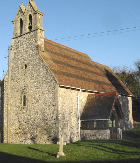
All Saints Church, Waldershare

All Saints Church is a redundant Anglican church in Waldershare, Kent, England. It is recorded in the National Heritage List for England as a designated...

Coldred

Coldred is a settlement and former civil parish, now in the parish of Shepherdswell with Coldred, in the Dover district of Kent, England. The main part...

Nearby Amenities

Located within 500m of 51.170676,1.2748864
Turning Loop
Lat/Long: 51.1665947/1.2720403
Dover Clay Pigeon Club
Addr City: Dover
Addr Postcode: CT15 5AF
Addr Street: Singledge Lane
Contact Facebook: https://www.facebook.com/Dover-Clay-Pigeon-Club-756738001137034/timeline
Description: Dover Clay Pigeon (not for profit) Club, established in 1972 and CPSA affiliated welcomes members and non members to participate in the sport of clay pigeon shooting.
Fee: yes
Leisure: sports_centre
Mobile: 07932011287
Sport: shooting
Website: https://doverclaypigeon.club/
Lat/Long: 51.1712928/1.2684142
The data included in this document is from www.openstreetmap.org. The data is made available under ODbL.

Have you been to Singledge Wood?

Leave your review of Singledge Wood below (or comments, questions and feedback).