Round Clump

Wood, Forest in Norfolk Broadland

England

Round Clump

Atlantic Avenue Part of an expansion of Norwich to the northeast.
Atlantic Avenue Credit: Hugh Venables

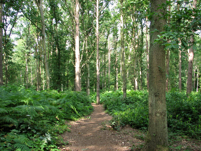
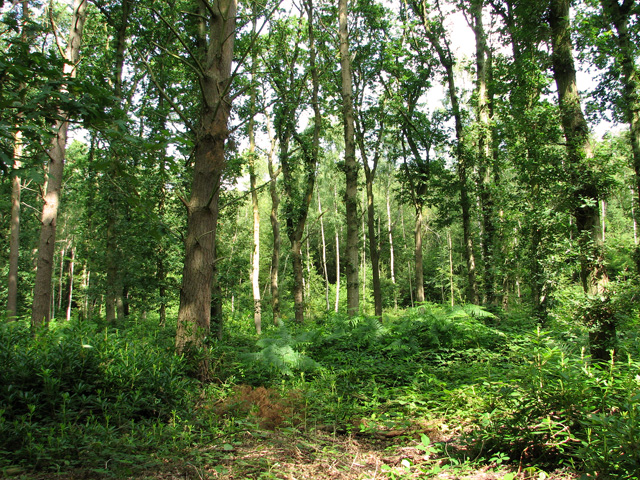
Round Clump is a small woodland area located in Norfolk, England. Situated near the village of Wood, the forest is known for its picturesque beauty and rich biodiversity. Covering an area of approximately 50 acres, Round Clump is a popular destination for nature enthusiasts and hikers.

The woodland is characterized by its dense vegetation, consisting mainly of oak, beech, and birch trees. The forest floor is adorned with a variety of wildflowers, mosses, and ferns, creating a vibrant and colorful landscape. The diverse flora provides a conducive habitat for numerous species of birds, butterflies, and small mammals.

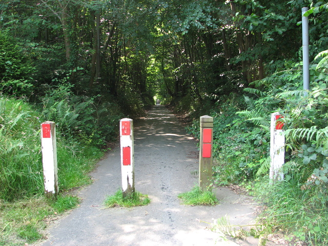
Round Clump is crisscrossed by a network of well-maintained trails, making it easily accessible to visitors. These paths wind through the forest, leading to hidden clearings and peaceful glades, offering opportunities for leisurely walks and relaxation. The serene atmosphere and tranquil surroundings make it an ideal spot for picnics or meditation.

The forest is also home to several species of wildlife, including deer, foxes, and badgers. Birdwatchers can spot various species such as woodpeckers, owls, and thrushes, making it a haven for bird lovers.

Managed by the local authorities, Round Clump is well-preserved and protected. Visitors are encouraged to follow designated paths and respect the natural surroundings. The forest provides a valuable ecosystem service by purifying air, regulating temperature, and supporting local wildlife populations.

Overall, Round Clump in Norfolk is a captivating woodland area that offers visitors a chance to immerse themselves in nature and experience the beauty of the English countryside.

If you have any feedback on the listing, please let us know in the comments section below.

Round Clump Images

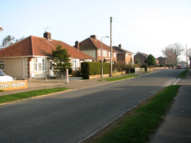
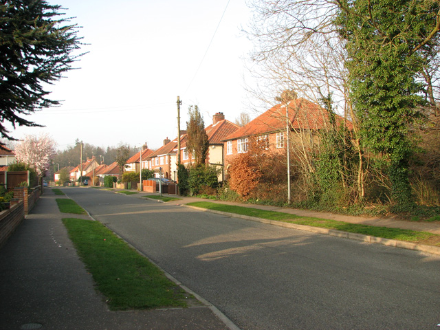
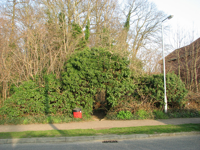
Images are sourced within 2km of 52.645191/1.3599332 or Grid Reference TG2710. Thanks to Geograph Open Source API. All images are credited.

Atlantic Avenue Part of an expansion of Norwich to the northeast.
Atlantic Avenue
Part of an expansion of Norwich to the northeast.
Cycle path closed by Broadland Northway The cyclepath doesn't follow the length of the new road, just stretches where roads have been cut off.
Cycle path closed by Broadland Northway
The cyclepath doesn't follow the length of the new road, just stretches where roads have been cut off.
Pound Lane past Belmore Plantation, Thorpe St Andrew Belmore Plantation is one of three woodlands (Racecourse, Belmore and Brown’s Plantations) in Thorpe St Andrew, just outside Norwich. Their total area is 205 acres (82 hectares), and together they form the largest area of woodland within several miles of Norwich. The woodlands are owned by the Thorpe & Felthorpe Trust, the Trustees of which are five members of the Gurney family. Local residents are opposing a developer's plan to build 631 housing 'units' here.
Pound Lane past Belmore Plantation, Thorpe St Andrew
Belmore Plantation is one of three woodlands (Racecourse, Belmore and Brown’s Plantations) in Thorpe St Andrew, just outside Norwich. Their total area is 205 acres (82 hectares), and together they form the largest area of woodland within several miles of Norwich. The woodlands are owned by the Thorpe & Felthorpe Trust, the Trustees of which are five members of the Gurney family. Local residents are opposing a developer's plan to build 631 housing 'units' here.
Belmore Plantation as seen from Pound Lane, Thorpe St Andrew Belmore Plantation is one of three woodlands (Racecourse, Belmore and Brown’s Plantations) in Thorpe St Andrew, just outside Norwich. Their total area is 205 acres (82 hectares), and together they form the largest area of woodland within several miles of Norwich. The woodlands are owned by the Thorpe & Felthorpe Trust, the Trustees of which are five members of the Gurney family. Local residents are opposing a developer's plan to build 631 housing 'units' here.
Belmore Plantation as seen from Pound Lane, Thorpe St Andrew
Belmore Plantation is one of three woodlands (Racecourse, Belmore and Brown’s Plantations) in Thorpe St Andrew, just outside Norwich. Their total area is 205 acres (82 hectares), and together they form the largest area of woodland within several miles of Norwich. The woodlands are owned by the Thorpe & Felthorpe Trust, the Trustees of which are five members of the Gurney family. Local residents are opposing a developer's plan to build 631 housing 'units' here.
Cottages in Pound Lane, Thorpe St Andrew
Cottages on the edge of Belmore Plantation, Thorpe St Andrew The tree in the foreground (right) is a large redwood tree. The term 'redwood' generally refers to one of several species of tree with red or reddish coloured wood; the bark of mature trees is commonly orange to red-brown in colour and of a stringy texture. Redwoods are conifers of the Cupressaceae or cypress family that has a worldwide distribution ranging from arctic Norway to southern Chile.

Belmore Plantation is one of three woodlands (Racecourse, Belmore and Brown’s Plantations) in Thorpe St Andrew, just outside Norwich. Their total area is 205 acres (82 hectares), and together they form the largest area of woodland within several miles of Norwich. The woodlands are owned by the Thorpe & Felthorpe Trust, the Trustees of which are five members of the Gurney family. Local residents are opposing a developer's plan to build 631 housing 'units' here.
Cottages on the edge of Belmore Plantation, Thorpe St Andrew
The tree in the foreground (right) is a large redwood tree. The term 'redwood' generally refers to one of several species of tree with red or reddish coloured wood; the bark of mature trees is commonly orange to red-brown in colour and of a stringy texture. Redwoods are conifers of the Cupressaceae or cypress family that has a worldwide distribution ranging from arctic Norway to southern Chile. Belmore Plantation is one of three woodlands (Racecourse, Belmore and Brown’s Plantations) in Thorpe St Andrew, just outside Norwich. Their total area is 205 acres (82 hectares), and together they form the largest area of woodland within several miles of Norwich. The woodlands are owned by the Thorpe & Felthorpe Trust, the Trustees of which are five members of the Gurney family. Local residents are opposing a developer's plan to build 631 housing 'units' here.
Redwood tree on the edge of Belmore Plantation, Thorpe St Andrew In a class of its own and standing out from the surrounding broadleaf trees this large redwood tree is growing on the edge of Belmore Plantation. The term 'redwood' generally refers to one of several species of tree with red or reddish coloured wood; the bark of mature trees is commonly orange to red-brown in colour and of a stringy texture. Redwoods are conifers of the Cupressaceae or cypress family that has a worldwide distribution ranging from arctic Norway to southern Chile.

Belmore Plantation is one of three woodlands (Racecourse, Belmore and Brown’s Plantations) in Thorpe St Andrew, just outside Norwich. Their total area is 205 acres (82 hectares), and together they form the largest area of woodland within several miles of Norwich. The woodlands are owned by the Thorpe & Felthorpe Trust, the Trustees of which are five members of the Gurney family. Local residents are opposing a developer's plan to build 631 housing 'units' here.
Redwood tree on the edge of Belmore Plantation, Thorpe St Andrew
In a class of its own and standing out from the surrounding broadleaf trees this large redwood tree is growing on the edge of Belmore Plantation. The term 'redwood' generally refers to one of several species of tree with red or reddish coloured wood; the bark of mature trees is commonly orange to red-brown in colour and of a stringy texture. Redwoods are conifers of the Cupressaceae or cypress family that has a worldwide distribution ranging from arctic Norway to southern Chile. Belmore Plantation is one of three woodlands (Racecourse, Belmore and Brown’s Plantations) in Thorpe St Andrew, just outside Norwich. Their total area is 205 acres (82 hectares), and together they form the largest area of woodland within several miles of Norwich. The woodlands are owned by the Thorpe & Felthorpe Trust, the Trustees of which are five members of the Gurney family. Local residents are opposing a developer's plan to build 631 housing 'units' here.
Dry pond in Belmore Plantation, Thorpe St Andrew Belmore Plantation is one of three woodlands (Racecourse, Belmore and Brown’s Plantations) in Thorpe St Andrew, just outside Norwich. Their total area is 205 acres (82 hectares), and together they form the largest area of woodland within several miles of Norwich. The woodlands are owned by the Thorpe & Felthorpe Trust, the Trustees of which are five members of the Gurney family. Local residents are opposing a developer's plan to build 631 housing 'units' here.
Dry pond in Belmore Plantation, Thorpe St Andrew
Belmore Plantation is one of three woodlands (Racecourse, Belmore and Brown’s Plantations) in Thorpe St Andrew, just outside Norwich. Their total area is 205 acres (82 hectares), and together they form the largest area of woodland within several miles of Norwich. The woodlands are owned by the Thorpe & Felthorpe Trust, the Trustees of which are five members of the Gurney family. Local residents are opposing a developer's plan to build 631 housing 'units' here.
Path past ponds in Belmore Plantation, Thorpe St Andrew Belmore Plantation is one of three woodlands (Racecourse, Belmore and Brown’s Plantations) in Thorpe St Andrew, just outside Norwich. Their total area is 205 acres (82 hectares), and together they form the largest area of woodland within several miles of Norwich. The woodlands are owned by the Thorpe & Felthorpe Trust, the Trustees of which are five members of the Gurney family. Local residents are opposing a developer's plan to build 631 housing 'units' here.
Path past ponds in Belmore Plantation, Thorpe St Andrew
Belmore Plantation is one of three woodlands (Racecourse, Belmore and Brown’s Plantations) in Thorpe St Andrew, just outside Norwich. Their total area is 205 acres (82 hectares), and together they form the largest area of woodland within several miles of Norwich. The woodlands are owned by the Thorpe & Felthorpe Trust, the Trustees of which are five members of the Gurney family. Local residents are opposing a developer's plan to build 631 housing 'units' here.
Path in Belmore Plantation, Thorpe St Andrew Belmore Plantation is one of three woodlands (Racecourse, Belmore and Brown’s Plantations) in Thorpe St Andrew, just outside Norwich. Their total area is 205 acres (82 hectares), and together they form the largest area of woodland within several miles of Norwich. The woodlands are owned by the Thorpe & Felthorpe Trust, the Trustees of which are five members of the Gurney family. Local residents are opposing a developer's plan to build 631 housing 'units' here.
Path in Belmore Plantation, Thorpe St Andrew
Belmore Plantation is one of three woodlands (Racecourse, Belmore and Brown’s Plantations) in Thorpe St Andrew, just outside Norwich. Their total area is 205 acres (82 hectares), and together they form the largest area of woodland within several miles of Norwich. The woodlands are owned by the Thorpe & Felthorpe Trust, the Trustees of which are five members of the Gurney family. Local residents are opposing a developer's plan to build 631 housing 'units' here.
Pound Lane past Brown's Plantation, Thorpe St Andrew The woodland to the right (west) of the lane is Belmore Plantation. Belmore Plantation is one of three woodlands (Racecourse, Belmore and Brown’s Plantations) in Thorpe St Andrew, just outside Norwich. Their total area is 205 acres (82 hectares), and together they form the largest area of woodland within several miles of Norwich. The woodlands are owned by the Thorpe & Felthorpe Trust, the Trustees of which are five members of the Gurney family. Local residents are opposing a developer's plan to build 631 housing 'units' here.
Pound Lane past Brown's Plantation, Thorpe St Andrew
The woodland to the right (west) of the lane is Belmore Plantation. Belmore Plantation is one of three woodlands (Racecourse, Belmore and Brown’s Plantations) in Thorpe St Andrew, just outside Norwich. Their total area is 205 acres (82 hectares), and together they form the largest area of woodland within several miles of Norwich. The woodlands are owned by the Thorpe & Felthorpe Trust, the Trustees of which are five members of the Gurney family. Local residents are opposing a developer's plan to build 631 housing 'units' here.
The northern end of Pound Lane, Thorpe St Andrew
Bungalows by the southern edge of Belmore Plantation, Thorpe St Andrew
Path through bracken in Belmore Plantation, Thorpe St Andrew Belmore Plantation is one of three woodlands (Racecourse, Belmore and Brown’s Plantations) in Thorpe St Andrew, just outside Norwich. Their total area is 205 acres (82 hectares), and together they form the largest area of woodland within several miles of Norwich. The woodlands are owned by the Thorpe & Felthorpe Trust, the Trustees of which are five members of the Gurney family. Local residents are opposing a developer's plan to build 631 housing 'units' here.
Path through bracken in Belmore Plantation, Thorpe St Andrew
Belmore Plantation is one of three woodlands (Racecourse, Belmore and Brown’s Plantations) in Thorpe St Andrew, just outside Norwich. Their total area is 205 acres (82 hectares), and together they form the largest area of woodland within several miles of Norwich. The woodlands are owned by the Thorpe & Felthorpe Trust, the Trustees of which are five members of the Gurney family. Local residents are opposing a developer's plan to build 631 housing 'units' here.
Belmore Plantation, Thorpe St Andrew Belmore Plantation is one of three woodlands (Racecourse, Belmore and Brown’s Plantations) in Thorpe St Andrew, just outside Norwich. Their total area is 205 acres (82 hectares), and together they form the largest area of woodland within several miles of Norwich. The woodlands are owned by the Thorpe & Felthorpe Trust, the Trustees of which are five members of the Gurney family. Local residents are opposing a developer's plan to build 631 housing 'units' here.
Belmore Plantation, Thorpe St Andrew
Belmore Plantation is one of three woodlands (Racecourse, Belmore and Brown’s Plantations) in Thorpe St Andrew, just outside Norwich. Their total area is 205 acres (82 hectares), and together they form the largest area of woodland within several miles of Norwich. The woodlands are owned by the Thorpe & Felthorpe Trust, the Trustees of which are five members of the Gurney family. Local residents are opposing a developer's plan to build 631 housing 'units' here.
Cottages in South Hill Road, Thorpe St Andrew
Path into Belmore Plantation, Thorpe St Andrew Belmore Plantation is one of three woodlands (Racecourse, Belmore and Brown’s Plantations) in Thorpe St Andrew, just outside Norwich. Their total area is 205 acres (82 hectares), and together they form the largest area of woodland within several miles of Norwich. The woodlands are owned by the Thorpe & Felthorpe Trust, the Trustees of which are five members of the Gurney family. Local residents are opposing a developer's plan to build 631 housing 'units' here.
Path into Belmore Plantation, Thorpe St Andrew
Belmore Plantation is one of three woodlands (Racecourse, Belmore and Brown’s Plantations) in Thorpe St Andrew, just outside Norwich. Their total area is 205 acres (82 hectares), and together they form the largest area of woodland within several miles of Norwich. The woodlands are owned by the Thorpe & Felthorpe Trust, the Trustees of which are five members of the Gurney family. Local residents are opposing a developer's plan to build 631 housing 'units' here.
Show me another place!

Round Clump is located at Grid Ref: TG2710 (Lat: 52.645191, Lng: 1.3599332)

Administrative County: Norfolk

District: Broadland

Police Authority: Norfolk

What 3 Words

///normal.hunt.lonely. Near Rackheath, Norfolk

Related Wikis

Thorpe St Andrew School

Thorpe St. Andrew School is an 11 to 18 mixed secondary school in Thorpe St. Andrew on the outskirts of the city of Norwich in the English county of Norfolk...

Broadland

Broadland is a local government district in Norfolk, England, named after the Norfolk Broads. Its council is based at the Broadland Business Park on the...

Thorpe St Andrew

Thorpe St Andrew is a town and civil parish in the Broadland district of Norfolk, England. It is situated on the River Yare, two miles east of the centre...

Heartsease Estate, Norwich

The Heartsease is a housing estate located in Norwich, Norfolk and takes its name from the heartsease, a common European wild flower. == Location == The...

RAF Mousehold Heath

The area of Norwich between the Salhouse and Plumstead roads (outside of the outer ring road) was originally the Cavalry Training Ground and then became...

St Andrew's Hospital, Norwich

St Andrew's Hospital was a mental health facility in Thorpe St Andrew, Norwich, Norfolk, England. The main building survives and it is a Grade II listed...

Open Academy

Open Academy (formerly Heartsease High School) is a secondary school with academy status located in the Heartsease area of Norwich, in the English county...

Whitlingham railway station

Whitlingham was a station in Whitlingham, Norfolk. The simple station has been demolished leaving no trace of its existence. However the footbridge is...

Nearby Amenities

Located within 500m of 52.645191,1.3599332
Crossing
Crossing: uncontrolled
Lat/Long: 52.6465993/1.3618729
Bus Stop
Dussindale Drive, adj
Naptan AtcoCode: 2900T1335
Naptan Bearing: SW
Naptan CommonName: Dussindale Drive
Naptan Indicator: adj
Naptan Locality: Dussindale Park
Naptan NaptanCode: nfogadgp
Naptan PlusbusZoneRef: NRCH
Naptan Street: Plumstead Road
Naptan Verified: no
Source: naptan_import
Lat/Long: 52.6465158/1.3604568
Bus Stop
Dussindale Drive, opp
Naptan AtcoCode: 2900T1336
Naptan Bearing: NE
Naptan CommonName: Dussindale Drive
Naptan Indicator: opp
Naptan Locality: Dussindale Park
Naptan NaptanCode: nfogadgt
Naptan PlusbusZoneRef: NRCH
Naptan Street: Plumstead Road East
Naptan Verified: no
Source: naptan_import
Lat/Long: 52.6467591/1.3607565
Bus Stop
Rainsborough Rise, adj
Naptan AtcoCode: 2900T1337
Naptan Bearing: SE
Naptan CommonName: Rainsborough Rise
Naptan Indicator: adj
Naptan Landmark: Rainsborough Rise
Naptan Locality: Dussindale Park
Naptan NaptanCode: nfogadgw
Naptan PlusbusZoneRef: NRCH
Naptan Street: Dussindale Drive
Naptan Verified: no
Source: naptan_import
Lat/Long: 52.6436724/1.3614511
Bus Stop
Rainsborough Rise, opp
Naptan AtcoCode: 2900T1338
Naptan Bearing: NW
Naptan CommonName: Rainsborough Rise
Naptan Indicator: opp
Naptan Landmark: Rainsborough Rise
Naptan Locality: Dussindale Park
Naptan NaptanCode: nfogadja
Naptan PlusbusZoneRef: NRCH
Naptan Street: Dussindale Drive
Naptan Verified: no
Source: naptan_import
Lat/Long: 52.64358/1.3612222
Bus Stop
Pound Lane, adj
Bus: yes
Naptan AtcoCode: 2900T1352
Naptan Bearing: E
Naptan CommonName: Pound Lane
Naptan Indicator: adj
Naptan Landmark: Pound Lane junc
Naptan Locality: Thorpe St Andrew
Naptan NaptanCode: nfogadpd
Naptan PlusbusZoneRef: NRCH
Naptan Street: Booty Road
Naptan Verified: no
Public Transport: platform
Source: naptan_import
Lat/Long: 52.6410424/1.3574642
Priority: equal
Lat/Long: 52.6409745/1.3577154
Crossing
Crossing: uncontrolled
Lat/Long: 52.6414648/1.3630313
Give Way
Lat/Long: 52.648017/1.3654707
Give Way
Lat/Long: 52.6409812/1.3579435
Thorpe St Andrew
Inscription: Thorpe St. Andrew
Man Made: village_sign
Material: wood
Lat/Long: 52.6469888/1.362184
Crossing
Crossing: island
Lat/Long: 52.6467879/1.3617268
Give Way
Lat/Long: 52.6468694/1.3616616
Generator Method: photovoltaic
Generator Output Electricity: yes
Generator Source: solar
Generator Type: solar_photovoltaic_panel
Location: roof
Power: generator
Lat/Long: 52.6442954/1.3619962
Generator Method: photovoltaic
Generator Output Electricity: yes
Generator Source: solar
Generator Type: solar_photovoltaic_panel
Location: roof
Power: generator
Lat/Long: 52.6443247/1.3622805
Generator Method: photovoltaic
Generator Output Electricity: yes
Generator Source: solar
Generator Type: solar_photovoltaic_panel
Location: roof
Power: generator
Lat/Long: 52.6425334/1.3621389
Generator Method: photovoltaic
Generator Output Electricity: yes
Generator Source: solar
Generator Type: solar_photovoltaic_panel
Location: roof
Power: generator
Lat/Long: 52.641073/1.3613927
Source: OS_OpenData_VectorMapLocal
Lat/Long: 52.64855/1.3646463
Source: OS_OpenData_VectorMapLocal
Lat/Long: 52.6484801/1.3645578
Source: OS_OpenData_VectorMapLocal
Lat/Long: 52.6484243/1.3646821
Source: OS_OpenData_VectorMapLocal
Lat/Long: 52.6484498/1.3647143
Source: OS_OpenData_VectorMapLocal
Lat/Long: 52.6484344/1.3647502
Source: OS_OpenData_VectorMapLocal
Lat/Long: 52.6484751/1.364808
Source: OS_OpenData_VectorMapLocal
Lat/Long: 52.6487689/1.3631971
Source: OS_OpenData_VectorMapLocal
Lat/Long: 52.6487399/1.3632917
Source: OS_OpenData_VectorMapLocal
Lat/Long: 52.6488535/1.3633869
Source: OS_OpenData_VectorMapLocal
Lat/Long: 52.6488833/1.3632916
Source: OS_OpenData_VectorMapLocal
Lat/Long: 52.6487559/1.3633756
Source: OS_OpenData_VectorMapLocal
Lat/Long: 52.6487199/1.3634949
Source: OS_OpenData_VectorMapLocal
Lat/Long: 52.6488043/1.3635638
Source: OS_OpenData_VectorMapLocal
Lat/Long: 52.6488403/1.3634445
Source: OS_OpenData_VectorMapLocal
Lat/Long: 52.6487323/1.3637857
Source: OS_OpenData_VectorMapLocal
Lat/Long: 52.6487663/1.3636665
Source: OS_OpenData_VectorMapLocal
Lat/Long: 52.6486902/1.3636079
Source: OS_OpenData_VectorMapLocal
Lat/Long: 52.6486563/1.3637271
Source: OS_OpenData_VectorMapLocal
Lat/Long: 52.6486932/1.3635565
Source: OS_OpenData_VectorMapLocal
Lat/Long: 52.6487056/1.3635147
Source: OS_OpenData_VectorMapLocal
Lat/Long: 52.64864/1.3634621
Source: OS_OpenData_VectorMapLocal
Lat/Long: 52.6486276/1.3635038
Source: OS_OpenData_VectorMapLocal
Lat/Long: 52.6491175/1.3625606
Source: OS_OpenData_VectorMapLocal
Lat/Long: 52.6489839/1.3625529
Source: OS_OpenData_VectorMapLocal
Lat/Long: 52.6489808/1.3626699
Source: OS_OpenData_VectorMapLocal
Lat/Long: 52.6491153/1.3626777
Source: OS_OpenData_VectorMapLocal
Lat/Long: 52.6489352/1.363136
Source: OS_OpenData_VectorMapLocal
Lat/Long: 52.6488359/1.3630454
Source: OS_OpenData_VectorMapLocal
Lat/Long: 52.6488005/1.3631529
Source: OS_OpenData_VectorMapLocal
Lat/Long: 52.6489018/1.3632425
Source: OS_OpenData_VectorMapLocal
Lat/Long: 52.6489113/1.3626595
Source: OS_OpenData_VectorMapLocal
Lat/Long: 52.6488098/1.3628216
Source: OS_OpenData_VectorMapLocal
Lat/Long: 52.6488529/1.3628955
Source: OS_OpenData_VectorMapLocal
Lat/Long: 52.6489541/1.3627301
Source: OS_OpenData_VectorMapLocal
Lat/Long: 52.6488177/1.3628857
Source: OS_OpenData_VectorMapLocal
Lat/Long: 52.6487983/1.3629321
Source: OS_OpenData_VectorMapLocal
Lat/Long: 52.6488448/1.3629846
Source: OS_OpenData_VectorMapLocal
Lat/Long: 52.6488642/1.3629382
Source: OS_OpenData_VectorMapLocal
Lat/Long: 52.6486659/1.3638453
Source: OS_OpenData_VectorMapLocal
Lat/Long: 52.6486186/1.3639967
Source: OS_OpenData_VectorMapLocal
Lat/Long: 52.6485799/1.3639658
Source: OS_OpenData_VectorMapLocal
Lat/Long: 52.6485691/1.3639975
Source: OS_OpenData_VectorMapLocal
Lat/Long: 52.648693/1.3640995
Source: OS_OpenData_VectorMapLocal
Lat/Long: 52.64875/1.3639134
Source: OS_OpenData_VectorMapLocal
Lat/Long: 52.6486416/1.3642783
Source: OS_OpenData_VectorMapLocal
Lat/Long: 52.64868/1.364151
Source: OS_OpenData_VectorMapLocal
Lat/Long: 52.6485909/1.3640782
Source: OS_OpenData_VectorMapLocal
Lat/Long: 52.6485525/1.3642055
Source: OS_OpenData_VectorMapLocal
Lat/Long: 52.6486679/1.3643991
Source: OS_OpenData_VectorMapLocal
Lat/Long: 52.6485392/1.3642788
Source: OS_OpenData_VectorMapLocal
Lat/Long: 52.6485019/1.3643859
Source: OS_OpenData_VectorMapLocal
Lat/Long: 52.648632/1.3645072
Source: OS_OpenData_VectorMapLocal
Lat/Long: 52.6483608/1.3634915
Source: OS_OpenData_VectorMapLocal
Lat/Long: 52.6483879/1.3635026
Source: OS_OpenData_VectorMapLocal
Lat/Long: 52.6484044/1.3633931
Source: OS_OpenData_VectorMapLocal
Lat/Long: 52.6483773/1.363382
Source: OS_OpenData_VectorMapLocal
Lat/Long: 52.6492874/1.3627742
Source: OS_OpenData_VectorMapLocal
Lat/Long: 52.6491894/1.3626318
Source: OS_OpenData_VectorMapLocal
Lat/Long: 52.6491348/1.362733
Source: OS_OpenData_VectorMapLocal
Lat/Long: 52.6492322/1.3628749
Source: OS_OpenData_VectorMapLocal
Lat/Long: 52.6491023/1.3635502
Source: OS_OpenData_VectorMapLocal
Lat/Long: 52.6490805/1.3636483
Source: OS_OpenData_VectorMapLocal
Lat/Long: 52.6490323/1.3637168
Source: OS_OpenData_VectorMapLocal
Lat/Long: 52.6489991/1.3638571
Source: OS_OpenData_VectorMapLocal
Lat/Long: 52.6493115/1.3628366
Source: OS_OpenData_VectorMapLocal
Lat/Long: 52.6492494/1.362904
Source: OS_OpenData_VectorMapLocal
Lat/Long: 52.647275/1.366403
Source: OS_OpenData_VectorMapLocal
Lat/Long: 52.6473267/1.3663363
Source: OS_OpenData_VectorMapLocal
Lat/Long: 52.6476914/1.3658915
Source: OS_OpenData_VectorMapLocal
Lat/Long: 52.6477425/1.3657289
Source: OS_OpenData_VectorMapLocal
Lat/Long: 52.6476721/1.3656679
Source: OS_OpenData_VectorMapLocal
Lat/Long: 52.6476211/1.3658306
Source: OS_OpenData_VectorMapLocal
Lat/Long: 52.6474551/1.3662972
Source: OS_OpenData_VectorMapLocal
Lat/Long: 52.6475931/1.3661402
Source: OS_OpenData_VectorMapLocal
Lat/Long: 52.6475453/1.3660862
Source: OS_OpenData_VectorMapLocal
Lat/Long: 52.6475238/1.3649778
Source: OS_OpenData_VectorMapLocal
Lat/Long: 52.6475319/1.3650689
Source: OS_OpenData_VectorMapLocal
Lat/Long: 52.6475988/1.3650527
Source: OS_OpenData_VectorMapLocal
Lat/Long: 52.6475907/1.3649616
Source: OS_OpenData_VectorMapLocal
Lat/Long: 52.6484515/1.3648352
Source: OS_OpenData_VectorMapLocal
Lat/Long: 52.6484016/1.364731
Source: OS_OpenData_VectorMapLocal
Lat/Long: 52.6483128/1.3648478
Source: OS_OpenData_VectorMapLocal
Lat/Long: 52.6483619/1.3649511
Source: OS_OpenData_VectorMapLocal
Lat/Long: 52.6475069/1.3651852
Source: OS_OpenData_VectorMapLocal
Lat/Long: 52.6474536/1.365193
Source: OS_OpenData_VectorMapLocal
Lat/Long: 52.6473884/1.3651948
Source: OS_OpenData_VectorMapLocal
Lat/Long: 52.6473439/1.3652575
Source: OS_OpenData_VectorMapLocal
Lat/Long: 52.6473498/1.3653787
Source: OS_OpenData_VectorMapLocal
Lat/Long: 52.6475156/1.3653568
Source: OS_OpenData_VectorMapLocal
Lat/Long: 52.6476897/1.3653016
Source: OS_OpenData_VectorMapLocal
Lat/Long: 52.6476612/1.3651933
Source: OS_OpenData_VectorMapLocal
Lat/Long: 52.6475478/1.3652743
Source: OS_OpenData_VectorMapLocal
Lat/Long: 52.6475764/1.3653825
Source: OS_OpenData_VectorMapLocal
Lat/Long: 52.6478773/1.3652774
Source: OS_OpenData_VectorMapLocal
Lat/Long: 52.6478224/1.3650928
Source: OS_OpenData_VectorMapLocal
Lat/Long: 52.6477789/1.3651273
Source: OS_OpenData_VectorMapLocal
Lat/Long: 52.6478319/1.3653168
The data included in this document is from www.openstreetmap.org. The data is made available under ODbL.

Have you been to Round Clump?

Leave your review of Round Clump below (or comments, questions and feedback).