Christmasyards Wood

Wood, Forest in Suffolk East Suffolk

England

Christmasyards Wood

Vacant site off Walton Avenue, Felixstowe The map suggests that this was formerly the site of a motel, but is now simply an area used for parking (whether with official sanction or not is unclear).
Vacant site off Walton Avenue, Felixstowe Credit: Christopher Hilton

Christmasyards Wood is a picturesque forest located in Suffolk, England. Covering an area of approximately 50 acres, this enchanting woodland is renowned for its stunning natural beauty and festive atmosphere. The name "Christmasyards" is said to have originated from the tradition of locals gathering and cutting Christmas trees from this woodland for their celebrations.

The wood is predominantly composed of native deciduous trees, such as oak, beech, and birch, which create a vibrant tapestry of colors throughout the seasons. During the winter months, the forest transforms into a magical wonderland as the trees become adorned with a dusting of snow and icicles, evoking a true Christmas spirit.

Visitors to Christmasyards Wood can enjoy a variety of activities that cater to all ages and interests. There are numerous walking trails that wind through the forest, allowing visitors to immerse themselves in the tranquility of nature. These trails are well-maintained and suitable for both leisurely strolls and more challenging hikes.

Wildlife enthusiasts will also find much to admire in Christmasyards Wood. The forest is home to a diverse range of fauna, including deer, rabbits, squirrels, and a variety of bird species. Birdwatchers can spot woodpeckers, owls, and even the occasional rare migratory bird.

Overall, Christmasyards Wood is a delightful destination for nature lovers and those seeking a festive escape. With its scenic beauty, serene atmosphere, and rich biodiversity, it offers a memorable experience for all who venture into its enchanting embrace.

If you have any feedback on the listing, please let us know in the comments section below.

Christmasyards Wood Images

Images are sourced within 2km of 51.967031/1.3054086 or Grid Reference TM2735. Thanks to Geograph Open Source API. All images are credited.

Vacant site off Walton Avenue, Felixstowe The map suggests that this was formerly the site of a motel, but is now simply an area used for parking (whether with official sanction or not is unclear).
Vacant site off Walton Avenue, Felixstowe
The map suggests that this was formerly the site of a motel, but is now simply an area used for parking (whether with official sanction or not is unclear).
Walton Avenue, Felixstowe
Hodgkinson Road, Felixstowe Hodgkinson Road is lined with lorry depots; another lies just off the right of this picture.
Hodgkinson Road, Felixstowe
Hodgkinson Road is lined with lorry depots; another lies just off the right of this picture.
Lorry depot, Hodgkinson Road, Felixstowe Hodgkinson Road is lined with lorry depots.
Lorry depot, Hodgkinson Road, Felixstowe
Hodgkinson Road is lined with lorry depots.
Depots and car parks along Parker Avenue, Felixstowe
Leaving Felixstowe on the A14: railway bridge
Walton Avenue, Felixstowe
Ships alongside at Felixstowe A very busy container port.
Ships alongside at Felixstowe
A very busy container port.
'Taipei Triumph' alongside at Felixstowe Reportedly built in 2017, so, if true, this must have been close to a maiden revenue earning voyage.
'Taipei Triumph' alongside at Felixstowe
Reportedly built in 2017, so, if true, this must have been close to a maiden revenue earning voyage.
Pepys buoy, Harwich Haven On the near (SW) side of the deep dredged channel.
Pepys buoy, Harwich Haven
On the near (SW) side of the deep dredged channel.
'Allen Gardiner' turns back up the Orwell A 'river cruise restaurant' from and to Ipswich. The Fagbury buoy is on the left, marking the far (NE) side of the deep channel.
'Allen Gardiner' turns back up the Orwell
A 'river cruise restaurant' from and to Ipswich. The Fagbury buoy is on the left, marking the far (NE) side of the deep channel.
MV 'Allen Gardiner' heads up the Orwell A 'river cruise restaurant' from and to Ipswich. The red buoy, on this side of the deep channel, is called Bamburgh. The yellow buoy, on the other side, marks the start of a 6 knot speed limit up the river, and is just about on the port authority boundary between Harwich Haven and Ipswich.
MV 'Allen Gardiner' heads up the Orwell
A 'river cruise restaurant' from and to Ipswich. The red buoy, on this side of the deep channel, is called Bamburgh. The yellow buoy, on the other side, marks the start of a 6 knot speed limit up the river, and is just about on the port authority boundary between Harwich Haven and Ipswich.
Lightship LV20 moored, Harwich Haven Apparently laid up at a Trinity House mooring buoy.
Lightship LV20 moored, Harwich Haven
Apparently laid up at a Trinity House mooring buoy.
Felixstowe-The Owl and the Pussycat Next to Morrison's.
Felixstowe-The Owl and the Pussycat
Next to Morrison's.
Looking across borage crop towards Felixstowe Docks
Ruined station building, Trimley Trimley station remains in use, as the fresh information board on the right indicates, but the old station building is clearly out of action.
Ruined station building, Trimley
Trimley station remains in use, as the fresh information board on the right indicates, but the old station building is clearly out of action.
Pond near Kiln Grove
Show me another place!

Christmasyards Wood is located at Grid Ref: TM2735 (Lat: 51.967031, Lng: 1.3054086)

Administrative County: Suffolk

District: East Suffolk

Police Authority: Suffolk

What 3 Words

///streetcar.functions.focal. Near Shotley Gate, Suffolk

Related Wikis

River Orwell

The River Orwell flows through the county of Suffolk in England from Ipswich to Felixstowe. Above Ipswich, the river is known as the River Gipping, but...

Trimley Marshes

Trimley Marshes is a 77 hectare nature reserve west of Trimley St Mary, on the outskirts of Felixstowe in Suffolk. It is managed by the Suffolk Wildlife...

Trimley railway station

Trimley railway station is on the Felixstowe Branch Line in the east of England, serving the village of Trimley St. Mary, Suffolk. It is 14 miles 5 chains...
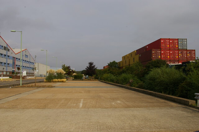
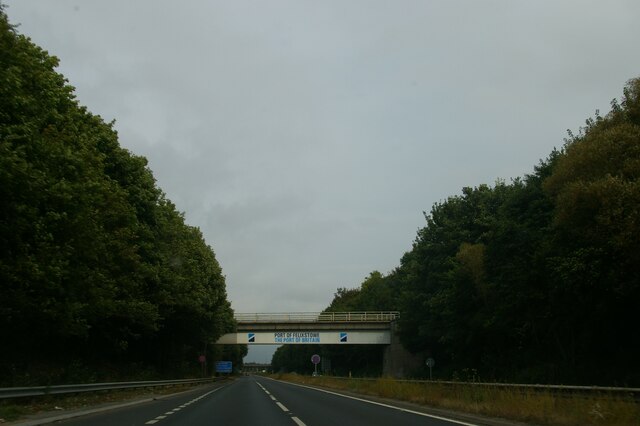
Port of Felixstowe

The Port of Felixstowe, in Felixstowe, Suffolk, is the United Kingdom's largest container port, dealing with 48% of Britain's containerised trade. In 2017...

Alston, Suffolk

Alston was a medieval parish in the county of Suffolk. Without enough people to ensure its survival, the parish was consolidated with that of Trimley St...

Trimley St Mary

Trimley St. Mary is a parish and village on the outskirts of Felixstowe, on a low-lying peninsula between Harwich Harbour and the River Deben, in Suffolk...

Felixstowe Academy

Felixstowe School is a secondary school and sixth form with academy status, located in Felixstowe, Suffolk, England. The school was formed in September...

HMS Gipsy (H63)

HMS Gipsy was a G-class destroyer built for the Royal Navy during the 1930s. She spent most of the pre-war period as part of the Mediterranean Fleet. The...

Nearby Amenities

Located within 500m of 51.967031,1.3054086
Power: pole
Lat/Long: 51.9690912/1.3091659
Power: pole
Lat/Long: 51.9701595/1.3066272
Power: pole
Lat/Long: 51.9690151/1.3090291
Power: pole
Lat/Long: 51.9714219/1.3042669
Power: pole
Lat/Long: 51.9695415/1.3079308
Power: pole
Lat/Long: 51.9702421/1.3067292
Power: pole
Lat/Long: 51.9707676/1.3053827
Power: pole
Lat/Long: 51.9708469/1.3054739
Power: pole
Lat/Long: 51.9713459/1.3041811
Power: pole
Lat/Long: 51.9683674/1.3103662
Power: pole
Lat/Long: 51.9696208/1.3080059
Crossing Barrier: full
Railway: crossing
Lat/Long: 51.9631084/1.3088394
Railway: switch
Lat/Long: 51.9635985/1.3089012
Railway: switch
Lat/Long: 51.9633138/1.3088054
Railway: switch
Lat/Long: 51.9640489/1.3088726
Crossing Barrier: full
Railway: crossing
Lat/Long: 51.9630973/1.3088878
Railway: switch
Lat/Long: 51.9637975/1.3088105
Railway: switch
Lat/Long: 51.9633954/1.3089919
Crossing Barrier: full
Railway: crossing
Lat/Long: 51.9631497/1.308536
Railway: switch
Lat/Long: 51.9634981/1.3087055
Crossing Barrier: full
Note: Gate electrically locked. Use phone to request unlocking
Railway: crossing
Lat/Long: 51.9631654/1.3084759
Location Transition: yes
Power: pole
Lat/Long: 51.9684375/1.3110208
Location Transition: yes
Power: pole
Lat/Long: 51.9683565/1.3109323
Location Transition: yes
Power: pole
Lat/Long: 51.9682111/1.3108157
Location Transition: yes
Power: pole
Lat/Long: 51.9681277/1.3107312
The data included in this document is from www.openstreetmap.org. The data is made available under ODbL.

Have you been to Christmasyards Wood?

Leave your review of Christmasyards Wood below (or comments, questions and feedback).