Broomhill Grove

Wood, Forest in Suffolk East Suffolk

England

Broomhill Grove

Lorry traffic on A14, north of Trimley St Martin On the far carriageway some lorries are halted in a layby.
Lorry traffic on A14, north of Trimley St Martin Credit: Christopher Hilton

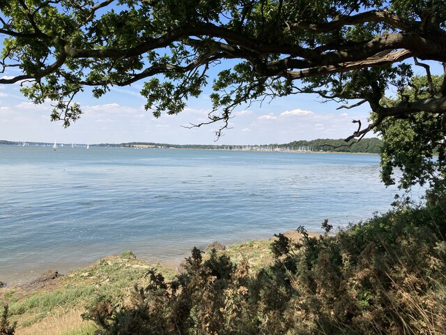
Broomhill Grove is a picturesque woodland area located in Suffolk, England. Situated in the heart of the Suffolk countryside, this idyllic forest is known for its stunning natural beauty and tranquil ambiance. The grove is located in the village of Broomhill, which is surrounded by rolling hills and lush greenery.

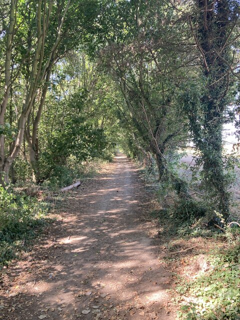
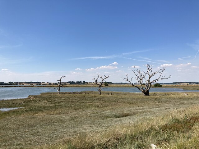
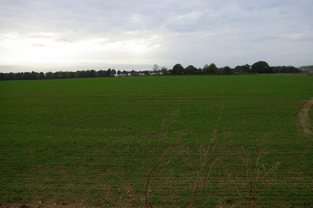
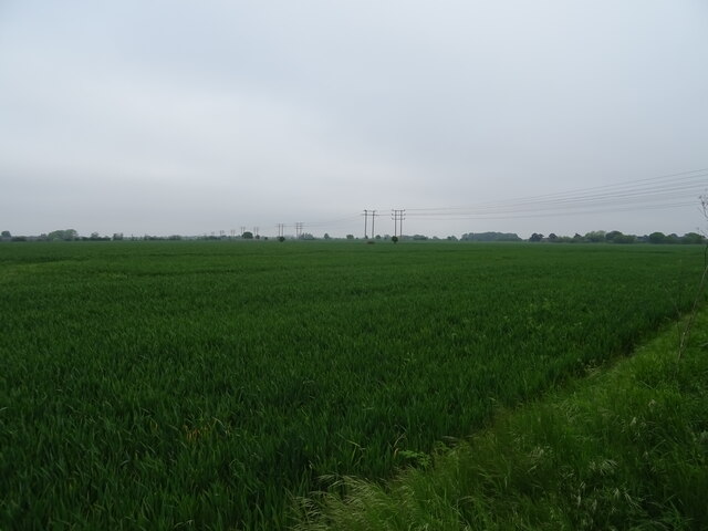
Covering a vast area of around 100 acres, Broomhill Grove boasts an impressive variety of trees, including oak, beech, and pine. The dense canopy of foliage provides a haven for numerous species of wildlife, making it a popular destination for nature enthusiasts and birdwatchers. The grove is home to an array of bird species, such as woodpeckers, owls, and warblers, which can often be spotted flitting among the treetops.

The forest offers a network of well-maintained walking trails, allowing visitors to explore its natural wonders at their own pace. These trails wind through the grove, passing by babbling brooks and peaceful meadows. Along the way, one can discover hidden clearings and secluded picnic spots, perfect for enjoying a peaceful respite amidst nature.

Broomhill Grove is not just a haven for wildlife and nature lovers; it also offers recreational activities for visitors of all ages. The forest features a designated camping area, where families and outdoor enthusiasts can set up tents and spend a night under the stars. Additionally, there are facilities for barbecues and outdoor games, making it an ideal spot for a day trip or a weekend getaway.

Overall, Broomhill Grove in Suffolk is a true gem of natural beauty, offering a peaceful escape from the hustle and bustle of everyday life. Whether you are seeking a serene walk through ancient woodlands or a memorable camping experience, this enchanting forest is sure to captivate and inspire.

If you have any feedback on the listing, please let us know in the comments section below.

Broomhill Grove Images

Images are sourced within 2km of 51.994029/1.295888 or Grid Reference TM2637. Thanks to Geograph Open Source API. All images are credited.

Lorry traffic on A14, north of Trimley St Martin On the far carriageway some lorries are halted in a layby.
Lorry traffic on A14, north of Trimley St Martin
On the far carriageway some lorries are halted in a layby.
Trimley churches and churchyard Trimley is divided into two parishes, each with its own church in a shared churchyard; each parish gives its name to one end of the village.  St Martin's, the nearer church, is still in use, but St Mary's, the further building, is generally locked.
Trimley churches and churchyard
Trimley is divided into two parishes, each with its own church in a shared churchyard; each parish gives its name to one end of the village. St Martin's, the nearer church, is still in use, but St Mary's, the further building, is generally locked.
Pond near Kiln Grove
Cottage at Trimley Lower Street
Wooded footpath near Alston Hall
Looking across the Orwell towards Levington Marina
Dead trees near the Orwell This area is part of the Trimley Marsh Managed Realignment Site. The river wall has been deliberately breached and a new wall created on the landward side to create this area of saltmarsh: <span class="nowrap"><a title="https://www.ecoshape.org/en/knowledge-articles/managed-realignment-schemes/" rel="nofollow ugc noopener" href="https://www.ecoshape.org/en/knowledge-articles/managed-realignment-schemes/">Link</a><img style="margin-left:2px;" alt="External link" title="External link - shift click to open in new window" src="https://s1.geograph.org.uk/img/external.png" width="10" height="10"/></span>
Dead trees near the Orwell
This area is part of the Trimley Marsh Managed Realignment Site. The river wall has been deliberately breached and a new wall created on the landward side to create this area of saltmarsh: LinkExternal link
Trimley Lower Street
Level crossing, Thorpe Lane
View towards the estuary from the Thorpe Lane level crossing
Cereal crop, Stratton Hall
National Cycle Route 51, Stratton Hall
Cereal crop near railway
Strattonhall Drift approaching level crossing National Cycle Route 51.
Strattonhall Drift approaching level crossing
National Cycle Route 51.
Level crossing on Strattonhall Drift National Cycle Route 51.
Level crossing on Strattonhall Drift
National Cycle Route 51.
Railway towards Ipswich From the level crossing on Strattonhall Drift.
Railway towards Ipswich
From the level crossing on Strattonhall Drift.
Railway towards Felixstowe From the level crossing on Strattonhall Drift.
Railway towards Felixstowe
From the level crossing on Strattonhall Drift.
Level crossing on Strattonhall Drift National Cycle Route 51.
Level crossing on Strattonhall Drift
National Cycle Route 51.
Show me another place!

Broomhill Grove is located at Grid Ref: TM2637 (Lat: 51.994029, Lng: 1.295888)

Administrative County: Suffolk

District: East Suffolk

Police Authority: Suffolk

What 3 Words

///responses.mascots.cutback. Near Shotley Gate, Suffolk

Related Wikis

Colneis Hundred

Colneis is a hundred of Suffolk, consisting of 16,712 acres (67.63 km2).Running from the south-east outskirts of Ipswich to the North Sea coast, the hundred...

Trimley St Martin

Trimley St. Martin is a parish and village that lies between the rivers Orwell and the Deben, on the long narrow tongue of land from Ipswich to Felixstowe...

Alston, Suffolk

Alston was a medieval parish in the county of Suffolk. Without enough people to ensure its survival, the parish was consolidated with that of Trimley St...

Stratton Hall

Stratton Hall is a civil parish in the East Suffolk district of Suffolk in eastern England. In 2005 its population was 30. It shares a parish council with...

Nearby Amenities

Located within 500m of 51.994029,1.295888
Power: pole
Lat/Long: 51.9931224/1.2894396
Power: pole
Lat/Long: 51.9922537/1.291344
Power: pole
Lat/Long: 51.9915534/1.2918536
Power: pole
Lat/Long: 51.9930398/1.2893431
Power: pole
Lat/Long: 51.9914972/1.2915961
Power: pole
Lat/Long: 51.9922305/1.2911133
Thorpe Common
Nat Gaz Id: E0025201
Place: hamlet
Lat/Long: 51.9909566/1.2964729
Power: pole
Lat/Long: 51.9898338/1.2977547
Bench
Lat/Long: 51.9904316/1.2926451
Power: pole
Lat/Long: 51.9945608/1.2922778
Power: pole
Lat/Long: 51.9909283/1.2970171
Power: pole
Lat/Long: 51.9971107/1.2912666
Power: pole
Lat/Long: 51.9920646/1.2957726
Power: pole
Lat/Long: 51.995469/1.2919211
Power: pole
Lat/Long: 51.9931801/1.2937235
Power: pole
Lat/Long: 51.9963344/1.2915724
Power: pole
Lat/Long: 51.9915772/1.2967207
The data included in this document is from www.openstreetmap.org. The data is made available under ODbL.

Have you been to Broomhill Grove?

Leave your review of Broomhill Grove below (or comments, questions and feedback).