Cuttings Grove

Wood, Forest in Suffolk East Suffolk

England

Cuttings Grove

Ships alongside at Felixstowe A very busy container port.
Ships alongside at Felixstowe Credit: Robin Webster

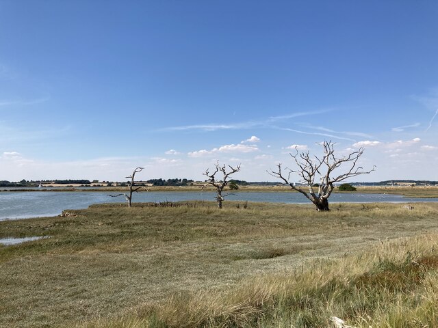
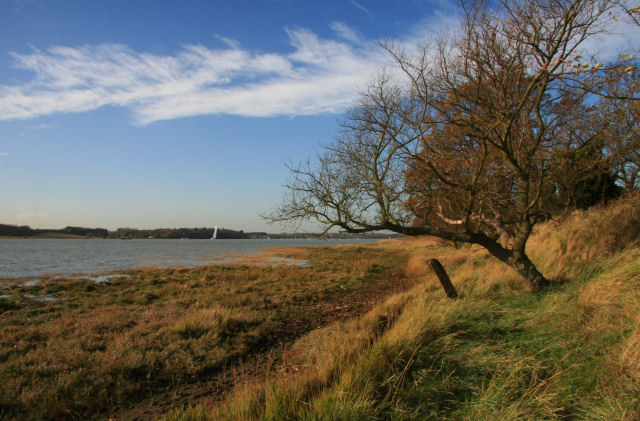
Cuttings Grove, located in Suffolk, is a picturesque woodland area that attracts nature enthusiasts and outdoor adventurers alike. Nestled in the heart of the county, this wood boasts a rich history and diverse ecosystem, making it a popular destination for visitors of all ages.

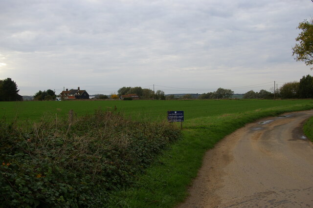
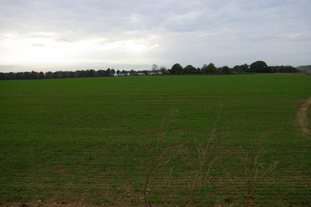
Covering an area of approximately 100 acres, Cuttings Grove is home to a variety of tree species, including oak, beech, and pine. The dense canopy provides a tranquil and shaded environment, perfect for leisurely walks or picnics with friends and family. The forest floor is carpeted with vibrant wildflowers, adding a splash of color to the surroundings.

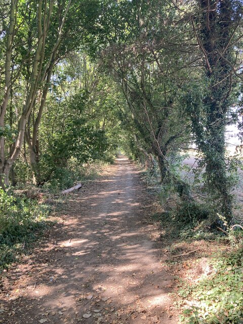
The woodland is crisscrossed by a network of well-maintained footpaths, allowing visitors to explore the grove at their own pace. The paths wind through the trees, offering glimpses of local wildlife such as rabbits, squirrels, and a variety of bird species. Nature enthusiasts will delight in the abundance of flora and fauna, with notable sightings including woodpeckers and deer.

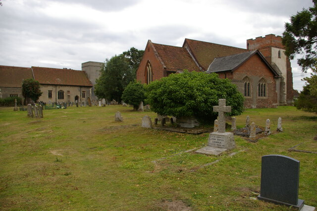
Cuttings Grove also holds cultural significance, with traces of ancient settlements and historical landmarks scattered throughout the area. Archaeologists have uncovered remnants of Iron Age settlements, suggesting human habitation in the region for thousands of years. These archaeological findings have sparked interest among history enthusiasts, adding another layer of intrigue to the woodland's allure.

Overall, Cuttings Grove is a captivating destination that seamlessly blends natural beauty with historical significance. Whether you seek a peaceful retreat or wish to delve into the area's rich heritage, this Suffolk woodland offers a truly immersive and memorable experience for all who visit.

If you have any feedback on the listing, please let us know in the comments section below.

Cuttings Grove Images

Images are sourced within 2km of 51.978463/1.289035 or Grid Reference TM2536. Thanks to Geograph Open Source API. All images are credited.

Ships alongside at Felixstowe A very busy container port.
Ships alongside at Felixstowe
A very busy container port.
'Taipei Triumph' alongside at Felixstowe Reportedly built in 2017, so, if true, this must have been close to a maiden revenue earning voyage.
'Taipei Triumph' alongside at Felixstowe
Reportedly built in 2017, so, if true, this must have been close to a maiden revenue earning voyage.
Pepys buoy, Harwich Haven On the near (SW) side of the deep dredged channel.
Pepys buoy, Harwich Haven
On the near (SW) side of the deep dredged channel.
'Allen Gardiner' turns back up the Orwell A 'river cruise restaurant' from and to Ipswich. The Fagbury buoy is on the left, marking the far (NE) side of the deep channel.
'Allen Gardiner' turns back up the Orwell
A 'river cruise restaurant' from and to Ipswich. The Fagbury buoy is on the left, marking the far (NE) side of the deep channel.
MV 'Allen Gardiner' heads up the Orwell A 'river cruise restaurant' from and to Ipswich. The red buoy, on this side of the deep channel, is called Bamburgh. The yellow buoy, on the other side, marks the start of a 6 knot speed limit up the river, and is just about on the port authority boundary between Harwich Haven and Ipswich.
MV 'Allen Gardiner' heads up the Orwell
A 'river cruise restaurant' from and to Ipswich. The red buoy, on this side of the deep channel, is called Bamburgh. The yellow buoy, on the other side, marks the start of a 6 knot speed limit up the river, and is just about on the port authority boundary between Harwich Haven and Ipswich.
Looking across borage crop towards Felixstowe Docks
Trimley churches and churchyard Trimley is divided into two parishes, each with its own church in a shared churchyard; each parish gives its name to one end of the village.  St Martin's, the nearer church, is still in use, but St Mary's, the further building, is generally locked.
Trimley churches and churchyard
Trimley is divided into two parishes, each with its own church in a shared churchyard; each parish gives its name to one end of the village. St Martin's, the nearer church, is still in use, but St Mary's, the further building, is generally locked.
Pond near Kiln Grove
Cottage at Trimley Lower Street
Wooded footpath near Alston Hall
Looking across the Orwell towards Levington Marina
Dead trees near the Orwell This area is part of the Trimley Marsh Managed Realignment Site. The river wall has been deliberately breached and a new wall created on the landward side to create this area of saltmarsh: <span class="nowrap"><a title="https://www.ecoshape.org/en/knowledge-articles/managed-realignment-schemes/" rel="nofollow ugc noopener" href="https://www.ecoshape.org/en/knowledge-articles/managed-realignment-schemes/">Link</a><img style="margin-left:2px;" alt="External link" title="External link - shift click to open in new window" src="https://s1.geograph.org.uk/img/external.png" width="10" height="10"/></span>
Dead trees near the Orwell
This area is part of the Trimley Marsh Managed Realignment Site. The river wall has been deliberately breached and a new wall created on the landward side to create this area of saltmarsh: LinkExternal link
Cattle grazing on Trimley Marshes Nature Reserve
Dock cranes reflected in a drainage ditch
Trimley Lower Street
Level crossing, Thorpe Lane
View towards the estuary from the Thorpe Lane level crossing
Container Cranes and ship The Port of Felixstowe, is the UK's busiest container port, dealing with 35% of the country's container cargo. In 2005, it was ranked as the 28th busiest container port in the world and Europe's sixth busiest.
The port is operated by the Felixstowe Dock and Railway Company, which was set up under an Act of Parliament, the Felixstowe Railway and Pier Act 1875 and so, is one of the few limited companies in the UK that do not have the word "Limited" in their name.
In 1967 it set up Britain's first container terminal. The dock was developed into Britain's largest container port. In terms of freight volumes Felixstowe is Britain's largest port handling nearly two-fifths of Britain's container trade.
Container Cranes and ship
The Port of Felixstowe, is the UK's busiest container port, dealing with 35% of the country's container cargo. In 2005, it was ranked as the 28th busiest container port in the world and Europe's sixth busiest. The port is operated by the Felixstowe Dock and Railway Company, which was set up under an Act of Parliament, the Felixstowe Railway and Pier Act 1875 and so, is one of the few limited companies in the UK that do not have the word "Limited" in their name. In 1967 it set up Britain's first container terminal. The dock was developed into Britain's largest container port. In terms of freight volumes Felixstowe is Britain's largest port handling nearly two-fifths of Britain's container trade.
Show me another place!

Cuttings Grove is located at Grid Ref: TM2536 (Lat: 51.978463, Lng: 1.289035)

Administrative County: Suffolk

District: East Suffolk

Police Authority: Suffolk

What 3 Words

///bidder.hairstyle.cactus. Near Shotley Gate, Suffolk

Nearby Locations

Cuttings Grove

Related Wikis

Alston, Suffolk

Alston was a medieval parish in the county of Suffolk. Without enough people to ensure its survival, the parish was consolidated with that of Trimley St...

Trimley Marshes

Trimley Marshes is a 77 hectare nature reserve west of Trimley St Mary, on the outskirts of Felixstowe in Suffolk. It is managed by the Suffolk Wildlife...

River Orwell

The River Orwell flows through the county of Suffolk in England from Ipswich to Felixstowe. Above Ipswich, the river is known as the River Gipping, but...

Trimley railway station

Trimley railway station is on the Felixstowe Branch Line in the east of England, serving the village of Trimley St. Mary, Suffolk. It is 14 miles 5 chains...

Nearby Amenities

Located within 500m of 51.978463,1.289035
Power: pole
Lat/Long: 51.9771619/1.2927227
Power: pole
Lat/Long: 51.9827922/1.2872402
Power: pole
Lat/Long: 51.9817382/1.2880127
Power: pole
Lat/Long: 51.9766564/1.2940369
Power: pole
Lat/Long: 51.9803505/1.288812
Power: pole
Lat/Long: 51.9784605/1.2904642
Power: pole
Lat/Long: 51.9798615/1.2894235
Power: pole
Lat/Long: 51.9811303/1.288517
Power: pole
Lat/Long: 51.9778856/1.2913011
Power: pole
Lat/Long: 51.9793328/1.289563
Power: pole
Lat/Long: 51.9770496/1.2932484
Power: pole
Lat/Long: 51.9765638/1.2939136
Power: pole
Lat/Long: 51.9820951/1.2873851
Power: pole
Lat/Long: 51.9760318/1.2951796
Power: pole
Lat/Long: 51.9779517/1.2914137
Power: pole
Lat/Long: 51.9783845/1.2902818
Power: pole
Lat/Long: 51.9813616/1.2879805
Power: pole
Lat/Long: 51.975969/1.2951045
The data included in this document is from www.openstreetmap.org. The data is made available under ODbL.

Have you been to Cuttings Grove?

Leave your review of Cuttings Grove below (or comments, questions and feedback).