Little Fidge's Wood

Wood, Forest in Kent Dover

England

Little Fidge's Wood

St Johns Farm Viewed from an unnamed lane, an outbuilding is in the process of being erected on the farm.
St Johns Farm Credit: John Baker

Little Fidge's Wood, located in Kent, England, is a charming and picturesque woodland that covers an area of approximately 20 acres. Situated near the village of Fidge's Green, the wood is a popular destination for nature enthusiasts and those seeking tranquility in a natural setting.

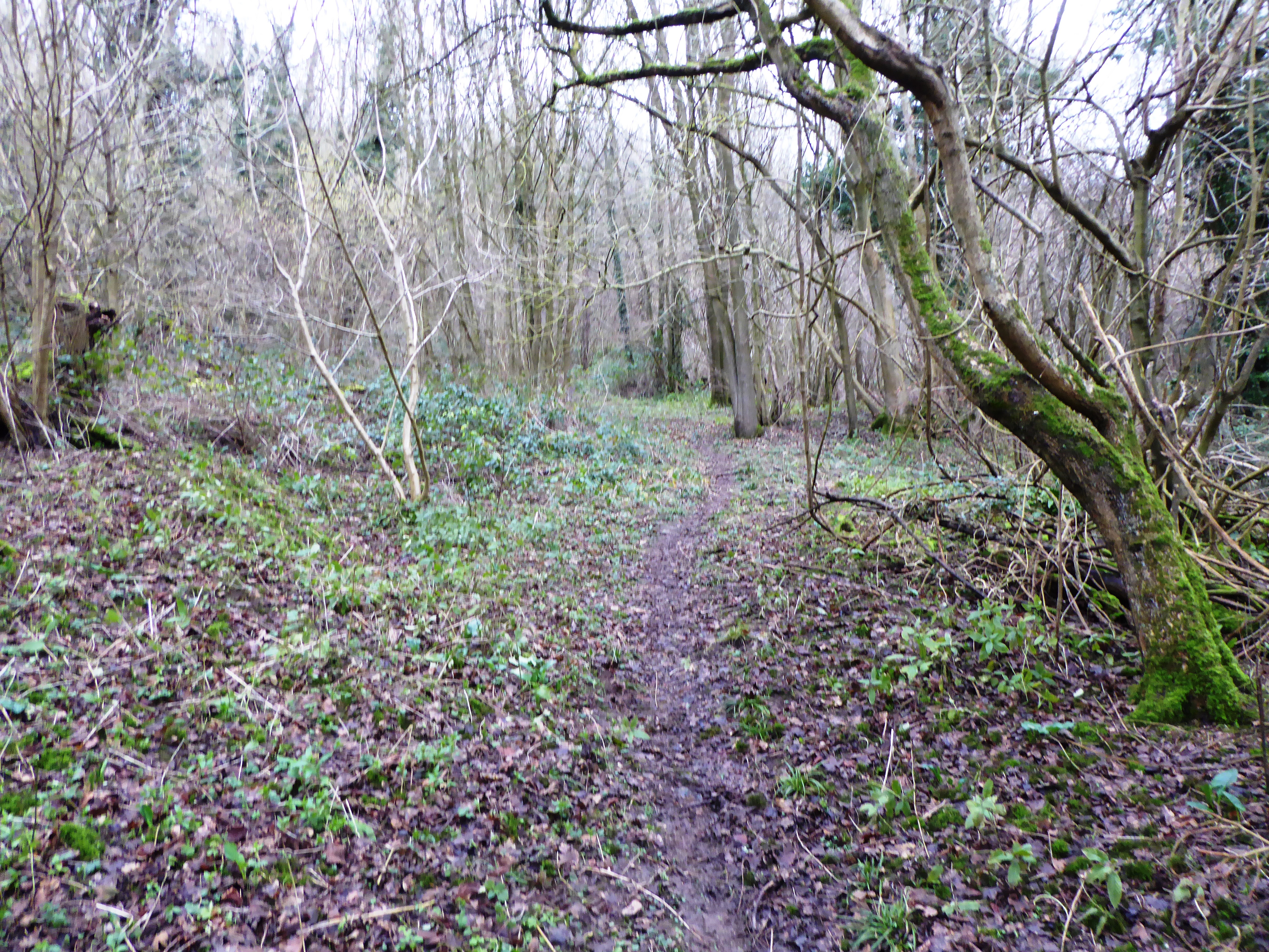
The wood is predominantly composed of broadleaf trees, including oak, beech, and ash, which create a dense canopy that provides shade and shelter for a variety of wildlife. The woodland floor is carpeted with a diverse range of wildflowers, such as bluebells, wood anemones, and primroses, offering a vibrant display of colors during the spring months.

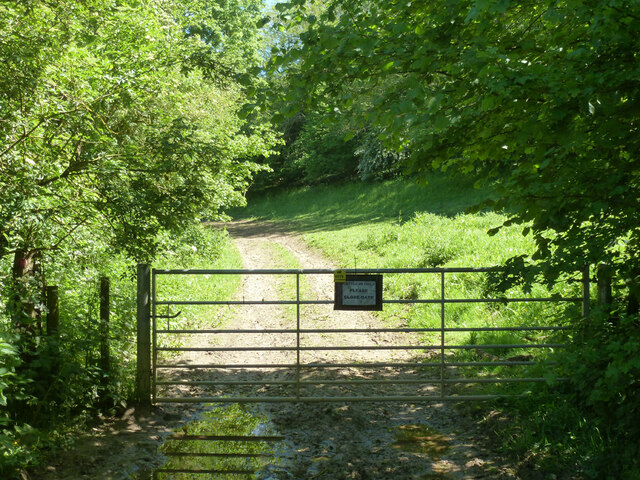
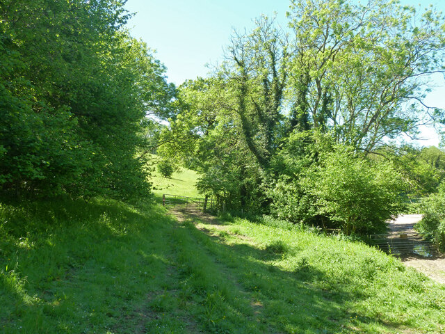
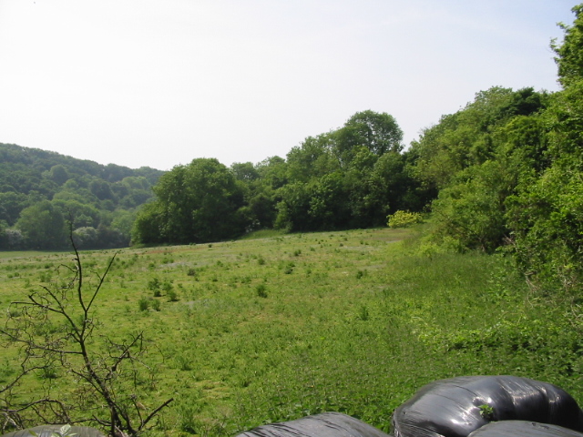
Little Fidge's Wood is crisscrossed by a network of well-maintained footpaths, allowing visitors to explore the area easily. These paths wind through the woodland, offering glimpses of babbling brooks, small ponds, and occasional clearings, perfect for picnicking or simply enjoying the serenity of the surroundings.

The wood is home to a rich and varied wildlife population. Visitors may spot squirrels darting through the trees, rabbits hopping along the forest floor, and a myriad of bird species, including woodpeckers, thrushes, and warblers. If lucky, one might even catch a glimpse of a deer or a fox, which occasionally venture into the wood from the surrounding countryside.

Little Fidge's Wood is a cherished natural haven, providing a peaceful and enchanting escape from the hustle and bustle of everyday life. Its natural beauty and diverse wildlife make it a must-visit destination for nature lovers and anyone seeking solace in the embrace of nature.

If you have any feedback on the listing, please let us know in the comments section below.

Little Fidge's Wood Images

Images are sourced within 2km of 51.150276/1.2113422 or Grid Reference TR2443. Thanks to Geograph Open Source API. All images are credited.

St Johns Farm Viewed from an unnamed lane, an outbuilding is in the process of being erected on the farm.
St Johns Farm
Viewed from an unnamed lane, an outbuilding is in the process of being erected on the farm.
St Johns Farm A zoom view, from an unnamed lane, shows that an outbuilding is in the process of being erected on the farm. 

This was a closer view of the outbuilding at <a href="https://www.geograph.org.uk/photo/7126331">TR2343 : St Johns Farm</a> taken a week earlier.
St Johns Farm
A zoom view, from an unnamed lane, shows that an outbuilding is in the process of being erected on the farm. This was a closer view of the outbuilding at TR2343 : St Johns Farm taken a week earlier.
View through a gate Of a dilapidated building in the distant hedgerow.
View through a gate
Of a dilapidated building in the distant hedgerow.
St Johns Farm This view of <a href="https://www.geograph.org.uk/photo/7138279">TR2343 : St Johns Farm</a>, from an unnamed lane, shows the large outbuilding during its construction.
St Johns Farm
This view of TR2343 : St Johns Farm, from an unnamed lane, shows the large outbuilding during its construction.
Outbuilding, St Johns Cottages This view shows the <a href="https://www.geograph.org.uk/photo/4746072">TR2344 : Erection of an outbuilding, St Johns Cottages</a> in October 2015.
Outbuilding, St Johns Cottages
This view shows the TR2344 : Erection of an outbuilding, St Johns Cottages in October 2015.
The Marquis, Alkham 'Restaurant, bar, rooms' rather than pub.
The Marquis, Alkham
'Restaurant, bar, rooms' rather than pub.
Slip Lane looking west From Alkham towards Swingfield Street.
Slip Lane looking west
From Alkham towards Swingfield Street.
Chalksole Green Lane west of Slip Lane junction Towards Swingfield Street.
Chalksole Green Lane west of Slip Lane junction
Towards Swingfield Street.
Slip Lane east of Chalksole Green Lane junction Towards Alkham.
Slip Lane east of Chalksole Green Lane junction
Towards Alkham.
Chalksole Green Lane east of Slip Lane junction Towards Chalksole and Ewell Minnis.
Chalksole Green Lane east of Slip Lane junction
Towards Chalksole and Ewell Minnis.
Chalksole Green Lane Looking west towards Swingfield Street.
Chalksole Green Lane
Looking west towards Swingfield Street.
Harvested field near Ellinge House It looks like it was rape.
Harvested field near Ellinge House
It looks like it was rape.
Corner of harvested field near Ellinge House It looks like it was rape.
Corner of harvested field near Ellinge House
It looks like it was rape.
View from Holloway Lane
Bottom near North Court Much further down near Lydden it is called Warren Bottom.
Bottom near North Court
Much further down near Lydden it is called Warren Bottom.
Start of public byway ER122 Alkham Gated, but not locked, as should be.
Start of public byway ER122 Alkham
Gated, but not locked, as should be.
Tracks and gates near the corner on Holloway Lane At the lower level, public byway ER122 passes through a gate to reach Holloway Lane. It is Alkham parish this side of the gate, Swingfield the other.  At the higher level public footpath ER151, Alkham, heads into the field.
Tracks and gates near the corner on Holloway Lane
At the lower level, public byway ER122 passes through a gate to reach Holloway Lane. It is Alkham parish this side of the gate, Swingfield the other. At the higher level public footpath ER151, Alkham, heads into the field.
Public byway ER122 Alkham Heading away from Holloway Lane.
Public byway ER122 Alkham
Heading away from Holloway Lane.
Show me another place!

Little Fidge's Wood is located at Grid Ref: TR2443 (Lat: 51.150276, Lng: 1.2113422)

Administrative County: Kent

District: Dover

Police Authority: Kent

What 3 Words

///enlighten.pricier.secondly. Near Wootton, Kent

Related Wikis

Alkham, Lydden and Swingfield Woods

Alkham, Lydden and Swingfield Woods is a 228.3-hectare (564-acre) biological Site of Special Scientific Interest north-west of Dover in Kent. Alkham Valley...

Swingfield Preceptory

Swingfield Preceptory (or St John's Commandery, Swingfield) was a priory about 5 miles north of Folkestone, Kent on the south coast of England. == History... ==

St Peter's Church, Swingfield

St Peter's Church is a redundant Anglican church in the village of Swingfield, some 3 miles (5 km) northeast of Hawkinge, Kent, England. It is recorded...

Sladden Wood

Sladden Wood is a 7-hectare (17-acre) nature reserve north of Alkham in Kent. It is managed by the Kent Wildlife Trust.The main trees in this wood are...

Nearby Amenities

Located within 500m of 51.150276,1.2113422
Barrier: stile
Lat/Long: 51.1546177/1.2120387
Barrier: stile
Lat/Long: 51.1514369/1.2123085
The data included in this document is from www.openstreetmap.org. The data is made available under ODbL.

Have you been to Little Fidge's Wood?

Leave your review of Little Fidge's Wood below (or comments, questions and feedback).