Friezland

Settlement in Yorkshire

England

Friezland

Pots & Pans Monument & Greenfield This war memorial was erected in 1923 to honour the 259 people from the villages of Saddleworth who died during the first world war and was located here specifically to be visible from the villages in the area. When plans were submitted for the war memorial there was much opposition from local people who wanted a memorial in the village rather than on top of a bleak hill.
Pots & Pans Monument & Greenfield Credit: Colin Park

Friezland is a picturesque village located in the metropolitan borough of Oldham, within the ceremonial county of Yorkshire, England. Situated on the eastern edge of the Pennines, it lies approximately five miles east of Oldham town center and borders the Peak District National Park.

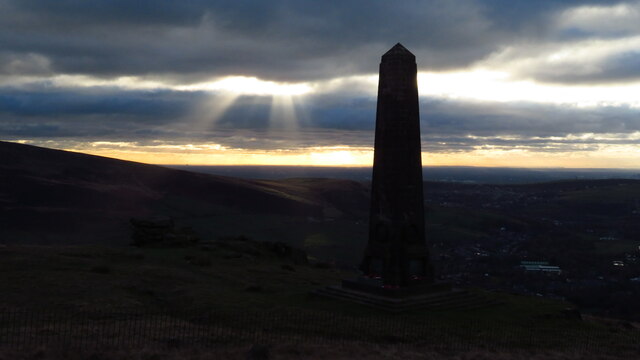
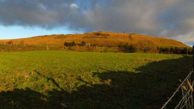
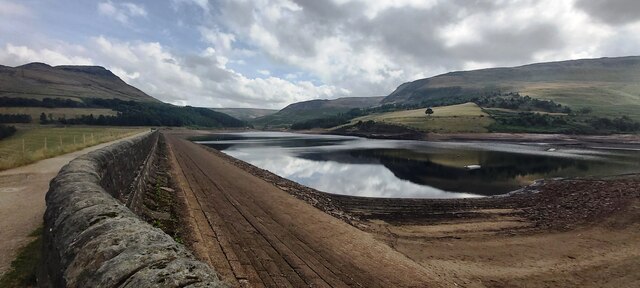
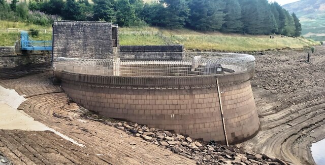
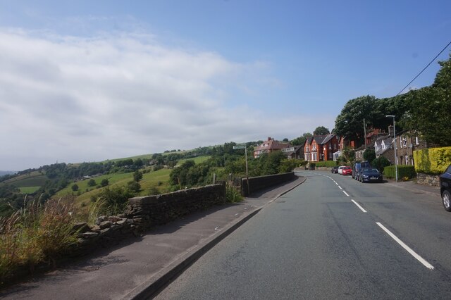
This charming village offers a tranquil and idyllic setting, surrounded by rolling hills and breathtaking landscapes. Friezland's natural beauty is further enhanced by the presence of Chew Reservoir, a vast expanse of water that provides a scenic backdrop for residents and visitors alike.

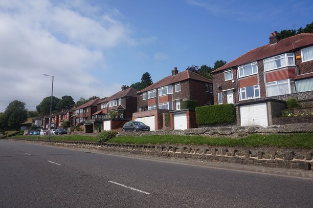
The village itself boasts a close-knit community, with a population of around 1,500 residents. It offers a range of amenities, including a local primary school, a village hall, and a small selection of shops and eateries. Friezland is also home to several churches, reflecting its strong religious heritage.

For those seeking outdoor activities, Friezland offers an abundance of opportunities. The nearby Saddleworth Moor provides ample walking and hiking trails, allowing visitors to explore the stunning countryside. The village is also renowned for its annual brass band contest, attracting musicians from far and wide.

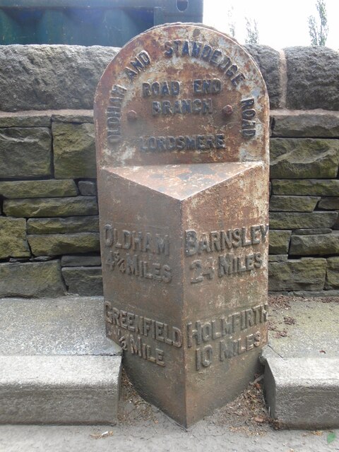
Friezland's location provides easy access to the wider region, with the bustling city of Manchester just a short drive away. Additionally, the village benefits from excellent transport links, including regular bus services and nearby train stations.

Overall, Friezland is a hidden gem in the heart of Yorkshire, offering a peaceful and scenic haven for residents and visitors seeking a rural retreat within easy reach of urban amenities.

If you have any feedback on the listing, please let us know in the comments section below.
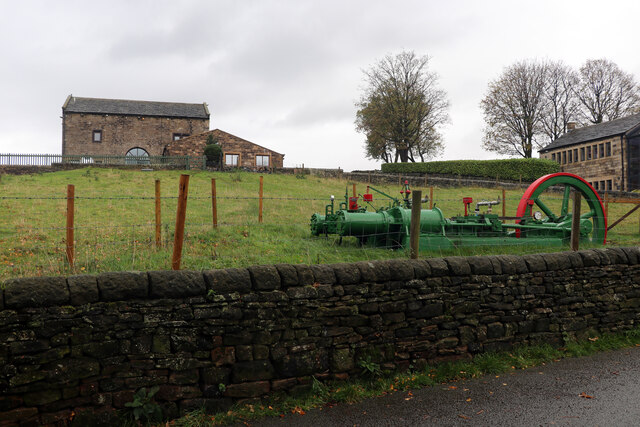
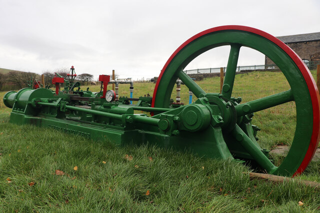
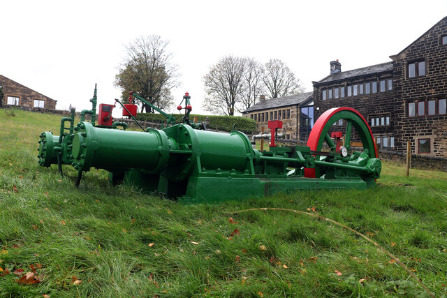
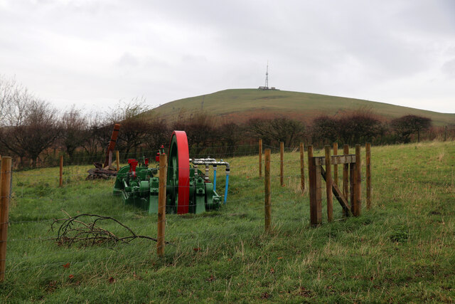
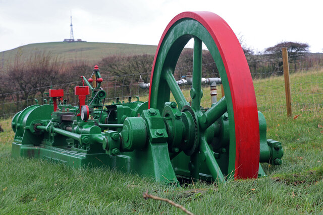
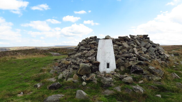
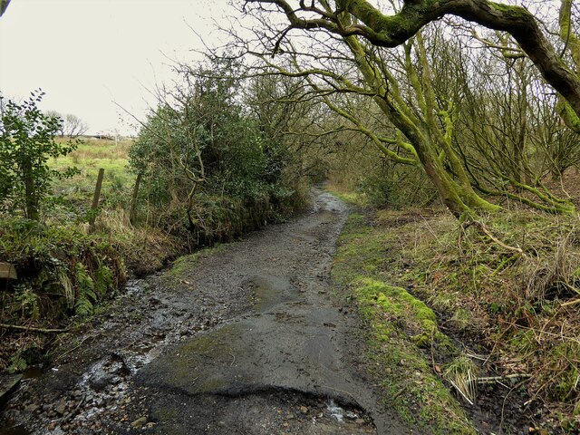
Friezland Images

Images are sourced within 2km of 53.533277/-2.008265 or Grid Reference SD9904. Thanks to Geograph Open Source API. All images are credited.

Pots & Pans Monument & Greenfield This war memorial was erected in 1923 to honour the 259 people from the villages of Saddleworth who died during the first world war and was located here specifically to be visible from the villages in the area. When plans were submitted for the war memorial there was much opposition from local people who wanted a memorial in the village rather than on top of a bleak hill.
Pots & Pans Monument & Greenfield
This war memorial was erected in 1923 to honour the 259 people from the villages of Saddleworth who died during the first world war and was located here specifically to be visible from the villages in the area. When plans were submitted for the war memorial there was much opposition from local people who wanted a memorial in the village rather than on top of a bleak hill.
Late afternoon sunlight on Pots & Pans Monument near Greenfield
Old milestone This milestone is not quite like any of the other late 19C West Riding CC milestones so may be an early replacement.  There is no raised edge to the top section and the lettering is a different style.   It is on the A669 Chew Valley Road near St Mary's CE school.   This area was once in the West Riding but now Greater Manchester.
Old milestone
This milestone is not quite like any of the other late 19C West Riding CC milestones so may be an early replacement. There is no raised edge to the top section and the lettering is a different style. It is on the A669 Chew Valley Road near St Mary's CE school. This area was once in the West Riding but now Greater Manchester.
Dove Stone Reservoir in drought The first six months of 2022 are the driest in the UK since 1976
Dove Stone Reservoir in drought
The first six months of 2022 are the driest in the UK since 1976
Redundant Reservoir Overflow Drain at Dove Stone Reservoir The first six months of 2022 are the driest since 1976
Redundant Reservoir Overflow Drain at Dove Stone Reservoir
The first six months of 2022 are the driest since 1976
A surprising find, Kinders Lane, Greenfield The building on the left is Dolefield Barn while on the right is part of Fur Lane Farm with a building looking like a former weaver's cottage. The surprise was the green and red lump in the field. This is a steam powered hydraulic pumping engine by Henry Berry of Leeds. It is a horizontal twin tandem compound steam engine with four single acting hydraulic pumps straddling the Laird type crosshead guides on each side. It can apparently be run on compressed air. It was recovered from a scrapyard in the Doncaster area and has been named 'Proud Mary'. It bears an uncanny resemblance to the engine that was at Storey Brothers xylonite works at Cattawade in Suffolk and it is very tempting to think it is the same as it is such an unusual beast. This is the engine at Cattawade - <a href="https://www.geograph.org.uk/photo/1649917">TM1032 : Steam hydraulic pumping engine</a>.
A surprising find, Kinders Lane, Greenfield
The building on the left is Dolefield Barn while on the right is part of Fur Lane Farm with a building looking like a former weaver's cottage. The surprise was the green and red lump in the field. This is a steam powered hydraulic pumping engine by Henry Berry of Leeds. It is a horizontal twin tandem compound steam engine with four single acting hydraulic pumps straddling the Laird type crosshead guides on each side. It can apparently be run on compressed air. It was recovered from a scrapyard in the Doncaster area and has been named 'Proud Mary'. It bears an uncanny resemblance to the engine that was at Storey Brothers xylonite works at Cattawade in Suffolk and it is very tempting to think it is the same as it is such an unusual beast. This is the engine at Cattawade - TM1032 : Steam hydraulic pumping engine.
Proud Mary, Kinders Lane, Greenfield This is a steam powered hydraulic pumping engine by Henry Berry of Leeds. It is a horizontal twin tandem compound steam engine with four single acting hydraulic pumps straddling the Laird type crosshead guides on each side. It can apparently be run on compressed air. It was recovered from a scrapyard in the Doncaster area and has been named 'Proud Mary'. It bears an uncanny resemblance to the engine that was at Storey Brothers xylonite works at Cattawade in Suffolk and it is very tempting to think it is the same as it is such an unusual beast. This is the engine at Cattawade - <a href="https://www.geograph.org.uk/photo/1649917">TM1032 : Steam hydraulic pumping engine</a>.
Proud Mary, Kinders Lane, Greenfield
This is a steam powered hydraulic pumping engine by Henry Berry of Leeds. It is a horizontal twin tandem compound steam engine with four single acting hydraulic pumps straddling the Laird type crosshead guides on each side. It can apparently be run on compressed air. It was recovered from a scrapyard in the Doncaster area and has been named 'Proud Mary'. It bears an uncanny resemblance to the engine that was at Storey Brothers xylonite works at Cattawade in Suffolk and it is very tempting to think it is the same as it is such an unusual beast. This is the engine at Cattawade - TM1032 : Steam hydraulic pumping engine.
Proud Mary, Kinders Lane, Greenfield This is a steam powered hydraulic pumping engine by Henry Berry of Leeds. It is a horizontal twin tandem compound steam engine with four single acting hydraulic pumps straddling the Laird type crosshead guides on each side. It can apparently be run on compressed air. It was recovered from a scrapyard in the Doncaster area and has been named 'Proud Mary'. It bears an uncanny resemblance to the engine that was at Storey Brothers xylonite works at Cattawade in Suffolk and it is very tempting to think it is the same as it is such an unusual beast. This is the engine at Cattawade - <a href="https://www.geograph.org.uk/photo/1649917">TM1032 : Steam hydraulic pumping engine</a>. The engine does really slope with the flywheel end being lower.
Proud Mary, Kinders Lane, Greenfield
This is a steam powered hydraulic pumping engine by Henry Berry of Leeds. It is a horizontal twin tandem compound steam engine with four single acting hydraulic pumps straddling the Laird type crosshead guides on each side. It can apparently be run on compressed air. It was recovered from a scrapyard in the Doncaster area and has been named 'Proud Mary'. It bears an uncanny resemblance to the engine that was at Storey Brothers xylonite works at Cattawade in Suffolk and it is very tempting to think it is the same as it is such an unusual beast. This is the engine at Cattawade - TM1032 : Steam hydraulic pumping engine. The engine does really slope with the flywheel end being lower.
Proud Mary, Kinders Lane, Greenfield This is a steam powered hydraulic pumping engine by Henry Berry of Leeds. It is a horizontal twin tandem compound steam engine with four single acting hydraulic pumps straddling the Laird type crosshead guides on each side. It can apparently be run on compressed air. It was recovered from a scrapyard in the Doncaster area and has been named 'Proud Mary'. It bears an uncanny resemblance to the engine that was at Storey Brothers xylonite works at Cattawade in Suffolk and it is very tempting to think it is the same as it is such an unusual beast. This is the engine at Cattawade - <a href="https://www.geograph.org.uk/photo/1649917">TM1032 : Steam hydraulic pumping engine</a>.
Proud Mary, Kinders Lane, Greenfield
This is a steam powered hydraulic pumping engine by Henry Berry of Leeds. It is a horizontal twin tandem compound steam engine with four single acting hydraulic pumps straddling the Laird type crosshead guides on each side. It can apparently be run on compressed air. It was recovered from a scrapyard in the Doncaster area and has been named 'Proud Mary'. It bears an uncanny resemblance to the engine that was at Storey Brothers xylonite works at Cattawade in Suffolk and it is very tempting to think it is the same as it is such an unusual beast. This is the engine at Cattawade - TM1032 : Steam hydraulic pumping engine.
Proud Mary, Kinders Lane, Greenfield This is a steam powered hydraulic pumping engine by Henry Berry of Leeds. It is a horizontal twin tandem compound steam engine with four single acting hydraulic pumps straddling the Laird type crosshead guides on each side. It can apparently be run on compressed air. It was recovered from a scrapyard in the Doncaster area and has been named 'Proud Mary'. It bears an uncanny resemblance to the engine that was at Storey Brothers xylonite works at Cattawade in Suffolk and it is very tempting to think it is the same as it is such an unusual beast
Proud Mary, Kinders Lane, Greenfield
This is a steam powered hydraulic pumping engine by Henry Berry of Leeds. It is a horizontal twin tandem compound steam engine with four single acting hydraulic pumps straddling the Laird type crosshead guides on each side. It can apparently be run on compressed air. It was recovered from a scrapyard in the Doncaster area and has been named 'Proud Mary'. It bears an uncanny resemblance to the engine that was at Storey Brothers xylonite works at Cattawade in Suffolk and it is very tempting to think it is the same as it is such an unusual beast
Trig Point on Alphin
Shaws Lane The lane changes from a well surfaced route to a rough track at this point
Shaws Lane
The lane changes from a well surfaced route to a rough track at this point
Old milestone This milestone on Chew Valley Road near a pedestrian crossing at St Mary's CE school has been painted since 2022.   Although very similar to the West Riding CC milestones this forging may be an early replacement.   The style of lettering is slightly different and it doesn't have the maker's name on the bevel.
Old milestone
This milestone on Chew Valley Road near a pedestrian crossing at St Mary's CE school has been painted since 2022. Although very similar to the West Riding CC milestones this forging may be an early replacement. The style of lettering is slightly different and it doesn't have the maker's name on the bevel.
Old milestone This shows the position of the milestone on the A669 in relation to the school buildings behind it.
Old milestone
This shows the position of the milestone on the A669 in relation to the school buildings behind it.
Houses on the A670 Mossley Road
A670 Mossley Road towards Mossley
Mossley Road A670 at Grasscroft
Clough Lane off Mossley Road, Grasscroft
Show me another place!

Friezland is located at Grid Ref: SD9904 (Lat: 53.533277, Lng: -2.008265)

Division: West Riding

Unitary Authority: Oldham

Police Authority: Greater Manchester

What 3 Words

///zoos.fund.conspired. Near Mossley, Manchester

Related Wikis

Friezland railway station

Friezland Railway Station served the Hamlet of Friezland in Saddleworth until closure on 1 January 1917. It was built by the London and North Western Railway...

Greenfield, Greater Manchester

Greenfield is a village in the civil parish of Saddleworth in the Metropolitan Borough of Oldham, in Greater Manchester, England. It is 4 miles (6.4 km...

Huddersfield Narrow Canal

The Huddersfield Narrow Canal is an inland waterway in northern England. It runs just under 20 miles (32 km) from Lock 1E at the rear of the University...

Greenfield railway station

Greenfield railway station in the village of Greenfield, Greater Manchester, England, is on the Huddersfield Line 12 miles (20 km) northeast of Manchester...

Nearby Amenities

Located within 500m of 53.533277,-2.008265
Greenfield
Is In: Saddleworth, Oldham, Greater Manchester, England, UK
Name Ur: گرینزفیلڈ
Place: village
Source: npe
Wikidata: Q5603930
Lat/Long: 53.5354092/-2.0055825
Crossing
Lat/Long: 53.5365298/-2.0080383
Mini Roundabout
Direction: clockwise
Lat/Long: 53.5335135/-2.0020032
Bus Stop
Greenfield, Chew Valley Road / opposite Central Avenue
Bench: no
Bin: no
Bus: yes
Naptan AtcoCode: 1800ED13571
Naptan Bearing: NW
Naptan CommonName: Chew Valley Road/Central Avenue
Naptan Indicator: Gemini
Naptan Landmark: GEMINI
Naptan NaptanCode: manapatg
Naptan PlusbusZoneRef: MNCRPIC
Naptan ShortCommonName: Central Avenue
Naptan Street: Chew Valley Road
Naptan Verified: no
Network: TfGM
Operator: TfGM
Public Transport: platform
Shelter: no
Source: naptan_import
Lat/Long: 53.534194/-2.0027993
Bus Stop
Greenfield, Chew Valley Road / near Central Avenue
Bench: no
Bus: yes
Naptan AtcoCode: 1800ED13581
Naptan Bearing: SE
Naptan CommonName: Chew Valley Road/Central Avenue
Naptan Indicator: Opp House 154
Naptan Landmark: PARK
Naptan NaptanCode: manapatj
Naptan PlusbusZoneRef: MNCRPIC
Naptan ShortCommonName: Central Avenue
Naptan Street: Chew Valley Road
Naptan Verified: no
Network: TfGM
Operator: TfGM
Public Transport: platform
Shelter: no
Source: naptan_import
Tactile Paving: no
Lat/Long: 53.5340262/-2.0023989
Bus Stop
Greenfield, Chew Valley Road / outside King William IV
Bench: no
Bin: no
Bus: yes
Lit: no
Naptan AtcoCode: 1800ED13591
Naptan Bearing: NW
Naptan CommonName: Chew Valley Road/King William IV
Naptan Indicator: Lampost Ltd
Naptan Landmark: HOUSE 136/138
Naptan NaptanCode: manapatm
Naptan PlusbusZoneRef: MNCRPIC
Naptan ShortCommonName: King William IV
Naptan Street: Chew Valley Road
Naptan Verified: no
Network: TfGM
Operator: TfGM
Public Transport: platform
Shelter: no
Source: naptan_import
Tactile Paving: no
Lat/Long: 53.5351138/-2.0043303
Bus Stop
Greenfield, Chew Valley Road / opposite King William IV
Bench: no
Bin: no
Bus: yes
Lit: yes
Naptan AtcoCode: 1800ED13601
Naptan Bearing: SE
Naptan CommonName: Chew Valley Road/King William IV
Naptan Indicator: O/s House 115
Naptan Landmark: HOUSE 115
Naptan NaptanCode: manapatp
Naptan PlusbusZoneRef: MNCRPIC
Naptan ShortCommonName: King William IV
Naptan Street: Chew Valley Road
Naptan Verified: no
Network: TfGM
Operator: TfGM
Public Transport: platform
Shelter: no
Source: naptan_import
Tactile Paving: no
Lat/Long: 53.5357609/-2.0054921
Bus Stop
Greenfield, Chew Valley Road / adjacent Bridlepath
Bench: no
Bin: no
Bus: yes
Lit: no
Naptan AtcoCode: 1800ED13611
Naptan Bearing: NW
Naptan CommonName: Chew Valley Road/Conservative Club
Naptan Indicator: Tory Club
Naptan Landmark: HOUSE 66D
Naptan NaptanCode: manapatw
Naptan PlusbusZoneRef: MNCRPIC
Naptan ShortCommonName: Conservative Club
Naptan Street: Chew Valley Road
Naptan Verified: no
Network: TfGM
Operator: TfGM
Public Transport: platform
Shelter: no
Source: naptan_import
Tactile Paving: no
Lat/Long: 53.5367765/-2.0088872
Bus Stop
Greenfield, Chew Valley Road / by Bridlepath
Bench: yes
Bin: yes
Bus: yes
Lit: yes
Naptan AtcoCode: 1800ED13621
Naptan Bearing: SE
Naptan CommonName: Chew Valley Road/Conservative Club
Naptan Indicator: Opp Cons Club
Naptan Landmark: HOUSE 69
Naptan NaptanCode: manapawa
Naptan PlusbusZoneRef: MNCRPIC
Naptan ShortCommonName: Conservative Club
Naptan Street: Chew Valley Road
Naptan Verified: no
Network: TfGM
Operator: TfGM
Public Transport: platform
Shelter: yes
Source: naptan_import
Tactile Paving: no
Lat/Long: 53.5366238/-2.0081043
Bus Stop
Greenfield, Manchester Road / near Fernlea Vale
Bench: no
Bus: yes
Naptan AtcoCode: 1800ED45021
Naptan Bearing: E
Naptan CommonName: Manchester Road/Fernlea Vale
Naptan Indicator: Opp Sub Stn
Naptan Landmark: HOUSE 33
Naptan NaptanCode: manatpjw
Naptan PlusbusZoneRef: MNCRPIC
Naptan ShortCommonName: Fernlea Vale
Naptan Street: Manchester Rad
Naptan Verified: yes
Network: TfGM
Operator: TfGM
Public Transport: platform
Shelter: no
Source: naptan_import
Tactile Paving: no
Lat/Long: 53.5327508/-2.0041698
Bus Stop
Greenfield, Manchester Road / adjacent Fernlea Vale
Bench: no
Bus: yes
Naptan AtcoCode: 1800ED45031
Naptan Bearing: W
Naptan CommonName: Manchester Road/Fernlea Vale
Naptan Indicator: Norweb Sub Stn
Naptan Landmark: HOUSE 39
Naptan NaptanCode: manatpma
Naptan PlusbusZoneRef: MNCRPIC
Naptan ShortCommonName: Fernlea Vale
Naptan Street: MANCHESTER ROAD
Naptan Verified: yes
Network: TfGM
Operator: TfGM
Public Transport: platform
Shelter: no
Source: naptan_import
Tactile Paving: no
Lat/Long: 53.532663/-2.0046487
Bus Stop
Greenfield, Manchester Road / opposite Oak View Mill
Bus: yes
Naptan AtcoCode: 1800ED45041
Naptan Bearing: E
Naptan CommonName: Manchester Road/Oak View Mill
Naptan Indicator: Brick Shelter
Naptan Landmark: MILL
Naptan NaptanCode: manatpmd
Naptan PlusbusZoneRef: MNCRPIC
Naptan ShortCommonName: Oak View Mill
Naptan Street: MANCHESTER ROAD
Naptan Verified: yes
Network: TfGM
Operator: TfGM
Public Transport: platform
Source: naptan_import
Lat/Long: 53.5329473/-2.0094899
Bus Stop
Greenfield, Manchester Road / outside Oak View Mill
Bus: yes
Naptan AtcoCode: 1800ED45051
Naptan Bearing: W
Naptan CommonName: Manchester Road/Oak View Mill
Naptan Indicator: Oak View Mills
Naptan Landmark: OAK VIEW MILLS
Naptan NaptanCode: manatpmg
Naptan PlusbusZoneRef: MNCRPIC
Naptan ShortCommonName: Oak View Mill
Naptan Street: MANCHESTER ROAD
Naptan Verified: yes
Network: TfGM
Operator: TfGM
Public Transport: platform
Source: naptan_import
Lat/Long: 53.5328532/-2.0099943
Bus Stop
Greenfield, Manchester Road / opposite Warlow Drive
Bus: yes
Naptan AtcoCode: 1800ED45061
Naptan Bearing: E
Naptan CommonName: Manchester Road/Warlow Drive
Naptan Indicator: House No 58
Naptan Landmark: HOUSE 58A
Naptan NaptanCode: manatpmj
Naptan PlusbusZoneRef: MNCRPIC
Naptan ShortCommonName: Warlow Drive
Naptan Street: MANCHESTER ROAD
Naptan Verified: yes
Network: TfGM
Operator: TfGM
Public Transport: platform
Shelter: no
Source: naptan_import
Tactile Paving: no
Lat/Long: 53.5325723/-2.0125867
Bus Stop
Greenfield, Manchester Road / near Warlow Drive
Bus: yes
Naptan AtcoCode: 1800ED45071
Naptan Bearing: W
Naptan CommonName: Manchester Road/Warlow Drive
Naptan Indicator: O/s House 133
Naptan Landmark: HOUSE 133
Naptan NaptanCode: manatpmp
Naptan PlusbusZoneRef: MNCRPIC
Naptan ShortCommonName: Warlow Drive
Naptan Street: MANCHESTER ROAD
Naptan Verified: yes
Network: TfGM
Operator: TfGM
Public Transport: platform
Shelter: no
Source: naptan_import
Tactile Paving: no
Lat/Long: 53.532437/-2.0126752
Noexit: yes
Lat/Long: 53.5359628/-2.0122436
Noexit: yes
Lat/Long: 53.5308845/-2.0119477
Noexit: yes
Lat/Long: 53.5311179/-2.0124209
Noexit: yes
Lat/Long: 53.5323779/-2.009734
Noexit: yes
Lat/Long: 53.5344609/-2.0036666
Noexit: yes
Lat/Long: 53.5347236/-2.0041706
Turning Circle
Lat/Long: 53.5331306/-2.0050219
Noexit: yes
Lat/Long: 53.5313033/-2.0130731
Brand: Royal Mail
Brand Wikidata: Q638098
Brand Wikipedia: en:Royal Mail
Colour: red
Drive Through: no
Operator: Royal Mail
Operator Wikidata: Q638098
Removed Amenity: post_box
Support: wall_mounted
Lat/Long: 53.5328396/-2.0087262
Bench
Lat/Long: 53.535083/-2.0100808
Bench
Backrest: yes
Lat/Long: 53.5345952/-2.01121
Tourism: picnic_site
Lat/Long: 53.5344415/-2.0109806
Noexit: yes
Lat/Long: 53.5334817/-2.0038408
Addr Housenumber: 44
Addr Street: Chew Valley Road
Source: interpolation
Lat/Long: 53.5370891/-2.0098087
Addr Housenumber: 42
Addr Street: Chew Valley Road
Source: interpolation
Lat/Long: 53.5371137/-2.0098778
Addr Housenumber: 40
Addr Street: Chew Valley Road
Source: interpolation
Lat/Long: 53.5371304/-2.0099248
Addr Housenumber: 38
Addr Street: Chew Valley Road
Source: interpolation
Lat/Long: 53.5371474/-2.0099726
Addr Housenumber: 36
Addr Street: Chew Valley Road
Source: interpolation
Lat/Long: 53.5371864/-2.0100823
Post Box
Collection Times: Mo-Fr 17:00; Sa 11:30
Post Box Type: pillar
Ref: OL3 154
Royal Cypher: EIIR
Royal Cypher Wikidata: Q33102113
Source: survey
Source Geometry: Geograph
Lat/Long: 53.5372693/-2.010136
Post Box
Collection Times: Mo-Fr 09:00; Sa 07:00
Post Box Type: pillar
Ref: OL3 39D
Royal Cypher: GVIR
Royal Cypher Wikidata: Q33102169
Source: survey
Lat/Long: 53.5353915/-2.0049928
Addr Housenumber: 32-34
Addr Postcode: OL3 7DA
Addr Street: Chew Vallley Road
Source Addr: FHRS Open Data
Lat/Long: 53.5372549/-2.0102432
Addr Housenumber: 115
Addr Street: Chew Valley Road
Source: Naptan
Lat/Long: 53.5357948/-2.0054528
Generator Method: photovoltaic
Generator Output Electricity: yes
Generator Source: solar
Generator Type: solar_photovoltaic_panel
Location: roof
Power: generator
Lat/Long: 53.5314601/-2.0121644
Generator Method: photovoltaic
Generator Output Electricity: yes
Generator Source: solar
Generator Type: solar_photovoltaic_panel
Location: roof
Power: generator
Lat/Long: 53.5309987/-2.0126398
Generator Method: photovoltaic
Generator Output Electricity: yes
Generator Source: solar
Generator Type: solar_photovoltaic_panel
Location: roof
Power: generator
Lat/Long: 53.5330011/-2.0117385
Generator Method: photovoltaic
Generator Output Electricity: yes
Generator Source: solar
Generator Type: solar_photovoltaic_panel
Location: roof
Power: generator
Lat/Long: 53.53328/-2.0085762
Generator Method: photovoltaic
Generator Output Electricity: yes
Generator Source: solar
Generator Type: solar_photovoltaic_panel
Location: roof
Power: generator
Lat/Long: 53.5333215/-2.00727
Generator Method: photovoltaic
Generator Output Electricity: yes
Generator Source: solar
Generator Type: solar_photovoltaic_panel
Location: roof
Power: generator
Lat/Long: 53.5347027/-2.0045228
Generator Method: photovoltaic
Generator Output Electricity: yes
Generator Source: solar
Generator Type: solar_photovoltaic_panel
Location: roof
Power: generator
Lat/Long: 53.5349172/-2.0015756
Noexit: yes
Lat/Long: 53.5325886/-2.0115574
Noexit: yes
Lat/Long: 53.5318571/-2.0103547
Noexit: yes
Lat/Long: 53.5323379/-2.0034667
Playground: slide
Lat/Long: 53.5349799/-2.0055277
Playground: swing
Lat/Long: 53.5348165/-2.0054264
Playground: swing
Lat/Long: 53.5348392/-2.0053768
Playground: climbingframe
Lat/Long: 53.5349101/-2.0056075
Barrier: bollard
Bollard: fixed
Lat/Long: 53.5373385/-2.0051575
Barrier: stile
Material: wood
Stile: stepover
Lat/Long: 53.5324532/-2.0052312
Line Management: transition
Material: wood
Power: pole
Lat/Long: 53.5362435/-2.0139223
Crossing
Crossing: unmarked
Lat/Long: 53.53286/-2.0068132
Noexit: yes
Lat/Long: 53.5347322/-2.0100752
Defibrillator
Access: yes
Booth: K6
Covered: booth
Defibrillator Location: Inside telephone box
Emergency: defibrillator
Indoor: no
Man Made: telephone_box
Lat/Long: 53.5353866/-2.0049741
Power: pole
Lat/Long: 53.5295768/-2.0106074
Power: pole
Lat/Long: 53.5307702/-2.0091636
Power: pole
Lat/Long: 53.5314234/-2.0092074
Power: pole
Lat/Long: 53.5319381/-2.0093814
Friezland
Historic Railway: station
Railway: site
Wikidata: Q5504473
Wikipedia: en:Friezland railway station
Lat/Long: 53.5338422/-2.0114594
Crossing
Crossing: marked
Crossing Island: no
Crossing Ref: zebra
Kerb: lowered
Tactile Paving: yes
Lat/Long: 53.5368861/-2.0090396
Post Office
Greenfield News
Addr City: Greenfield
Addr Housenumber: 125
Addr Postcode: OL3 7JJ
Addr Street: Chew Valley Road
Shop: newsagent
Lat/Long: 53.5356876/-2.0051854
Pharmacy
Well Pharmacy
Brand: Well Pharmacy
Brand Wikidata: Q7726524
Dispensing: yes
Healthcare: pharmacy
Website: https://finder.well.co.uk/store/greenfield-chew-valley-road
Lat/Long: 53.535627/-2.0054898
Byroms
Office: estate_agent
Lat/Long: 53.5354162/-2.0045507
Harrops
Butcher: yes
Fhrs Id: 87769
Outdoor Seating: yes
Shop: farm
Takeaway: yes
Lat/Long: 53.5354876/-2.0046238
Parcel Locker
Brand: InPost
Brand Wikidata: Q3182097
Parcel Mail In: yes
Parcel Pickup: yes
Lat/Long: 53.5342336/-2.0035873
Defibrillator
Access: yes
Defibrillator Location: On the wall of the Greenfield cricket pavilion
Emergency: defibrillator
Indoor: no
Lat/Long: 53.5339221/-2.006293
Bench
Backrest: yes
Direction: 225
Lat/Long: 53.5346637/-2.0063609
Bench
Backrest: yes
Direction: 225
Lat/Long: 53.5346286/-2.0063039
Bench
Backrest: yes
Direction: 225
Lat/Long: 53.5345876/-2.0062335
Waste Basket
Waste: trash
Lat/Long: 53.5346852/-2.0063944
The data included in this document is from www.openstreetmap.org. The data is made available under ODbL.

Have you been to Friezland?

Leave your review of Friezland below (or comments, questions and feedback).