Night Plantation

Wood, Forest in Norfolk Norwich

England

Night Plantation

The Rosebery, New Catton Light is rapidly fading on this December afternoon but the fine old Victorian pub looks inviting. It was formerly known as the Lord Rosebery, named after Archibald Primrose who was Liberal Prime Minister between 1894 and 1895.
The Rosebery, New Catton Credit: Stephen McKay

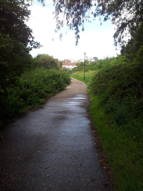
Night Plantation is a stunning woodland located in Norfolk, England. Covering an extensive area, it is renowned for its serene atmosphere and captivating natural beauty. The plantation is predominantly composed of a diverse range of trees, including oak, beech, and birch, which create a majestic forest canopy.

The woodland offers a sanctuary for a variety of wildlife, making it a popular destination for nature enthusiasts and photographers. Visitors can often spot native species such as deer, foxes, and a wide array of birds. The plantation's tranquil ambiance is enhanced by the soothing sounds of chirping birds and rustling leaves, providing a peaceful retreat from the hustle and bustle of city life.

Night Plantation offers numerous walking trails that meander through its enchanting landscape. These paths cater to all levels of fitness and provide opportunities for leisurely strolls or more challenging hikes. Along the trails, visitors can admire the vibrant flora, including wildflowers, ferns, and moss-covered rocks.

The plantation's management prioritizes conservation, ensuring the preservation of its natural wonders. This commitment is reflected in the maintenance of the trails and the implementation of sustainable practices. Night Plantation also hosts educational programs and guided tours to promote environmental awareness and appreciation for the local ecosystem.

Night Plantation is a hidden gem in Norfolk, offering a sanctuary for both nature lovers and those seeking solace in the midst of woodlands. Its tranquil atmosphere, diverse wildlife, and scenic trails make it a must-visit destination for anyone looking to immerse themselves in the beauty of nature.

If you have any feedback on the listing, please let us know in the comments section below.

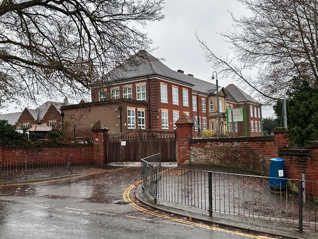
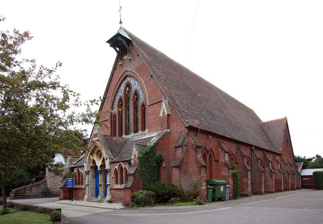
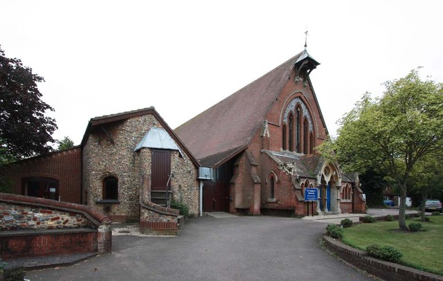
Night Plantation Images

Images are sourced within 2km of 52.659616/1.2911235 or Grid Reference TG2211. Thanks to Geograph Open Source API. All images are credited.

The Rosebery, New Catton Light is rapidly fading on this December afternoon but the fine old Victorian pub looks inviting. It was formerly known as the Lord Rosebery, named after Archibald Primrose who was Liberal Prime Minister between 1894 and 1895.
The Rosebery, New Catton
Light is rapidly fading on this December afternoon but the fine old Victorian pub looks inviting. It was formerly known as the Lord Rosebery, named after Archibald Primrose who was Liberal Prime Minister between 1894 and 1895.
The Firs, Old Catton A very fine mid/late C18th house in five bays and three storeys. Rusticated lintels to the windows and good Ionic doorcase (<a href="https://www.geograph.org.uk/photo/7454374">TG2311 : Detail of The Firs, Old Catton</a>). Grade II* listed.
The Firs, Old Catton
A very fine mid/late C18th house in five bays and three storeys. Rusticated lintels to the windows and good Ionic doorcase (TG2311 : Detail of The Firs, Old Catton). Grade II* listed.
Detail of The Firs, Old Catton Good Ionic doorcase to this house: <a href="https://www.geograph.org.uk/photo/7454371">TG2311 : The Firs, Old Catton</a>.
Detail of The Firs, Old Catton
Good Ionic doorcase to this house: TG2311 : The Firs, Old Catton.
81 Spixworth Road, Old Catton A well-proportioned late C18th house in three bays and storeys with a good doorcase (<a href="https://www.geograph.org.uk/photo/7454378">TG2311 : Detail of 81 Spixworth Road, Old Catton</a>). Grade II listed.
81 Spixworth Road, Old Catton
A well-proportioned late C18th house in three bays and storeys with a good doorcase (TG2311 : Detail of 81 Spixworth Road, Old Catton). Grade II listed.
Detail of 81 Spixworth Road, Old Catton Rather a grand Doric doorcase to this house: <a href="https://www.geograph.org.uk/photo/7454376">TG2311 : 81 Spixworth Road, Old Catton</a>.
Detail of 81 Spixworth Road, Old Catton
Rather a grand Doric doorcase to this house: TG2311 : 81 Spixworth Road, Old Catton.
Police station, Sprowston On Wroxham Road. A period piece, 1950s neo-Georgian.
This may no longer be operational as police forces increasingly centralise facilities in order to keep costs down.
Police station, Sprowston
On Wroxham Road. A period piece, 1950s neo-Georgian. This may no longer be operational as police forces increasingly centralise facilities in order to keep costs down.
Alderford Terrace, Magdalen Road, Norwich Some early 19th century cottages along Magdalen Road, Norwich. An OS Map from the 1880s tells me this row is called Alderford Terrace but I am not sure if the name is still in use today.
Alderford Terrace, Magdalen Road, Norwich
Some early 19th century cottages along Magdalen Road, Norwich. An OS Map from the 1880s tells me this row is called Alderford Terrace but I am not sure if the name is still in use today.
The Dyers Arms, Magdalen Road, Norwich Sadly no longer a PH having closed around 2019. The former Dyers Arms has become a "health and wellbeing clinic". In 1986 the Norwich Society described it as an "unremarkable local".

<span class="nowrap"><a title="https://www.norfolkpubs.co.uk/norwich/gnorwich/ncgld.htm" rel="nofollow ugc noopener" href="https://www.norfolkpubs.co.uk/norwich/gnorwich/ncgld.htm">Link</a><img style="margin-left:2px;" alt="External link" title="External link - shift click to open in new window" src="https://s1.geograph.org.uk/img/external.png" width="10" height="10"/></span>
The Dyers Arms, Magdalen Road, Norwich
Sadly no longer a PH having closed around 2019. The former Dyers Arms has become a "health and wellbeing clinic". In 1986 the Norwich Society described it as an "unremarkable local". LinkExternal link
Christ Church, New Catton, Norwich A view across to Christ Church, New Catton in Norwich on a wet December morning. A rather striking church dating from 1842 and, apparently, pre-dating all of the housing which surrounds it. Simon Knott's excellent Norfolk Churches site seems to suggest it has a similarly striking mint green interior which I sadly did not get to see.

<span class="nowrap"><a title="http://www.norfolkchurches.co.uk/newcatton/newcatton.htm" rel="nofollow ugc noopener" href="http://www.norfolkchurches.co.uk/newcatton/newcatton.htm">Link</a><img style="margin-left:2px;" alt="External link" title="External link - shift click to open in new window" src="https://s1.geograph.org.uk/img/external.png" width="10" height="10"/></span>
Christ Church, New Catton, Norwich
A view across to Christ Church, New Catton in Norwich on a wet December morning. A rather striking church dating from 1842 and, apparently, pre-dating all of the housing which surrounds it. Simon Knott's excellent Norfolk Churches site seems to suggest it has a similarly striking mint green interior which I sadly did not get to see. LinkExternal link
Sewell Park, New Catton, Norwich The southern entrance to Sewell Park in New Catton. The handsome triangular drinking trough here can be seen on an OS Map from the late-19th century. A final stopping place before heading into the city centre perhaps.

A similarly handsome bronze plaque can be seen behind it describing how this open space was once used and loved by Philip Edward Sewell and is now dedicated to his memory.
Sewell Park, New Catton, Norwich
The southern entrance to Sewell Park in New Catton. The handsome triangular drinking trough here can be seen on an OS Map from the late-19th century. A final stopping place before heading into the city centre perhaps. A similarly handsome bronze plaque can be seen behind it describing how this open space was once used and loved by Philip Edward Sewell and is now dedicated to his memory.
Sewell Park Academy, Norwich As with many schools in Norfolk, this one has a long history of changing with the educational winds. It was opened in 1929 as Blyth Grammar School, it became a comprehensive school in 1971 and merged with Alderman Jex School to become Blyth-Jex School in 1972. In 2008, it became Sewell Park College and, in 2015, it became Sewell Park Academy. 

Apparently a whalebone, donated by a former student, stands in the grounds.
<a href="https://www.geograph.org.uk/photo/166094">TG2310 : Whale's Jawbone Arch in the grounds of Blyth Jex School</a>
Sewell Park Academy, Norwich
As with many schools in Norfolk, this one has a long history of changing with the educational winds. It was opened in 1929 as Blyth Grammar School, it became a comprehensive school in 1971 and merged with Alderman Jex School to become Blyth-Jex School in 1972. In 2008, it became Sewell Park College and, in 2015, it became Sewell Park Academy. Apparently a whalebone, donated by a former student, stands in the grounds. TG2310 : Whale's Jawbone Arch in the grounds of Blyth Jex School
Footpath from Wensum Park to Drayton Road
St Cuthbert, Sprowston, Norwich
St Cuthbert, Sprowston, Norwich - War Memorial
St Cuthbert, Sprowston, Norwich - East end
St Cuthbert, Sprowston, Norwich - West end
Show me another place!

Night Plantation is located at Grid Ref: TG2211 (Lat: 52.659616, Lng: 1.2911235)

Administrative County: Norfolk

District: Norwich

Police Authority: Norfolk

What 3 Words

///square.wide.adopt. Near Norwich, Norfolk

Related Wikis

Old Catton

Old Catton is a suburban village and civil parish in the English county of Norfolk which lies 2 miles (3.2 km) to the north-east of central Norwich. The...

Catton Grove Chalk Pit

Catton Grove Chalk Pit is a 0.6-hectare (1.5-acre) geological Site of Special Scientific Interest on the northern outskirts of Norwich in Norfolk. It is...

Norwich North (UK Parliament constituency)

Norwich North is a constituency represented in the House of Commons of the UK Parliament since 2009 by Conservative Chloe Smith. The constituency includes...

Mile Cross Estate, Norwich

Mile Cross Estate is a council estate in Norwich, England. The population of the Mile Cross Ward in Norwich at the 2011 census was 10,655. == Location... ==

Nearby Amenities

Located within 500m of 52.659616,1.2911235
Crossing
Crossing: uncontrolled
Crossing Island: no
Crossing Ref: zebra
Tactile Paving: yes
Lat/Long: 52.6640066/1.2898412
Mini Roundabout
Direction: clockwise
Lat/Long: 52.6620155/1.294486
Post Box
Collection Times: Mo-Fr 18:30; Sa 11:00
Operator: Royal Mail
Postal Code: NR6
Ref: NR6 614
Lat/Long: 52.6597613/1.2850544
Post Box
Collection Times: Mo-Fr 18:30; Sa 11:00
Operator: Royal Mail
Postal Code: NR6
Ref: NR6 621
Lat/Long: 52.6592895/1.2904993
Traffic Signals
Lat/Long: 52.6575179/1.2846596
Give Way
Lat/Long: 52.6568783/1.286712
Traffic Calming: hump
Lat/Long: 52.6560334/1.2884684
Crossing
Crossing: uncontrolled
Lat/Long: 52.6562556/1.2885064
Traffic Signals
Lat/Long: 52.6552802/1.292605
Traffic Signals
Lat/Long: 52.6553041/1.2922571
Recycling
Greenfields Community Centre
Recycling Beverage Cartons: yes
Recycling Cans: yes
Recycling Glass Bottles: yes
Recycling Paper: yes
Recycling Textiles: yes
Url: http://www.norwich.gov.uk/intranet_docs/A-Z/Recycling/Recycling_Centres.pdf
Lat/Long: 52.659696/1.290601
Bus Stop
The Hall School, adj
Naptan AtcoCode: 2900C1314
Naptan Bearing: S
Naptan CommonName: The Hall School
Naptan Indicator: adj
Naptan Locality: Old Catton
Naptan NaptanCode: nfoajgaj
Naptan PlusbusZoneRef: NRCH
Naptan Street: St Faiths Road
Naptan Verified: no
Note: Bearing should be SE
Shelter: no
Source: naptan_import
Lat/Long: 52.6611915/1.293659
Bus Stop
The Hall School, opp
Naptan AtcoCode: 2900C1315
Naptan Bearing: N
Naptan CommonName: The Hall School
Naptan Indicator: opp
Naptan Locality: Old Catton
Naptan NaptanCode: nfoajgam
Naptan PlusbusZoneRef: NRCH
Naptan Street: St Faiths Road
Naptan Verified: no
Note: Should be NW bearing
Shelter: no
Source: naptan_import
Lat/Long: 52.6614399/1.2937813
Bus Stop
Church Street, adj
Naptan AtcoCode: 2900C1333
Naptan Bearing: S
Naptan CommonName: Church Street
Naptan Indicator: adj
Naptan Locality: Old Catton
Naptan NaptanCode: nfoajgmd
Naptan PlusbusZoneRef: NRCH
Naptan Street: St Faiths Road
Naptan Verified: no
Source: naptan_import
Lat/Long: 52.6630131/1.2954233
Bus Stop
Church Street, opp
Bench: no
Naptan AtcoCode: 2900C1334
Naptan Bearing: N
Naptan CommonName: Church Street
Naptan Indicator: opp
Naptan Locality: Old Catton
Naptan NaptanCode: nfoajgmg
Naptan PlusbusZoneRef: NRCH
Naptan Street: St Faiths Road
Naptan Verified: no
Shelter: no
Source: naptan_import
Lat/Long: 52.6630344/1.2953066
Dowding Road, opp
Naptan AtcoCode: 2900N1216
Naptan Bearing: W
Naptan BusStopType: CUS
Naptan CommonName: Dowding Road
Naptan Indicator: opp
Naptan Landmark: Dowding Road
Naptan Locality: Old Catton
Naptan NaptanCode: nfodjagt
Naptan PlusbusZoneRef: NRCH
Naptan Street: Fifers Lane
Naptan Verified: no
Source: naptan_import
Lat/Long: 52.6634842/1.2914204
Bus Stop
Bussey Road, opp
Naptan AtcoCode: 2900N12167
Naptan Bearing: S
Naptan CommonName: Bussey Road
Naptan Indicator: opp
Naptan Landmark: Layby
Naptan Locality: Fiddlewood
Naptan NaptanCode: nfodjajp
Naptan PlusbusZoneRef: NRCH
Naptan Street: Fiddlewood Road
Naptan Verified: no
Source: naptan_import
Lat/Long: 52.6584235/1.2909955
Bus Stop
Bus Depot, adj
Bus: yes
Naptan AtcoCode: 2900N12177
Naptan Bearing: S
Naptan BusStopType: CUS
Naptan CommonName: Bus Depot
Naptan Indicator: adj
Naptan Landmark: Bus Depot
Naptan Locality: Norwich
Naptan NaptanCode: nfodjajw
Naptan PlusbusZoneRef: NRCH
Naptan Street: Vulcan Road South
Naptan Verified: no
Public Transport: platform
Source: naptan_import
Lat/Long: 52.6579414/1.2843922
Bus Stop
Dowding Road, adj
Naptan AtcoCode: 2900N12203
Naptan Bearing: SE
Naptan CommonName: Dowding Road
Naptan Indicator: adj
Naptan Landmark: Dowding Road Bus shelter
Naptan Locality: Old Catton
Naptan NaptanCode: nfodjatg
Naptan PlusbusZoneRef: NRCH
Naptan Street: Fifers Lane
Naptan Verified: no
Source: naptan_import
Lat/Long: 52.6636597/1.2912561
Bus Stop
Community Centre, adj
Naptan AtcoCode: 2900N122078
Naptan Bearing: SW
Naptan CommonName: Community Centre
Naptan Indicator: adj
Naptan Landmark: Community Centre
Naptan Locality: Old Catton
Naptan NaptanCode: nfogmtdj
Naptan PlusbusZoneRef: NRCH
Naptan Street: Ives Road
Naptan Verified: no
Source: naptan_import
Lat/Long: 52.6604537/1.2901127
Bus Stop
Junction, adj
Naptan AtcoCode: 2900N122079
Naptan Bearing: SW
Naptan CommonName: Junction
Naptan Indicator: adj
Naptan Landmark: Junction (pole 6)
Naptan Locality: Old Catton
Naptan NaptanCode: nfogmwgw
Naptan PlusbusZoneRef: NRCH
Naptan Street: Ives Road
Naptan Verified: no
Source: naptan_import
Lat/Long: 52.6631512/1.2898126
Junction, opp
Naptan AtcoCode: 2900N122080
Naptan Bearing: NE
Naptan BusStopType: CUS
Naptan CommonName: Junction
Naptan Indicator: opp
Naptan Landmark: Ives Road Est. Rd Junc.
Naptan Locality: Old Catton
Naptan NaptanCode: nfogmwja
Naptan PlusbusZoneRef: NRCH
Naptan Street: Ives Road
Naptan Verified: no
Source: naptan_import
Lat/Long: 52.6630105/1.289373
Bus Stop
Rosebay, opp
Naptan AtcoCode: 2900N122081
Naptan Bearing: N
Naptan CommonName: Rosebay
Naptan Indicator: opp
Naptan Landmark: No 2 Rosebay
Naptan Locality: Old Catton
Naptan NaptanCode: nfogpapa
Naptan PlusbusZoneRef: NRCH
Naptan Street: Ives Road
Naptan Verified: no
Source: naptan_import
Lat/Long: 52.6614767/1.2885773
Bus Stop
Bussey Road, adj
Bus: yes
Naptan AtcoCode: 2900N12265
Naptan Bearing: N
Naptan CommonName: Bussey Road
Naptan Indicator: adj
Naptan Landmark: Bussey Road
Naptan Locality: Fiddlewood
Naptan NaptanCode: nfodjgaw
Naptan PlusbusZoneRef: NRCH
Naptan Street: Fiddlewood Road
Naptan Verified: no
Public Transport: platform
Source: naptan_import
Lat/Long: 52.6582001/1.2908949
Bus Stop
Bus Depot, opp
Bus: yes
Naptan AtcoCode: 2900N12266
Naptan Bearing: NE
Naptan BusStopType: CUS
Naptan CommonName: Bus Depot
Naptan Indicator: opp
Naptan Landmark: Bus Depot
Naptan Locality: Norwich
Naptan NaptanCode: nfodjgda
Naptan PlusbusZoneRef: NRCH
Naptan Street: Vulcan Road South
Naptan Verified: no
Public Transport: platform
Source: naptan_import
Lat/Long: 52.6583281/1.2843916
Spindle Road, adj
Naptan AtcoCode: 2900N12537
Naptan Bearing: N
Naptan BusStopType: CUS
Naptan CommonName: Spindle Road
Naptan Indicator: adj
Naptan Locality: Fiddlewood
Naptan NaptanCode: nfodmawa
Naptan PlusbusZoneRef: NRCH
Naptan Street: St. Faiths Road
Naptan Verified: no
Source: naptan_import
Lat/Long: 52.6566201/1.2924573
Bus Stop
Fiddlewood Road, adj
Bench: no
Bin: no
Naptan AtcoCode: 2900N12539
Naptan Bearing: N
Naptan CommonName: Fiddlewood Road
Naptan Indicator: adj
Naptan Landmark: Fiddlewood Road
Naptan Locality: Norwich
Naptan NaptanCode: nfodmawg
Naptan PlusbusZoneRef: NRCH
Naptan Street: St Faiths Road
Naptan Verified: no
Shelter: no
Source: naptan_import
Lat/Long: 52.6588896/1.2923469
Bus Stop
Concorde Road, adj
Bus: yes
Naptan AtcoCode: 2900N12547
Naptan Bearing: S
Naptan BusStopType: CUS
Naptan CommonName: Concorde Road
Naptan Indicator: adj
Naptan Landmark: Spar Road
Naptan Locality: Norwich
Naptan NaptanCode: nfodmdap
Naptan PlusbusZoneRef: NRCH
Naptan Street: Vulcan Road South
Naptan Verified: no
Public Transport: platform
Source: naptan_import
Lat/Long: 52.6598563/1.2850684
Bus Stop
Concorde Road, opp
Bus: yes
Naptan AtcoCode: 2900N12548
Naptan Bearing: N
Naptan BusStopType: CUS
Naptan CommonName: Concorde Road
Naptan Indicator: opp
Naptan Landmark: Concorde Road
Naptan Locality: Norwich
Naptan NaptanCode: nfodmdat
Naptan PlusbusZoneRef: NRCH
Naptan Street: Vulcan Road South
Naptan Verified: no
Public Transport: platform
Source: naptan_import
Lat/Long: 52.6594944/1.2848193
Bus Stop
Dogwood Road, adj
Naptan AtcoCode: 2900N12580
Naptan Bearing: NE
Naptan CommonName: Dogwood Road
Naptan Indicator: adj
Naptan Landmark: Dogwood Road
Naptan Locality: Fiddlewood
Naptan NaptanCode: nfodmdtj
Naptan PlusbusZoneRef: NRCH
Naptan Street: Fiddlewood Road
Naptan Verified: no
Source: naptan_import
Lat/Long: 52.6567413/1.2919783
Bus Stop
Vulcan Road, adj
Bus: yes
Naptan AtcoCode: 2900N12605
Naptan Bearing: SE
Naptan BusStopType: CUS
Naptan CommonName: Vulcan Road
Naptan Indicator: adj
Naptan Landmark: Vulcan Road
Naptan Locality: Norwich
Naptan NaptanCode: nfodmgjd
Naptan PlusbusZoneRef: NRCH
Naptan Street: Mile Cross Lane
Naptan Verified: no
Public Transport: platform
Source: naptan_import
Lat/Long: 52.6574529/1.2854889
Partridge Way, opp
Naptan AtcoCode: 2900N12606
Naptan Bearing: NW
Naptan BusStopType: CUS
Naptan CommonName: Partridge Way
Naptan Indicator: opp
Naptan Landmark: Hammer Road
Naptan Locality: Norwich
Naptan NaptanCode: nfodmgjg
Naptan PlusbusZoneRef: NRCH
Naptan Street: Mile Cross Lane
Naptan Verified: no
Source: naptan_import
Lat/Long: 52.6562176/1.2888182
St Faiths Road, adj
Naptan AtcoCode: 2900N12607
Naptan Bearing: SE
Naptan BusStopType: CUS
Naptan CommonName: St Faiths Road
Naptan Indicator: adj
Naptan Landmark: St. Faiths Road
Naptan Locality: Norwich
Naptan NaptanCode: nfodmgjm
Naptan PlusbusZoneRef: NRCH
Naptan Street: Mile Cross Lane
Naptan Verified: no
Source: naptan_import
Lat/Long: 52.6556449/1.2909789
St Faiths Road, opp
Naptan AtcoCode: 2900N12608
Naptan Bearing: NW
Naptan BusStopType: CUS
Naptan CommonName: St Faiths Road
Naptan Indicator: opp
Naptan Landmark: Catton Grove Road
Naptan Locality: Norwich
Naptan NaptanCode: nfodmgjp
Naptan PlusbusZoneRef: NRCH
Naptan Street: Mile Cross Lane
Naptan Verified: no
Source: naptan_import
Lat/Long: 52.6554817/1.2910258
Crossing
Crossing: traffic_signals
Lat/Long: 52.6558361/1.2901654
Crossing
Crossing: uncontrolled
Lat/Long: 52.6563412/1.2906934
Traffic Signals
Lat/Long: 52.6552042/1.2922535
Crossing
Crossing: traffic_signals
Crossing Ref: toucan
Tactile Paving: yes
Traffic Signals Sound: yes
Traffic Signals Vibration: yes
Lat/Long: 52.6553356/1.2923052
Crossing
Crossing: traffic_signals
Tactile Paving: yes
Lat/Long: 52.6552153/1.2926073
Turning Circle
Lat/Long: 52.6583221/1.2888222
Parking
Fee: no
Lat/Long: 52.658846/1.289453
Parking
Fee: no
Parking: surface
Lat/Long: 52.6592975/1.289433
Barrier: bollard
Foot: yes
Lat/Long: 52.663172/1.288816
Barrier: bollard
Foot: yes
Lat/Long: 52.663409/1.288473
Crossing
Crossing: traffic_signals
Lat/Long: 52.6638029/1.2906351
Bus Depot
First Eastern Counties bus depot
Description: Mainly low-floor buses used for city routes
Operator: First Eastern Counties
Lat/Long: 52.657942/1.285258
Traffic Calming: bump
Lat/Long: 52.6604617/1.2937649
Traffic Calming: bump
Lat/Long: 52.6604984/1.2935322
Speed Camera
Maxspeed: 40 mph
Ref: F14
Speed Camera Type: Truvelo D-Cam
Website: http://norfolk-safety-camera.org.uk/index.php?page=fixed-cameras
Lat/Long: 52.6561963/1.2891997
Barrier: kissing_gate
Foot: yes
Lat/Long: 52.6581919/1.2925098
Entrance: main
Lat/Long: 52.6590571/1.2870534
Entrance: yes
Lat/Long: 52.6590962/1.2870661
Bench
Backrest: no
Material: wood
Seats: 3
Lat/Long: 52.6591748/1.293066
Barrier: kissing_gate
Foot: yes
Lat/Long: 52.6568387/1.2925924
Bench
Backrest: yes
Colour: brown
Material: wood
Lat/Long: 52.6624965/1.2967891
Crossing
Crossing: uncontrolled
Tactile Paving: no
Lat/Long: 52.6615518/1.2877959
Give Way
Lat/Long: 52.6581485/1.2843399
Crossing
Crossing: unmarked
Lat/Long: 52.6565758/1.2875264
Bench
Backrest: yes
Seats: 3
Lat/Long: 52.6563468/1.2949866
Leisure: picnic_table
Lat/Long: 52.6562508/1.2950751
Leisure: picnic_table
Lat/Long: 52.6562882/1.2949222
Bench
Backrest: no
Material: wood
Seats: 3
Lat/Long: 52.659185/1.2931184
Entrance: main
Lat/Long: 52.6621964/1.2861762
Shelter
Shelter Type: gazebo
Lat/Long: 52.6604046/1.291641
Shelter
Shelter Type: gazebo
Lat/Long: 52.6603529/1.2912035
Man Made: obelisk
Lat/Long: 52.6579422/1.2913266
Crossing
Crossing: unmarked
Lat/Long: 52.6565998/1.2903686
Barrier: yes
Lat/Long: 52.6616161/1.2883011
Camera Mount: wall
Camera Type: fixed
Man Made: surveillance
Surveillance: outdoor
Surveillance Type: camera
Surveillance Zone: parking
Lat/Long: 52.6561796/1.2872263
Give Way
Lat/Long: 52.656557/1.2875093
Give Way
Lat/Long: 52.6563986/1.2885202
Give Way
Lat/Long: 52.6562891/1.2885291
Charging Station
Shared Load Chargers
Access: permissive
Amperage: 32
Authentication None: yes
Capacity: 4
Fee: yes
Motorcar: yes
Opening Hours: 24/7
Operator: Tesla
Phases: 3
Power: 22 kW
Socket Tesla Destination: 4
Voltage: 400
Lat/Long: 52.6559272/1.2871825
Charging Station
Tesla Superchargers
Access: yes
Amperage: 575
Authentication None: yes
Brand: Tesla Supercharger
Capacity: 12
Covered: no
Fee: 0.52 GBP/kWh
Fee Conditional: 0.67 GBP/kWh @ (Mo-Su 16:00-20:00);no @ free_supercharging
Motorcar: yes
Opening Hours: 24/7
Operator: Tesla
Output: 250 kW
Phases: 1
Socket Tesla Supercharger Ccs: 8
Socket Tesla Supercharger Ccs Output: 250 kW
Start Date: 2023-08-03
Vehicle Electric: yes
Voltage: 1000
Lat/Long: 52.6563118/1.2876422
Supercharging Lounge
Access: customers
Indoor: yes
Lit: yes
Room: lounge
Lat/Long: 52.6560979/1.2876658
Access: customers
Barrier: swing_gate
Material: metal
Opening Hours: Mo-Sa 09:00-17:00; Su 10:00-16:00
Swing Gate Type: double
Lat/Long: 52.6561358/1.2872162
Entrance: garage
Lat/Long: 52.6559683/1.287333
Entrance: main
Lat/Long: 52.6559905/1.28737
Barrier: swing_gate
Swing Gate Type: single
Lat/Long: 52.655672/1.2876863
Crossing
Crossing: uncontrolled
Crossing Island: no
Crossing Ref: zebra
Tactile Paving: no
Lat/Long: 52.6561557/1.287343
Entrance: emergency
Lat/Long: 52.6559705/1.2872913
Entrance: emergency
Lat/Long: 52.655884/1.2876906
Entrance: emergency
Lat/Long: 52.6559567/1.2877007
Entrance: garage
Lat/Long: 52.6558432/1.2876849
Entrance: garage
Lat/Long: 52.6556626/1.2875824
Crossing
Crossing: traffic_signals
Crossing Ref: toucan
Lat/Long: 52.6551829/1.2923213
Entrance: yes
Lat/Long: 52.6561173/1.2876687
Entrance: main
Lat/Long: 52.6561077/1.2874532
Waste Basket
Lat/Long: 52.6570589/1.2912268
Waste Basket
Colour: green
Material: plastic
Lat/Long: 52.656842/1.2914142
Waste Basket
Colour: green
Material: plastic
Lat/Long: 52.6583753/1.2910121
Waste Basket
Lat/Long: 52.6600518/1.2902202
Waste Basket
Colour: green
Material: plastic
Lat/Long: 52.6613816/1.2883924
Waste Basket
Lat/Long: 52.660023/1.2910353
Waste Basket
Colour: green
Material: plastic
Lat/Long: 52.6562532/1.2904007
Waste Basket
Lat/Long: 52.6633626/1.2909692
Waste Basket
Colour: green
Material: plastic
Lat/Long: 52.6614075/1.2910428
Waste Basket
Colour: green
Material: plastic
Lat/Long: 52.6616843/1.2897789
Waste Basket
Lat/Long: 52.6585014/1.2902294
Crossing
Crossing: unmarked
Tactile Paving: yes
Lat/Long: 52.6637569/1.2900791
Barrier: bollard
Bicycle: yes
Foot: yes
Lat/Long: 52.656211/1.2902721
Give Way
Lat/Long: 52.6563682/1.2897515
Give Way
Lat/Long: 52.6571699/1.2903472
Give Way
Lat/Long: 52.6563823/1.2905349
Give Way
Lat/Long: 52.6579761/1.2908761
Give Way
Lat/Long: 52.6589751/1.2907128
Bicycle Parking
Bicycle Parking: stands
Capacity: 8
Lat/Long: 52.6602913/1.2906803
Crossing
Crossing: uncontrolled
Lat/Long: 52.660569/1.2906972
Give Way
Lat/Long: 52.662047/1.2910458
Give Way
Lat/Long: 52.6616291/1.290444
Give Way
Lat/Long: 52.6616029/1.2909174
Barrier: cycle_barrier
Bicycle Parking: no
Lat/Long: 52.6610282/1.2901869
Give Way
Lat/Long: 52.6604418/1.2893361
Give Way
Lat/Long: 52.6588604/1.2871043
Street Lamp
Lat/Long: 52.6560763/1.2867723
Street Lamp
Lat/Long: 52.6560645/1.287062
Grit Bin
Grit Salt
Colour: yellow
Lat/Long: 52.6563207/1.2867123
Note: Finish of Catton parkrun
Lat/Long: 52.656455/1.2948377
Note: Start of Catton parkrun
Lat/Long: 52.6567014/1.2939996
Communication Mobile Phone: yes
Man Made: mast
Material: metal
Operator: O2-UK;Vodafone UK
Tower Construction: lattice
Tower Type: communication
Lat/Long: 52.6629959/1.2865363
Crossing
Crossing: uncontrolled
Crossing Ref: zebra
Lat/Long: 52.6627185/1.2876789
Communication Microwave: yes
Communication Mobile Phone: yes
Layer: 1
Man Made: mast
Material: metal
Operator: Three UK;EE
Tower Construction: lattice
Tower Type: communication
Lat/Long: 52.6567519/1.287915
The data included in this document is from www.openstreetmap.org. The data is made available under ODbL.

Have you been to Night Plantation?

Leave your review of Night Plantation below (or comments, questions and feedback).