Comet Plantation

Wood, Forest in Norfolk Broadland

England

Comet Plantation

Taking up most of the road A tractor and cultivator on a narrow country lane just north of Stratton Strawless, Norfolk
Taking up most of the road Credit: Adrian S Pye

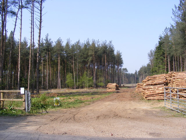
Comet Plantation, located in Norfolk, England, is a picturesque woodland area known for its diverse flora and fauna. Spanning over a vast expanse, the plantation is a popular destination for nature enthusiasts and hikers alike. The woodland is primarily composed of various species of trees, including oak, beech, and birch, which contribute to its enchanting charm.

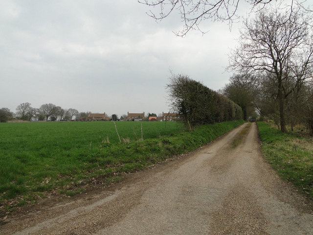
One of the standout features of Comet Plantation is its well-maintained trails, which wind through the forest, offering visitors the opportunity to immerse themselves in the natural beauty of the area. These trails are suitable for all levels of hikers, from beginners to experienced trekkers. Along the way, visitors may come across a variety of wildlife, including deer, rabbits, and squirrels, making the plantation an ideal spot for wildlife observation and photography.

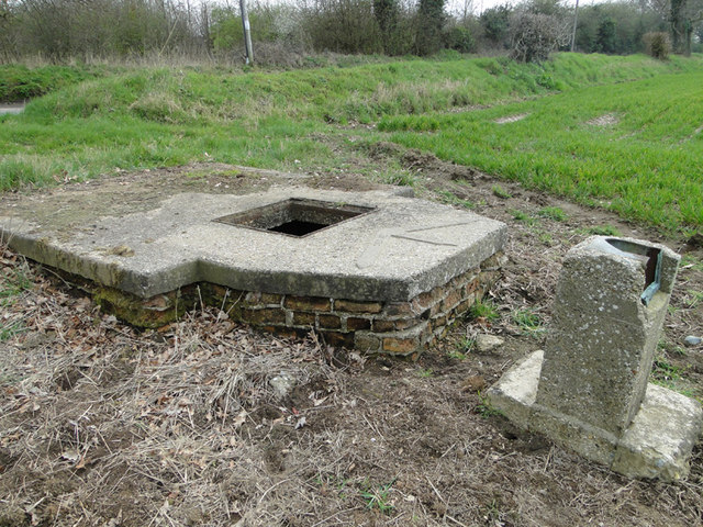
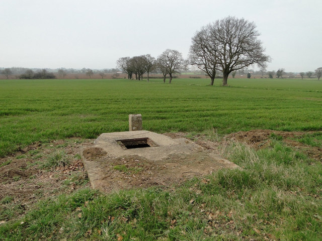
Aside from its natural beauty, Comet Plantation is also home to a rich history. The woodland has been carefully managed for centuries, with evidence of human activity dating back to the medieval era. Today, remnants of old structures and boundaries can still be seen, adding an intriguing historical element to the plantation.

Accessibility is another notable aspect of Comet Plantation. Situated close to major roads and public transportation, the woodland is easily reachable for both locals and tourists. Furthermore, the plantation provides ample parking facilities and well-marked paths, ensuring a hassle-free experience for all visitors.

In conclusion, Comet Plantation in Norfolk is a captivating woodland oasis, offering a delightful escape into nature. Its diverse range of flora and fauna, well-maintained trails, historical significance, and convenient accessibility make it a must-visit destination for nature lovers and history enthusiasts alike.

If you have any feedback on the listing, please let us know in the comments section below.

Comet Plantation Images

Images are sourced within 2km of 52.746147/1.2812547 or Grid Reference TG2121. Thanks to Geograph Open Source API. All images are credited.

Taking up most of the road A tractor and cultivator on a narrow country lane just north of Stratton Strawless, Norfolk
Taking up most of the road
A tractor and cultivator on a narrow country lane just north of Stratton Strawless, Norfolk
Housing off Mill Road, Marsham
Manhole for an irrigation pump On the concrete pad is the plan for the irrigation outlets which can be seen here > <a href="https://www.geograph.org.uk/photo/2329748">TG2123 : Plan of irrigation outlets cemented onto the top of the pump</a>
Manhole for an irrigation pump
On the concrete pad is the plan for the irrigation outlets which can be seen here > TG2123 : Plan of irrigation outlets cemented onto the top of the pump
Plan of irrigation outlets cemented onto the top of the pump For a full view goto > <a title="https://www.geograph.org.uk/photo/2329742" href="https://www.geograph.org.uk/photo/2329742">Link</a>
Plan of irrigation outlets cemented onto the top of the pump
For a full view goto > Link
Irrigation manhole on the edge of the field See also <a href="https://www.geograph.org.uk/photo/2329748">TG2123 : Plan of irrigation outlets cemented onto the top of the pump</a>
Irrigation manhole on the edge of the field
Potato planting at Oxnead The hopper on the tractor is full of potatoes ready for planting while the tractor in the background is putting a fine tilth on the soil and creating the rows.
Potato planting at Oxnead
The hopper on the tractor is full of potatoes ready for planting while the tractor in the background is putting a fine tilth on the soil and creating the rows.
St.Botolph's Church, Hevingham Off the A140 Cromer Road
St.Botolph's Church, Hevingham
Off the A140 Cromer Road
St.Botolph's Church, Hevingham Off the A140 Cromer Road
St.Botolph's Church, Hevingham
Off the A140 Cromer Road
St.Botolph's Church, Hevingham Notice Board Off the A140 Cromer Road
St.Botolph's Church, Hevingham Notice Board
Off the A140 Cromer Road
A140 Cromer Road Looking towards Marsham
A140 Cromer Road
Looking towards Marsham
A140 Cromer Road Looking towards Stratton Strawless
A140 Cromer Road
Looking towards Stratton Strawless
The entrance to The Old Rectory Special Needs Home Off the A140 Cromer Road
The entrance to The Old Rectory Special Needs Home
Off the A140 Cromer Road
Short - Thorn Road At the junction with the A140 Cromer Road
Short - Thorn Road
At the junction with the A140 Cromer Road
Mansom Plantation Off Short Thorn Road
Mansom Plantation
Off Short Thorn Road
Short -Thorn Road Looking towards  Short Thorn & the A1149 Holt Road near Mansom Plantation
Short -Thorn Road
Looking towards Short Thorn & the A1149 Holt Road near Mansom Plantation
The Fox Inn, Hevingham On the A140 Cromer Road at Hevingham
<span class="nowrap"><a title="http://www.wheresbest.co.uk/venue/99484/The-Fox/" rel="nofollow ugc noopener" href="http://www.wheresbest.co.uk/venue/99484/The-Fox/">Link</a><img style="margin-left:2px;" alt="External link" title="External link - shift click to open in new window" src="https://s1.geograph.org.uk/img/external.png" width="10" height="10"/></span>
The Fox Inn, Hevingham
On the A140 Cromer Road at Hevingham LinkExternal link
The Fox Inn Public House On the A140 Cromer Road at Hevingham
<span class="nowrap"><a title="http://www.wheresbest.co.uk/venue/99484/The-Fox/" rel="nofollow ugc noopener" href="http://www.wheresbest.co.uk/venue/99484/The-Fox/">Link</a><img style="margin-left:2px;" alt="External link" title="External link - shift click to open in new window" src="https://s1.geograph.org.uk/img/external.png" width="10" height="10"/></span>
The Fox Inn Public House
On the A140 Cromer Road at Hevingham LinkExternal link
The Fox Inn, Public House sign On the A140 Cromer Road at Hevingham
The Fox Inn, Public House sign
On the A140 Cromer Road at Hevingham
Show me another place!

Comet Plantation is located at Grid Ref: TG2121 (Lat: 52.746147, Lng: 1.2812547)

Administrative County: Norfolk

District: Broadland

Police Authority: Norfolk

What 3 Words

///bangle.green.courts. Near Buxton, Norfolk

Nearby Locations

Comet Plantation

Related Wikis

Stratton Strawless

Stratton Strawless is a village in the county of Norfolk and district of Broadland. The civil parish covers 714 acres (289 ha) and has a population of...

Hevingham

Hevingham is a village and civil parish in the Broadland district of the English county of Norfolk. Situated between the A140 road Norwich to Cromer road...

Buxton, Norfolk

Buxton is a village in the parish of Buxton with Lamas, in the Broadland district of the county of Norfolk, England. It is located between Norwich and...

Brampton, Norfolk

Brampton is a small village and parish in the county of Norfolk, England, in the Bure Valley, east of Aylsham. == History == Brampton was the subject of...

Nearby Amenities

Located within 500m of 52.746147,1.2812547
Strattonhill Farm
Place: farm
Source: NLS - OS 1:25k 1st Series 1937-61
Lat/Long: 52.7430992/1.2771549
Barrier: stile
Bicycle: no
Foot: yes
Material: wood
Stile: stepover
Lat/Long: 52.7483387/1.2755755
Barrier: stile
Bicycle: no
Foot: yes
Material: wood
Stile: stepover
Lat/Long: 52.7464326/1.2763801
Description: Uninscribed possible boundary marker
Historic: stone
Inscription: no
Material: granite_stone
Lat/Long: 52.7483226/1.2755002
The data included in this document is from www.openstreetmap.org. The data is made available under ODbL.

Have you been to Comet Plantation?

Leave your review of Comet Plantation below (or comments, questions and feedback).