Lingstack Grove

Wood, Forest in Norfolk Broadland

England

Lingstack Grove

Woodland Meadow at Burial Park
Woodland Meadow at Burial Park Credit: David Pashley

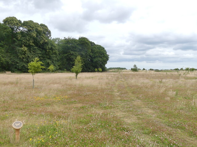
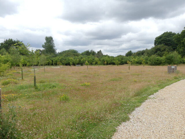
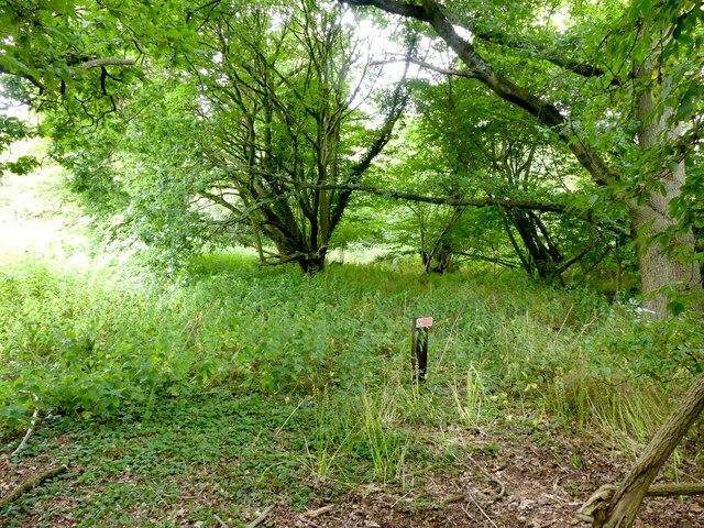
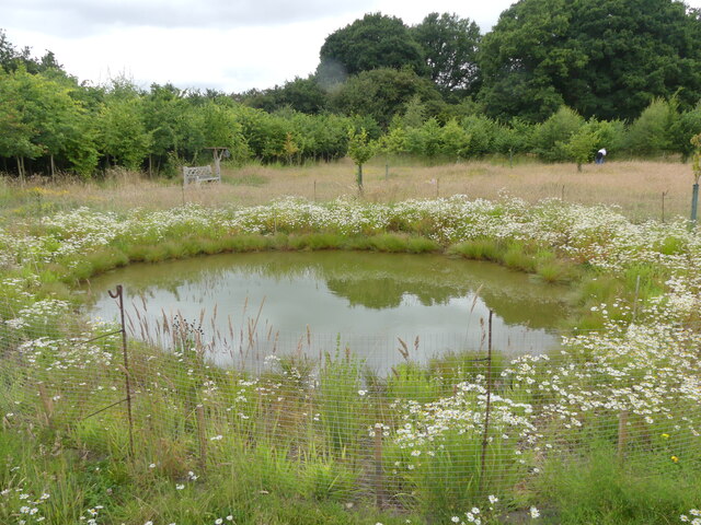
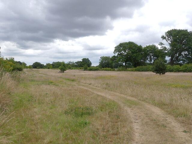
Lingstack Grove is a picturesque woodland area located in Norfolk, England. Situated in the heart of the county, this wood, or forest, is renowned for its natural beauty and diverse ecosystem. Covering an expansive area of approximately 100 acres, Lingstack Grove is home to a rich variety of flora and fauna, making it an ideal destination for nature enthusiasts and outdoor enthusiasts alike.

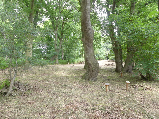
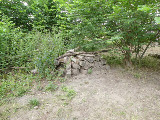
The woodland is primarily composed of native broad-leaf trees such as oak, beech, and birch, which provide a dense canopy and create a tranquil atmosphere. The forest floor is adorned with a colorful carpet of wildflowers during the spring and summer months, adding to the enchanting ambiance.

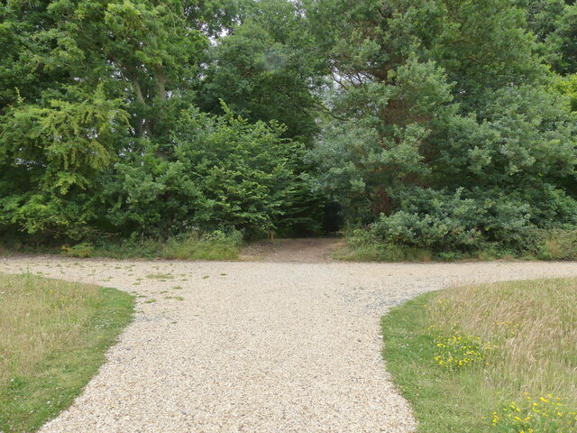
Lingstack Grove boasts an extensive network of well-maintained trails, making it easily accessible for visitors to explore its natural wonders. These trails wind through the woodland, offering breathtaking views of the surrounding countryside and providing opportunities for hiking, walking, and cycling.

The forest is also home to a variety of wildlife, including deer, foxes, badgers, and numerous bird species. Birdwatchers flock to Lingstack Grove to catch glimpses of rare or migratory birds that make the woodland their temporary home.

In addition to its natural beauty, Lingstack Grove offers educational opportunities. The forest hosts workshops and guided tours, allowing visitors to learn about the local flora and fauna, as well as the history and conservation efforts of the woodlands.

Overall, Lingstack Grove is a captivating woodland area that showcases the diverse beauty of Norfolk's natural landscape. With its scenic trails, abundant wildlife, and educational offerings, it is a must-visit destination for nature enthusiasts seeking to experience the tranquility and serenity of a true English forest.

If you have any feedback on the listing, please let us know in the comments section below.

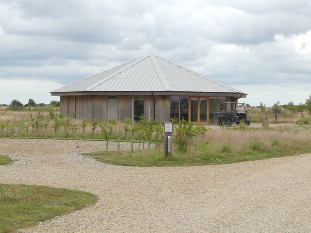
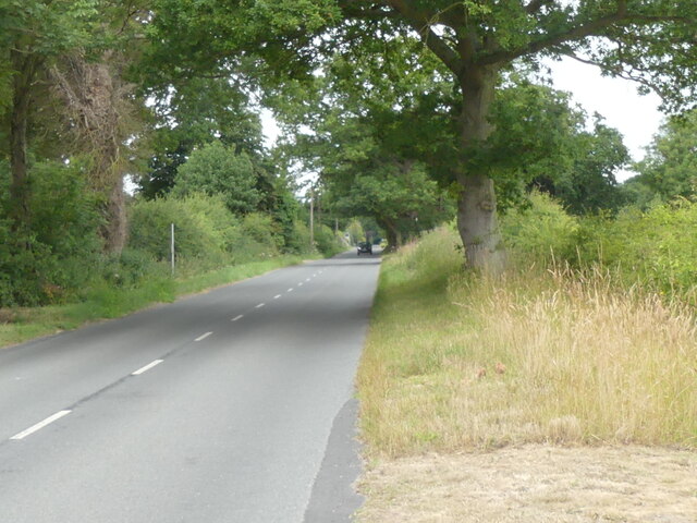
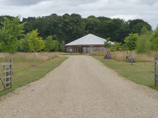
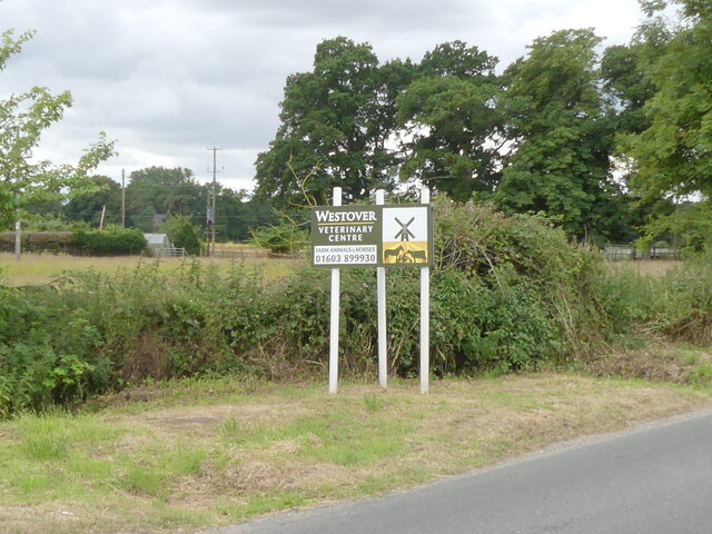
Lingstack Grove Images

Images are sourced within 2km of 52.731218/1.2675547 or Grid Reference TG2019. Thanks to Geograph Open Source API. All images are credited.

Woodland Meadow at Burial Park
Meadow with young oaks
Entrance to Bluebell Wood in Burial Park
Memorials under oak canopy
No entry wildlife area Bluebell Wood Burial Park
Wildlife log pile
Wildlife log pile
Wildlife pond
Wildlife pond
Flower meadow at Bluebell Wood Burial Park
Oedemera lurida on Thistle flower
Cinnabar moth caterpillars
Cedar Hall used for funeral and memorial services Bluebell Wood Burial Park
Cedar Hall used for funeral and memorial services
Bluebell Wood Burial Park
West on Old Church Road
Entrance road to Bluebell Wood Burial Park
Westover Veterinary Centre sign
B1354 Old Church Road, Waterloo At the junction with the B1354 Waterloo Road & Stratton Road
B1354 Old Church Road, Waterloo
At the junction with the B1354 Waterloo Road & Stratton Road
Stratton Road, Waterloo At the junction with the B1354 Old Church Road & B1354 Waterloo Road
Stratton Road, Waterloo
At the junction with the B1354 Old Church Road & B1354 Waterloo Road
Stratton Road sign On Stratton Road at the junction with the B1354 Old Church Road & B1354 Waterloo Road
Stratton Road sign
On Stratton Road at the junction with the B1354 Old Church Road & B1354 Waterloo Road
The Chequers Public House sign & Old Church Road sign On B1354 Old Church Road at the junction with the B1354 Waterloo Road & Stratton Road
Postbox No.NR10 1003D
<span class="nowrap"><a title="https://www.thechequershainford.co.uk/food" rel="nofollow ugc noopener" href="https://www.thechequershainford.co.uk/food">Link</a><img style="margin-left:2px;" alt="External link" title="External link - shift click to open in new window" src="https://s1.geograph.org.uk/img/external.png" width="10" height="10"/></span>
The Chequers Public House sign & Old Church Road sign
On B1354 Old Church Road at the junction with the B1354 Waterloo Road & Stratton Road Postbox No.NR10 1003D LinkExternal link
Show me another place!

Lingstack Grove is located at Grid Ref: TG2019 (Lat: 52.731218, Lng: 1.2675547)

Administrative County: Norfolk

District: Broadland

Police Authority: Norfolk

What 3 Words

///quitter.mini.berated. Near Buxton, Norfolk

Related Wikis

St Faith's and Aylsham Rural District

St Faith's and Aylsham Rural Districts were adjacent rural districts in Norfolk, England from 1894 to 1935.They were formed under the Local Government...

Hevingham

Hevingham is a village and civil parish in the Broadland district of the English county of Norfolk. Situated between the A140 road Norwich to Cromer road...

Stratton Strawless

Stratton Strawless is a village in the county of Norfolk and district of Broadland. The civil parish covers 714 acres (289 ha) and has a population of...

Hainford

Hainford (originally Haynford) is a village and civil parish in the English county of Norfolk. It covers an area of 6.94 km2 (2.68 sq mi) and had a population...

Buxton, Norfolk

Buxton is a village in the parish of Buxton with Lamas, in the Broadland district of the county of Norfolk, England. It is located between Norwich and...

Brampton, Norfolk

Brampton is a small village and parish in the county of Norfolk, England, in the Bure Valley, east of Aylsham. == History == Brampton was the subject of...

Horsford

Horsford is a village six miles north of Norwich, England which is surrounded by the Horsford Forest and is named after the dried up section of the River...

Buxton Lamas railway station

Buxton Lamas was a railway station in Buxton with Lamas, Norfolk. It was located near the Bure Valley Railway's present Buxton station. == References ==

Nearby Amenities

Located within 500m of 52.731218,1.2675547
Eastons Depot, adj
Naptan AtcoCode: 2900S551
Naptan Bearing: SW
Naptan BusStopType: CUS
Naptan CommonName: Eastons Depot
Naptan Indicator: adj
Naptan Landmark: Eastons Depot
Naptan Locality: Stratton Strawless
Naptan NaptanCode: nfodwdam
Naptan Street: Parish Road
Naptan Verified: no
Source: naptan_import
Lat/Long: 52.7332547/1.2707649
Bus Stop
Stratton Hall
Bench: yes
Check Date Shelter: 2023-10-07
Naptan AtcoCode: 2900S555
Naptan Bearing: NW
Naptan BusStopType: CUS
Naptan CommonName: Stratton Hall
Naptan Indicator: opp
Naptan Landmark: bus shelter
Naptan Locality: Stratton Strawless
Naptan NaptanCode: nfodwdga
Naptan Street: A140 Cromer Road
Shelter: yes
Source: naptan_import;survey
Lat/Long: 52.7299701/1.2716833
Bus Stop
Stratton Hall
Naptan AtcoCode: 2900S556
Naptan Bearing: SE
Naptan BusStopType: CUS
Naptan CommonName: Stratton Hall
Naptan Indicator: adj
Naptan Landmark: bus shelter
Naptan Locality: Stratton Strawless
Naptan NaptanCode: nfodwdgd
Naptan Street: A140 Cromer Road
Shelter: yes
Source: naptan_import
Lat/Long: 52.7300828/1.2719643
Man Made: mile_stone
Lat/Long: 52.7344258/1.2691605
Note: Aviaries are located here
Lat/Long: 52.727762/1.2722074
Recycling
Recycling Type: container
Lat/Long: 52.7332611/1.2706885
Communication Mobile Phone: yes
Man Made: mast
Material: metal
Operator: O2-UK;Vodafone UK
Tower Construction: freestanding
Tower Type: communication
Lat/Long: 52.7317685/1.2711914
Colour: grey
Communication Mobile Phone: yes
Man Made: mast
Material: metal
Operator: Three UK;EE
Tower Construction: freestanding
Tower Type: communication
Lat/Long: 52.7349404/1.2689819
Traffic Calming: island
Lat/Long: 52.7333149/1.269703
Traffic Calming: island
Lat/Long: 52.7332659/1.2701886
The data included in this document is from www.openstreetmap.org. The data is made available under ODbL.

Have you been to Lingstack Grove?

Leave your review of Lingstack Grove below (or comments, questions and feedback).