Heater Plantation

Wood, Forest in Suffolk Mid Suffolk

England

Heater Plantation

View east along Thorpe Lane, from the hedge bank
View east along Thorpe Lane, from the hedge bank Credit: Christopher Hilton

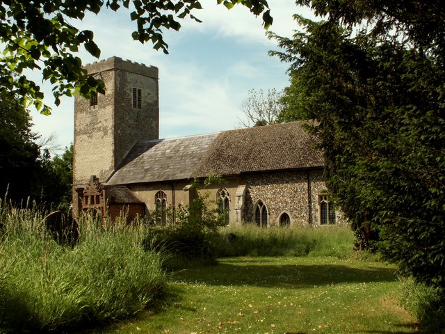
Heater Plantation, located in Suffolk, is a picturesque woodland area known for its abundant natural beauty and serene atmosphere. Covering a vast expanse of land, the plantation is primarily characterized by its dense forests and flourishing woodlands, making it a perfect destination for nature enthusiasts and outdoor lovers.

The woodland area is home to a diverse range of tree species, including oak, beech, and pine, creating a rich and diverse ecosystem. The trees provide a habitat for various wildlife species, such as deer, rabbits, and numerous bird species, making it an ideal spot for birdwatching and wildlife observation.

Visitors to Heater Plantation can explore the numerous walking trails that wind their way through the woodlands, offering a chance to immerse oneself in the tranquility of nature. The paths are well-maintained and suitable for all ages and fitness levels, allowing families and individuals to enjoy a leisurely stroll or engage in more challenging hikes.

The plantation also offers a range of recreational activities, including picnicking, camping, and cycling. There are designated picnic areas with tables and benches, providing a perfect spot to enjoy a meal amidst the natural surroundings. Camping facilities are available for those seeking an overnight stay, allowing visitors to experience the enchanting atmosphere of the woodland at dusk and dawn.

Overall, Heater Plantation in Suffolk is a captivating destination for nature lovers, providing an opportunity to escape the hustle and bustle of daily life and immerse oneself in the beauty and serenity of a woodland setting.

If you have any feedback on the listing, please let us know in the comments section below.

Heater Plantation Images

Images are sourced within 2km of 52.220284/1.2244419 or Grid Reference TM2062. Thanks to Geograph Open Source API. All images are credited.

View east along Thorpe Lane, from the hedge bank
Field north of Thorpe Lane
Track leading north off Thorpe Lane
Looking up the Deben valley along Thorpe Lane
View along the Deben valley from Thorpe Lane The distant road signs mark the junction with the A1120.
View along the Deben valley from Thorpe Lane
The distant road signs mark the junction with the A1120.
Minor  crossroad  on  the  A1120 Left to Cretingham, to the right Thorpe Lane to Debenham. The house to the left is Swan House. It has a long straight section on its frontage above the door, could it possibly have been a former public house? The Swan?
Minor crossroad on the A1120
Left to Cretingham, to the right Thorpe Lane to Debenham. The house to the left is Swan House. It has a long straight section on its frontage above the door, could it possibly have been a former public house? The Swan?
Minor  road  junction  at  Whitepost  Corner Turn right for Ashfield Cum Thorpe
Minor road junction at Whitepost Corner
Turn right for Ashfield Cum Thorpe
In  the  dip  minor  road  junction  on  A1120 Left for Ashfield Cum Thorpe at Whitepost Corner
In the dip minor road junction on A1120
Left for Ashfield Cum Thorpe at Whitepost Corner
Stile and footpath
Stile and footpath
Track to Crows Hall
Track to Crows Hall
Farmhouse at Oaktree Farm
Bridleway west from Grove Farm Making its way over gentle countryside to Debenham.
Bridleway west from Grove Farm
Making its way over gentle countryside to Debenham.
Crows Hall Picture taken at the Crows Hall Fete, May 2009. <span class="nowrap"><a title="http://www.crows-hall.co.uk/" rel="nofollow ugc noopener" href="http://www.crows-hall.co.uk/">Link</a><img style="margin-left:2px;" alt="External link" title="External link - shift click to open in new window" src="https://s1.geograph.org.uk/img/external.png" width="10" height="10"/></span>
Crows Hall
Picture taken at the Crows Hall Fete, May 2009. LinkExternal link
Crows Hall Crows Hall is a 16th Century moated manor house on the outskirts of Debenham. <span class="nowrap"><a title="http://www.crows-hall.co.uk/history.html" rel="nofollow ugc noopener" href="http://www.crows-hall.co.uk/history.html">Link</a><img style="margin-left:2px;" alt="External link" title="External link - shift click to open in new window" src="https://s1.geograph.org.uk/img/external.png" width="10" height="10"/></span>
Crows Hall
Crows Hall is a 16th Century moated manor house on the outskirts of Debenham. LinkExternal link
Waddlegoose Lane, now a bridleway A tree lined track across quiet countryside east of Debenham.  On a dull day that turned wet as the final stages of the thaw were in progress.
Waddlegoose Lane, now a bridleway
A tree lined track across quiet countryside east of Debenham. On a dull day that turned wet as the final stages of the thaw were in progress.
Track junction The track to the left branches of Waddlegoose Lane and heads for Hill Farm.
Track junction
The track to the left branches of Waddlegoose Lane and heads for Hill Farm.
Track to Grove Farm Seen near a junction on the track called Waddlegoose Lane. The last remnants of snow were getting washed away on a wet day.
Track to Grove Farm
Seen near a junction on the track called Waddlegoose Lane. The last remnants of snow were getting washed away on a wet day.
Farm track to Oaktree Farm Seen from a footpath north of Waddlegoose Lane.
Farm track to Oaktree Farm
Seen from a footpath north of Waddlegoose Lane.
Show me another place!

Heater Plantation is located at Grid Ref: TM2062 (Lat: 52.220284, Lng: 1.2244419)

Administrative County: Suffolk

District: Mid Suffolk

Police Authority: Suffolk

What 3 Words

///outcasts.singer.protrude. Near Debenham, Suffolk

Related Wikis

Ashfield cum Thorpe

Ashfield cum Thorpe is a civil parish in the Mid Suffolk district of Suffolk, England, between the town of Framlingham to the East and the village of Debenham...

Earl Soham

Earl Soham is a small settlement in Suffolk, England. It is on the A1120 road and is 4 kilometres (2 mi) west of the town of Framlingham. Earl Soham once...

Monk Soham

Monk Soham is a village in Suffolk, eastern England, four miles (6.4 km) northeast of Debenham and six miles (10 km) northwest of Framlingham. The neighbouring...

Winston, Suffolk

Winston is a village and civil parish in the Mid Suffolk district of Suffolk in eastern England. Located around 8 miles (13 km) east of Stowmarket, the...

Nearby Amenities

Located within 500m of 52.220284,1.2244419
Power: pole
Lat/Long: 52.2246227/1.2261638
Power: pole
Lat/Long: 52.2246301/1.2247503
Power: pole
Lat/Long: 52.2246433/1.2233287
The data included in this document is from www.openstreetmap.org. The data is made available under ODbL.

Have you been to Heater Plantation?

Leave your review of Heater Plantation below (or comments, questions and feedback).