Jack's Wood
Wood, Forest in Norfolk Broadland
England
Jack's Wood

Jack's Wood is a picturesque woodland located in Norfolk, England. Covering an area of approximately 50 acres, it is a stunning example of a mixed deciduous forest that attracts nature enthusiasts and hikers alike.
The wood is known for its diverse range of tree species, including oak, beech, ash, and birch, which create a stunning canopy that changes with the seasons. In spring, the forest floor is carpeted with bluebells, creating a magical and vibrant display. During autumn, the leaves transform into a riot of colors, providing a breathtaking spectacle for visitors.
The woodland is home to a rich array of wildlife, including deer, foxes, badgers, and various bird species. Birdwatchers can often spot woodpeckers, owls, and various songbirds flitting among the trees. The serene atmosphere and the abundance of wildlife make it a perfect place for nature photography and wildlife observation.
The wood also features several well-maintained trails and pathways, making it an ideal destination for walkers and hikers. These trails offer varying levels of difficulty, catering to both casual strollers and avid outdoor enthusiasts. Along the way, visitors can enjoy the tranquil ambiance, listen to the soothing sounds of nature, and breathe in the fresh woodland air.
Jack's Wood is a true haven for nature lovers, offering a serene escape from the hustle and bustle of everyday life. With its diverse flora and fauna, well-kept trails, and breathtaking scenery, it is a must-visit destination for anyone seeking a peaceful and enchanting woodland experience in Norfolk.
If you have any feedback on the listing, please let us know in the comments section below.
Jack's Wood Images
Images are sourced within 2km of 52.676878/1.2558596 or Grid Reference TG2013. Thanks to Geograph Open Source API. All images are credited.


Jack's Wood is located at Grid Ref: TG2013 (Lat: 52.676878, Lng: 1.2558596)
Administrative County: Norfolk
District: Broadland
Police Authority: Norfolk
What 3 Words
///hired.dome.cycles. Near Horsford, Norfolk
Nearby Locations
Related Wikis

Dussindale & Hellesdon Rovers F.C.
Dussindale & Hellesdon Rovers Football Club is a football club based in Norwich, England. They are currently members of the Eastern Counties League Division...

Manor Park, Horsford
Manor Park is a cricket ground in Horsford, Norfolk. The ground is the main home ground of Norfolk County Cricket Club. The first recorded match on the...

City of Norwich Aviation Museum
The City of Norwich Aviation Museum is a volunteer-run museum and charitable trust dedicated to the preservation of the aviation history of the county...
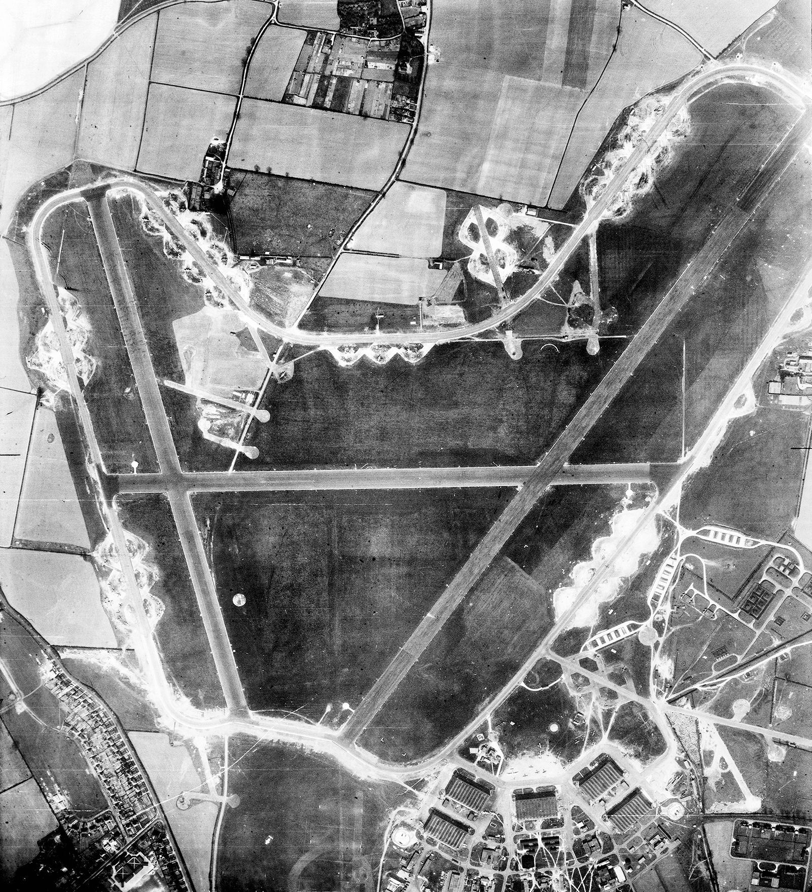
RAF Horsham St Faith
Royal Air Force Horsham St Faith or more simply RAF Horsham St Faith is a former Royal Air Force station near Norwich, Norfolk, England which was operational...
Nearby Amenities
Located within 500m of 52.676878,1.2558596Have you been to Jack's Wood?
Leave your review of Jack's Wood below (or comments, questions and feedback).