Bedlam Wood

Wood, Forest in Kent Dover

England

Bedlam Wood

Elham Valley Rd
Elham Valley Rd Credit: N Chadwick

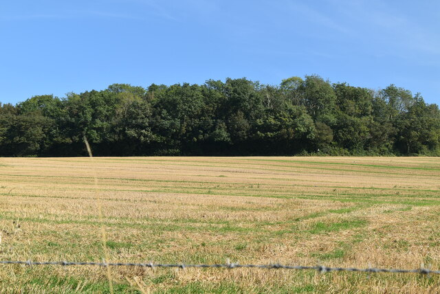
Bedlam Wood, located in Kent, England, is a sprawling forested area that spans over several acres. This enchanting woodland is renowned for its natural beauty, offering visitors a serene and tranquil escape from the hustle and bustle of everyday life. Bedlam Wood is a popular destination for nature enthusiasts, hikers, and birdwatchers alike.

The wood features a diverse range of tree species, including oak, beech, and chestnut, creating a rich and vibrant ecosystem. The dense canopy provides a cool and shaded environment, perfect for leisurely walks or picnics on sunny days. The forest floor is adorned with a carpet of wildflowers, adding a splash of color to the landscape.

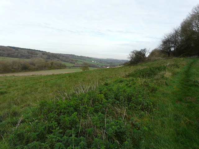
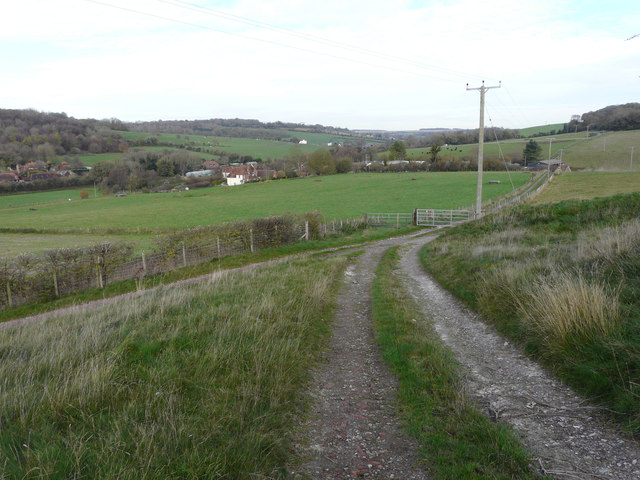
One of the highlights of Bedlam Wood is its well-maintained network of walking paths and trails. These winding paths offer visitors the opportunity to explore the wood at their own pace, discovering hidden glades and secluded spots along the way. The wood is also intersected by a small stream, which adds to its charm and provides a refreshing place to rest and observe the local wildlife.

Speaking of wildlife, Bedlam Wood is home to a variety of animals and birds. Foxes, badgers, and rabbits can often be spotted darting among the trees, while the songs of various bird species fill the air. Birdwatchers can expect to see species such as woodpeckers, robins, and thrushes.

Overall, Bedlam Wood is a natural gem in the heart of Kent, offering a peaceful and picturesque retreat for all nature lovers. Whether you're seeking a quiet stroll, a family outing, or a chance to connect with the natural world, this woodland is sure to leave a lasting impression.

If you have any feedback on the listing, please let us know in the comments section below.

Bedlam Wood Images

Images are sourced within 2km of 51.173846/1.1467443 or Grid Reference TR2046. Thanks to Geograph Open Source API. All images are credited.

Elham Valley Rd
Elham Valley Rd
Roadside woodland
Roadside woodland
Elham Valley Rd
Elham Valley Rd
Breach Down
Breach Down
Possible drainage pit Access to the pit seems to be along a track from Whitehall Farm.
Possible drainage pit
Access to the pit seems to be along a track from Whitehall Farm.
Looking north over the Elham Valley From a bridleway, towards the hamlet of Breach in <a href="https://www.geograph.org.uk/gridref/TR1947">TR1947</a>.
Looking north over the Elham Valley
From a bridleway, towards the hamlet of Breach in TR1947.
Looking north-northeast from a track Towards the hamlet of Breach. A bridleway joins the track from the left.
Looking north-northeast from a track
Towards the hamlet of Breach. A bridleway joins the track from the left.
Erection of an amenities building In the distance is Palm Tree House, which was formerly <a href="https://www.geograph.org.uk/photo/368930">TR1947 : The 'Palm Tree'</a>. The new building lies in the grounds of the house and is being erected on behalf of Goldpark Leisure <span class="nowrap"><a title="http://www.ukcampsite.co.uk/sites/details.asp?revid=7905" rel="nofollow ugc noopener" href="http://www.ukcampsite.co.uk/sites/details.asp?revid=7905">Link</a><img style="margin-left:2px;" alt="External link" title="External link - shift click to open in new window" src="https://s1.geograph.org.uk/img/external.png" width="10" height="10"/></span> It will have toilets, showers, a disabled shower and facilities for washing up and there will be 45 pitches for tents, caravans or motorhomes. 

This shows how the <a href="https://www.geograph.org.uk/photo/4966306">TR1947 : Amenities building</a> looks now it has been completed.
Erection of an amenities building
In the distance is Palm Tree House, which was formerly TR1947 : The 'Palm Tree'. The new building lies in the grounds of the house and is being erected on behalf of Goldpark Leisure LinkExternal link It will have toilets, showers, a disabled shower and facilities for washing up and there will be 45 pitches for tents, caravans or motorhomes. This shows how the TR1947 : Amenities building looks now it has been completed.
The house at Wingate Farm Seen from a nearby lane.
The house at Wingate Farm
Seen from a nearby lane.
A view over a gate Of the rolling countryside of the North Downs in an Area of Outstanding Natural Beauty (AONB).
A view over a gate
Of the rolling countryside of the North Downs in an Area of Outstanding Natural Beauty (AONB).
Kissing gate On a footpath leading from near the house called Verchoyles to Dreal’s Farm, whose house can be seen to the left of the kissing gate.
Kissing gate
On a footpath leading from near the house called Verchoyles to Dreal’s Farm, whose house can be seen to the left of the kissing gate.
Amenities building The building, owned by Goldpark Leisure, has toilets, showers, a disabled shower and facilities for washing up and there are 45 pitches for tents, caravans or motorhomes <span class="nowrap"><a title="http://www.ukcampsite.co.uk/sites/details.asp?revid=7905" rel="nofollow ugc noopener" href="http://www.ukcampsite.co.uk/sites/details.asp?revid=7905">Link</a><img style="margin-left:2px;" alt="External link" title="External link - shift click to open in new window" src="https://s1.geograph.org.uk/img/external.png" width="10" height="10"/></span> 

This is view shows the <a href="https://www.geograph.org.uk/photo/4773075">TR1947 : Erection of an amenities building</a> during construction.
Amenities building
The building, owned by Goldpark Leisure, has toilets, showers, a disabled shower and facilities for washing up and there are 45 pitches for tents, caravans or motorhomes LinkExternal link This is view shows the TR1947 : Erection of an amenities building during construction.
Entrance to Barham Business Park
Lane by Baker's Close Baker's Close is a small wood to the right.
Lane by Baker's Close
Baker's Close is a small wood to the right.
Lane towards Denton Bedlam Wood to the left, Knoll Wood on the right.
Lane towards Denton
Bedlam Wood to the left, Knoll Wood on the right.
Elham Valley Road Towards Canterbury.
Elham Valley Road
Towards Canterbury.
Elham Valley Road, Breach Towards Canterbury.
Elham Valley Road, Breach
Towards Canterbury.
Elham Valley Way towards Hall Downs
Show me another place!

Bedlam Wood is located at Grid Ref: TR2046 (Lat: 51.173846, Lng: 1.1467443)

Administrative County: Kent

District: Dover

Police Authority: Kent

What 3 Words

///promising.focal.alternate. Near Wootton, Kent

Related Wikis

Breach, Kent

Breach is a small settlement in the Elham Valley about one mile (1.6 km) south of Barham(where, at the 2011 Census, the population was included) in Kent...

Wingmore

Wingmore is a small village between Canterbury and Folkestone in Kent, England. It is situated in the Elham Valley approximately halfway between the larger...

Denton, Kent

Denton is a village and former civil parish, now in the parish of Denton with Wootton, in the Dover district of Kent, England. In 1961 the parish had a...

Bladbean

Bladbean is a scattered hamlet between Canterbury and Folkestone in Kent, England. It lies along a minor road east of Stelling Minnis. It is in the civil...

Nearby Amenities

Located within 500m of 51.173846,1.1467443
Nursery
Blakeney House Nurseries Ltd.
Note: Phone number on sign shows STD code from pre One Day.
Phone: +44 1227 831800
Lat/Long: 51.1731173/1.1485046
Tadridge Farm
Landuse: farm
Note Retag: CS #48756035
Lat/Long: 51.1757892/1.150701
Post Box
Collection Times: Mo-Fr 09:00; Sa 07:00
Operator: Royal Mail
Operator Wikidata: Q638098
Post Box Mounting: metal_post
Post Box Type: lamp
Postal Code: CT4
Ref: CT4 198
Royal Cypher: EIIR
Source: survey
Lat/Long: 51.1760776/1.1513009
Barrier: stile
Lat/Long: 51.1756449/1.1410011
Barrier: stile
Lat/Long: 51.1755562/1.1451354
Barrier: stile
Lat/Long: 51.1756215/1.1410955
Barrier: stile
Lat/Long: 51.1756879/1.1457108
Barrier: stile
Lat/Long: 51.1760664/1.1477799
Generator Method: photovoltaic
Generator Output Electricity: yes
Generator Source: solar
Generator Type: solar_photovoltaic_panel
Location: roof
Power: generator
Lat/Long: 51.1720744/1.1470695
The data included in this document is from www.openstreetmap.org. The data is made available under ODbL.

Have you been to Bedlam Wood?

Leave your review of Bedlam Wood below (or comments, questions and feedback).