Frenchbeer
Settlement in Devon West Devon
England
Frenchbeer

Frenchbeer is a small, picturesque village located in the county of Devon, England. Situated amidst the stunning Dartmoor National Park, this charming hamlet offers visitors a tranquil escape from the hustle and bustle of city life. The village is nestled within rolling green hills and is known for its idyllic countryside views, making it a popular destination for nature lovers and outdoor enthusiasts.
The name "Frenchbeer" is believed to have derived from a historic association with French prisoners of war who were employed in local tin mines during the Napoleonic era. Today, the village retains its rural character with traditional thatched cottages and stone houses, giving it a timeless appeal.
Despite its small size, Frenchbeer has a close-knit community with a friendly and welcoming atmosphere. The village features a couple of local pubs and tea rooms, where visitors can enjoy a refreshing drink or indulge in traditional English cuisine. There are also some quaint shops selling local produce and crafts, providing an opportunity to immerse oneself in the village's rich heritage.
Frenchbeer's prime location within Dartmoor National Park offers endless opportunities for outdoor activities. The surrounding landscape is perfect for hiking, cycling, and horse riding, with numerous trails that lead to breathtaking viewpoints and ancient landmarks such as stone circles and medieval ruins.
For those seeking a peaceful retreat in the heart of Devon's natural beauty, Frenchbeer is a hidden gem that promises a truly enchanting experience.
If you have any feedback on the listing, please let us know in the comments section below.
Frenchbeer Images
Images are sourced within 2km of 50.649458/-3.8826409 or Grid Reference SX6785. Thanks to Geograph Open Source API. All images are credited.


Frenchbeer is located at Grid Ref: SX6785 (Lat: 50.649458, Lng: -3.8826409)
Administrative County: Devon
District: West Devon
Police Authority: Devon and Cornwall
What 3 Words
///scoots.stuffy.splinters. Near Chagford, Devon
Nearby Locations
Related Wikis

Frenchbeer
Frenchbeer is a settlement in Devon, England. It is in Dartmoor national park. Fernworthy reservoir is to the south and so is the South Teign river. Chagford...
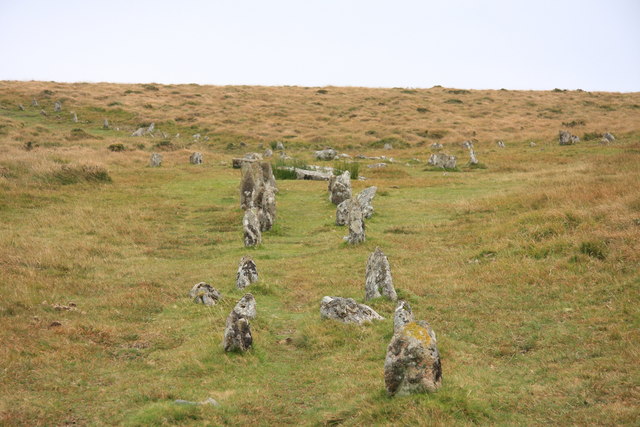
Shovel Down
Shovel Down is an area of Dartmoor in Devon that is covered in megaliths including the remains of several stone rows, the Fourfold Stone Circle, and several...

Scorhill
Scorhill (pronounced Scorill) Stone Circle is now the commonly known name for Gidleigh Stone Circle or Steep Hill Stone Circle, one of Devon's biggest...

Gidleigh Park
Gidleigh Park is a hotel and restaurant located in Gidleigh, near Chagford, Devon, England. Chris Eden joined as Executive Head Chef in September 2019...
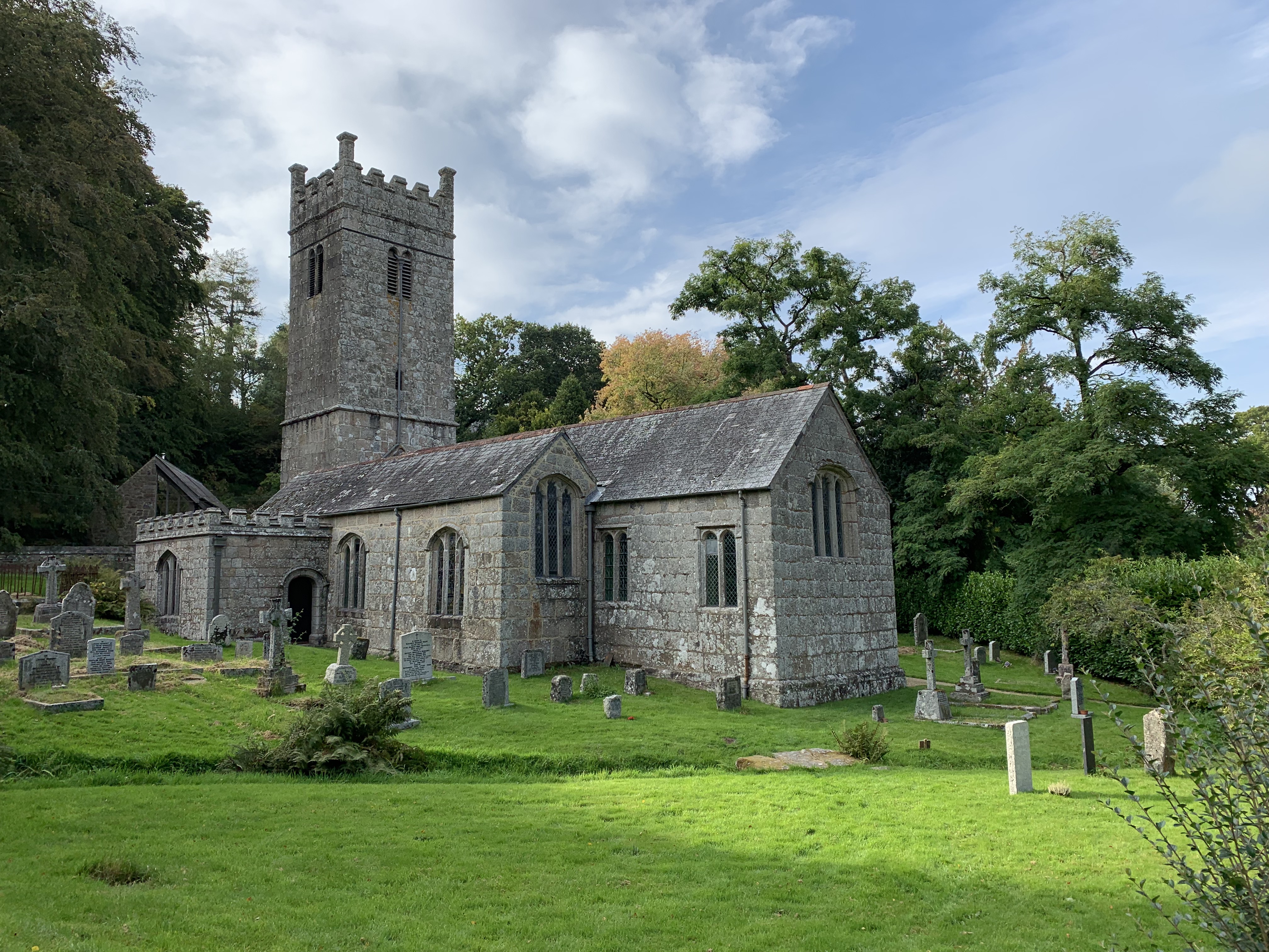
Holy Trinity Church, Gidleigh
Holy Trinity Church, Gidleigh dates from the late 15th-century, and is a Grade I listed parish church in the Church of England Diocese of Exeter in Gidleigh...

Gidleigh
Gidleigh is a village and civil parish in the West Devon district of Devon, England. Located within Dartmoor National Park, the parish is surrounded clockwise...

Gidleigh Castle
Gidleigh Castle was the manor house of the manor of Gidleigh on the north-eastern edge of Dartmoor, about two miles (3.2 km) north-west of the town of...
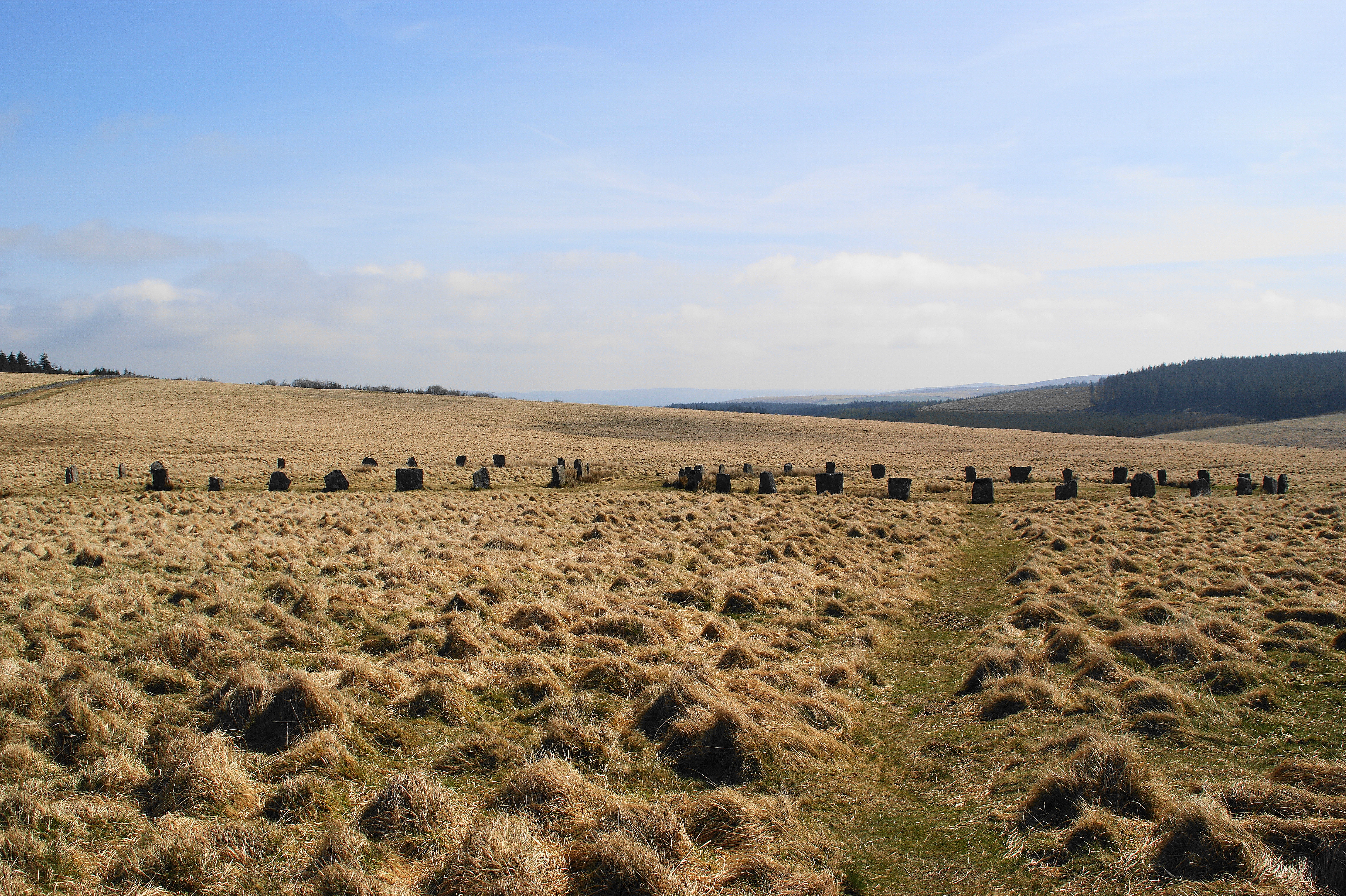
Grey Wethers
Grey Wethers consists of a pair of prehistoric stone circles, situated on grassy plateau to the north of Postbridge, Dartmoor, in the United Kingdom....
Nearby Amenities
Located within 500m of 50.649458,-3.8826409Have you been to Frenchbeer?
Leave your review of Frenchbeer below (or comments, questions and feedback).