Deal Plantation

Wood, Forest in Suffolk Mid Suffolk

England

Deal Plantation

Bridleway out of Reading Green
Bridleway out of Reading Green Credit: Jeff Tomlinson

Deal Plantation is a vast woodland area located in Suffolk, England. Covering an expansive area, it is commonly referred to as Deal Wood or Deal Forest. The plantation is situated in the eastern part of the county, near the town of Ipswich, and is easily accessible by various modes of transportation.

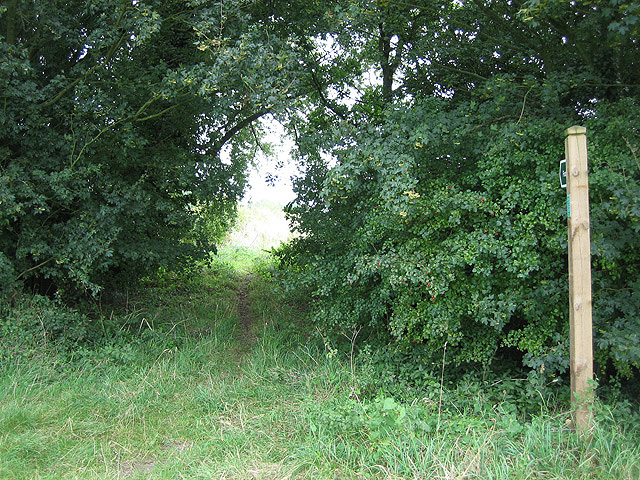
The woodland is known for its diverse range of flora and fauna, making it a haven for nature enthusiasts and wildlife lovers. The forest is characterized by its dense canopy of towering trees, primarily consisting of oak, beech, and birch species. These trees provide a picturesque backdrop and create a serene and tranquil atmosphere.

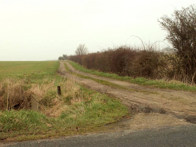
Deal Plantation boasts numerous walking trails that wind through the forest, allowing visitors to explore its natural beauty. These trails vary in difficulty, catering to both casual strollers and avid hikers. Along the way, visitors can spot a plethora of wildlife, including deer, squirrels, rabbits, and a wide variety of bird species.

The plantation also offers recreational activities such as picnicking and camping, providing an ideal setting for families and friends to spend quality time in nature. The management of the woodland ensures that the environment is well-maintained and preserved, promoting sustainability and conservation.

Overall, Deal Plantation is a captivating destination for those seeking solace in nature. With its scenic beauty, abundant wildlife, and recreational opportunities, it offers a delightful experience for all who visit.

If you have any feedback on the listing, please let us know in the comments section below.

Deal Plantation Images

Images are sourced within 2km of 52.317528/1.20916 or Grid Reference TM1873. Thanks to Geograph Open Source API. All images are credited.

Bridleway out of Reading Green
Road to Park Farm
Road to Park Farm
No great welcome at Maggotts Farm Although the gate is open, this end-of-the-road farm deters callers with two signs: "Private Property No Admittance" and "Notice Keep Out". I'll be dropping by for coffee, then. Not.
No great welcome at Maggotts Farm
Although the gate is open, this end-of-the-road farm deters callers with two signs: "Private Property No Admittance" and "Notice Keep Out". I'll be dropping by for coffee, then. Not.
Out of the darkness and into the light Close to <a href="https://www.geograph.org.uk/photo/547419">TM2073 : No great welcome at Maggotts Farm</a>, this footpath entrance offers an escape route towards Thorpe Hall (in Gothic script in Explorer) and with two mentions of Moat (ditto) - always intriguing.
Out of the darkness and into the light
Close to TM2073 : No great welcome at Maggotts Farm, this footpath entrance offers an escape route towards Thorpe Hall (in Gothic script in Explorer) and with two mentions of Moat (ditto) - always intriguing.
So what do you expect from an old airfield? One of many, many in Suffolk and Norfolk, this area was an airfield in the Second World War.  Now restored as farmland, it still bears some of the cleared open feeling it must have had then.
So what do you expect from an old airfield?
One of many, many in Suffolk and Norfolk, this area was an airfield in the Second World War. Now restored as farmland, it still bears some of the cleared open feeling it must have had then.
Horham Airfield Runway Runway 01/19. Looking North.
<span class="nowrap"><a title="http://www.airfields.fotopic.net/" rel="nofollow ugc noopener" href="http://www.airfields.fotopic.net/">Link</a><img style="margin-left:2px;" alt="External link" title="External link - shift click to open in new window" src="https://s1.geograph.org.uk/img/external.png" width="10" height="10"/></span>
Horham Airfield Runway
Runway 01/19. Looking North. LinkExternal link
Ford at Reading Green This ford is found at Reading Green at its junction with Watering Road.
Ford at Reading Green
This ford is found at Reading Green at its junction with Watering Road.
Track to Whitehouse Farm
Footpath This part of the footpath is also the drive to Grove Farm.
Footpath
This part of the footpath is also the drive to Grove Farm.
A footbridge for a footpath
Footpath to Denham church
Part of College Farm This is a view from Church Road.
Part of College Farm
This is a view from Church Road.
Denham Road, heading towards Hoxne
Footpath heading to Hoxne Place
A house at Shingle Hill Corner The main road is the B.1117
A house at Shingle Hill Corner
The main road is the B.1117
Road to Denham Hall Farm
Denham church interior
Footpath towards South Green Just behind the photographer, a sharp bend in the B1117 has been smoothed out, leaving a convenient parking place for walkers north along this path to South Green. Unfortunately, it also provides an opportunity for unspeakable fly-tippers.
Footpath towards South Green
Just behind the photographer, a sharp bend in the B1117 has been smoothed out, leaving a convenient parking place for walkers north along this path to South Green. Unfortunately, it also provides an opportunity for unspeakable fly-tippers.
Show me another place!

Deal Plantation is located at Grid Ref: TM1873 (Lat: 52.317528, Lng: 1.20916)

Administrative County: Suffolk

District: Mid Suffolk

Police Authority: Suffolk

What 3 Words

///bleaker.slows.rich. Near Stradbroke, Suffolk

Nearby Locations

Deal Plantation Denham

Related Wikis

Denham, Mid Suffolk

Denham is a village and civil parish in northern Suffolk. Located approximately 3 miles east of Eye, it is within the district of Mid Suffolk. It shares...

Redlingfield

Redlingfield is a village and civil parish in the Mid Suffolk district of Suffolk in eastern England. Located around six miles south-east of Diss, in 2011...

Hoxne Priory

Hoxne Priory was a Benedictine priory at Hoxne in Suffolk, England. It was founded as a religious house around the year 950, with a chapel at the supposed...

Horham

Horham (pronounced 'Hohrum') is a village in the county of Suffolk, in the East Anglia region of eastern England, United Kingdom. The village contains...

Nearby Amenities

Located within 500m of 52.317528,1.20916
95th Bomb Group Memorial Hospital
Addr City: Denham
Addr Housename: Shingle Hill
Addr Postcode: IP21 5EU
Addr Street: Denham Low Road
Museum: history
Tourism: museum
Website: http://www.hexpek.co.uk/95thbghm
Lat/Long: 52.3185452/1.2042438
Shingle Hill
Naptan AtcoCode: 390040153
Naptan Bearing: W
Naptan BusStopType: CUS
Naptan CommonName: Shingle Hill
Naptan Indicator: adj
Naptan Landmark: Shingle Hill
Naptan NaptanCode: sufawdjw
Naptan Street: B1117
Naptan Verified: no
Source: naptan_import
Lat/Long: 52.3158931/1.2027919
Shingle Hill
Naptan AtcoCode: 390040154
Naptan Bearing: E
Naptan BusStopType: CUS
Naptan CommonName: Shingle Hill
Naptan Indicator: opp
Naptan Landmark: Shingle Hill
Naptan NaptanCode: sufawdma
Naptan Street: B1117
Naptan Verified: no
Source: naptan_import
Lat/Long: 52.3159931/1.2027551
The data included in this document is from www.openstreetmap.org. The data is made available under ODbL.

Have you been to Deal Plantation?

Leave your review of Deal Plantation below (or comments, questions and feedback).