Moat Rough
Wood, Forest in Kent Canterbury
England
Moat Rough
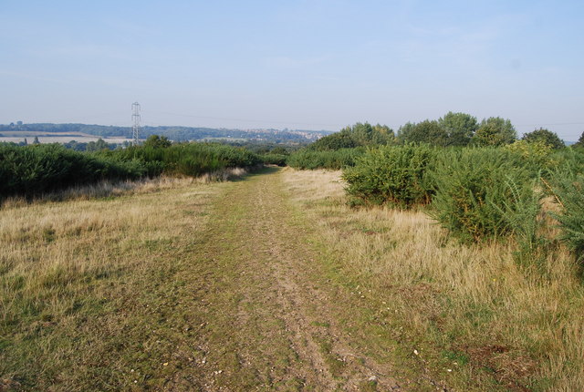
Moat Rough, situated in Kent, England, is a picturesque woodland area known for its enchanting beauty and rich biodiversity. Covering an expansive area, it serves as a vital habitat for numerous plant and animal species, making it a popular destination for nature enthusiasts and wildlife lovers.
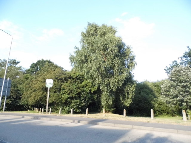
The woodland, with its dense canopy of beech and oak trees, creates a serene and tranquil atmosphere. The forest floor is adorned with a diverse array of wildflowers, including bluebells, primroses, and wood anemones, which bloom in vibrant colors during the springtime, creating a stunning spectacle. The woodland is also home to various species of ferns and mosses, adding to its natural charm.
The area's wildlife is equally impressive. Visitors may spot a variety of bird species, such as woodpeckers, owls, and jays, among others, or encounter small mammals like foxes, badgers, and rabbits. Moat Rough is also home to several species of deer, including roe deer and muntjac deer, which can often be observed grazing peacefully in the forest.
The woodland offers several walking trails and paths, allowing visitors to explore its beauty at their own pace. Additionally, there are picnic areas and benches scattered throughout, providing an opportunity for visitors to relax and enjoy the surroundings.
Overall, Moat Rough, Kent is a captivating woodland that offers a peaceful retreat from bustling city life. Its lush greenery, diverse wildlife, and tranquil atmosphere make it a must-visit destination for those seeking a connection with nature.
If you have any feedback on the listing, please let us know in the comments section below.
Moat Rough Images
Images are sourced within 2km of 51.28403/1.132387 or Grid Reference TR1858. Thanks to Geograph Open Source API. All images are credited.
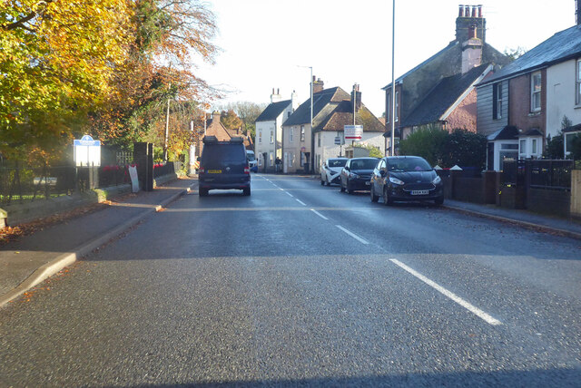
![Buildings for sale, High Street, Sturry Both are for sale through the estate agents PearsonGore <span class="nowrap"><a title="http://pearsongore.co.uk/" rel="nofollow ugc noopener" href="http://pearsongore.co.uk/">Link</a><img style="margin-left:2px;" alt="External link" title="External link - shift click to open in new window" src="https://s1.geograph.org.uk/img/external.png" width="10" height="10"/></span>
Straight ahead is The Swan Inn, which is open to unconditional offers in the region of £850,000 + VAT. The particulars also mention that it is grade II listed and has the following planning consent CA/14/01989/FUL granted by Canterbury City Council CA//14/01990 for “alterations and extensions to provide kitchen facilities and a block of six letting rooms”. The details of the grade II listing mention that it is probably a 15th century timber-framed building, which was re-fronted in the 18th century <span class="nowrap"><a title="http://www.britishlistedbuildings.co.uk/101085531-the-swan-inn-sturry#.WSXXj_6GPcc" rel="nofollow ugc noopener" href="http://www.britishlistedbuildings.co.uk/101085531-the-swan-inn-sturry#.WSXXj_6GPcc">Link</a><img style="margin-left:2px;" alt="External link" title="External link - shift click to open in new window" src="https://s1.geograph.org.uk/img/external.png" width="10" height="10"/></span>
On the left is The Jolly Chef, at number 10, which is a former Chinese takeaway and is open to offers in the region of £429,000. The particulars also mention that it is grade II listed and has the following planning consent CA/115/02203 [which is actually CA//15/02203] granted by Canterbury City Council for the “replacement of existing timber sheds with brick building”. The details of the grade II listing mention that the building dates from the 18th century <span class="nowrap"><a title="http://www.britishlistedbuildings.co.uk/101085530-7-10-high-street-sturry#.WSXVKv6GPcc" rel="nofollow ugc noopener" href="http://www.britishlistedbuildings.co.uk/101085530-7-10-high-street-sturry#.WSXVKv6GPcc">Link</a><img style="margin-left:2px;" alt="External link" title="External link - shift click to open in new window" src="https://s1.geograph.org.uk/img/external.png" width="10" height="10"/></span>
Pam Fray’s view of the <a href="https://www.geograph.org.uk/photo/1351242">TR1760 : High Street, Sturry</a> show both businesses, when they were thriving.](https://s1.geograph.org.uk/geophotos/05/40/34/5403473_a1290081.jpg)
![Buildings for sale, High Street, Sturry Both are for sale through the estate agents PearsonGore <span class="nowrap"><a title="http://pearsongore.co.uk/" rel="nofollow ugc noopener" href="http://pearsongore.co.uk/">Link</a><img style="margin-left:2px;" alt="External link" title="External link - shift click to open in new window" src="https://s1.geograph.org.uk/img/external.png" width="10" height="10"/></span>
On the left is The Swan Inn, which is open to unconditional offers in the region of £850,000 + VAT. The particulars also mention that it is grade II listed and has the following planning consent CA/14/01989/FUL granted by Canterbury City Council CA//14/01990 for “alterations and extensions to provide kitchen facilities and a block of six letting rooms”. The details of the grade II listing mention that it is probably a 15th century timber-framed building, which was re-fronted in the 18th century <span class="nowrap"><a title="http://www.britishlistedbuildings.co.uk/101085531-the-swan-inn-sturry#.WSXXj_6GPcc" rel="nofollow ugc noopener" href="http://www.britishlistedbuildings.co.uk/101085531-the-swan-inn-sturry#.WSXXj_6GPcc">Link</a><img style="margin-left:2px;" alt="External link" title="External link - shift click to open in new window" src="https://s1.geograph.org.uk/img/external.png" width="10" height="10"/></span>
Straight ahead is The Jolly Chef, at number 10, which is a former Chinese takeaway and is open to offers in the region of £429,000. The particulars also mention that it is grade II listed and has the following planning consent CA/115/02203 [which is actually CA//15/02203] granted by Canterbury City Council for the “replacement of existing timber sheds with brick building”. The details of the grade II listing mention that the building dates from the 18th century <span class="nowrap"><a title="http://www.britishlistedbuildings.co.uk/101085530-7-10-high-street-sturry#.WSXVKv6GPcc" rel="nofollow ugc noopener" href="http://www.britishlistedbuildings.co.uk/101085530-7-10-high-street-sturry#.WSXVKv6GPcc">Link</a><img style="margin-left:2px;" alt="External link" title="External link - shift click to open in new window" src="https://s1.geograph.org.uk/img/external.png" width="10" height="10"/></span>
Pam Fray’s view of the <a href="https://www.geograph.org.uk/photo/1351242">TR1760 : High Street, Sturry</a> show both businesses, when they were thriving.](https://s2.geograph.org.uk/geophotos/05/40/34/5403482_96303f95.jpg)
Moat Rough is located at Grid Ref: TR1858 (Lat: 51.28403, Lng: 1.132387)
Administrative County: Kent
District: Canterbury
Police Authority: Kent
What 3 Words
///scornful.assurance.upgrading. Near Sturry, Kent
Nearby Locations
Related Wikis
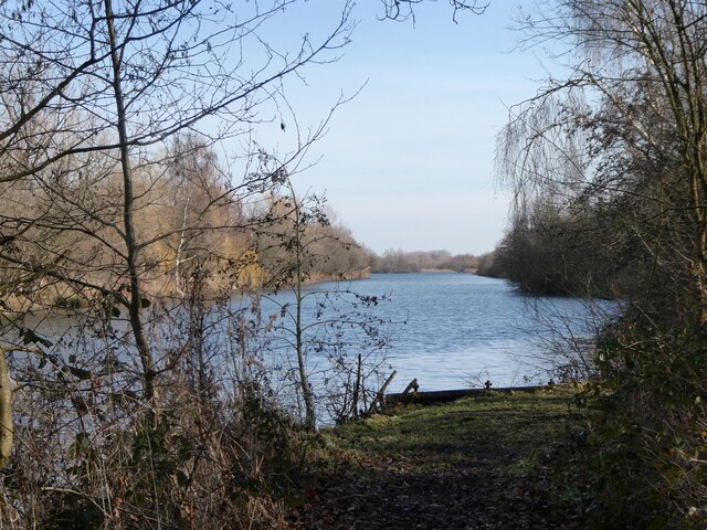
Chequer's Wood and Old Park
Chequer's Wood and Old Park is a 106.9-hectare (264-acre) biological and geological Site of Special Scientific Interest on the eastern outskirts of Canterbury...

Fordwich
Fordwich is a market town and a civil parish in east Kent, England, on the River Stour, northeast of Canterbury. It is the smallest community by population...

Church of St Mary the Virgin, Fordwich
The Church of St Mary the Virgin is a redundant Anglican church in the small town of Fordwich, Kent, England. It is recorded in the National Heritage...

Fordwich Town Hall
Fordwich Town Hall is a municipal structure in King Street, Fordwich, Kent, England. The structure, which serves as the meeting place of Fordwich Town...

St Nicholas' Church, Sturry
St Nicholas' Church, Sturry, is a joint Anglican and Methodist church standing on a bank beside the River Stour, in the village of Sturry, near Canterbury...

St Martin's Hospital, Canterbury
St Martin's Hospital is a mental health facility on Littlebourne Road in Canterbury, Kent, England. It is managed by the Kent and Medway NHS and Social...

Tithe Barn, Sturry
The Tithe Barn, Sturry, Kent, England is a barn dating from the early 16th century. The barn was built as the tithe barn for the grange of St Augustine...

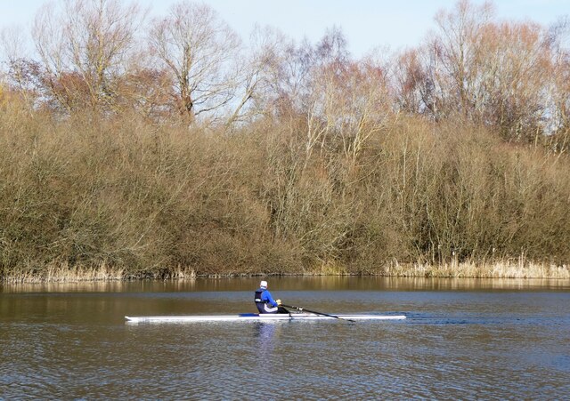
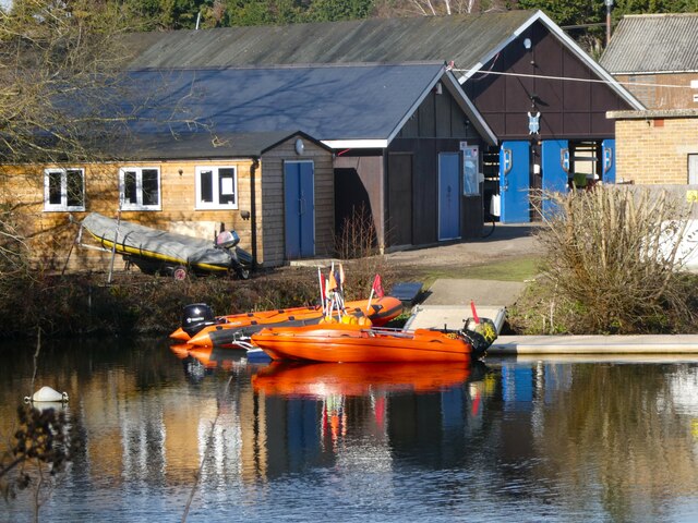
King's School Canterbury Boat Club
King's School Canterbury Boat Club is a rowing club based at Brett Sturry Quarry, Westbere Lakes, Sturry, Canterbury, Kent. == History == The club has...
Nearby Amenities
Located within 500m of 51.28403,1.132387Have you been to Moat Rough?
Leave your review of Moat Rough below (or comments, questions and feedback).