The Rookery

Wood, Forest in Norfolk South Norfolk

England

The Rookery

Old Milestone, Drayton On the South side of the A1067, 20yds W of junction with Taverham Road, in the parish of Drayton. Alternative views are <a href="https://www.geograph.org.uk/photo/1391707">TG1713 : Drayton Milestone</a> & <a href="https://www.geograph.org.uk/photo/1558894">TG1713 : Old Milepost</a>.

Inscription: To / Norwich / 4 / Miles // Fakenham / 20 // Drayton

Milestone Society National ID: NO_NF04
Old Milestone, Drayton Credit: Alan Lake

The Rookery, located in Norfolk, England, is a stunning example of a wood or forest landscape. Spanning approximately 50 acres, this idyllic woodland is nestled in the heart of the English countryside, offering visitors a tranquil and picturesque experience.

The Rookery is characterized by its diverse and dense collection of trees, including native species such as oak, beech, and birch. The canopy of these towering trees provides ample shade and creates a serene and cool atmosphere even on the hottest of summer days. The forest floor is adorned with a vibrant carpet of wildflowers, ferns, and mosses, adding to the enchanting beauty of the landscape.

The wood is home to a variety of wildlife, with numerous species of birds, mammals, and insects making their habitat within its boundaries. Visitors may be lucky enough to spot deer, foxes, squirrels, and a plethora of bird species, including woodpeckers and owls.

Tranquil walking trails wind through the Rookery, allowing visitors to fully immerse themselves in the beauty of nature. The paths are well-maintained and suitable for all ages and abilities, making it an ideal destination for families, nature enthusiasts, and those seeking a peaceful retreat.

The Rookery offers a true escape from the hustle and bustle of modern life, providing a haven of natural beauty and tranquility. Whether it's a leisurely stroll, birdwatching, or simply enjoying the serenity of the forest, visitors to the Rookery are guaranteed a memorable and rejuvenating experience.

If you have any feedback on the listing, please let us know in the comments section below.

The Rookery Images

Images are sourced within 2km of 52.669264/1.2208825 or Grid Reference TG1712. Thanks to Geograph Open Source API. All images are credited.

Old Milestone, Drayton On the South side of the A1067, 20yds W of junction with Taverham Road, in the parish of Drayton. Alternative views are <a href="https://www.geograph.org.uk/photo/1391707">TG1713 : Drayton Milestone</a> & <a href="https://www.geograph.org.uk/photo/1558894">TG1713 : Old Milepost</a>.

Inscription: To / Norwich / 4 / Miles // Fakenham / 20 // Drayton

Milestone Society National ID: NO_NF04
Old Milestone, Drayton
On the South side of the A1067, 20yds W of junction with Taverham Road, in the parish of Drayton. Alternative views are TG1713 : Drayton Milestone & TG1713 : Old Milepost. Inscription: To / Norwich / 4 / Miles // Fakenham / 20 // Drayton Milestone Society National ID: NO_NF04
Bridge Cottage, River Wensum, Costessey Nestling close to the river and the site of an old Toll Bridge, this cottage would have been the toll keeper's residence. The bridge looks to have been collecting tolls as late as 1905, run by a private company. It was not part of the turnpike system and would originally obviated some turnpike miles to Norwich.

Milestone Society National ID: NO.COS
Bridge Cottage, River Wensum, Costessey
Nestling close to the river and the site of an old Toll Bridge, this cottage would have been the toll keeper's residence. The bridge looks to have been collecting tolls as late as 1905, run by a private company. It was not part of the turnpike system and would originally obviated some turnpike miles to Norwich. Milestone Society National ID: NO.COS
Barber, baker and beautician, Drayton On Taverham Road.
Barber, baker and beautician, Drayton
On Taverham Road.
Oops a Daisy, Drayton Florist on Fakenham Road.
Oops a Daisy, Drayton
Florist on Fakenham Road.
Village sign, Drayton Commemorating 50 years since the founding of Drayton 'afternoon W I'.
Village sign, Drayton
Commemorating 50 years since the founding of Drayton 'afternoon W I'.
The Red Lion public house, Drayton The building dates from 1678, becoming an inn in the mid 1700s. Damaged by enemy action in 1942.
The Red Lion public house, Drayton
The building dates from 1678, becoming an inn in the mid 1700s. Damaged by enemy action in 1942.
The Cock Inn, Drayton The present building replaced an 18th century inn in 1956. It was renovated  in 1998-1999. One of the Marston chain of brewers.
The Cock Inn, Drayton
The present building replaced an 18th century inn in 1956. It was renovated in 1998-1999. One of the Marston chain of brewers.
Children's play area, Drayton Playground on School Road, next to St. Margaret's church which can be seen in the background.
Children's play area, Drayton
Playground on School Road, next to St. Margaret's church which can be seen in the background.
St. Margaret's church, Drayton The church dates from 1198 with some medieval fabric but mainly rebuilt in the 19th century. Inside is a fragment of the 15th century rood screen stair by the pulpit.  Grade II* listed.
St. Margaret's church, Drayton
The church dates from 1198 with some medieval fabric but mainly rebuilt in the 19th century. Inside is a fragment of the 15th century rood screen stair by the pulpit. Grade II* listed.
Inside St. Margaret's church, Drayton Looking eastwards along the nave. The church dates from 1198 with some medieval fabric but mainly rebuilt in the 19th century. A fragment of the 15th century rood screen stair can be seen by the pulpit. A Grade II* listed building.
Inside St. Margaret's church, Drayton
Looking eastwards along the nave. The church dates from 1198 with some medieval fabric but mainly rebuilt in the 19th century. A fragment of the 15th century rood screen stair can be seen by the pulpit. A Grade II* listed building.
A poppyhead in St. Margaret's church, Drayton A poppyhead is a form of carving on the top of the end of a bench or a choir stall. Its name is unrelated to the poppy flower but derived by way of Old French, from the Latin word puppis, which means the poop or the figurehead of a ship.
A poppyhead in St. Margaret's church, Drayton
A poppyhead is a form of carving on the top of the end of a bench or a choir stall. Its name is unrelated to the poppy flower but derived by way of Old French, from the Latin word puppis, which means the poop or the figurehead of a ship.
East window, St. Margaret's church, Drayton The church dates from 1198 with some medieval fabric but mainly rebuilt in the 19th century.  A Grade II* listed building.
East window, St. Margaret's church, Drayton
The church dates from 1198 with some medieval fabric but mainly rebuilt in the 19th century. A Grade II* listed building.
18th century gravestone, St. Margaret's church, Drayton A child's grave, John, son of John and Elizabeth Cannell, who died in 1781 in the 6th year of his age.
18th century gravestone, St. Margaret's church, Drayton
A child's grave, John, son of John and Elizabeth Cannell, who died in 1781 in the 6th year of his age.
18th century gravestone, St. Margaret's church, Drayton A detail on a child's grave, John, son of John and Elizabeth Cannell, who died in 1781 in the 6th year of his age.
18th century gravestone, St. Margaret's church, Drayton
A detail on a child's grave, John, son of John and Elizabeth Cannell, who died in 1781 in the 6th year of his age.
Old Milepost by the A1067, Drayton High Road, Drayton Cast iron post by the A1067, in parish of DRAYTON (BROADLAND District), 150yds East of junction with Hurn Road. Just East of entrance to former David Rice Hospital, on the verge, near lamppost, on South side of road. Fakenham ci l-top, erected by the Norwich & Fakenham turnpike trust in the 19th century. An earlier photograph can be found here <a title="https://www.geograph.org.uk/photo/6617195" href="https://www.geograph.org.uk/photo/6617195">Link</a>.

Inscription reads:- : TO / FAKENHAM / 21 : : TO / NORWICH / 3 : : DRAYTON :

Listed.

Milestone Society National ID: NO_NF03.
Old Milepost by the A1067, Drayton High Road, Drayton
Cast iron post by the A1067, in parish of DRAYTON (BROADLAND District), 150yds East of junction with Hurn Road. Just East of entrance to former David Rice Hospital, on the verge, near lamppost, on South side of road. Fakenham ci l-top, erected by the Norwich & Fakenham turnpike trust in the 19th century. An earlier photograph can be found here Link. Inscription reads:- : TO / FAKENHAM / 21 : : TO / NORWICH / 3 : : DRAYTON : Listed. Milestone Society National ID: NO_NF03.
St Edmund, Costessey
St Edmund, Costessey - East end
Show me another place!

The Rookery is located at Grid Ref: TG1712 (Lat: 52.669264, Lng: 1.2208825)

Administrative County: Norfolk

District: South Norfolk

Police Authority: Norfolk

What 3 Words

///deep.plants.seeing. Near Costessey, Norfolk

Nearby Locations

The Rookery Money's Hills

Related Wikis

Drayton railway station

Drayton railway station is a former station in Norfolk, England. Constructed by the Midland and Great Northern Joint Railway in the 1880s, on the line...
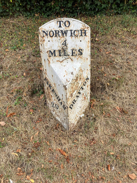
Drayton, Norfolk

Drayton, Norfolk, is a suburban village in the English county of Norfolk. The village is located in the district of Broadland, 4.3 miles (6.9 km) north...

Marriott's Way

The Marriott's Way is a footpath, cycle-path and bridleway in north Norfolk, England, between Norwich and Aylsham via Themelthorpe. It forms part of the...

Costessey

Costessey ( KOSS-ee) is a town and civil parish in the South Norfolk district of Norfolk, England, and is 4 miles (6.4 km) north west of Norwich. The...

Thorpe Marriott

Thorpe Marriott is a residential area in Norfolk, England covering part of Taverham and Drayton parishes. Much of the housing was built in the latter part...

Taverham

Taverham is a village and civil parish in Norfolk, in England. It is approximately 5 miles (8 km) north-west of Norwich. Taverham sits on the River Wensum...

Costessey Hall

Costessey Hall (pronounced and sometimes spelt Cossey Hall, also written as Cotesby Hall) was a manor house in Costessey, Norfolk, England, four miles...

Ormiston Victory Academy

Ormiston Victory Academy (formerly Costessey High School) is a secondary school and sixth form located in Costessey, Norfolk, England. The academy has...

Nearby Amenities

Located within 500m of 52.669264,1.2208825
Waterway: weir
Lat/Long: 52.6686729/1.2177664
Grit Bin
Colour: yellow
Lat/Long: 52.6686968/1.2191728
Power: pole
Lat/Long: 52.6653014/1.221237
Power: pole
Lat/Long: 52.6660202/1.2203219
Power: pole
Transformer: distribution
Lat/Long: 52.6667485/1.2196224
Entrance: main
Lat/Long: 52.6659755/1.2181847
Power: pole
Lat/Long: 52.670005/1.2168726
Power: pole
Lat/Long: 52.671085/1.2171221
Power: pole
Lat/Long: 52.6715567/1.2177417
Power: pole
Lat/Long: 52.6724642/1.2189594
Power: pole
Lat/Long: 52.6720349/1.2183908
Power: pole
Lat/Long: 52.6729245/1.2195682
Location Transition: yes
Power: pole
Transformer: distribution
Lat/Long: 52.6737214/1.2206411
Power: pole
Lat/Long: 52.6673424/1.2157863
Power: pole
Lat/Long: 52.6689331/1.2166393
Power: pole
Lat/Long: 52.6682549/1.2162799
Power: pole
Lat/Long: 52.6669796/1.2181118
Traffic Calming: choker
Lat/Long: 52.6662989/1.2192868
Traffic Calming: choker
Lat/Long: 52.66616/1.2192294
Generator Method: photovoltaic
Generator Output Electricity: yes
Generator Source: solar
Generator Type: solar_photovoltaic_panel
Location: roof
Power: generator
Lat/Long: 52.6655254/1.2198472
Generator Method: photovoltaic
Generator Output Electricity: yes
Generator Source: solar
Generator Type: solar_photovoltaic_panel
Location: roof
Power: generator
Lat/Long: 52.6655352/1.2197909
Generator Method: photovoltaic
Generator Output Electricity: yes
Generator Source: solar
Generator Type: solar_photovoltaic_panel
Location: roof
Power: generator
Lat/Long: 52.6655953/1.2198365
Generator Method: photovoltaic
Generator Output Electricity: yes
Generator Source: solar
Generator Type: solar_photovoltaic_panel
Location: roof
Power: generator
Lat/Long: 52.6655953/1.2193564
Generator Method: photovoltaic
Generator Output Electricity: yes
Generator Source: solar
Generator Type: solar_photovoltaic_panel
Location: roof
Power: generator
Lat/Long: 52.6656474/1.2193912
Generator Method: photovoltaic
Generator Output Electricity: yes
Generator Source: solar
Generator Type: solar_photovoltaic_panel
Location: roof
Power: generator
Lat/Long: 52.6649967/1.2190291
Generator Method: photovoltaic
Generator Output Electricity: yes
Generator Source: solar
Generator Type: solar_photovoltaic_panel
Location: roof
Power: generator
Lat/Long: 52.6651415/1.2196675
Generator Method: photovoltaic
Generator Output Electricity: yes
Generator Source: solar
Generator Type: solar_photovoltaic_panel
Location: roof
Power: generator
Lat/Long: 52.6651236/1.2197587
Generator Method: photovoltaic
Generator Output Electricity: yes
Generator Source: solar
Generator Type: solar_photovoltaic_panel
Location: roof
Power: generator
Lat/Long: 52.6648747/1.2195897
Generator Method: photovoltaic
Generator Output Electricity: yes
Generator Source: solar
Generator Type: solar_photovoltaic_panel
Location: roof
Power: generator
Lat/Long: 52.6648617/1.2194958
Artwork Type: sculpture
Inscription: KAAH - KAAH
Tourism: artwork
Lat/Long: 52.6668704/1.226302
The data included in this document is from www.openstreetmap.org. The data is made available under ODbL.

Have you been to The Rookery?

Leave your review of The Rookery below (or comments, questions and feedback).