Billingford Wood

Wood, Forest in Norfolk South Norfolk

England

Billingford Wood

Norwich Road, Thelveton Norgate Lane on the right led to Billingford but has been closed for some time.
Norwich Road, Thelveton Credit: David Howard

Billingford Wood is a picturesque woodland located in the county of Norfolk, England. Covering an area of approximately 100 acres, it is situated near the village of Billingford, just a few miles south of the market town of Diss. The woodland is a popular destination for nature enthusiasts and offers a peaceful retreat from the hustle and bustle of urban life.

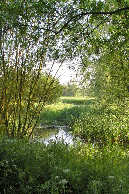
Billingford Wood is characterized by a diverse range of tree species, including oak, beech, ash, and birch, which create a rich and varied habitat for wildlife. The woodland is particularly known for its vibrant displays of bluebells in the spring, attracting visitors from far and wide.

The wood is crisscrossed by a network of well-maintained footpaths, providing visitors with the opportunity to explore and enjoy the natural beauty of the area. These paths wind through the trees and offer glimpses of wildlife such as deer, squirrels, and a variety of bird species.

In addition to its natural beauty, Billingford Wood also has historical significance. The remains of a medieval village can be found within the woodland, adding an air of mystery to the area. Archaeological excavations have revealed evidence of human activity dating back thousands of years, including pottery fragments and flint tools.

Overall, Billingford Wood is a serene and enchanting woodland, offering a peaceful escape and a chance to connect with nature. Its combination of diverse flora and fauna, well-maintained footpaths, and historical significance make it a popular destination for both locals and tourists alike.

If you have any feedback on the listing, please let us know in the comments section below.

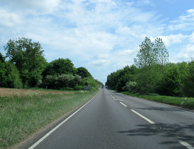
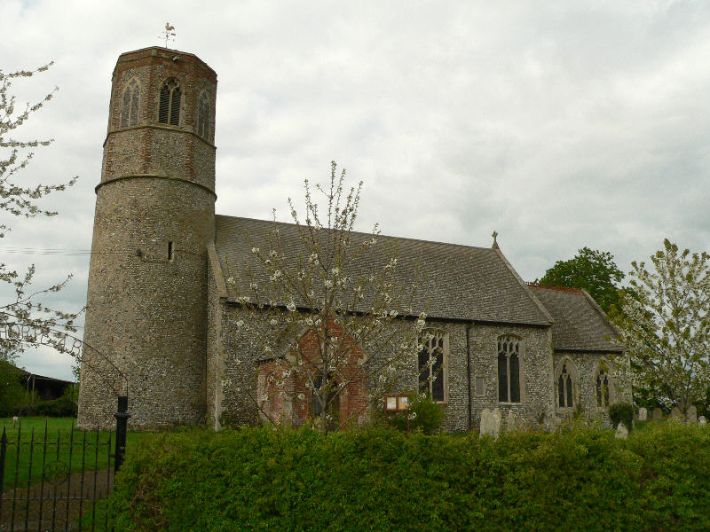
Billingford Wood Images

Images are sourced within 2km of 52.377211/1.1978672 or Grid Reference TM1780. Thanks to Geograph Open Source API. All images are credited.

Norwich Road, Thelveton Norgate Lane on the right led to Billingford but has been closed for some time.
Norwich Road, Thelveton
Norgate Lane on the right led to Billingford but has been closed for some time.
Norwich Road at the junction of the Scole Bypass
Layby on the Scole Bypass, Thelveton
Norwich Road, Thelveton
Rape field by Norwich Road, Thelveton
Norwich Road, Thelveton
Layby on the Scole Bypass, Thelveton
Thelveton: The Old Manor House
Thelveton: Post box
Thelveton: Post box
Thelveton: Junction of Norwich Road and Norgate Lane
Billingford windmill
A143 east near The Hall, Thorpe Abbotts
A143 east at turning for Thorpe Abbotts
Church of St Leonard, Billingford <span class="nowrap"><a title="https://historicengland.org.uk/listing/the-list/list-entry/1050112?section=official-list-entry" rel="nofollow ugc noopener" href="https://historicengland.org.uk/listing/the-list/list-entry/1050112?section=official-list-entry">Link</a><img style="margin-left:2px;" alt="External link" title="External link - shift click to open in new window" src="https://s1.geograph.org.uk/img/external.png" width="10" height="10"/></span>
Church of St Leonard, Billingford
Billingford Dovecote <span class="nowrap"><a title="https://historicengland.org.uk/listing/the-list/list-entry/1303013?section=official-list-entry" rel="nofollow ugc noopener" href="https://historicengland.org.uk/listing/the-list/list-entry/1303013?section=official-list-entry">Link</a><img style="margin-left:2px;" alt="External link" title="External link - shift click to open in new window" src="https://s1.geograph.org.uk/img/external.png" width="10" height="10"/></span>
Billingford Dovecote
Billingford Hall <span class="nowrap"><a title="https://historicengland.org.uk/listing/the-list/list-entry/1373278?section=official-list-entry" rel="nofollow ugc noopener" href="https://historicengland.org.uk/listing/the-list/list-entry/1373278?section=official-list-entry">Link</a><img style="margin-left:2px;" alt="External link" title="External link - shift click to open in new window" src="https://s1.geograph.org.uk/img/external.png" width="10" height="10"/></span>
Billingford Hall
Show me another place!

Billingford Wood is located at Grid Ref: TM1780 (Lat: 52.377211, Lng: 1.1978672)

Administrative County: Norfolk

District: South Norfolk

Police Authority: Norfolk

What 3 Words

///widen.unzipped.flags. Near Dickleburgh, Norfolk

Related Wikis

100th Bomb Group Memorial Museum

The 100th Bomb Group Memorial Museum, located in the original control tower and other remaining buildings of the RAF Thorpe Abbotts airfield east of Diss...

Thorpe Abbotts

Thorpe Abbotts is a village and (as Thorpe Abbots) a former civil parish, now in the parish of Brockdish, in the South Norfolk district, in the county...

Thelveton

Thelveton (historically Thelton, earlier Telvetun) is a village and former civil parish, now in the parish of Scole, in the South Norfolk district, in...

River Dove, Suffolk

The River Dove is a river in the county of Suffolk. It is a tributary of the River Waveney starting near Bacton going through Eye to the Waveney. ��2...

Nearby Amenities

Located within 500m of 52.377211,1.1978672
Upper Street
Place: hamlet
Lat/Long: 52.3743813/1.1972124
Post Box
Collection Times: Mo-Fr 09:00; Sa 07:00
Operator: Royal Mail
Post Box Mounting: pier
Post Box Type: lamp
Ref: IP21 7081
Royal Cypher: EIIR
Royal Cypher Wikidata: Q33102113
Lat/Long: 52.3743865/1.1979225
Bunker Type: blast_shelter
Historic: yes
Location: overground
Military: bunker
Note: WW2 Thorpe Abbotts airfield buildings.
Ruins: yes
Lat/Long: 52.3803914/1.1954576
Bunker Type: blast_shelter
Historic: yes
Location: overground
Military: bunker
Note: WW2 Thorpe Abbotts airfield buildings.
Ruins: yes
Lat/Long: 52.3757621/1.1920235
Bunker Type: blast_shelter
Historic: yes
Location: overground
Military: bunker
Note: WW2 Thorpe Abbotts airfield buildings.
Ruins: yes
Lat/Long: 52.3761493/1.1922481
Bunker Type: blast_shelter
Historic: yes
Location: overground
Military: bunker
Note: WW2 Thorpe Abbotts airfield buildings.
Ruins: yes
Lat/Long: 52.3761854/1.1919079
Bunker Type: blast_shelter
Historic: yes
Location: overground
Military: bunker
Note: WW2 Thorpe Abbotts airfield buildings.
Ruins: yes
Lat/Long: 52.3765359/1.1922842
Note: RoW obstructed by ditch.
Lat/Long: 52.3733706/1.2002917
Note: RoW obstructed by hedge.
Lat/Long: 52.3740947/1.1994894
Waste Basket
Waste: trash
Lat/Long: 52.374665/1.1967554
Board Type: notice
Information: board
Tourism: information
Lat/Long: 52.3745066/1.1974689
Booth: K6
Covered: booth
Disused Amenity: telephone
Man Made: telephone_box
Lat/Long: 52.374569/1.1971983
The data included in this document is from www.openstreetmap.org. The data is made available under ODbL.

Have you been to Billingford Wood?

Leave your review of Billingford Wood below (or comments, questions and feedback).