Ghost Hill Wood

Wood, Forest in Norfolk Broadland

England

Ghost Hill Wood

Taverham Mill, near Norwich One of the sluices by the weir pool. Taverham Mill is owned by Anglian Water and consists of a nature trail, fishing lakes, café, visitors' centre, tackle shop and playground. The nature trail covers over 100 acres and includes a stretch of the River Wensum. It is on the site of a paper mill which opened in the 18th century and closed at the end of the 19th century. None of the mill buildings survive.
Taverham Mill, near Norwich Credit: pam fray

Ghost Hill Wood is a picturesque woodland located in the county of Norfolk, England. Situated near the village of Great Bircham, the wood covers an area of approximately 12 hectares and is a popular destination for nature enthusiasts and walkers alike.

The wood gets its intriguing name from the local folklore and tales of paranormal activities that have been associated with the area for centuries. It is said that the ghost of a young girl haunts the woods, wandering among the ancient trees. However, despite its eerie reputation, Ghost Hill Wood offers visitors a serene and tranquil atmosphere.

The wood is predominantly made up of a mixture of broadleaf trees, including oak, beech, and ash, which provide a dense canopy, allowing only dappled sunlight to filter through. This creates a magical ambiance, especially during the autumn months when the leaves turn vibrant shades of red and gold.

The woodland floor is covered with a rich carpet of mosses, ferns, and bluebells, providing a haven for a variety of woodland flora and fauna. Visitors to Ghost Hill Wood may spot woodland birds such as woodpeckers, owls, and thrushes, along with small mammals like foxes, rabbits, and squirrels.

The wood is crisscrossed by a network of well-maintained footpaths, allowing visitors to explore and soak in the natural beauty of the surroundings. Interpretive signs along the way provide information about the flora, fauna, and history of the area.

Overall, Ghost Hill Wood is a captivating woodland that offers a unique blend of natural beauty, folklore, and tranquility, making it a must-visit destination for nature lovers and those intrigued by the supernatural.

If you have any feedback on the listing, please let us know in the comments section below.

Ghost Hill Wood Images

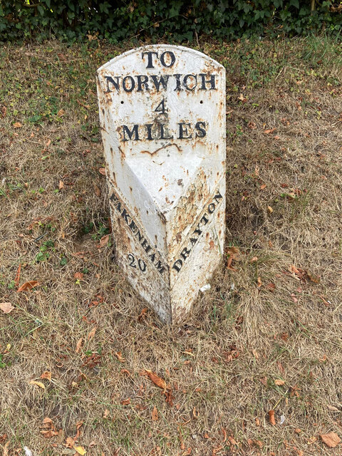
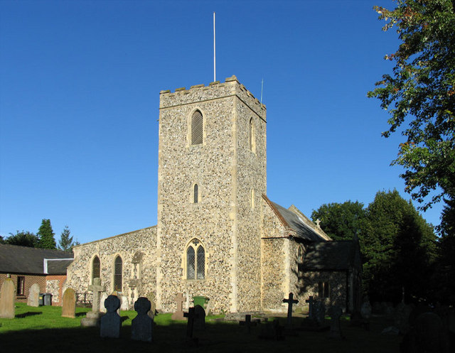
Images are sourced within 2km of 52.676837/1.2099284 or Grid Reference TG1713. Thanks to Geograph Open Source API. All images are credited.

Taverham Mill, near Norwich One of the sluices by the weir pool. Taverham Mill is owned by Anglian Water and consists of a nature trail, fishing lakes, café, visitors' centre, tackle shop and playground. The nature trail covers over 100 acres and includes a stretch of the River Wensum. It is on the site of a paper mill which opened in the 18th century and closed at the end of the 19th century. None of the mill buildings survive.
Taverham Mill, near Norwich
One of the sluices by the weir pool. Taverham Mill is owned by Anglian Water and consists of a nature trail, fishing lakes, café, visitors' centre, tackle shop and playground. The nature trail covers over 100 acres and includes a stretch of the River Wensum. It is on the site of a paper mill which opened in the 18th century and closed at the end of the 19th century. None of the mill buildings survive.
Taverham Mill, the weir pool Taverham Mill is owned by Anglian Water and consists of a nature trail, fishing lakes, café, visitors' centre, tackle shop and playground. The nature trail covers over 100 acres and includes a stretch of the River Wensum. It is on the site of a paper mill which opened in the 18th century and closed at the end of the 19th century. None of the mill buildings survive.
Taverham Mill, the weir pool
Taverham Mill is owned by Anglian Water and consists of a nature trail, fishing lakes, café, visitors' centre, tackle shop and playground. The nature trail covers over 100 acres and includes a stretch of the River Wensum. It is on the site of a paper mill which opened in the 18th century and closed at the end of the 19th century. None of the mill buildings survive.
The River Wensum, Taverham Mill Taverham Mill is owned by Anglian Water and consists of a nature trail, fishing lakes, café, visitors' centre, tackle shop and playground. The nature trail covers over 100 acres and includes a stretch of the River Wensum. It is on the site of a paper mill which opened in the 18th century and closed at the end of the 19th century. None of the mill buildings survive.
The River Wensum, Taverham Mill
Taverham Mill is owned by Anglian Water and consists of a nature trail, fishing lakes, café, visitors' centre, tackle shop and playground. The nature trail covers over 100 acres and includes a stretch of the River Wensum. It is on the site of a paper mill which opened in the 18th century and closed at the end of the 19th century. None of the mill buildings survive.
Gatekeeper butterfly by the River Wensum, Taverham Mill Taverham Mill is owned by Anglian Water and consists of a nature trail, fishing lakes, café, visitors' centre, tackle shop and playground. The nature trail covers over 100 acres and includes a stretch of the River Wensum. It is on the site of a paper mill which opened in the 18th century and closed at the end of the 19th century. None of the mill buildings survives.
Gatekeeper butterfly by the River Wensum, Taverham Mill
Taverham Mill is owned by Anglian Water and consists of a nature trail, fishing lakes, café, visitors' centre, tackle shop and playground. The nature trail covers over 100 acres and includes a stretch of the River Wensum. It is on the site of a paper mill which opened in the 18th century and closed at the end of the 19th century. None of the mill buildings survives.
The River Wensum, Taverham Mill Water lilies on the river. Taverham Mill is owned by Anglian Water and consists of a nature trail, fishing lakes, café, visitors' centre, tackle shop and playground. The nature trail covers over 100 acres and includes a stretch of the River Wensum. It is on the site of a paper mill which opened in the 18th century and closed at the end of the 19th century. None of the mill buildings survive.
The River Wensum, Taverham Mill
Water lilies on the river. Taverham Mill is owned by Anglian Water and consists of a nature trail, fishing lakes, café, visitors' centre, tackle shop and playground. The nature trail covers over 100 acres and includes a stretch of the River Wensum. It is on the site of a paper mill which opened in the 18th century and closed at the end of the 19th century. None of the mill buildings survive.
Butterfly on the boardwalk, Taverham Mill A small tortoiseshell, Aglais urticae on the walk between the River Wensum and the fishing lake and woodland. Taverham Mill is owned by Anglian Water and consists of a nature trail, fishing lakes, café, visitors' centre, tackle shop and playground. The nature trail covers over 100 acres and includes a stretch of the River Wensum. It is on the site of a paper mill which opened in the 18th century and closed at the end of the 19th century. None of the mill buildings survive.
Butterfly on the boardwalk, Taverham Mill
A small tortoiseshell, Aglais urticae on the walk between the River Wensum and the fishing lake and woodland. Taverham Mill is owned by Anglian Water and consists of a nature trail, fishing lakes, café, visitors' centre, tackle shop and playground. The nature trail covers over 100 acres and includes a stretch of the River Wensum. It is on the site of a paper mill which opened in the 18th century and closed at the end of the 19th century. None of the mill buildings survive.
A highland cow, Taverham Mill The small herd of highland cattle were near woodland on the eastern side of the lake. They usually graze on the grassland by the river and assist in the meadow conservation objectives. Taverham Mill is owned by Anglian Water and consists of a nature trail, fishing lakes, café, visitors' centre, tackle shop and playground. The nature trail covers over 100 acres and includes a stretch of the River Wensum.
A highland cow, Taverham Mill
The small herd of highland cattle were near woodland on the eastern side of the lake. They usually graze on the grassland by the river and assist in the meadow conservation objectives. Taverham Mill is owned by Anglian Water and consists of a nature trail, fishing lakes, café, visitors' centre, tackle shop and playground. The nature trail covers over 100 acres and includes a stretch of the River Wensum.
A very small  pond, Taverham Mill On part of the nature trail, the  pond is covered in duckweed. Taverham Mill is owned by Anglian Water and consists of a nature trail, fishing lakes, café, visitors' centre, tackle shop and playground. The nature trail covers over 100 acres and includes a stretch of the River Wensum. It is on the site of a paper mill which opened in the 18th century and closed at the end of the 19th century. None of the mill buildings survive.
A very small pond, Taverham Mill
On part of the nature trail, the pond is covered in duckweed. Taverham Mill is owned by Anglian Water and consists of a nature trail, fishing lakes, café, visitors' centre, tackle shop and playground. The nature trail covers over 100 acres and includes a stretch of the River Wensum. It is on the site of a paper mill which opened in the 18th century and closed at the end of the 19th century. None of the mill buildings survive.
Food for the fish, Taverham Mill The fishing tackle shop located in the visitors' centre. Taverham Mill is owned by Anglian Water and consists of a nature trail, fishing lakes, café, visitors' centre, tackle shop and playground. The nature trail covers over 100 acres and includes a stretch of the River Wensum. It is on the site of a paper mill which opened in the 18th century and closed at the end of the 19th century. None of the mill buildings survive.
Food for the fish, Taverham Mill
The fishing tackle shop located in the visitors' centre. Taverham Mill is owned by Anglian Water and consists of a nature trail, fishing lakes, café, visitors' centre, tackle shop and playground. The nature trail covers over 100 acres and includes a stretch of the River Wensum. It is on the site of a paper mill which opened in the 18th century and closed at the end of the 19th century. None of the mill buildings survive.
Old Milestone, Drayton On the South side of the A1067, 20yds W of junction with Taverham Road, in the parish of Drayton. Alternative views are <a href="https://www.geograph.org.uk/photo/1391707">TG1713 : Drayton Milestone</a> & <a href="https://www.geograph.org.uk/photo/1558894">TG1713 : Old Milepost</a>.

Inscription: To / Norwich / 4 / Miles // Fakenham / 20 // Drayton

Milestone Society National ID: NO_NF04
Old Milestone, Drayton
On the South side of the A1067, 20yds W of junction with Taverham Road, in the parish of Drayton. Alternative views are TG1713 : Drayton Milestone & TG1713 : Old Milepost. Inscription: To / Norwich / 4 / Miles // Fakenham / 20 // Drayton Milestone Society National ID: NO_NF04
Bridge Cottage, River Wensum, Costessey Nestling close to the river and the site of an old Toll Bridge, this cottage would have been the toll keeper's residence. The bridge looks to have been collecting tolls as late as 1905, run by a private company. It was not part of the turnpike system and would originally obviated some turnpike miles to Norwich.

Milestone Society National ID: NO.COS
Bridge Cottage, River Wensum, Costessey
Nestling close to the river and the site of an old Toll Bridge, this cottage would have been the toll keeper's residence. The bridge looks to have been collecting tolls as late as 1905, run by a private company. It was not part of the turnpike system and would originally obviated some turnpike miles to Norwich. Milestone Society National ID: NO.COS
Barber, baker and beautician, Drayton On Taverham Road.
Barber, baker and beautician, Drayton
On Taverham Road.
Oops a Daisy, Drayton Florist on Fakenham Road.
Oops a Daisy, Drayton
Florist on Fakenham Road.
Village sign, Drayton Commemorating 50 years since the founding of Drayton 'afternoon W I'.
Village sign, Drayton
Commemorating 50 years since the founding of Drayton 'afternoon W I'.
The Red Lion public house, Drayton The building dates from 1678, becoming an inn in the mid 1700s. Damaged by enemy action in 1942.
The Red Lion public house, Drayton
The building dates from 1678, becoming an inn in the mid 1700s. Damaged by enemy action in 1942.
The Cock Inn, Drayton The present building replaced an 18th century inn in 1956. It was renovated  in 1998-1999. One of the Marston chain of brewers.
The Cock Inn, Drayton
The present building replaced an 18th century inn in 1956. It was renovated in 1998-1999. One of the Marston chain of brewers.
Children's play area, Drayton Playground on School Road, next to St. Margaret's church which can be seen in the background.
Children's play area, Drayton
Playground on School Road, next to St. Margaret's church which can be seen in the background.
St. Margaret's church, Drayton The church dates from 1198 with some medieval fabric but mainly rebuilt in the 19th century. Inside is a fragment of the 15th century rood screen stair by the pulpit.  Grade II* listed.
St. Margaret's church, Drayton
The church dates from 1198 with some medieval fabric but mainly rebuilt in the 19th century. Inside is a fragment of the 15th century rood screen stair by the pulpit. Grade II* listed.
Show me another place!

Ghost Hill Wood is located at Grid Ref: TG1713 (Lat: 52.676837, Lng: 1.2099284)

Administrative County: Norfolk

District: Broadland

Police Authority: Norfolk

What 3 Words

///bulletins.attitudes.soldiers. Near Costessey, Norfolk

Related Wikis

Thorpe Marriott

Thorpe Marriott is a residential area in Norfolk, England covering part of Taverham and Drayton parishes. Much of the housing was built in the latter part...

Drayton railway station

Drayton railway station is a former station in Norfolk, England. Constructed by the Midland and Great Northern Joint Railway in the 1880s, on the line...

Taverham

Taverham is a village and civil parish in Norfolk, in England. It is approximately 5 miles (8 km) north-west of Norwich. Taverham sits on the River Wensum...

Drayton, Norfolk

Drayton, Norfolk, is a suburban village in the English county of Norfolk. The village is located in the district of Broadland, 4.3 miles (6.9 km) north...

Taverham High School

Taverham High School is a secondary school and sixth form with academy status, located in Taverham in the English county of Norfolk. As well as serving...

Costessey

Costessey ( KOSS-ee) is a town and civil parish in the South Norfolk district of Norfolk, England, and is 4 miles (6.4 km) north west of Norwich. The...

Taverham Hall School

Taverham Hall School was a private co-educational day and boarding preparatory school. Situated in Taverham, Norfolk, it was founded in 1920. The school...

Marriott's Way

The Marriott's Way is a footpath, cycle-path and bridleway in north Norfolk, England, between Norwich and Aylsham via Themelthorpe. It forms part of the...

Nearby Amenities

Located within 500m of 52.676837,1.2099284
Bus Stop
Norgate Way, opp
Naptan AtcoCode: 2900T0420
Naptan Bearing: SW
Naptan CommonName: Norgate Way
Naptan Indicator: opp
Naptan Landmark: Norgate Way
Naptan Locality: Taverham
Naptan NaptanCode: nfodwmgt
Naptan PlusbusZoneRef: NRCH
Naptan Street: Shakespeare Way
Naptan Verified: no
Source: naptan_import
Lat/Long: 52.677002/1.2121638
Bus Stop
Seton Road, opp
Bench: no
Bin: no
Bus: yes
Naptan AtcoCode: 2900T0425
Naptan Bearing: NW
Naptan CommonName: Seton Road
Naptan Indicator: opp
Naptan Locality: Taverham
Naptan NaptanCode: nfodwmjm
Naptan PlusbusZoneRef: NRCH
Naptan Street: Fakenham Road
Naptan Verified: no
Public Transport: platform
Shelter: no
Source: naptan_import
Tactile Paving: yes
Lat/Long: 52.6809987/1.2100452
Bus Stop
Byron Road, adj
Naptan AtcoCode: 2900T0456
Naptan Bearing: SE
Naptan CommonName: Byron Road
Naptan Indicator: adj
Naptan Landmark: Keats Road
Naptan Locality: Taverham
Naptan NaptanCode: nfodwpda
Naptan PlusbusZoneRef: NRCH
Naptan ShortCommonName: Byron Road
Naptan Street: Byron Road
Naptan Verified: no
Source: naptan_import
Lat/Long: 52.6775679/1.2045553
Bus Stop
Tusser Road, adj
Naptan AtcoCode: 2900T0458
Naptan Bearing: SE
Naptan CommonName: Tusser Road
Naptan Indicator: adj
Naptan Landmark: Tusser Road
Naptan Locality: Taverham
Naptan NaptanCode: nfodwpdj
Naptan PlusbusZoneRef: NRCH
Naptan Street: Shakespeare Way
Naptan Verified: no
Source: naptan_import
Lat/Long: 52.6756316/1.2096366
Bus Stop
Tusser Road, opp
Naptan AtcoCode: 2900T0459
Naptan Bearing: NW
Naptan CommonName: Tusser Road
Naptan Indicator: opp
Naptan Landmark: No. 60
Naptan Locality: Taverham
Naptan NaptanCode: nfodwpdm
Naptan PlusbusZoneRef: NRCH
Naptan Street: Shakespeare Way
Naptan Verified: no
Source: naptan_import
Lat/Long: 52.6755488/1.2097045
Bus Stop
Beverley Way, opp
Naptan AtcoCode: 2900T0460
Naptan Bearing: NW
Naptan CommonName: Beverley Way
Naptan Indicator: opp
Naptan Landmark: Beverley Way
Naptan Locality: Taverham
Naptan NaptanCode: nfodwpdp
Naptan PlusbusZoneRef: NRCH
Naptan Street: Orchard Bank
Naptan Verified: no
Source: naptan_import
Lat/Long: 52.6774747/1.2159923
Bus Stop
Beverley Way, adj
Naptan AtcoCode: 2900T0461
Naptan Bearing: SE
Naptan CommonName: Beverley Way
Naptan Indicator: adj
Naptan Landmark: Beverley Way
Naptan Locality: Taverham
Naptan NaptanCode: nfodwpdt
Naptan PlusbusZoneRef: NRCH
Naptan Street: Orchard Bank
Naptan Verified: no
Source: naptan_import
Lat/Long: 52.6769596/1.2163778
Bus Stop
Sylvan Way, opp
Naptan AtcoCode: 2900T0462
Naptan Bearing: S
Naptan CommonName: Sylvan Way
Naptan Indicator: opp
Naptan Landmark: No. 2
Naptan Locality: Taverham
Naptan NaptanCode: nfodwpdw
Naptan PlusbusZoneRef: NRCH
Naptan Street: Orchard Bank
Naptan Verified: no
Source: naptan_import
Lat/Long: 52.6753792/1.2156254
Bus Stop
Sylvan Way, adj
Naptan AtcoCode: 2900T0463
Naptan Bearing: N
Naptan CommonName: Sylvan Way
Naptan Indicator: adj
Naptan Landmark: No. 2
Naptan Locality: Taverham
Naptan NaptanCode: nfodwpga
Naptan PlusbusZoneRef: NRCH
Naptan Street: Orchard Bank
Naptan Verified: no
Source: naptan_import
Lat/Long: 52.6753824/1.2155072
Bus Stop
Macks Lane, opp
Naptan AtcoCode: 2900T0464
Naptan Bearing: SE
Naptan CommonName: Macks Lane
Naptan Indicator: opp
Naptan Landmark: Shakespeare Way
Naptan Locality: Taverham
Naptan NaptanCode: nfodwpgd
Naptan PlusbusZoneRef: NRCH
Naptan Street: Taverham Road
Naptan Verified: no
Source: naptan_import
Lat/Long: 52.6762054/1.204056
Bus Stop
Macks Lane, adj
Naptan AtcoCode: 2900T0465
Naptan Bearing: NW
Naptan CommonName: Macks Lane
Naptan Indicator: adj
Naptan Landmark: Macks Lane
Naptan Locality: Taverham
Naptan NaptanCode: nfodwpgj
Naptan PlusbusZoneRef: NRCH
Naptan Street: Taverham Road
Naptan Verified: no
Source: naptan_import
Lat/Long: 52.6761524/1.2040225
Bus Stop
Norgate Way, adj
Naptan AtcoCode: 2900T047
Naptan Bearing: NE
Naptan CommonName: Norgate Way
Naptan Indicator: adj
Naptan Landmark: Norgate Way
Naptan Locality: Taverham
Naptan NaptanCode: nfodwpja
Naptan PlusbusZoneRef: NRCH
Naptan Street: Shakespeare Way
Naptan Verified: no
Source: naptan_import
Lat/Long: 52.6771367/1.2121737
Turning Circle
Lat/Long: 52.6778491/1.2115296
Barrier: cycle_barrier
Lat/Long: 52.6779419/1.2116344
Turning Circle
Lat/Long: 52.6753142/1.210239
Post Box
Collection Times: Mo-Fr 09:00; Sa 07:00
Operator: Royal Mail
Post Box Type: lamp
Ref: NR8 817D
Royal Cypher: EIIR
Royal Cypher Wikidata: Q33102113
Lat/Long: 52.6761224/1.2046174
Turning Circle
Lat/Long: 52.6770568/1.2148054
Turning Circle
Lat/Long: 52.67712/1.2150244
Barrier: bollard
Lat/Long: 52.6783906/1.2166259
Post Box
Collection Times: Mo-Fr 09:00; Sa 07:00
Operator: Royal Mail
Post Box Type: lamp
Ref: NR8 816D
Royal Cypher: EIIR
Royal Cypher Wikidata: Q33102113
Lat/Long: 52.6753669/1.2155062
Access: customers
Barrier: swing_gate
Bicycle: yes
Foot: yes
Motorcar: no
Motorcycle: yes
Lat/Long: 52.678802/1.2077588
Access: customers
Barrier: swing_gate
Bicycle: yes
Foot: yes
Motorcar: no
Motorcycle: yes
Lat/Long: 52.6788132/1.2077221
Entrance: yes
Wheelchair: yes
Lat/Long: 52.679033/1.2078531
Entrance: yes
Wheelchair: yes
Lat/Long: 52.6790364/1.2068496
Entrance: yes
Wheelchair: yes
Lat/Long: 52.6790647/1.2069182
Entrance: yes
Wheelchair: yes
Lat/Long: 52.6790655/1.2079819
Crossing
Crossing: unmarked
Lat/Long: 52.6785193/1.2085423
Crossing
Crossing: uncontrolled
Traffic Calming: table
Lat/Long: 52.6789668/1.2063968
Turning Circle
Lat/Long: 52.6780802/1.2079695
Crossing
Crossing: uncontrolled
Traffic Calming: table
Lat/Long: 52.6786728/1.2078226
Give Way
Lat/Long: 52.6807383/1.2102752
Crossing
Crossing: unmarked
Lat/Long: 52.6801745/1.2056554
Crossing
Crossing: unmarked
Lat/Long: 52.6791376/1.2055147
Crossing
Crossing: unmarked
Lat/Long: 52.6774322/1.2048625
Crossing
Crossing: unmarked
Lat/Long: 52.6788435/1.205088
Crossing
Crossing: unmarked
Lat/Long: 52.6769763/1.2052105
Crossing
Crossing: unmarked
Lat/Long: 52.680239/1.2051388
Crossing
Crossing: unmarked
Lat/Long: 52.6778631/1.2040625
Crossing
Crossing: unmarked
Lat/Long: 52.6782686/1.2045451
Give Way
Lat/Long: 52.680717/1.2103531
Give Way
Lat/Long: 52.677231/1.2162619
Give Way
Lat/Long: 52.6806253/1.2114151
Taverham
Colour: white;black
Direction: WNW
Material: metal
Traffic Sign: city_limit
Lat/Long: 52.6800703/1.2130585
Generator Method: photovoltaic
Generator Output Electricity: yes
Generator Source: solar
Generator Type: solar_photovoltaic_panel
Location: roof
Power: generator
Lat/Long: 52.6797727/1.205036
Generator Method: photovoltaic
Generator Output Electricity: yes
Generator Source: solar
Generator Type: solar_photovoltaic_panel
Location: roof
Power: generator
Lat/Long: 52.6798735/1.2051594
Generator Method: photovoltaic
Generator Output Electricity: yes
Generator Solar Modules: 16
Generator Source: solar
Generator Type: solar_photovoltaic_panel
Location: roof
Power: generator
Lat/Long: 52.6802703/1.2061733
Generator Method: photovoltaic
Generator Output Electricity: yes
Generator Source: solar
Generator Type: solar_photovoltaic_panel
Location: roof
Power: generator
Lat/Long: 52.6800199/1.2063664
Generator Method: photovoltaic
Generator Output Electricity: yes
Generator Source: solar
Generator Type: solar_photovoltaic_panel
Location: roof
Power: generator
Lat/Long: 52.6795402/1.2079301
Generator Method: photovoltaic
Generator Output Electricity: yes
Generator Source: solar
Generator Type: solar_photovoltaic_panel
Location: roof
Power: generator
Lat/Long: 52.6786214/1.2053364
Generator Method: photovoltaic
Generator Output Electricity: yes
Generator Source: solar
Generator Type: solar_photovoltaic_panel
Location: roof
Power: generator
Lat/Long: 52.6791336/1.2050709
Generator Method: photovoltaic
Generator Output Electricity: yes
Generator Source: solar
Generator Type: solar_photovoltaic_panel
Location: roof
Power: generator
Lat/Long: 52.6781075/1.2031665
Generator Method: photovoltaic
Generator Output Electricity: yes
Generator Source: solar
Generator Type: solar_photovoltaic_panel
Location: roof
Power: generator
Lat/Long: 52.6774066/1.2033865
Generator Method: photovoltaic
Generator Output Electricity: yes
Generator Source: solar
Generator Type: solar_photovoltaic_panel
Location: roof
Power: generator
Lat/Long: 52.6776668/1.2038693
Generator Method: photovoltaic
Generator Output Electricity: yes
Generator Source: solar
Generator Type: solar_photovoltaic_panel
Location: roof
Power: generator
Lat/Long: 52.677605/1.2039685
Generator Method: photovoltaic
Generator Output Electricity: yes
Generator Source: solar
Generator Type: solar_photovoltaic_panel
Location: roof
Power: generator
Lat/Long: 52.678075/1.2047544
Generator Method: photovoltaic
Generator Output Electricity: yes
Generator Source: solar
Generator Type: solar_photovoltaic_panel
Location: roof
Power: generator
Lat/Long: 52.6776912/1.2049556
Generator Method: photovoltaic
Generator Output Electricity: yes
Generator Source: solar
Generator Type: solar_photovoltaic_panel
Location: roof
Power: generator
Lat/Long: 52.6777758/1.2050682
Generator Method: photovoltaic
Generator Output Electricity: yes
Generator Source: solar
Generator Type: solar_photovoltaic_panel
Location: roof
Power: generator
Lat/Long: 52.6775676/1.2055591
Generator Method: photovoltaic
Generator Output Electricity: yes
Generator Source: solar
Generator Type: solar_photovoltaic_panel
Location: roof
Power: generator
Lat/Long: 52.6770505/1.2078497
Generator Method: photovoltaic
Generator Output Electricity: yes
Generator Source: solar
Generator Type: solar_photovoltaic_panel
Location: roof
Power: generator
Lat/Long: 52.6769903/1.2070262
Generator Method: photovoltaic
Generator Output Electricity: yes
Generator Source: solar
Generator Type: solar_photovoltaic_panel
Location: roof
Power: generator
Lat/Long: 52.6759316/1.2041241
Generator Method: photovoltaic
Generator Output Electricity: yes
Generator Source: solar
Generator Type: solar_photovoltaic_panel
Location: roof
Power: generator
Lat/Long: 52.6769529/1.2040731
Generator Method: photovoltaic
Generator Output Electricity: yes
Generator Source: solar
Generator Type: solar_photovoltaic_panel
Location: roof
Power: generator
Lat/Long: 52.6769952/1.2031156
Give Way
Lat/Long: 52.6761311/1.2044504
Give Way
Lat/Long: 52.6801656/1.205644
Give Way
Lat/Long: 52.6802759/1.2051676
Give Way
Lat/Long: 52.6788272/1.2051408
Give Way
Lat/Long: 52.6791435/1.2054947
Give Way
Lat/Long: 52.6769943/1.2060036
Give Way
Lat/Long: 52.6782493/1.2045925
Give Way
Lat/Long: 52.6778903/1.2040392
Give Way
Lat/Long: 52.6766461/1.2047354
Give Way
Lat/Long: 52.6769586/1.2052299
Give Way
Lat/Long: 52.6774176/1.2048409
Barrier: cycle_barrier
Bicycle: no
Lat/Long: 52.6777493/1.2058621
Barrier: cycle_barrier
Bicycle: no
Lat/Long: 52.6775878/1.2062849
Give Way
Lat/Long: 52.6785515/1.2085377
The data included in this document is from www.openstreetmap.org. The data is made available under ODbL.

Have you been to Ghost Hill Wood?

Leave your review of Ghost Hill Wood below (or comments, questions and feedback).