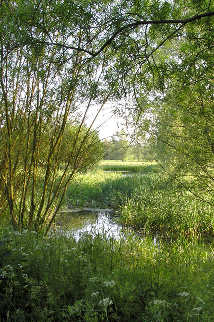
The Wilderness
Wood, Forest in Norfolk South Norfolk
England
The Wilderness

The Wilderness, Norfolk, is a beautiful and serene woodland area located in the eastern region of England. Covering an area of approximately 200 acres, this enchanting forest is a haven for nature enthusiasts and wildlife lovers alike.
The Wilderness is characterized by its dense and diverse vegetation, which consists of a variety of trees, including oak, beech, and birch. The forest floor is adorned with a rich carpet of ferns, moss, and wildflowers, creating a picturesque landscape that is a delight to explore.
The forest is home to a wide range of wildlife, making it a popular destination for birdwatchers and animal enthusiasts. Visitors can spot a plethora of bird species, such as woodpeckers, owls, and various songbirds. The forest is also inhabited by mammals, including deer, foxes, and badgers, which can occasionally be spotted roaming through the trees.
There are several walking trails and pathways that wind through The Wilderness, allowing visitors to immerse themselves in the tranquil surroundings. These well-maintained paths offer both short and long distance walks, catering to all levels of fitness and interests.
The Wilderness also boasts a small visitor center, where visitors can learn more about the forest's history and ecology. Additionally, there are picnic areas and benches scattered throughout the forest, providing the perfect spot to relax and soak in the natural beauty.
Overall, The Wilderness, Norfolk, is a magical woodland retreat that offers a peaceful escape from the hustle and bustle of everyday life. With its diverse flora and fauna, it is a haven for nature lovers and provides a unique opportunity to reconnect with the natural world.
If you have any feedback on the listing, please let us know in the comments section below.
The Wilderness Images
Images are sourced within 2km of 52.374878/1.1666336 or Grid Reference TM1579. Thanks to Geograph Open Source API. All images are credited.


The Wilderness is located at Grid Ref: TM1579 (Lat: 52.374878, Lng: 1.1666336)
Administrative County: Norfolk
District: South Norfolk
Police Authority: Norfolk
What 3 Words
///trams.warblers.safari. Near Scole, Norfolk
Nearby Locations
Related Wikis

Scole
Scole () is a village on the Norfolk–Suffolk border in England. It is 19 miles south of Norwich and lay on the old Roman road to Venta Icenorum, which...
Billingford, South Norfolk
Billingford or Pirleston is a village and former civil parish, 19 miles (31 km) south of Norwich, now in the parish of Scole, in the South Norfolk district...

Dickleburgh and Rushall
Dickleburgh and Rushall is a civil parish in South Norfolk. It covers an area of 14.90 km2 (5.75 sq mi) and had a population of 1356 in 565 households...

Thelveton
Thelveton (historically Thelton, earlier Telvetun) is a village and former civil parish, now in the parish of Scole, in the South Norfolk district, in...
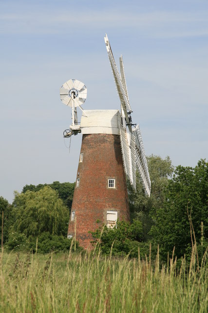
Billingford Windmill
Billingford Windmill is a grade II* listed brick tower mill at Billingford near Diss, Norfolk, England which has been preserved and restored to working...
Oakley, Suffolk
Oakley is a village and former civil parish in the Mid Suffolk district, in the north of the English county of Suffolk. It lies immediately to the south...

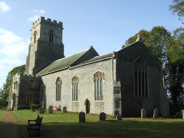
St Andrew's Church, Frenze
St Andrew's Church is a redundant Anglican church in the civil parish of Scole, Norfolk, England. It is recorded in the National Heritage List for England...
River Dove, Suffolk
The River Dove is a river in the county of Suffolk. It is a tributary of the River Waveney starting near Bacton going through Eye to the Waveney. ��2...
Nearby Amenities
Located within 500m of 52.374878,1.1666336Have you been to The Wilderness?
Leave your review of The Wilderness below (or comments, questions and feedback).