Blackhill Wood

Wood, Forest in Norfolk South Norfolk

England

Blackhill Wood

Easton: River Tud
Easton: River Tud Credit: Michael Garlick

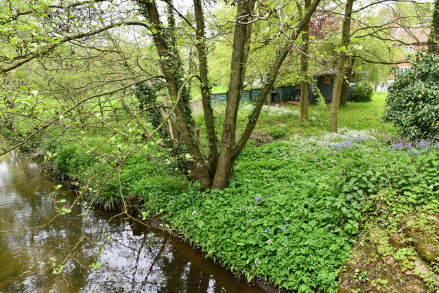
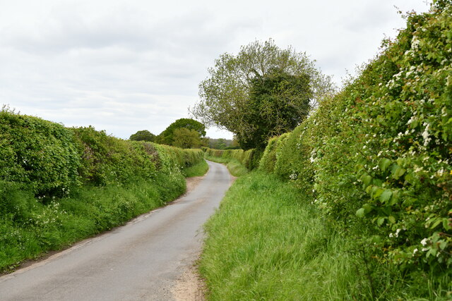
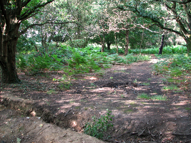
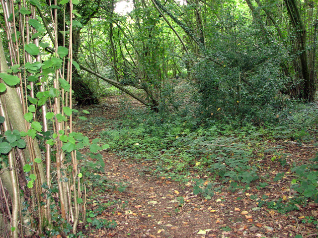
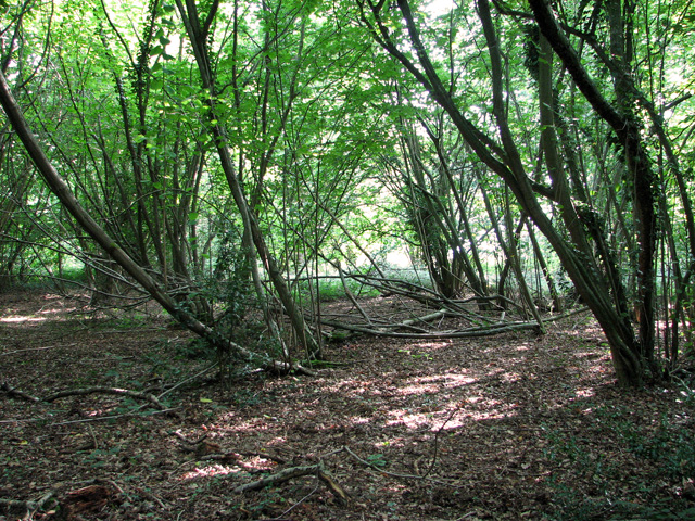
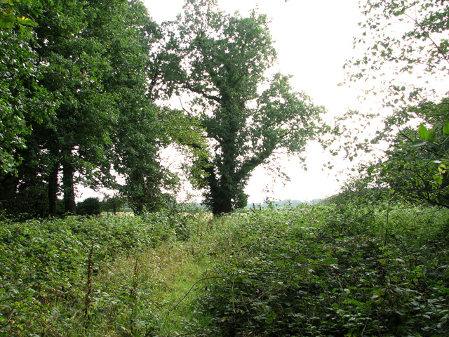
Blackhill Wood is a picturesque forest located in the county of Norfolk, England. Spanning over an area of approximately 100 acres, this woodland is known for its natural beauty and diverse wildlife.

The wood is primarily composed of a variety of indigenous tree species, including oak, ash, beech, and birch. These towering trees create a dense canopy that provides shade and shelter for the various animals that call Blackhill Wood their home. Additionally, the forest floor is covered with a rich layer of moss, ferns, and wildflowers, adding to its enchanting ambiance.

Walking through Blackhill Wood, visitors can enjoy the peacefulness and tranquility that this natural habitat offers. The woodland paths are well-maintained, allowing for easy navigation and exploration. Birdsong fills the air as a multitude of avian species, such as woodpeckers, thrushes, and owls, can be heard and spotted throughout the year.

The wood is also home to a diverse range of mammals, including rabbits, squirrels, and badgers. If lucky, visitors may even catch a glimpse of the elusive deer that roam freely within the confines of the forest.

Blackhill Wood is a popular destination for nature lovers, hikers, and photographers. Its natural beauty and serene atmosphere make it a perfect location for those seeking a peaceful escape from the hustle and bustle of everyday life. Whether it is a leisurely stroll, a bird-watching expedition, or simply a place to connect with nature, Blackhill Wood offers a truly memorable experience for all who visit.

If you have any feedback on the listing, please let us know in the comments section below.

Blackhill Wood Images

Images are sourced within 2km of 52.666932/1.1783735 or Grid Reference TG1512. Thanks to Geograph Open Source API. All images are credited.

Easton: River Tud
Easton: River Tud
Easton: Footbridge next to the road bridge over the River Tud
Easton: 73-75, Ringland Road
Easton: Weston Road
Easton: Weston Road
Easton: Track to West Lodge Farm
Old Milestone by Dereham Road, near Royal Norfolk Showground Metal plate attached to stone post by the UC road, in parish of COSTESSEY (SOUTH NORFOLK District), Dereham Road, 70yds West of Costessey Lodge entrance, rear of grass verge against wooden fence, on North side of road. Dereham iron plate, erected by the Norwich & Swaffham turnpike trust in the 19th century. An earlier photograph can be found here <a title="https://www.geograph.org.uk/photo/6037516" href="https://www.geograph.org.uk/photo/6037516">Link</a>.

Inscription reads:-
NORWICH
5
DEREHAM
11 
Carved benchmark on lower right side. 

Milestone Society National ID: NO_NSM05.
Old Milestone by Dereham Road, near Royal Norfolk Showground
Metal plate attached to stone post by the UC road, in parish of COSTESSEY (SOUTH NORFOLK District), Dereham Road, 70yds West of Costessey Lodge entrance, rear of grass verge against wooden fence, on North side of road. Dereham iron plate, erected by the Norwich & Swaffham turnpike trust in the 19th century. An earlier photograph can be found here Link. Inscription reads:- NORWICH 5 DEREHAM 11 Carved benchmark on lower right side. Milestone Society National ID: NO_NSM05.
Ringland Road, Lower Easton Ford Cottage in the distance
Ringland Road, Lower Easton
Ford Cottage in the distance
The Swan Inn Public House Off Costessey Road at the junction of Ringland Road & The Street at Ringland
The Swan Inn Public House
Off Costessey Road at the junction of Ringland Road & The Street at Ringland
The Swan Inn Public House Off Costessey Road at the junction of Ringland Road & The Street at Ringland
The Swan Inn Public House
Off Costessey Road at the junction of Ringland Road & The Street at Ringland
The Swan Inn Public House sign Off Costessey Road
The Swan Inn Public House sign
Off Costessey Road
Sainsbury's, Norwich The Longwater branch that's so big, it could almost be a hypermarket.
Sainsbury's, Norwich
The Longwater branch that's so big, it could almost be a hypermarket.
Bracken growing at Ringland Hills
View towards Aves' Gap, Ringland
Path in Stonyhole Plantation, Ringland
Stonyhole Plantation, Ringland
On the southern edge of Stonyhole Plantation, Ringland
Field west of Sandy Lane, Ringland Hills
Willowherb growing alongside Sandy Lane, Ringland Hills
Show me another place!

Blackhill Wood is located at Grid Ref: TG1512 (Lat: 52.666932, Lng: 1.1783735)

Administrative County: Norfolk

District: South Norfolk

Police Authority: Norfolk

What 3 Words

///marble.commuted.agenda. Near Costessey, Norfolk

Related Wikis

Taverham Hall School

Taverham Hall School was a private co-educational day and boarding preparatory school. Situated in Taverham, Norfolk, it was founded in 1920. The school...

Costessey Hall

Costessey Hall (pronounced and sometimes spelt Cossey Hall, also written as Cotesby Hall) was a manor house in Costessey, Norfolk, England, four miles...
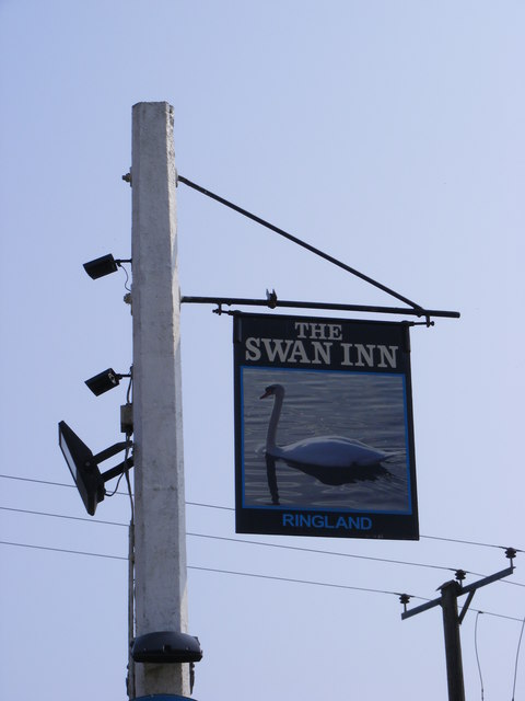
Ringland, Norfolk

Ringland is a village and civil parish in Norfolk, England, and in the valley of the River Wensum, approximately 7 miles (11 km) north-west of Norwich...

Taverham

Taverham is a village and civil parish in Norfolk, in England. It is approximately 5 miles (8 km) north-west of Norwich. Taverham sits on the River Wensum...

Nearby Amenities

Located within 500m of 52.666932,1.1783735
Crossing
Crossing: unmarked
Crossing Island: no
Tactile Paving: yes
Lat/Long: 52.6635019/1.1825723
Crossing
Crossing: unmarked
Crossing Island: no
Tactile Paving: yes
Lat/Long: 52.6634192/1.1825831
Crossing
Crossing: unmarked
Tactile Paving: yes
Lat/Long: 52.6635986/1.1832415
Stockwell Road / Costessey
Operator: EDF Energy Networks Ltd.
Power: substation
Ref: TG 1519 1227
Lat/Long: 52.6654857/1.1808744
Barrier: bollard
Foot: yes
Lat/Long: 52.6635236/1.1820148
Barrier: bollard
Foot: yes
Lat/Long: 52.6641167/1.1826144
Barrier: bollard
Foot: yes
Lat/Long: 52.6641753/1.1831212
School Queens Hills / Costessey
Operator: EDF Energy Networks Ltd.
Power: substation
Ref: TG 1528 1237
Lat/Long: 52.666327/1.1823595
Kestral Avenue, adj
Naptan AtcoCode: 2900C270
Naptan Bearing: E
Naptan BusStopType: CUS
Naptan CommonName: Kestral Avenue
Naptan Indicator: adj
Naptan Locality: Queen's Hill
Naptan NaptanCode: nfogtdpa
Naptan Street: Field Fare Way
Naptan Verified: no
Source: naptan_import
Lat/Long: 52.6652846/1.1824726
Bus Stop
Solario Road, opp
Bench: yes
Naptan AtcoCode: 2900C2793
Naptan Bearing: E
Naptan CommonName: Solario Road
Naptan Indicator: opp
Naptan Locality: Queen's Hill
Naptan NaptanCode: nfogtdtd
Naptan Street: Fairway
Naptan Verified: no
Shelter: yes
Source: naptan_import
Lat/Long: 52.6644467/1.1788467
Bus Stop
Robin Close, adj
Naptan AtcoCode: 2900C2794
Naptan Bearing: SE
Naptan CommonName: Robin Close
Naptan Indicator: adj
Naptan Locality: Queen's Hill
Naptan NaptanCode: nfogtdtg
Naptan Street: Poethlyn Drive
Naptan Verified: no
Source: naptan_import
Lat/Long: 52.6644338/1.1843485
Crossing
Tactile Paving: yes
Lat/Long: 52.6633755/1.1818146
Crossing
Crossing: uncontrolled
Tactile Paving: yes
Lat/Long: 52.6643205/1.1808573
Crossing
Crossing: uncontrolled
Tactile Paving: yes
Lat/Long: 52.6643539/1.1794694
Crossing
Crossing: uncontrolled
Tactile Paving: yes
Lat/Long: 52.6646484/1.1808026
Crossing
Crossing: uncontrolled
Tactile Paving: yes
Lat/Long: 52.6646986/1.1806026
Crossing
Crossing: uncontrolled
Lat/Long: 52.6652624/1.1839643
Post Box
Collection Times: Mo-Fr 16:15; Sa 11:00
Operator: Royal Mail
Post Box Type: pillar
Ref: NR8 826
Royal Cypher: EIIR
Royal Cypher Wikidata: Q33102113
Lat/Long: 52.6652682/1.1834297
Parking
Lat/Long: 52.6645835/1.1816881
Barrier: bollard
Lat/Long: 52.6639755/1.1768062
Parking
Lat/Long: 52.6673802/1.1832532
Parking
Lat/Long: 52.6647169/1.1823864
Parking
Lat/Long: 52.6642433/1.1818319
Parking
Lat/Long: 52.6680614/1.1848022
Crossing
Lat/Long: 52.6646404/1.1839109
Give Way
Lat/Long: 52.6634067/1.1818126
Crossing
Lat/Long: 52.6643206/1.1783969
The data included in this document is from www.openstreetmap.org. The data is made available under ODbL.

Have you been to Blackhill Wood?

Leave your review of Blackhill Wood below (or comments, questions and feedback).