Eastleigh Wood

Wood, Forest in Kent Shepway

England

Eastleigh Wood

Lane to Wheelbarrow Town and Stelling Minnis From the Elham direction.
Lane to Wheelbarrow Town and Stelling Minnis Credit: Robin Webster

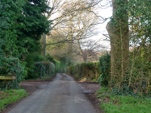
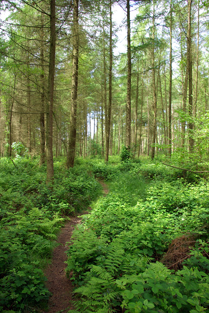
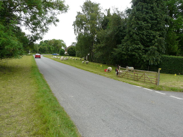
Eastleigh Wood, located in Kent, England, is a picturesque forest that covers an area of approximately 500 acres. Known for its natural beauty and diverse wildlife, the wood attracts nature enthusiasts and hikers alike.

The wood is characterized by its dense canopy of mature trees, including oak, beech, and ash, which create a serene and tranquil atmosphere. The trees provide ample shade during the summer months, making it an ideal spot for picnics and leisurely walks. In spring, the forest comes alive with vibrant wildflowers, adding bursts of color to the landscape.

Eastleigh Wood is home to a rich variety of wildlife, making it a haven for nature lovers. Birdwatchers can spot a wide range of species, including woodpeckers, owls, and various songbirds. The woodland floor is inhabited by small mammals such as squirrels, rabbits, and foxes. Visitors may also come across deer, which roam freely in the area.

The wood offers numerous walking trails, ranging from easy strolls to more challenging hikes, catering to all levels of fitness. These trails are well-maintained and provide breathtaking views of the surrounding countryside. Additionally, there are designated picnic areas and benches throughout the wood, allowing visitors to relax and soak in the peaceful ambiance.

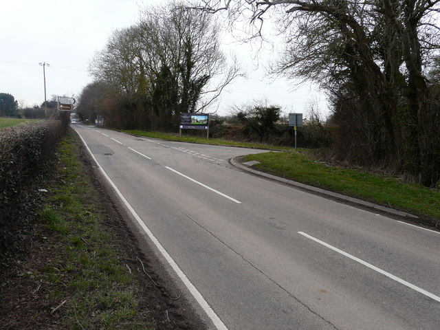
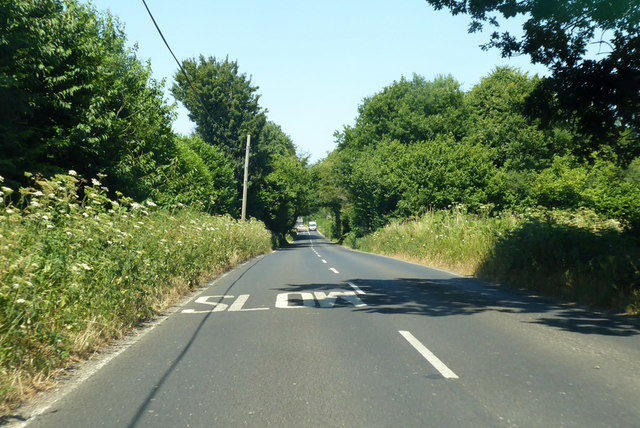
Eastleigh Wood is easily accessible, with ample parking facilities available nearby. It is a popular destination for families, nature enthusiasts, and those seeking a peaceful retreat in the heart of nature.

If you have any feedback on the listing, please let us know in the comments section below.

Eastleigh Wood Images

Images are sourced within 2km of 51.166822/1.0620287 or Grid Reference TR1445. Thanks to Geograph Open Source API. All images are credited.

Lane to Wheelbarrow Town and Stelling Minnis From the Elham direction.
Lane to Wheelbarrow Town and Stelling Minnis
From the Elham direction.
Erection of two storey house and garage Planning permission was approved, with conditions, by Folkestone and Hythe District Council under application number Y15/0145/SH for the “erection of a 2-storey detached dwelling house with basement accommodation, detached garage/store, reconfigured access driveway and associated landscaping following the demolition of the existing dwelling and outbuildings (resubmission of Y14/1034/SH)”. The location was given as Sunnyside Farm, Wheelbarrow Town, Stelling Minnis.
Erection of two storey house and garage
Planning permission was approved, with conditions, by Folkestone and Hythe District Council under application number Y15/0145/SH for the “erection of a 2-storey detached dwelling house with basement accommodation, detached garage/store, reconfigured access driveway and associated landscaping following the demolition of the existing dwelling and outbuildings (resubmission of Y14/1034/SH)”. The location was given as Sunnyside Farm, Wheelbarrow Town, Stelling Minnis.
Path in West Wood Forestry Commission access woodland.
Path in West Wood
Forestry Commission access woodland.
Ride in West Wood Forestry Commission access woodland. This is also a public footpath.
Ride in West Wood
Forestry Commission access woodland. This is also a public footpath.
Large White butterfly, West Wood A Large White rather than a Small White, as the black on the outer tip of the forewing (seen here through the wing) extends some way along the outer (here the bottom) margin. It is also larger, but that is sometimes hard to judge in isolation.
Large White butterfly, West Wood
A Large White rather than a Small White, as the black on the outer tip of the forewing (seen here through the wing) extends some way along the outer (here the bottom) margin. It is also larger, but that is sometimes hard to judge in isolation.
Muddy path in West Wood Forestry Commission access woodland.
Muddy path in West Wood
Forestry Commission access woodland.
Path in West Wood Forestry Commission access woodland.
Path in West Wood
Forestry Commission access woodland.
Entrance, Beveridge Bottom Wood Forestry Commission access woodland.
Entrance, Beveridge Bottom Wood
Forestry Commission access woodland.
Sunnyside, Wheelbarrow Town Compared with <a href="https://www.geograph.org.uk/photo/4784993">TR1546 : Erection of two storey house and garage</a>, all building work has been completed. The name of the house is affixed to the post, to the right of the gate.
Sunnyside, Wheelbarrow Town
Compared with TR1546 : Erection of two storey house and garage, all building work has been completed. The name of the house is affixed to the post, to the right of the gate.
Keeping the verges tidy This flock of sheep and lambs was securely penned, by the use of an electric fence. There were signs that they had previously enjoyed the grass across the road.
Keeping the verges tidy
This flock of sheep and lambs was securely penned, by the use of an electric fence. There were signs that they had previously enjoyed the grass across the road.
Stonegate Business Park, Stone Street Planning permission was approved, with conditions, by Folkestone and Hythe  District Council under application number Y15/1292/SH for the “demolition of buildings and structures, remediation of land and the erection of 30 houses and two B1 office units of 465m2 floor area, plus the closure of existing access to Stone Street and creation of new access to Thorn Lane”. 

This image shows where the access to/from Thorn Lane will be located.
Stonegate Business Park, Stone Street
Planning permission was approved, with conditions, by Folkestone and Hythe District Council under application number Y15/1292/SH for the “demolition of buildings and structures, remediation of land and the erection of 30 houses and two B1 office units of 465m2 floor area, plus the closure of existing access to Stone Street and creation of new access to Thorn Lane”. This image shows where the access to/from Thorn Lane will be located.
Stonegate Business Park, Stone Street Planning permission was approved, with conditions, by Folkestone and Hythe  District Council under application number Y15/1292/SH for the “demolition of buildings and structures, remediation of land and the erection of 30 houses and two B1 office units of 465m2 floor area, plus the closure of existing access to Stone Street and creation of new access to Thorn Lane”.

This image shows the information board depicting Stonegate Business Park.    

A resident from Stelling Minnis told me that the road junction at this location is to be redesigned to reduce the speed of traffic on Stone Street and make it safer for vehicles turning into Thorn Lane.
Stonegate Business Park, Stone Street
Planning permission was approved, with conditions, by Folkestone and Hythe District Council under application number Y15/1292/SH for the “demolition of buildings and structures, remediation of land and the erection of 30 houses and two B1 office units of 465m2 floor area, plus the closure of existing access to Stone Street and creation of new access to Thorn Lane”. This image shows the information board depicting Stonegate Business Park. A resident from Stelling Minnis told me that the road junction at this location is to be redesigned to reduce the speed of traffic on Stone Street and make it safer for vehicles turning into Thorn Lane.
Stonegate Business Park, Stone Street Planning permission was approved, with conditions, by Folkestone and Hythe  District Council under application number Y15/1292/SH for the “demolition of buildings and structures, remediation of land and the erection of 30 houses and two B1 office units of 465m2 floor area, plus the closure of existing access to Stone Street and creation of new access to Thorn Lane”.

This image shows the main entrance into the site from Stone Street.
Stonegate Business Park, Stone Street
Planning permission was approved, with conditions, by Folkestone and Hythe District Council under application number Y15/1292/SH for the “demolition of buildings and structures, remediation of land and the erection of 30 houses and two B1 office units of 465m2 floor area, plus the closure of existing access to Stone Street and creation of new access to Thorn Lane”. This image shows the main entrance into the site from Stone Street.
B2068 Stone Street towards Canterbury The Roman road approaches the George Inn.
B2068 Stone Street towards Canterbury
The Roman road approaches the George Inn.
B2068 Stone Street towards Canterbury Passing Stone Hall on the right.
B2068 Stone Street towards Canterbury
Passing Stone Hall on the right.
B2068 Stone Street towards Canterbury The Roman road nears an area with several turnings.
B2068 Stone Street towards Canterbury
The Roman road nears an area with several turnings.
Junction with grass triangle Stone Street, Stowting and Canterbury left, Stelling Minnis and Bossingham right.
Junction with grass triangle
Stone Street, Stowting and Canterbury left, Stelling Minnis and Bossingham right.
Park Wood East of the road between Stelling Minnis and Rhodes Minnis.
Park Wood
East of the road between Stelling Minnis and Rhodes Minnis.
Show me another place!

Eastleigh Wood is located at Grid Ref: TR1445 (Lat: 51.166822, Lng: 1.0620287)

Administrative County: Kent

District: Shepway

Police Authority: Kent

What 3 Words

///parsnips.horizons.firework. Near Lyminge, Kent

Related Wikis

Davison's Mill, Stelling Minnis

Davison's Mill, also known as Stelling Minnis Windmill, is a Grade I listed smock mill in Stelling Minnis, Kent, England that was built in 1866. It was...

Stelling Minnis

Stelling Minnis is a village and civil parish in the Folkestone and Hythe district in Kent, England. The village lies 13 kilometres (8 mi) to the south...

Spong Wood

Spong Wood is a 18-hectare (44-acre) nature reserve west of Stelling Minnis in Kent. It is managed by Kent Wildlife Trust.Common trees in this coppiced...

Rhodes Minnis

Rhodes Minnis is a village near Folkestone in Kent, England, located between Lyminge and Stelling Minnis. It is in the civil parish of Elham. It was a...

Elmsted

Elmsted is a village and civil parish in the Folkestone and Hythe District of Kent, England. It is located west of Stone Street (the B2068), the Roman...

Yockletts Bank

Yockletts Bank is a 25.4-hectare (63-acre) biological Site of Special Scientific Interest west of Stelling Minnis in Kent. It is managed by KWT and is...

Lynsore Bottom

Lynsore Bottom is a 70.6-hectare (174-acre) biological Site of Special Scientific Interest north of Folkestone in Kent.These coppice with standards woods...

Park Gate Down

Park Gate Down or Parkgate Down is a 7-hectare (17-acre) biological Site of Special Scientific Interest south-east of Stelling Minnis in Kent. It is also...

Nearby Amenities

Located within 500m of 51.166822,1.0620287
Barrier: stile
Lat/Long: 51.1695496/1.0606945
Power: tower
Lat/Long: 51.1635206/1.0658566
The data included in this document is from www.openstreetmap.org. The data is made available under ODbL.

Have you been to Eastleigh Wood?

Leave your review of Eastleigh Wood below (or comments, questions and feedback).