Brotherhood Wood

Wood, Forest in Kent Canterbury

England

Brotherhood Wood

University of Kent at Canterbury A road on the northern side of the campus site.
University of Kent at Canterbury Credit: Jim Barton

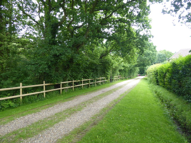
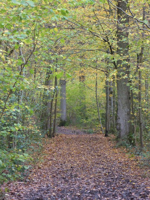
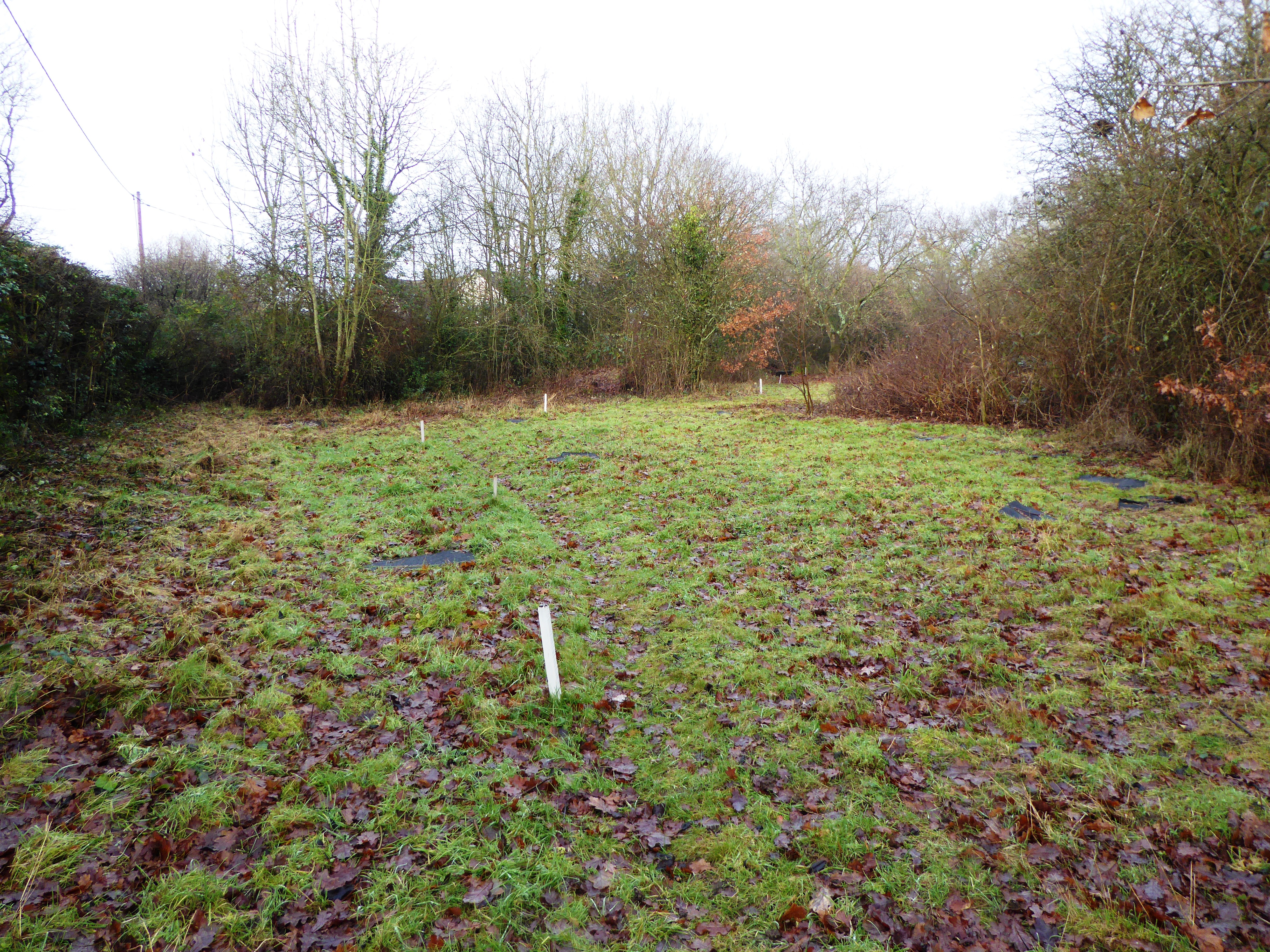
Brotherhood Wood is a picturesque forest located in the county of Kent, England. Spanning over a vast area, this woodland is renowned for its natural beauty and diverse ecosystem, making it a popular destination for nature enthusiasts and hikers alike. The wood is situated near the village of Brotherhood, hence its name.

The wood is predominantly composed of deciduous trees, such as oak, beech, and chestnut, which create a vibrant and ever-changing landscape throughout the seasons. The forest floor is covered with a rich carpet of ferns, wildflowers, and mosses, adding to the enchanting atmosphere of the wood.

Brotherhood Wood is home to a wide array of wildlife, including various species of birds, mammals, and insects. Birdwatchers can delight in spotting common woodland birds like song thrushes, woodpeckers, and owls, while lucky visitors may even catch a glimpse of elusive mammals such as deer or foxes. The wood also supports a thriving insect population, with butterflies, dragonflies, and bees being particularly abundant in the warmer months.

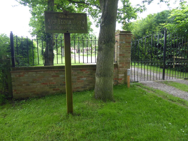
With its well-maintained network of walking trails, Brotherhood Wood offers visitors the opportunity to explore its natural wonders at their own pace. These trails wind through the forest, passing by tranquil ponds, babbling brooks, and ancient trees, providing a perfect escape from the hustle and bustle of everyday life.

Overall, Brotherhood Wood in Kent is a captivating woodland that showcases the beauty of nature in all its glory. Its stunning landscapes, diverse wildlife, and peaceful ambiance make it a truly special place for both relaxation and exploration.

If you have any feedback on the listing, please let us know in the comments section below.

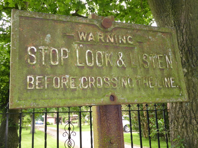
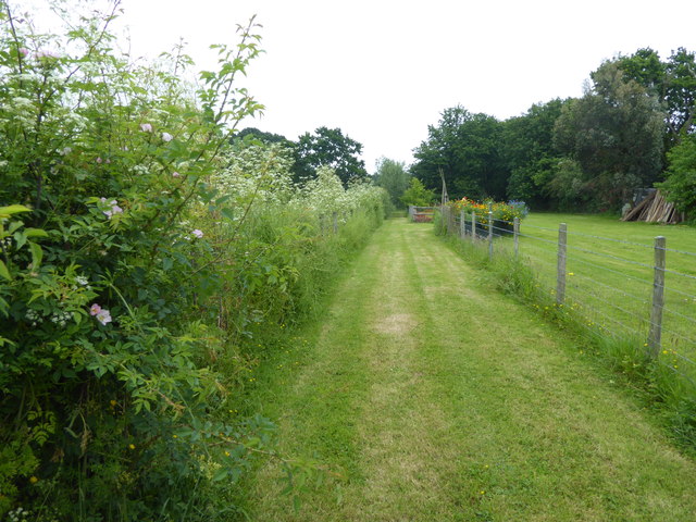
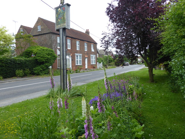
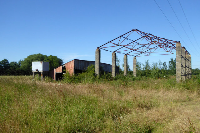
Brotherhood Wood Images

Images are sourced within 2km of 51.299584/1.065423 or Grid Reference TR1360. Thanks to Geograph Open Source API. All images are credited.

University of Kent at Canterbury A road on the northern side of the campus site.
University of Kent at Canterbury
A road on the northern side of the campus site.
A290 past the Blean Tavern Heading towards Whitstable.
A290 past the Blean Tavern
Heading towards Whitstable.
Route of the former Canterbury & Whitstable Railway The Canterbury & Whitstable Railway is often said to have been the first passenger railway in the world.  Construction of the 6 mile line took several years and work excavating the 828 yard Tyler Hill Tunnel proved difficult and lengthy. There were great celebrations for the opening on 3rd May 1830. In Canterbury, the cathedral bells were rung and guns were fired in salute.  

Sections of the line were so steeply graded that stationary engines were required to haul trains by cable up the steep ascents.  After the First World War, bus competition began to cause problems and the line to Whitstable finally closed to passengers on 1st January 1931. Goods traffic continued for a number of years but final closure came on 1st December 1952 after which time the track was removed.  A path now follows part of the old route and is known as the Crab & Winkle Way. Here though it is a private driveway to a house known appropriately as 'The Halt'. The Halt is now a private residence converted from an engineer's cottage.

This section of the old trackbed is particularly interesting as Blean & Tyler Hill Halt was located ahead between here and Tyler Hill Road. It was opened in 1908 and closed a mere 22 years later with the last passenger train. See <a title="https://www.geograph.org.uk/photo/1832585" href="https://www.geograph.org.uk/photo/1832585">Link</a>

See <span class="nowrap"><a title="http://www.bbc.co.uk/kent/content/articles/2008/05/27/history_lost_railway_feature.shtml" rel="nofollow ugc noopener" href="http://www.bbc.co.uk/kent/content/articles/2008/05/27/history_lost_railway_feature.shtml">Link</a><img style="margin-left:2px;" alt="External link" title="External link - shift click to open in new window" src="https://s1.geograph.org.uk/img/external.png" width="10" height="10"/></span>  and <span class="nowrap"><a title="https://en.wikipedia.org/wiki/Canterbury_and_Whitstable_Railway" rel="nofollow ugc noopener" href="https://en.wikipedia.org/wiki/Canterbury_and_Whitstable_Railway">Link</a><img style="margin-left:2px;" alt="External link" title="External link - shift click to open in new window" src="https://s1.geograph.org.uk/img/external.png" width="10" height="10"/></span>   and <span class="nowrap"><a title="http://crabandwinkle.org/?page_id=19" rel="nofollow ugc noopener" href="http://crabandwinkle.org/?page_id=19">Link</a><img style="margin-left:2px;" alt="External link" title="External link - shift click to open in new window" src="https://s1.geograph.org.uk/img/external.png" width="10" height="10"/></span>
Route of the former Canterbury & Whitstable Railway
The Canterbury & Whitstable Railway is often said to have been the first passenger railway in the world. Construction of the 6 mile line took several years and work excavating the 828 yard Tyler Hill Tunnel proved difficult and lengthy. There were great celebrations for the opening on 3rd May 1830. In Canterbury, the cathedral bells were rung and guns were fired in salute. Sections of the line were so steeply graded that stationary engines were required to haul trains by cable up the steep ascents. After the First World War, bus competition began to cause problems and the line to Whitstable finally closed to passengers on 1st January 1931. Goods traffic continued for a number of years but final closure came on 1st December 1952 after which time the track was removed. A path now follows part of the old route and is known as the Crab & Winkle Way. Here though it is a private driveway to a house known appropriately as 'The Halt'. The Halt is now a private residence converted from an engineer's cottage. This section of the old trackbed is particularly interesting as Blean & Tyler Hill Halt was located ahead between here and Tyler Hill Road. It was opened in 1908 and closed a mere 22 years later with the last passenger train. See Link See LinkExternal link and LinkExternal link and LinkExternal link
Old sign for the Canterbury & Whitstable Railway The Canterbury & Whitstable Railway is often said to have been the first passenger railway in the world.  Construction of the 6 mile line took several years and work excavating the 828 yard Tyler Hill Tunnel proved difficult and lengthy. There were great celebrations for the opening on 3rd May 1830. In Canterbury, the cathedral bells were rung and guns were fired in salute.  

Sections of the line were so steeply graded that stationary engines were required to haul trains by cable up the steep ascents.  After the First World War, bus competition began to cause problems and the line to Whitstable finally closed to passengers on 1st January 1931. Goods traffic continued for a number of years but final closure came on 1st December 1952 after which time the track was removed.  A path now follows part of the old route and is known as the Crab & Winkle Way. Here though it is alongside a private driveway to a house known appropriately as 'The Halt'. The old sign has survived - see <a title="https://www.geograph.org.uk/photo/5809263" href="https://www.geograph.org.uk/photo/5809263">Link</a>  for a close up. The Halt is now a private residence converted from an engineer's cottage. This section of the old trackbed is particularly interesting as Blean & Tyler Hill Halt was located between here and Tyler Hill Road just behind where I am standing. It was opened in 1908 and closed a mere 22 years later with the last passenger train. See <a title="https://www.geograph.org.uk/photo/1832585" href="https://www.geograph.org.uk/photo/1832585">Link</a>


See <span class="nowrap"><a title="http://www.bbc.co.uk/kent/content/articles/2008/05/27/history_lost_railway_feature.shtml" rel="nofollow ugc noopener" href="http://www.bbc.co.uk/kent/content/articles/2008/05/27/history_lost_railway_feature.shtml">Link</a><img style="margin-left:2px;" alt="External link" title="External link - shift click to open in new window" src="https://s1.geograph.org.uk/img/external.png" width="10" height="10"/></span>  and <span class="nowrap"><a title="https://en.wikipedia.org/wiki/Canterbury_and_Whitstable_Railway" rel="nofollow ugc noopener" href="https://en.wikipedia.org/wiki/Canterbury_and_Whitstable_Railway">Link</a><img style="margin-left:2px;" alt="External link" title="External link - shift click to open in new window" src="https://s1.geograph.org.uk/img/external.png" width="10" height="10"/></span>   and <span class="nowrap"><a title="http://crabandwinkle.org/?page_id=19" rel="nofollow ugc noopener" href="http://crabandwinkle.org/?page_id=19">Link</a><img style="margin-left:2px;" alt="External link" title="External link - shift click to open in new window" src="https://s1.geograph.org.uk/img/external.png" width="10" height="10"/></span>
Old sign for the Canterbury & Whitstable Railway
The Canterbury & Whitstable Railway is often said to have been the first passenger railway in the world. Construction of the 6 mile line took several years and work excavating the 828 yard Tyler Hill Tunnel proved difficult and lengthy. There were great celebrations for the opening on 3rd May 1830. In Canterbury, the cathedral bells were rung and guns were fired in salute. Sections of the line were so steeply graded that stationary engines were required to haul trains by cable up the steep ascents. After the First World War, bus competition began to cause problems and the line to Whitstable finally closed to passengers on 1st January 1931. Goods traffic continued for a number of years but final closure came on 1st December 1952 after which time the track was removed. A path now follows part of the old route and is known as the Crab & Winkle Way. Here though it is alongside a private driveway to a house known appropriately as 'The Halt'. The old sign has survived - see Link for a close up. The Halt is now a private residence converted from an engineer's cottage. This section of the old trackbed is particularly interesting as Blean & Tyler Hill Halt was located between here and Tyler Hill Road just behind where I am standing. It was opened in 1908 and closed a mere 22 years later with the last passenger train. See Link See LinkExternal link and LinkExternal link and LinkExternal link
Old railway sign The Canterbury & Whitstable Railway is often said to have been the first passenger railway in the world.  Construction of the 6 mile line took several years and work excavating the 828 yard Tyler Hill Tunnel proved difficult and lengthy. There were great celebrations for the opening on 3rd May 1830. In Canterbury, the cathedral bells were rung and guns were fired in salute.  

Sections of the line were so steeply graded that stationary engines were required to haul trains by cable up the steep ascents.  After the First World War, bus competition began to cause problems and the line to Whitstable finally closed to passengers on 1st January 1931. Goods traffic continued for a number of years but final closure came on 1st December 1952 after which time the track was removed.  

A path now follows part of the old route and is known as the Crab & Winkle Way. Here though it a private driveway to a house known appropriately as 'The Halt'. The Halt is now a private residence converted from an engineer's cottage. This section of the old trackbed is particularly interesting as Blean & Tyler Hill Halt was located between here and Tyler Hill Road just behind where I am standing. It was opened in 1908 and closed a mere 22 years later with the last passenger train. See <a title="https://www.geograph.org.uk/photo/1832585" href="https://www.geograph.org.uk/photo/1832585">Link</a>  The other reminder that this was once a railway is this old sign - see <a title="https://www.geograph.org.uk/photo/5809261" href="https://www.geograph.org.uk/photo/5809261">Link</a>  for its location.

See <span class="nowrap"><a title="http://www.bbc.co.uk/kent/content/articles/2008/05/27/history_lost_railway_feature.shtml" rel="nofollow ugc noopener" href="http://www.bbc.co.uk/kent/content/articles/2008/05/27/history_lost_railway_feature.shtml">Link</a><img style="margin-left:2px;" alt="External link" title="External link - shift click to open in new window" src="https://s1.geograph.org.uk/img/external.png" width="10" height="10"/></span>  and <span class="nowrap"><a title="https://en.wikipedia.org/wiki/Canterbury_and_Whitstable_Railway" rel="nofollow ugc noopener" href="https://en.wikipedia.org/wiki/Canterbury_and_Whitstable_Railway">Link</a><img style="margin-left:2px;" alt="External link" title="External link - shift click to open in new window" src="https://s1.geograph.org.uk/img/external.png" width="10" height="10"/></span>   and <span class="nowrap"><a title="http://crabandwinkle.org/?page_id=19" rel="nofollow ugc noopener" href="http://crabandwinkle.org/?page_id=19">Link</a><img style="margin-left:2px;" alt="External link" title="External link - shift click to open in new window" src="https://s1.geograph.org.uk/img/external.png" width="10" height="10"/></span>
Old railway sign
The Canterbury & Whitstable Railway is often said to have been the first passenger railway in the world. Construction of the 6 mile line took several years and work excavating the 828 yard Tyler Hill Tunnel proved difficult and lengthy. There were great celebrations for the opening on 3rd May 1830. In Canterbury, the cathedral bells were rung and guns were fired in salute. Sections of the line were so steeply graded that stationary engines were required to haul trains by cable up the steep ascents. After the First World War, bus competition began to cause problems and the line to Whitstable finally closed to passengers on 1st January 1931. Goods traffic continued for a number of years but final closure came on 1st December 1952 after which time the track was removed. A path now follows part of the old route and is known as the Crab & Winkle Way. Here though it a private driveway to a house known appropriately as 'The Halt'. The Halt is now a private residence converted from an engineer's cottage. This section of the old trackbed is particularly interesting as Blean & Tyler Hill Halt was located between here and Tyler Hill Road just behind where I am standing. It was opened in 1908 and closed a mere 22 years later with the last passenger train. See Link The other reminder that this was once a railway is this old sign - see Link for its location. See LinkExternal link and LinkExternal link and LinkExternal link
Footpath from Tyler Hill Road This footpath crosses the old route of the Canterbury & Whitstable Railway just ahead - see <a title="https://www.geograph.org.uk/photo/5809261" href="https://www.geograph.org.uk/photo/5809261">Link</a>  Beyond that it meets Fleets Lane.
Footpath from Tyler Hill Road
This footpath crosses the old route of the Canterbury & Whitstable Railway just ahead - see Link Beyond that it meets Fleets Lane.
Tyler Hill Tyler Hill is just to the north of the University of Kent campus. This is at the centre of the village with the village sign on Hackington Road.
Tyler Hill
Tyler Hill is just to the north of the University of Kent campus. This is at the centre of the village with the village sign on Hackington Road.
Hackington Road at Tyler Hill Tyler Hill is just to the north of the University of Kent campus. This is at the centre of the village with the village sign on Hackington Road.
Hackington Road at Tyler Hill
Tyler Hill is just to the north of the University of Kent campus. This is at the centre of the village with the village sign on Hackington Road.
Tyler Hill Tyler Hill is just to the north of the University of Kent campus. This is at the centre of the village with the village sign on Hackington Road. The village sign includes, of course, oast houses.
Tyler Hill
Tyler Hill is just to the north of the University of Kent campus. This is at the centre of the village with the village sign on Hackington Road. The village sign includes, of course, oast houses.
Calais Hill, Tyler Hill This is immediately west of the village centre of Tyler Hill - see <a title="https://www.geograph.org.uk/photo/5810136" href="https://www.geograph.org.uk/photo/5810136">Link</a>
Calais Hill, Tyler Hill
This is immediately west of the village centre of Tyler Hill - see Link
Calais Hill, Tyler Hill This is immediately west of the village centre of Tyler Hill - see <a title="https://www.geograph.org.uk/photo/5810136" href="https://www.geograph.org.uk/photo/5810136">Link</a>
Calais Hill, Tyler Hill
This is immediately west of the village centre of Tyler Hill - see Link
Derelict barn, Well Court The public bridleway passing through here is hardly used and unclear on the ground, with a lack of visible official signage. One OS map has it passing to the right of these barns, another to the left.
Derelict barn, Well Court
The public bridleway passing through here is hardly used and unclear on the ground, with a lack of visible official signage. One OS map has it passing to the right of these barns, another to the left.
Calais Hill is closed Blean was accessible via a diversion route further up the road at Tyler Hill.
Calais Hill is closed
Blean was accessible via a diversion route further up the road at Tyler Hill.
Hackington Road, Tyler Hill Towards Whitstable.
Hackington Road, Tyler Hill
Towards Whitstable.
Weather vane, Well Court Farm
Old Milestone by the A290, Tile Kiln Hill, Blean Metal plate attached to stone post by the A290, in parish of ST COSMUS AND ST DAMIAN IN THE BLEAN (CANTERBURY District), Tile Kiln Hill, opposite No. 32, by No. 27, in domestic hedge at back of tarmac footpath, on West side of road. Whitstable iron plate, erected by the Whitstable turnpike trust in the 19th century. 

Inscription reads:- : 4½ / MILES / TO / WHITSTABLE : : 2 / MILES / TO / CANTERBURY : 
Carved benchmark and rivet on top.

Milestone Society National ID: KE_CYWS02.
Old Milestone by the A290, Tile Kiln Hill, Blean
Metal plate attached to stone post by the A290, in parish of ST COSMUS AND ST DAMIAN IN THE BLEAN (CANTERBURY District), Tile Kiln Hill, opposite No. 32, by No. 27, in domestic hedge at back of tarmac footpath, on West side of road. Whitstable iron plate, erected by the Whitstable turnpike trust in the 19th century. Inscription reads:- : 4½ / MILES / TO / WHITSTABLE : : 2 / MILES / TO / CANTERBURY : Carved benchmark and rivet on top. Milestone Society National ID: KE_CYWS02.
Path in Blean Woods Part of the RSPB Blean Woods Nature Reserve.
Path in Blean Woods
Part of the RSPB Blean Woods Nature Reserve.
St Cosmus & St Damian, Blean
Show me another place!

Brotherhood Wood is located at Grid Ref: TR1360 (Lat: 51.299584, Lng: 1.065423)

Administrative County: Kent

District: Canterbury

Police Authority: Kent

What 3 Words

///ketchup.body.ushering. Near Blean, Kent

Nearby Locations

Brotherhood Wood

Related Wikis

Kent Business School

Kent Business School (KBS) is the business school of the University of Kent. Although there are two business schools known as KBS, generally people seem...

British Cartoon Archive

The British Cartoon Archive (BCA) is a department of the University of Kent, at Canterbury in Kent, England, and holds the national collection of political...

University of Kent

The University of Kent (formerly the University of Kent at Canterbury, abbreviated as UKC) is a semi-collegiate public research university based in Kent...

Fifteenth Lambeth Conference

The fifteenth Lambeth Conference was an assembly of bishops of the Anglican Communion convened by the archbishop of Canterbury, Justin Welby, between 27...

CSR 97.4FM

Canterbury Student Radio (CSR FM) is a membership based student and community radio station based in Canterbury, England. It is currently funded by Kent...

Tyler Hill, Kent

Tyler Hill is a small village on the northern outskirts of Canterbury, Kent in England. The population is included in the civil parish of Hackington. Its...

Tyler Hill Meadow

Tyler Hill Meadow is a 0.8-hectare (2.0-acre) Local Nature Reserve in Hackington, north of Canterbury in Kent. It is owned by Hackington Parish Council...

The Archbishop's School

The Archbishop's School is a mixed-ability Church of England secondary school and sixth form located on a parkland site on the outskirts of Canterbury...

Nearby Amenities

Located within 500m of 51.299584,1.065423
Check Date: 2021-08-29
Traffic Calming: cushion
Lat/Long: 51.3001097/1.0724255
Mini Roundabout
Direction: clockwise
Lat/Long: 51.2997467/1.0713278
Traffic Calming: cushion
Lat/Long: 51.2994982/1.0703832
Check Date: 2021-08-30
Traffic Calming: cushion
Lat/Long: 51.2989874/1.0686604
Crossing
Crossing: traffic_signals
Crossing Ref: toucan
Lat/Long: 51.2976025/1.0668483
Created By: osmeditor2
Lat/Long: 51.2962904/1.0662863
Created By: osmeditor2
Lat/Long: 51.2962141/1.0665681
Traffic Calming: table
Lat/Long: 51.2961647/1.066667
Traffic Calming: cushion
Lat/Long: 51.2990221/1.0644788
Traffic Calming: cushion
Lat/Long: 51.2988371/1.0654729
Mini Roundabout
Direction: clockwise
Lat/Long: 51.2984501/1.0671971
Post Box
Collection Times: Mo-Fr 09:00, Sa 07:00
Post Box Type: pillar
Postal Code: CT2
Ref: CT2 349
Royal Cypher: EIIR
Royal Cypher Wikidata: Q33102113
Source: survey
Lat/Long: 51.2961572/1.0672837
Traffic Calming: hump
Lat/Long: 51.2980414/1.0588666
Turning Circle
Source: Bing
Lat/Long: 51.2966476/1.0639882
Post Box
Collection Plate: CP7D
Collection Times: Mo-Fr 09:00; Sa 07:00
Operator: Royal Mail
Operator Wikidata: Q638098
Post Box Mounting: pier
Post Box Type: lamp
Postal Code: CT2
Ref: CT2 327D
Royal Cypher: EIIR
Royal Cypher Wikidata: Q33102113
Source: survey
Lat/Long: 51.2958204/1.0632523
Bicycle Parking
Capacity: 8
Covered: no
Lat/Long: 51.2957465/1.064803
Taxi
Lat/Long: 51.2961734/1.0661601
Bicycle Parking
Capacity: 20
Covered: yes
Cyclestreets Id: 26929;26919
Lat/Long: 51.2960397/1.0681229
Bicycle Parking
Bicycle Parking: stands
Capacity: 52
Covered: yes
Cyclestreets Id: 26849
Lat/Long: 51.2964439/1.0681067
Bicycle Parking
Capacity: 8
Covered: no
Lat/Long: 51.297274/1.0674555
Bicycle Parking
Bicycle Parking: stands
Capacity: 20
Covered: no
Lat/Long: 51.2965616/1.0681071
Cinema
Gulbenkian Cinema
Old Name: Cinema 3
Opening Hours: "Hours vary depending on programme"
Phone: +44 1227 769075
Postal Code: CT2 7NB
Source Phone: Programme
Source Postal Code: Programme
Source Url: Programme
Url: http://www.gulbenkiantheatre.co.uk/
Wheelchair: yes
Lat/Long: 51.2984513/1.0692569
Bicycle Parking
Capacity: 46
Covered: no
Lat/Long: 51.2985628/1.070711
Bicycle Parking
Capacity: 12
Covered: no
Lat/Long: 51.2986911/1.0712807
Entrance: main
Lat/Long: 51.2961973/1.0685644
Bicycle Parking
Capacity: 11
Covered: yes
Lat/Long: 51.2984663/1.0589859
Bicycle Parking
Capacity: 11
Covered: yes
Lat/Long: 51.2984453/1.0584722
Bicycle Parking
Jennison bike shed
Access: private
Bicycle Parking: shed
Capacity: 40
Covered: yes
Lat/Long: 51.2979573/1.0645245
Bicycle Parking
Capacity: 5
Covered: yes
Lat/Long: 51.2982041/1.0652193
Bicycle Parking
Capacity: 8
Covered: no
Lat/Long: 51.2974423/1.0650262
Bicycle Parking
Capacity: 6
Covered: no
Lat/Long: 51.2954564/1.0655142
Bicycle Parking
Capacity: 20
Covered: yes
Lat/Long: 51.2955003/1.0655208
Bicycle Parking
Capacity: 2
Covered: no
Lat/Long: 51.2958655/1.0677405
Bicycle Parking
Capacity: 10
Covered: yes
Lat/Long: 51.299058/1.0705068
Bicycle Parking
Capacity: 12
Covered: yes
Lat/Long: 51.2992358/1.0703586
Cafe
Library Cafe
Addr City: Canterbury
Addr Country: GB
Addr County: Kent
Addr Postcode: CT2 7NZ
Fhrs Id: 1102819
Opening Hours: Mo-Fr 09:00-22:00; Sa-Su 11:00-17:00
Source Addr: FHRS Open Data
Wheelchair: yes
Lat/Long: 51.2975346/1.0688647
Cafe
Sports Centre Cafe
Lat/Long: 51.2975452/1.0645593
Barrier: bollard
Lat/Long: 51.2999432/1.0705029
Barrier: bollard
Lat/Long: 51.3000039/1.0706305
Crossing
Crossing: traffic_signals
Crossing Ref: pelican
Lat/Long: 51.2992787/1.0696665
Bus Stop
Science Building
Naptan AtcoCode: 2400100702
Naptan Bearing: S
Naptan CommonName: Science Building
Naptan Indicator: opp
Naptan Landmark: Science Building
Naptan NaptanCode: kntgtgad
Naptan Street: Giles Lane
Naptan Verified: no
Shelter: no
Source: naptan_import
Lat/Long: 51.2972871/1.0668553
Bus Stop
Science Building
Naptan AtcoCode: 2400100704
Naptan Bearing: N
Naptan CommonName: Science Building
Naptan Indicator: adj
Naptan Landmark: Science Building
Naptan NaptanCode: kntgtgtg
Naptan Street: Giles Lane
Naptan Verified: no
Shelter: no
Source: naptan_import
Lat/Long: 51.2978733/1.0667804
Bus Stop
Darwin College
Bench: yes
Check Date Shelter: 2021-06-22
Lit: yes
Naptan AtcoCode: 240095612
Naptan Bearing: N
Naptan CommonName: Darwin College
Naptan Indicator: opp
Naptan Landmark: Registry
Naptan NaptanCode: kntgmwma
Naptan PlusbusZoneRef: CNTBE
Naptan Street: Darwin Road
Naptan Verified: no
Shelter: yes
Source: naptan_import
Tactile Paving: yes
Lat/Long: 51.2990478/1.0716128
Bus Stop
Ingram Building
Bus: yes
Naptan AtcoCode: 240097595
Naptan Bearing: W
Naptan CommonName: Ingram Building
Naptan Indicator: adj
Naptan NaptanCode: kntgmpjw
Naptan PlusbusZoneRef: CNTBE
Naptan Street: Parkwood Road
Naptan Verified: no
Public Transport: platform
Shelter: no
Source: naptan_import
Lat/Long: 51.2988859/1.0648679
Bus Stop
Ingram Building
Bus: yes
Naptan AtcoCode: 240097597
Naptan Bearing: E
Naptan CommonName: Ingram Building
Naptan Indicator: opp
Naptan NaptanCode: kntgpapa
Naptan PlusbusZoneRef: CNTBE
Naptan Street: Parkwood Road
Naptan Verified: no
Public Transport: platform
Shelter: no
Source: naptan_import
Lat/Long: 51.299192/1.0638266
Bus Stop
Kent Business School
Bus: yes
Naptan AtcoCode: 240097599
Naptan Bearing: E
Naptan CommonName: Kent Business School
Naptan Indicator: adj
Naptan NaptanCode: kntgpawa
Naptan PlusbusZoneRef: CNTBE
Naptan Street: Parkwood Road
Naptan Verified: no
Public Transport: platform
Shelter: no
Source: naptan_import
Lat/Long: 51.2988756/1.0618255
Bus Stop
Kent Business School
Naptan AtcoCode: 240097602
Naptan Bearing: E
Naptan CommonName: Kent Business School
Naptan Indicator: opp
Naptan NaptanCode: kntgpawd
Naptan PlusbusZoneRef: CNTBE
Naptan Street: Parkwood Road
Naptan Verified: no
Shelter: no
Source: naptan_import
Lat/Long: 51.2988936/1.0614823
Bus Stop
Gulbenkian Theatre
Naptan AtcoCode: 2400A040360A
Naptan Bearing: NE
Naptan CommonName: Gulbenkian Theatre
Naptan Indicator: opp
Naptan Landmark: Wolfe Building
Naptan NaptanCode: kntdpwdm
Naptan PlusbusZoneRef: CNTBE
Naptan Street: Giles Lane
Naptan Verified: no
Shelter: no
Source: naptan_import
Lat/Long: 51.2995522/1.0702489
Bus Stop
Gulbenkian Theatre
Bench: no
Bin: no
Bus: yes
Check Date Shelter: 2021-08-30
Lit: yes
Naptan AtcoCode: 2400A040370A
Naptan Bearing: SW
Naptan CommonName: Gulbenkian Theatre
Naptan Indicator: adj
Naptan Landmark: Gulbenkian Theatre
Naptan NaptanCode: kntdpwdp
Naptan PlusbusZoneRef: CNTBE
Naptan Street: Giles Lane
Naptan Verified: no
Public Transport: platform
Shelter: no
Source: naptan_import
Tactile Paving: no
Lat/Long: 51.2989162/1.0688587
Disused Amenity: place_of_worship
Lat/Long: 51.2959199/1.0616979
Traffic Calming: cushion
Lat/Long: 51.2986727/1.0676636
Bicycle Parking
Bicycle Parking: stands
Capacity: 20
Covered: no
Source: survey
Lat/Long: 51.2964851/1.0678686
Restaurant
Rutherford Dining Hall
Addr City: Canterbury
Addr Country: GB
Addr County: Kent
Addr Postcode: CT2 7NX
Delivery: no
Fhrs Id: 1102611
Not Addr Postcode: CT2 7LR
Opening Hours: Mo-Su 08:00-11:00, Mo-Fr 12:00-13:45, Sa,Su 08:00-13:45, Mo-Su 17:30-19:30
Takeaway: no
Lat/Long: 51.2970041/1.0712865
Atm
Check Date: 2021-06-22
Operator: Natwest
Lat/Long: 51.2963171/1.0676355
Telephone
Lat/Long: 51.2976021/1.0673765
Bicycle Parking
Covered: yes
Lat/Long: 51.2999413/1.070316
Pharmacy
Cheadles
Healthcare: pharmacy
Lat/Long: 51.2960269/1.0622931
Kent Union Co-op
Addr City: Canterbury
Addr Country: GB
Addr County: Kent
Addr Housename: Locke Building
Addr Postcode: CT2 7UG
Addr Street: University Road
Fhrs Id: 1152901
Internet Access: wlan
Opening Hours: Mo-Fr 00:00-24:00; Sa-Su 09:00-03:00
Operator: Kent Union
Shop: convenience
Source Addr: FHRS Open Data
Wheelchair: yes
Lat/Long: 51.2961812/1.0673954
Bicycle Parking
Bicycle Parking: wall_loops
Capacity: 2
Lat/Long: 51.296145/1.0617664
Huella Humana
Tourism: artwork
Lat/Long: 51.2977628/1.0658779
Doctors
Healthcare: doctor
Lat/Long: 51.2961546/1.0621783
Telephone
Lat/Long: 51.2983701/1.0721386
Bench
Lat/Long: 51.2965011/1.0674181
Operator: Seeboard
Power: substation
Lat/Long: 51.2975265/1.0654672
Waste Basket
Lat/Long: 51.2959034/1.0676462
Waste Basket
Lat/Long: 51.2968873/1.0655114
Bench
Lat/Long: 51.2978323/1.0658012
Blackwell
Addr City: Canterbury
Addr Country: GB
Addr County: Kent
Addr Postcode: CT2 7UG
Brand: Blackwell's
Brand Wikidata: Q2905612
Brand Wikipedia: en:Blackwell's
Contact Website: https://blackwells.co.uk/bookshop/home
Opening Hours: Mo-Fr 08:30-18:00; Sa 10:00-16:00
Shop: books
Lat/Long: 51.2963711/1.0679041
Recycling
Location: overground
Recycling Type: container
Lat/Long: 51.296268/1.0673859
Bench
Lat/Long: 51.2965643/1.0676353
Bench
Backrest: no
Check Date: 2021-06-22
Lat/Long: 51.2964513/1.0674637
Waste Basket
Lat/Long: 51.2959316/1.0674203
Kent Union JobShop
Office: employment_agency
Lat/Long: 51.2958763/1.0675079
Waste Basket
Lat/Long: 51.295883/1.0677419
Bench
Lat/Long: 51.2965078/1.0676823
Student Media Centre
Lat/Long: 51.2959726/1.0672816
Waste Basket
Lat/Long: 51.2980982/1.0641039
Waste Basket
Lat/Long: 51.2977444/1.0650275
Leisure: picnic_table
Lat/Long: 51.2979976/1.0640358
Bench
Lat/Long: 51.2979685/1.0640203
Bench
Lat/Long: 51.297955/1.0637387
Waste Basket
Lat/Long: 51.2975103/1.064158
Waste Basket
Lat/Long: 51.2980421/1.0639399
Waste Basket
Check Date: 2024-02-10
Lat/Long: 51.2991378/1.0692326
Waste Basket
Lat/Long: 51.2998514/1.0701351
Waste Basket
Lat/Long: 51.2978435/1.0652771
Bench
Lat/Long: 51.2978385/1.0647146
Bench
Lat/Long: 51.2983702/1.0667183
Waste Basket
Lat/Long: 51.2978596/1.0649344
Waste Basket
Lat/Long: 51.2986655/1.0655939
Bench
Lat/Long: 51.2998413/1.0701016
Waste Basket
Check Date: 2021-08-30
Lat/Long: 51.2990198/1.0688457
Waste Basket
Lat/Long: 51.2997982/1.0701777
Bench
Lat/Long: 51.2997899/1.0701442
Waste Basket
Lat/Long: 51.2975747/1.0643145
Recycling
Lat/Long: 51.2974629/1.0676132
Recycling
Lat/Long: 51.297614/1.067369
Bench
Lat/Long: 51.2978499/1.0680216
Bench
Lat/Long: 51.297468/1.0676441
Bench
Lat/Long: 51.2974514/1.0675929
Recycling
Lat/Long: 51.2974148/1.0699448
Recycling
Lat/Long: 51.2983825/1.0697642
Bench
Lat/Long: 51.2976832/1.0665013
Recycling
Lat/Long: 51.2986853/1.0710436
Bench
Lat/Long: 51.298428/1.0698724
Waste Basket
Lat/Long: 51.298129/1.0714091
Waste Basket
Lat/Long: 51.29773/1.068274
Waste Basket
Lat/Long: 51.2983347/1.0698384
Waste Basket
Lat/Long: 51.2979223/1.0708739
Waste Basket
Lat/Long: 51.2977321/1.0702438
Waste Basket
Lat/Long: 51.2976796/1.066539
Tourism: artwork
Lat/Long: 51.2985061/1.071562
Waste Basket
Lat/Long: 51.2983369/1.0720408
Bench
Lat/Long: 51.298024/1.0685159
Bench
Lat/Long: 51.2982069/1.0710885
Waste Basket
Lat/Long: 51.2976534/1.0683315
Bench
Lat/Long: 51.2978269/1.0706069
Bench
Lat/Long: 51.2984449/1.0698401
Tourism: artwork
Lat/Long: 51.29826/1.0698403
Bicycle Parking
Capacity: 5
Covered: no
Lat/Long: 51.2988969/1.0694623
Recycling
Lat/Long: 51.296533/1.0676568
Recycling
Lat/Long: 51.2964744/1.0674428
Bicycle Parking
Bicycle Parking: stands
Capacity: 14
Covered: yes
Cyclestreets Id: 26735
Lat/Long: 51.297825/1.0709933
Bicycle Parking
Bicycle Parking: stands
Capacity: 6
Covered: no
Cyclestreets Id: 26735
Lat/Long: 51.2978004/1.070941
Traffic Calming: cushion
Lat/Long: 51.2987275/1.0593397
Traffic Calming: hump
Lat/Long: 51.2984934/1.0599018
Barrier: bollard
Lat/Long: 51.2954961/1.0631887
Bicycle Parking
Bicycle Parking: stands
Capacity: 8
Covered: no
Lat/Long: 51.2954737/1.0630332
Bench
Lat/Long: 51.2989124/1.0660183
Bench
Lat/Long: 51.2990661/1.0664568
Bench
Lat/Long: 51.2994274/1.0658029
Bench
Lat/Long: 51.2982465/1.0692417
Waste Basket
Lat/Long: 51.2982605/1.069193
Waste Basket
Lat/Long: 51.2989223/1.0698926
Waste Basket
Lat/Long: 51.2989451/1.0678243
Waste Basket
Lat/Long: 51.2989489/1.0707868
Waste Basket
Lat/Long: 51.2990833/1.0713728
Waste Basket
Lat/Long: 51.2992456/1.0721413
Bench
Lat/Long: 51.2995055/1.0723988
Park Wood Reception
Building: yes
Lat/Long: 51.2978513/1.0590003
Tanglewood - Accommodation office
Building: yes
Lat/Long: 51.2961042/1.0654732
Power: pole
Lat/Long: 51.301379/1.0682452
Power: pole
Lat/Long: 51.3003804/1.0671155
Power: pole
Lat/Long: 51.3001569/1.0607679
Power: pole
Lat/Long: 51.3032788/1.0671908
Power: pole
Lat/Long: 51.3002575/1.0685793
Power: pole
Lat/Long: 51.3011498/1.0631933
Power: pole
Lat/Long: 51.3008836/1.0644739
Power: pole
Lat/Long: 51.3002781/1.0594037
Power: pole
Lat/Long: 51.3023263/1.0677113
Power: pole
Lat/Long: 51.3001318/1.0684208
Power: pole
Lat/Long: 51.3006531/1.0619584
Power: pole
Lat/Long: 51.3006309/1.0658029
Fast Food
Create
Cuisine: sandwich
Opening Hours: 09:00-18:00
Smoking: no
Wheelchair: yes
Lat/Long: 51.2970815/1.0676518
Bench
Lat/Long: 51.296347/1.0698496
Waste Basket
Lat/Long: 51.2963611/1.0696031
Waste Basket
Lat/Long: 51.2963875/1.0686003
Waste Basket
Lat/Long: 51.2964636/1.0690934
Bench
Lat/Long: 51.2964772/1.0690431
Bench
Lat/Long: 51.2964839/1.0687056
Bench
Lat/Long: 51.2965197/1.0689059
Recycling
Location: overground
Recycling Type: container
Lat/Long: 51.2969137/1.0681248
Waste Basket
Lat/Long: 51.2973253/1.067675
Recycling
Lat/Long: 51.2983507/1.0703087
Entrance: yes
Wheelchair: yes
Lat/Long: 51.2975585/1.0711894
Entrance: main
Wheelchair: yes
Lat/Long: 51.2975323/1.0710989
Entrance: yes
Lat/Long: 51.2991093/1.0721153
Entrance: yes
Lat/Long: 51.2988878/1.0696385
Entrance: yes
Lat/Long: 51.2986107/1.0700467
Bar
Gulbenkian Bar
Addr City: Canterbury
Addr Country: GB
Addr County: Kent
Addr Postcode: CT2 7NB
Addr Street: Giles Lane
Opening Hours: Mo-Fr 10:00-19:00; Sa,Su 12:00-19:00
Wheelchair: yes
Lat/Long: 51.2982836/1.0695694
Entrance: main
Lat/Long: 51.2987669/1.0710105
Entrance: main
Lat/Long: 51.2988244/1.0709597
Entrance: main
Lat/Long: 51.2986657/1.0707778
Entrance: main
Lat/Long: 51.2984479/1.0701734
Entrance: main
Wheelchair: yes
Lat/Long: 51.2984588/1.0711647
Entrance: main
Wheelchair: yes
Lat/Long: 51.2975227/1.0692166
Entrance: yes
Wheelchair: yes
Lat/Long: 51.2978172/1.0689711
Entrance: main
Lat/Long: 51.2988629/1.0706017
Entrance: emergency
Lat/Long: 51.2977186/1.0697051
Entrance: yes
Wheelchair: yes
Lat/Long: 51.2983233/1.0706561
Entrance: yes
Lat/Long: 51.2972975/1.0698858
Entrance: yes
Wheelchair: yes
Lat/Long: 51.29838/1.0706154
Entrance: yes
Lat/Long: 51.297126/1.0703898
Entrance: yes
Lat/Long: 51.2973479/1.0698527
Barrier: bollard
Lat/Long: 51.2977137/1.068434
Entrance: service
Lat/Long: 51.298145/1.0692814
Entrance: main
Lat/Long: 51.2977322/1.0681815
Entrance: service
Lat/Long: 51.295931/1.0683394
Entrance: main
Lat/Long: 51.2967303/1.0688724
Entrance: yes
Lat/Long: 51.2957019/1.0680724
Entrance: yes
Lat/Long: 51.2976519/1.0651447
Traffic Calming: hump
Lat/Long: 51.298139/1.0595146
Entrance: yes
Lat/Long: 51.2972343/1.0674505
Entrance: main
Lat/Long: 51.2953753/1.0656817
Bar
K Bar
Addr City: Canterbury
Addr Country: GB
Addr Place: Keynes College
Addr Postcode: CT2 7NP
Addr Street: University Road
Fhrs Id: 1107726
Not Addr Postcode: CT2 5HW
Opening Hours: Mo-Su 12:00-23:00
Source Addr: FHRS Open Data
Lat/Long: 51.2953343/1.0648963
Recycling
Lat/Long: 51.2974373/1.0694358
Bench
Lat/Long: 51.2974829/1.0699999
Entrance: yes
Lat/Long: 51.296325/1.0694934
Entrance: service
Lat/Long: 51.2974719/1.0717111
Entrance: yes
Lat/Long: 51.2981946/1.069654
Bench
Lat/Long: 51.2973056/1.0688203
Vending Machine
Operator: University of Kent
Vending: drinks
Lat/Long: 51.2985378/1.070095
Check Date: 2021-06-22
Leisure: picnic_table
Lat/Long: 51.2981932/1.0697705
Bench
Lat/Long: 51.2973811/1.0690617
Entrance: yes
Lat/Long: 51.2984562/1.0695359
Bench
Lat/Long: 51.2975777/1.0696336
Vending Machine
Operator: University of Kent
Vending: snacks
Lat/Long: 51.2985278/1.0701043
Bench
Lat/Long: 51.2975245/1.069478
Bench
Lat/Long: 51.2973534/1.0689765
Bench
Lat/Long: 51.2975534/1.0695606
Leisure: picnic_table
Lat/Long: 51.2982074/1.0698147
Leisure: picnic_table
Lat/Long: 51.2981773/1.0697248
Entrance: yes
Lat/Long: 51.2992783/1.0707594
Bench
Lat/Long: 51.2973303/1.0689054
Bench
Lat/Long: 51.2976037/1.0697134
Taxi
Lat/Long: 51.2961262/1.0667757
Entrance: yes
Lat/Long: 51.2963853/1.0691479
Recycling
Lat/Long: 51.2974906/1.0695826
Leisure: picnic_table
Lat/Long: 51.297078/1.0684199
Leisure: picnic_table
Lat/Long: 51.2970696/1.0683796
Recycling
Lat/Long: 51.2973082/1.0690267
Recycling
Lat/Long: 51.2973967/1.069305
Waste Basket
Lat/Long: 51.2975246/1.0693419
Waste Basket
Lat/Long: 51.2974608/1.06914
Recycling
Lat/Long: 51.2973589/1.069189
Waste Basket
Lat/Long: 51.2968889/1.0696611
Recycling
Lat/Long: 51.2970625/1.0698294
Recycling
Lat/Long: 51.2967875/1.0690609
Recycling
Location: overground
Recycling Type: container
Lat/Long: 51.2964005/1.0678083
Recycling
Location: overground
Recycling Type: container
Lat/Long: 51.2963342/1.0675978
Recycling
Lat/Long: 51.2983929/1.0702693
Entrance: emergency
Lat/Long: 51.2979033/1.0695668
Entrance: emergency
Lat/Long: 51.2978983/1.0695274
Entrance: emergency
Lat/Long: 51.29773/1.0696759
Recycling
Location: overground
Recycling Type: container
Lat/Long: 51.2965721/1.0681964
Waste Basket
Lat/Long: 51.2951921/1.0665443
Waste Basket
Check Date: 2021-08-29
Lat/Long: 51.2958954/1.0651123
Traffic Calming: hump
Lat/Long: 51.2984151/1.0721879
Traffic Calming: hump
Lat/Long: 51.2988785/1.0718894
Blean Woods information
Board Type: history
Information: board
Tourism: information
Lat/Long: 51.2974277/1.0693957
Entrance: yes
Lat/Long: 51.2969297/1.0678394
Entrance: yes
Lat/Long: 51.2976273/1.0677789
Entrance: yes
Lat/Long: 51.2978276/1.0677672
Entrance: yes
Lat/Long: 51.2988379/1.0695863
Building: yes
Lat/Long: 51.2975253/1.0713955
Bicycle Parking
Capacity: 20
Covered: yes
Lat/Long: 51.2986781/1.0694978
Atm
Operator: HSBC
Lat/Long: 51.2959674/1.0670967
Entrance: main
Lat/Long: 51.2959796/1.0671312
Entrance: main
Lat/Long: 51.2988759/1.0692263
Barrier: bollard
Lat/Long: 51.2972789/1.0690459
Barrier: bollard
Lat/Long: 51.2974614/1.0693954
Barrier: bollard
Lat/Long: 51.2980459/1.0693952
Barrier: bollard
Lat/Long: 51.2983077/1.0721117
Barrier: bollard
Lat/Long: 51.2988476/1.071703
Entrance: exit
Lat/Long: 51.2987586/1.070383
Waste Basket
Lat/Long: 51.2973076/1.0690228
Waste Basket
Lat/Long: 51.2973583/1.0691864
Waste Basket
Lat/Long: 51.2973963/1.0693023
Waste Basket
Lat/Long: 51.2974363/1.0694334
Waste Basket
Lat/Long: 51.2974896/1.0695789
Entrance: main
Lat/Long: 51.2961749/1.0669118
Bicycle Parking
Bicycle Parking: stands
Capacity: 20
Covered: no
Fixme: incomplete
Lat/Long: 51.297375/1.0696573
A: S128a
B: cor40
Buildingpart: door
Lat/Long: 51.2984337/1.070024
A: S128c
B: cor40
Buildingpart: door
Lat/Long: 51.2984405/1.0700472
A: S128b
B: cor40
Buildingpart: door
Lat/Long: 51.2984472/1.0700188
A: S128
B: cor40
Buildingpart: door
Lat/Long: 51.2984528/1.0700885
A: S129a
B: cor40
Buildingpart: door
Lat/Long: 51.2984542/1.0700426
A: G01/2
B: cor8
Buildingpart: door
Lat/Long: 51.298459/1.0700616
A: G03
B: cor8
Buildingpart: door
Lat/Long: 51.2984636/1.0700205
entc5
A: cor7
Buildingpart: buildingentrance
Lat/Long: 51.2984636/1.0701647
A: cor7
B: outside
Buildingpart: door
Lat/Long: 51.2984636/1.0701647
A: cor39
B: cor40
Buildingpart: door
Lat/Long: 51.2984662/1.0701081
A: S129b
B: cor40
Buildingpart: door
Lat/Long: 51.2984675/1.0700873
A: cor7
B: cor8
Buildingpart: door
Lat/Long: 51.2984795/1.0701011
A: G03
B: G03a
Buildingpart: door
Lat/Long: 51.2984884/1.0700757
A: SW104
B: cor36
Buildingpart: door
Lat/Long: 51.298495/1.0695568
A: SW11
B: cor60
Buildingpart: door
Lat/Long: 51.2984957/1.0696858
A: cor38
B: cor39
Buildingpart: door
Lat/Long: 51.2984978/1.0701281
A: cor9
B: SW05
Buildingpart: door
Lat/Long: 51.2984985/1.0699245
A: cor60
B: SW10
Buildingpart: door
Lat/Long: 51.2984997/1.0697212
A: cor6
B: cor7
Buildingpart: door
Lat/Long: 51.2985005/1.0701726
A: cor9
B: SW04
Buildingpart: door
Lat/Long: 51.2985034/1.069941
A: cor9
B: SW06
Buildingpart: door
Lat/Long: 51.2985037/1.0698991
A: S101
B: cor41
Buildingpart: door
Lat/Long: 51.2985038/1.070202
A: cor60
B: SW09
Buildingpart: door
Lat/Long: 51.2985063/1.0697434
A: SW105
B: cor36
Buildingpart: door
Lat/Long: 51.2985069/1.0695428
A: SW104
B: cor36
Buildingpart: door
Lat/Long: 51.2985083/1.0696018
A: cor7
B: sta3
Buildingpart: door
Lat/Long: 51.2985086/1.0701095
A: S25
B: cor6
Buildingpart: door
Lat/Long: 51.298509/1.070226
A: SW07
B: cor9
Buildingpart: door
Lat/Long: 51.2985113/1.069881
A: cor9
B: SW03
Buildingpart: door
Lat/Long: 51.2985113/1.0699453
A: S102
B: cor41
Buildingpart: door
Lat/Long: 51.2985163/1.070244
A: S26
B: cor6
Buildingpart: door
Lat/Long: 51.2985168/1.0702523
A: SW106
B: cor36
Buildingpart: door
Lat/Long: 51.298523/1.0695976
A: SW02
B: cor9
Buildingpart: door
Lat/Long: 51.298525/1.069886
A: cor58
B: cor6
Buildingpart: door
Lat/Long: 51.2985255/1.070231
A: SW08
B: cor9
Buildingpart: door
Lat/Long: 51.2985275/1.0698435
A: S103
B: cor41
Buildingpart: door
Lat/Long: 51.2985276/1.0702821
A: lto3
B: cor7
Buildingpart: door
Lat/Long: 51.2985279/1.0701504
A: sta19
A Level: 1
B: sta3
B Level: 0
Buildingpart: levelLink
Lat/Long: 51.2985282/1.0700885
A: S113
B: cor41
Buildingpart: door
Lat/Long: 51.2985283/1.0702313
A: S27
B: cor6
Buildingpart: door
Lat/Long: 51.2985293/1.0702942
A: SW103
B: cor36
Buildingpart: door
Lat/Long: 51.2985319/1.0696815
A: S112
B: cor41
Buildingpart: door
Lat/Long: 51.2985329/1.0702469
A: SW107
B: cor36
Buildingpart: door
Lat/Long: 51.2985346/1.0696363
A: S23
B: cor58
Buildingpart: door
Lat/Long: 51.2985373/1.0702329
A: S104
B: cor40
Buildingpart: door
Lat/Long: 51.2985395/1.0703222
A: S28
B: cor6
Buildingpart: door
Lat/Long: 51.2985407/1.0703332
A: cor10
B: cor60
Buildingpart: door
Lat/Long: 51.2985415/1.0697446
A: SW13
B: cor59
Buildingpart: door
Lat/Long: 51.2985449/1.069643
A: cor38
B: sta19
Buildingpart: door
Lat/Long: 51.2985451/1.0700783
A: S111
B: cor41
Buildingpart: door
Lat/Long: 51.2985456/1.0702901
A: SW108
B: cor36
Buildingpart: door
Lat/Long: 51.298546/1.0696747
A: S23
B: S35
Buildingpart: door
Lat/Long: 51.2985476/1.0702745
A: SW102
B: cor36
Buildingpart: door
Lat/Long: 51.2985482/1.0697602
A: cor10
B: SW12
Buildingpart: door
Lat/Long: 51.2985505/1.0697265
A: S105
B: cor40
Buildingpart: door
Lat/Long: 51.2985508/1.0703604
A: S29
B: cor6
Buildingpart: door
Lat/Long: 51.2985516/1.0703701
A: S131a
B: cor37
Buildingpart: door
Lat/Long: 51.298552/1.069933
A: cor7
B: G04
Buildingpart: door
Lat/Long: 51.298553/1.0700621
A: S23
B: S23a
Buildingpart: door
Lat/Long: 51.2985537/1.0702562
A: SW101
B: cor36
Buildingpart: door
Lat/Long: 51.2985541/1.0697831
A: SW01
B: cor9
Buildingpart: door
Lat/Long: 51.2985546/1.06984
A: SW14
B: cor59
Buildingpart: door
Lat/Long: 51.2985574/1.0696666
A: SW109
B: cor36
Buildingpart: door
Lat/Long: 51.2985574/1.0697134
A: cor9
B: sta4
Buildingpart: door
Lat/Long: 51.2985574/1.0698266
A: S131
B: cor37
Buildingpart: door
Lat/Long: 51.2985603/1.0699611
A: cor10
B: cor59
Buildingpart: door
Lat/Long: 51.2985615/1.069732
A: S106
B: cor41
Buildingpart: door
Lat/Long: 51.298562/1.0703984
A: S30
B: cor6
Buildingpart: door
Lat/Long: 51.2985635/1.0704098
A: cor10
B: SW17
Buildingpart: door
Lat/Long: 51.2985658/1.0697578
A: cor36
B: sta18
Buildingpart: door
Lat/Long: 51.2985659/1.0697995
A: S110b
B: cor41
Buildingpart: door
Lat/Long: 51.2985665/1.0703604
A: SW110
B: cor36
Buildingpart: door
Lat/Long: 51.2985666/1.0697486
A: S113
B: S122a
Buildingpart: door
Lat/Long: 51.2985667/1.0702024
A: SW111
B: cor36
Buildingpart: door
Lat/Long: 51.2985684/1.0697765
A: sta4
B: cor10
Buildingpart: door
Lat/Long: 51.2985691/1.0697963
A: SW15
B: cor59
Buildingpart: door
Lat/Long: 51.2985692/1.0697063
A: S130
B: cor37
Buildingpart: door
Lat/Long: 51.2985708/1.0699969
A: S107
B: cor41
Buildingpart: door
Lat/Long: 51.2985711/1.0704288
A: gto3
B: cor7
Buildingpart: door
Lat/Long: 51.2985741/1.070115
A: SW16
B: cor59
Buildingpart: door
Lat/Long: 51.2985746/1.0697245
A: cor7
B: G06
Buildingpart: door
Lat/Long: 51.2985751/1.0700625
A: cor6
B: S35
Buildingpart: door
Lat/Long: 51.2985751/1.0703969
A: G06
B: G04
Buildingpart: door
Lat/Long: 51.2985764/1.0700443
A: sta18
A Level: 1
B: sta4
B Level: 0
Buildingpart: levelLink
Lat/Long: 51.2985766/1.0698333
A: S132
B: cor37
Buildingpart: door
Lat/Long: 51.2985834/1.0699815
A: cor41
B: cor65
Buildingpart: door
Lat/Long: 51.2985852/1.070404
A: sta4
B: cor11
Buildingpart: door
Lat/Long: 51.2985854/1.0698241
A: cor37
B: cor38
Buildingpart: door
Lat/Long: 51.2985872/1.0700179
A: G06
B: G05
Buildingpart: door
Lat/Long: 51.2985886/1.0700351
A: sta18
B: cor37
Buildingpart: door
Lat/Long: 51.298592/1.069887
A: S109a
B: cor41
Buildingpart: door
Lat/Long: 51.2985924/1.0704478
A: S23a
B: S35
Buildingpart: door
Lat/Long: 51.2985947/1.0702386
A: sta4
B: outside
Buildingpart: door
Lat/Long: 51.2985963/1.0698541
A: cor54
B: cor6
Buildingpart: door
Lat/Long: 51.2985966/1.0704894
A: sta22
A Level: 2
B: sta11
B Level: 1
Buildingpart: levelLink
Lat/Long: 51.2986016/1.0706317
A: S22b
B: cor54
Buildingpart: door
Lat/Long: 51.2986046/1.0704961
A: G19
B: cor7
Buildingpart: door
Lat/Long: 51.2986062/1.0700936
A: cor7
B: outside
Buildingpart: door
Lat/Long: 51.2986063/1.0700688
A: sta2
A Level: 0
B: sta11
B Level: 1
Buildingpart: levelLink
Lat/Long: 51.298607/1.0706428
A: cor42
B: cor38
Buildingpart: door
Lat/Long: 51.29861/1.0700991
A: sta18
B: cor35
Buildingpart: door
Lat/Long: 51.2986124/1.0697949
A: lto4
B: cor11
Buildingpart: door
Lat/Long: 51.2986147/1.0697894
A: sta2
B: outside
Buildingpart: door
Lat/Long: 51.2986158/1.0706255
entc4
A: sta2
Buildingpart: buildingentrance
Lat/Long: 51.2986158/1.0706255
A: sta22
B: cor46
Buildingpart: door
Lat/Long: 51.2986166/1.0706193
A: sta11
B: cor24
Buildingpart: door
Lat/Long: 51.29862/1.0706333
A: S115a
B: cor42
Buildingpart: door
Lat/Long: 51.2986202/1.0701087
A: S122a
B: cor42
Buildingpart: door
Lat/Long: 51.2986207/1.0701626
A: CNWsr01
B: cor11
Buildingpart: door
Lat/Long: 51.2986216/1.0698081
A: G19
B: cor58
Buildingpart: door
Lat/Long: 51.2986222/1.0701472
A: lto6
B: cor35
Buildingpart: door
Lat/Long: 51.2986235/1.0697768
A: cor57
B: cor58
Buildingpart: door
Lat/Long: 51.2986242/1.0701583
A: E220
B: cor46
Buildingpart: door
Lat/Long: 51.298627/1.0706547
A: E117
B: cor24
Buildingpart: door
Lat/Long: 51.2986301/1.0706678
A: E219
B: cor46
Buildingpart: door
Lat/Long: 51.2986328/1.0706737
A: S122
B: cor42
Buildingpart: door
Lat/Long: 51.298633/1.070204
A: 165
B: cor35
Buildingpart: door
Lat/Long: 51.2986352/1.0697913
A: S22b
B: S35
Buildingpart: door
Lat/Long: 51.2986357/1.0704598
A: E116
B: cor24
Buildingpart: door
Lat/Long: 51.2986368/1.0706894
A: G28
B: cor11
Buildingpart: door
Lat/Long: 51.298637/1.0697725
A: S115b
B: cor42
Buildingpart: door
Lat/Long: 51.2986382/1.070168
A: S22
B: cor57
Buildingpart: door
Lat/Long: 51.2986397/1.0701801
A: E218
B: cor46
Buildingpart: door
Lat/Long: 51.2986409/1.0706797
A: S36
B: cor26
Buildingpart: door
Lat/Long: 51.2986413/1.0706638
A: gto6
B: cor35
Buildingpart: door
Lat/Long: 51.2986425/1.0697623
A: S33
B: S22b
Buildingpart: door
Lat/Long: 51.2986428/1.0704799
A: S121
B: cor42
Buildingpart: door
Lat/Long: 51.2986439/1.0702407
A: E115
B: sta11
Buildingpart: door
Lat/Long: 51.2986455/1.0706915
A: 164
B: cor35
Buildingpart: door
Lat/Long: 51.2986484/1.0697812
A: S32
B: S22b
Buildingpart: door
Lat/Long: 51.2986491/1.0704656
A: gto4
B: cor11
Buildingpart: door
Lat/Long: 51.2986517/1.0697615
A: S21
B: cor57
Buildingpart: door
Lat/Long: 51.2986517/1.0702209
A: E221
B: cor46
Buildingpart: door
Lat/Long: 51.2986526/1.0706431
A: 150
B: cor35
Buildingpart: door
Lat/Long: 51.298653/1.0697544
A: S115b
B: cor42
Buildingpart: door
Lat/Long: 51.2986565/1.070229
A: S110a
B: cor65
Buildingpart: door
Lat/Long: 51.2986569/1.0703384
A: E118
B: cor24
Buildingpart: door
Lat/Long: 51.2986579/1.0706546
A: cor54
B: cor5
Buildingpart: door
Lat/Long: 51.2986587/1.0706525
A: CNWsr01
B: cor11
Buildingpart: door
Lat/Long: 51.2986593/1.0697797
A: S33
B: CC03
Buildingpart: door
Lat/Long: 51.2986597/1.0705466
A: E222
B: cor46
Buildingpart: door
Lat/Long: 51.2986605/1.0706368
A: S20
B: cor57
Buildingpart: door
Lat/Long: 51.298661/1.070252
A: E114
B: cor24
Buildingpart: door
Lat/Long: 51.2986623/1.0706787
A: S116
B: cor42
Buildingpart: door
Lat/Long: 51.2986626/1.0702491
A: 151
B: cor35
Buildingpart: door
Lat/Long: 51.2986641/1.069746
A: S109b
B: cor65
Buildingpart: door
Lat/Long: 51.298666/1.0703543
A: KITC
B: cor5
Buildingpart: door
Lat/Long: 51.2986667/1.0706792
A: E217
B: cor46
Buildingpart: door
Lat/Long: 51.298668/1.0706562
A: G30
B: cor11
Buildingpart: door
Lat/Long: 51.2986684/1.0697489
A: 163
B: cor35
Buildingpart: door
Lat/Long: 51.2986713/1.0697639
A: cor57
B: S35
Buildingpart: door
Lat/Long: 51.2986719/1.0703398
A: E119
B: cor24
Buildingpart: door
Lat/Long: 51.2986723/1.0706437
A: cor42
B: cor65
Buildingpart: door
Lat/Long: 51.2986726/1.0703376
A: S118
B: cor42
Buildingpart: door
Lat/Long: 51.2986746/1.0702886
A: S19
B: cor57
Buildingpart: door
Lat/Long: 51.2986763/1.0703034
A: cor5
B: cor55
Buildingpart: door
Lat/Long: 51.2986819/1.0706372
A: E113
B: cor24
Buildingpart: door
Lat/Long: 51.2986825/1.0706634
A: G38a
B: cor11
Buildingpart: door
Lat/Long: 51.298683/1.0697619
A: cor5
B: outside
Buildingpart: door
Lat/Long: 51.2986837/1.0707638
entc3
A: cor5
Buildingpart: buildingentrance
Lat/Long: 51.2986837/1.0707638
A: E223
B: cor46
Buildingpart: door
Lat/Long: 51.2986845/1.0706166
A: S119
B: cor42
Buildingpart: door
Lat/Long: 51.2986854/1.0703243
A: CC03
B: S32
Buildingpart: door
Lat/Long: 51.298686/1.0705267
A: 152
B: cor35
Buildingpart: door
Lat/Long: 51.2986885/1.0697275
A: G30a
B: cor11
Buildingpart: door
Lat/Long: 51.2986934/1.0697301
A: 162
B: cor35
Buildingpart: door
Lat/Long: 51.2986949/1.0697465
A: E120
B: cor24
Buildingpart: door
Lat/Long: 51.2986959/1.0706259
A: G37a
B: cor11
Buildingpart: door
Lat/Long: 51.2986966/1.0697516
A: S15
B: cor55
Buildingpart: door
Lat/Long: 51.2986973/1.0706366
A: S120
B: cor42
Buildingpart: door
Lat/Long: 51.2986978/1.0703653
A: S18
B: cor57
Buildingpart: door
Lat/Long: 51.2986984/1.0703777
A: cor56
B: cor57
Buildingpart: door
Lat/Long: 51.2987018/1.0704091
A: G37a
B: G37
Buildingpart: door
Lat/Long: 51.2987046/1.0697822
A: SO1b
B: cor5
Buildingpart: door
Lat/Long: 51.2987051/1.0707705
A: E216
B: cor46
Buildingpart: door
Lat/Long: 51.2987072/1.0706251
A: cor35
B: cor64
Buildingpart: door
Lat/Long: 51.2987103/1.0697215
A: E224
B: cor46
Buildingpart: door
Lat/Long: 51.2987113/1.0705959
A: 153
B: cor64
Buildingpart: door
Lat/Long: 51.2987118/1.0697099
A: cor56
B: sta9
Buildingpart: door
Lat/Long: 51.2987122/1.0704262
A: sta20
B: cor42
Buildingpart: door
Lat/Long: 51.2987156/1.070425
A: E112
B: cor24
Buildingpart: door
Lat/Long: 51.298717/1.0706375
A: cor55
B: CC03
Buildingpart: door
Lat/Long: 51.2987171/1.0705994
A: G31
B: cor61
Buildingpart: door
Lat/Long: 51.2987199/1.0697101
A: 161
B: cor64
Buildingpart: door
Lat/Long: 51.2987204/1.0697266
A: cor11
B: cor61
Buildingpart: door
Lat/Long: 51.298721/1.069721
A: SO1a
B: cor5
Buildingpart: door
Lat/Long: 51.2987218/1.0707446
A: SO1c
B: cor5
Buildingpart: door
Lat/Long: 51.2987283/1.0708138
A: E111
B: cor24
Buildingpart: door
Lat/Long: 51.2987302/1.0706274
A: E215
B: cor46
Buildingpart: door
Lat/Long: 51.2987326/1.0706048
A: cor46
B: cor66
Buildingpart: door
Lat/Long: 51.2987341/1.0705896
A: G36a
B: cor61
Buildingpart: door
Lat/Long: 51.2987347/1.0697228
A: sta9
A Level: 0
B: sta20
B Level: 1
Buildingpart: levelLink
Lat/Long: 51.2987364/1.0704129
A: S14a
B: cor5
Buildingpart: door
Lat/Long: 51.2987368/1.0707957
A: E225
B: cor66
Buildingpart: door
Lat/Long: 51.2987371/1.0705754
A: 154
B: cor64
Buildingpart: door
Lat/Long: 51.298738/1.06969
A: SO1d
B: cor5
Buildingpart: door
Lat/Long: 51.2987398/1.0708523
A: lto2
B: cor55
Buildingpart: door
Lat/Long: 51.2987412/1.0706021
A: E214
B: cor66
Buildingpart: door
Lat/Long: 51.2987423/1.0705973
A: G32
B: cor61
Buildingpart: door
Lat/Long: 51.2987444/1.0696917
A: sta9
B: cor16
Buildingpart: door
Lat/Long: 51.2987499/1.0703877
A: cor55
B: cor56
Buildingpart: door
Lat/Long: 51.29875/1.0705832
A: E07
B: cor56
Buildingpart: door
Lat/Long: 51.2987502/1.0705576
A: E110
B: cor24
Buildingpart: door
Lat/Long: 51.298751/1.0706117
A: S14
B: cor5
Buildingpart: door
Lat/Long: 51.298751/1.0708438
A: gto2
B: cor55
Buildingpart: door
Lat/Long: 51.2987558/1.0705908
A: S13
B: cor5
Buildingpart: door
Lat/Long: 51.2987571/1.0708643
A: SO2
B: cor5
Buildingpart: door
Lat/Long: 51.29876/1.0709209
A: G36
B: cor61
Buildingpart: door
Lat/Long: 51.2987603/1.0697036
A: 155
B: cor64
Buildingpart: door
Lat/Long: 51.2987635/1.0696707
A: 160
B: cor64
Buildingpart: door
Lat/Long: 51.2987649/1.069693
A: cor5
B: cor53
Buildingpart: door
Lat/Long: 51.2987659/1.0708904
A: cor4
B: outside
Buildingpart: door
Lat/Long: 51.2987674/1.0710108
entc1
A: cor4
Buildingpart: buildingentrance
Lat/Long: 51.2987674/1.0710108
A: E226
B: cor66
Buildingpart: door
Lat/Long: 51.2987686/1.0705513
A: E213
B: cor66
Buildingpart: door
Lat/Long: 51.2987707/1.070576
A: E109
B: cor24
Buildingpart: door
Lat/Long: 51.2987716/1.0705961
A: S04
B: cor5
Buildingpart: door
Lat/Long: 51.2987731/1.0709107
A: SO3
B: cor5
Buildingpart: door
Lat/Long: 51.2987757/1.0709616
A: G33
B: cor61
Buildingpart: door
Lat/Long: 51.2987784/1.0696661
A: cor4
B: cor5
Buildingpart: door
Lat/Long: 51.2987845/1.0709674
A: SE19
B: cor3
Buildingpart: door
Lat/Long: 51.2987858/1.0712078
A: 156
B: cor64
Buildingpart: door
Lat/Long: 51.298788/1.0696521
A: SE17
B: cor3
Buildingpart: door
Lat/Long: 51.2987916/1.071227
A: E213
B: cor66
Buildingpart: door
Lat/Long: 51.2987923/1.0705602
A: G35
B: cor61
Buildingpart: door
Lat/Long: 51.2987929/1.0696791
A: 158/9
B: cor64
Buildingpart: door
Lat/Long: 51.2987945/1.0696706
A: cor24
B: cor25
Buildingpart: door
Lat/Long: 51.2987949/1.0705671
A: cor3
B: SE20
Buildingpart: door
Lat/Long: 51.2987971/1.0710986
A: S12
B: cor53
Buildingpart: door
Lat/Long: 51.2987983/1.0708554
A: E227
B: cor66
Buildingpart: door
Lat/Long: 51.2988026/1.0705248
A: G33a
B: cor61
Buildingpart: door
Lat/Long: 51.298803/1.0696476
A: G34
B: cor61
Buildingpart: door
Lat/Long: 51.2988055/1.0696696
A: E212
B: cor66
Buildingpart: door
Lat/Long: 51.2988058/1.0705503
A: S05
B: cor53
Buildingpart: door
Lat/Long: 51.298806/1.0708709
A: 157
B: cor64
Buildingpart: door
Lat/Long: 51.2988082/1.0696602
A: G35
B: G34
Buildingpart: door
Lat/Long: 51.298809/1.0697138
A: SE16
B: cor3
Buildingpart: door
Lat/Long: 51.2988091/1.0712863
A: E108
B: cor25
Buildingpart: door
Lat/Long: 51.2988125/1.0705651
A: E01
B: E01c
Buildingpart: door
Lat/Long: 51.2988127/1.0706096
A: cor15
B: E05
Buildingpart: door
Lat/Long: 51.2988154/1.0705072
A: cor3
B: cor2
Buildingpart: door
Lat/Long: 51.298816/1.0710781
A: S11
B: cor53
Buildingpart: door
Lat/Long: 51.2988193/1.0708393
A: cor23
B: CC02
Buildingpart: door
Lat/Long: 51.2988204/1.0711989
A: SE109
B: cor23
Buildingpart: door
Lat/Long: 51.2988227/1.0711734
A: E228
B: cor66
Buildingpart: door
Lat/Long: 51.2988233/1.0705082
entc2
A: cor4
Buildingpart: buildingentrance
Lat/Long: 51.2988234/1.070967
A: sta5
B: cor61
Buildingpart: door
Lat/Long: 51.2988237/1.0696437
A: E01
B: E01a
Buildingpart: door
Lat/Long: 51.2988259/1.0706081
A: cor34
B: cor64
Buildingpart: door
Lat/Long: 51.2988278/1.0696338
A: E124
B: cor25
Buildingpart: door
Lat/Long: 51.2988283/1.0705291
A: E211
B: cor66
Buildingpart: door
Lat/Long: 51.2988286/1.0705332
A: cor2
B: cor4
Buildingpart: door
Lat/Long: 51.298829/1.0710457
A: dto1
B: cor2
Buildingpart: door
Lat/Long: 51.2988297/1.0710904
A: cor15
B: E01
Buildingpart: door
Lat/Long: 51.2988306/1.0705806
A: S06
B: cor53
Buildingpart: door
Lat/Long: 51.2988312/1.0708517
A: cor23
B: CC02
Buildingpart: door
Lat/Long: 51.298834/1.0712492
A: SE101/SE102
B: SE110
Buildingpart: door
Lat/Long: 51.2988356/1.0710609
A: lto1
B: cor2
Buildingpart: door
Lat/Long: 51.298837/1.0711155
A: S10
B: cor53
Buildingpart: door
Lat/Long: 51.2988375/1.0708253
A: gto1
B: cor52
Buildingpart: door
Lat/Long: 51.2988379/1.0711925
A: E108
B: E107
Buildingpart: door
Lat/Long: 51.2988382/1.0705578
A: sta5
B: outside
Buildingpart: door
Lat/Long: 51.2988395/1.0695988
entc6
A: sta5
Buildingpart: buildingentrance
Lat/Long: 51.2988395/1.0695988
A: cor52
B: cor2
Buildingpart: door
Lat/Long: 51.2988411/1.0711654
A: SE110
B: cor23
Buildingpart: door
Lat/Long: 51.2988412/1.0711116
A: cor20
B: E01b
Buildingpart: door
Lat/Long: 51.2988419/1.0707601
A: cor15
B: sta7
Buildingpart: door
Lat/Long: 51.2988487/1.070473
A: E107
B: cor25
Buildingpart: door
Lat/Long: 51.2988487/1.0705373
A: cor23
B: COLT3
Buildingpart: door
Lat/Long: 51.2988501/1.0712682
entc9
A: cor15
Buildingpart: buildingentrance
Lat/Long: 51.2988504/1.0705845
A: cor15
B: outside
Buildingpart: door
Lat/Long: 51.2988504/1.0705845
A: sta23
B: cor66
Buildingpart: door
Lat/Long: 51.298851/1.0704864
A: sta12
A Level: 1
B: sta23
B Level: 2
Buildingpart: levelLink
Lat/Long: 51.2988532/1.0704511
A: sta17
B: cor34
Buildingpart: door
Lat/Long: 51.298854/1.069624
A: SE101/SE102
B: cor23
Buildingpart: door
Lat/Long: 51.2988543/1.071102
A: sta17
A Level: 1
B: sta5
B Level: 0
Buildingpart: levelLink
Lat/Long: 51.2988548/1.0696576
A: E210
B: cor66
Buildingpart: door
Lat/Long: 51.298855/1.0705133
A: cor53
B: cor20
Buildingpart: door
Lat/Long: 51.2988552/1.0708118
A: COLT2
B: cor2
Buildingpart: door
Lat/Long: 51.2988557/1.0710855
A: S07
B: cor53
Buildingpart: door
Lat/Long: 51.2988575/1.0708317
A: S09
B: cor20
Buildingpart: door
Lat/Long: 51.2988587/1.0707973
A: sta5
B: cor12
Buildingpart: door
Lat/Long: 51.2988589/1.0696273
A: CNWsr02
B: cor12
Buildingpart: door
Lat/Long: 51.2988599/1.0695397
A: E02
B: cor15
Buildingpart: door
Lat/Long: 51.2988612/1.0705562
A: sta7
A Level: 0
B: sta12
B Level: 1
Buildingpart: levelLink
Lat/Long: 51.2988619/1.0704587
A: E106
B: cor25
Buildingpart: door
Lat/Long: 51.2988625/1.0705267
A: cor2
B: sta1
Buildingpart: door
Lat/Long: 51.2988627/1.0711799
A: sta1
A Level: 0
B: sta10
B Level: 1
Buildingpart: levelLink
Lat/Long: 51.2988633/1.0711798
A: cor66
B: cor67
Buildingpart: door
Lat/Long: 51.2988648/1.0704918
A: SE14
B: cor52
Buildingpart: door
Lat/Long: 51.2988656/1.0712612
A: cor33
B: cor34
Buildingpart: door
Lat/Long: 51.2988697/1.0696111
A: sta10
B: cor23
Buildingpart: door
Lat/Long: 51.2988739/1.0711671
A: sta23
B: cor67
Buildingpart: door
Lat/Long: 51.2988741/1.0704686
A: E209
B: cor67
Buildingpart: door
Lat/Long: 51.2988741/1.0704986
A: NW209
B: CNWsr10
Buildingpart: door
Lat/Long: 51.2988781/1.0694548
A: S08
B: cor53
Buildingpart: door
Lat/Long: 51.2988789/1.0708155
A: cor52
B: cor1
Buildingpart: door
Lat/Long: 51.2988799/1.0712421
A: cor51
B: cor2
Buildingpart: door
Lat/Long: 51.2988811/1.0711318
A: sta12
B: cor25
Buildingpart: door
Lat/Long: 51.2988844/1.0704804
A: SE11
B: cor1
Buildingpart: door
Lat/Long: 51.2988859/1.0712618
A: E201
B: cor67
Buildingpart: door
Lat/Long: 51.2988882/1.0704576
A: cor12
B: outside
Buildingpart: door
Lat/Long: 51.2988896/1.0696422
A: E105
B: cor25
Buildingpart: door
Lat/Long: 51.298892/1.0705043
A: cor51
B: cor1
Buildingpart: door
Lat/Long: 51.2988927/1.0712338
A: E03
B: cor15
Buildingpart: door
Lat/Long: 51.2988928/1.0705135
A: MathsLT
B: cor15
Buildingpart: door
Lat/Long: 51.2988967/1.0704921
A: E208
B: cor67
Buildingpart: door
Lat/Long: 51.2988969/1.0704813
A: E100
B: cor25
Buildingpart: door
Lat/Long: 51.2988986/1.0704751
A: sta16
B: cor33
Buildingpart: door
Lat/Long: 51.2988989/1.0694849
A: SE06
B: cor1
Buildingpart: door
Lat/Long: 51.2989001/1.0712582
A: cor33
B: NW107
Buildingpart: door
Lat/Long: 51.2989039/1.0694464
A: SE10
B: cor1
Buildingpart: door
Lat/Long: 51.2989048/1.0713108
A: MMLab2
B: cor33
Buildingpart: door
Lat/Long: 51.2989064/1.0695346
A: CNWsr2
B: cor12
Buildingpart: door
Lat/Long: 51.2989065/1.0695049
A: cor12
B: cor13
Buildingpart: door
Lat/Long: 51.2989079/1.0696278
A: SE09
B: cor1
Buildingpart: door
Lat/Long: 51.29891/1.0713069
A: CNWsr10
B: cor69
Buildingpart: door
Lat/Long: 51.2989101/1.0695338
A: SE101/SE102
B: cor23
Buildingpart: door
Lat/Long: 51.2989112/1.0711319
A: cor23
B: SE106
Buildingpart: door
Lat/Long: 51.2989115/1.0712663
A: sta16
A Level: 1
B: sta26
B Level: 2
Buildingpart: levelLink
Lat/Long: 51.2989123/1.069484
A: NW07
B: cor12
Buildingpart: door
Lat/Long: 51.2989131/1.0696096
A: E202
B: cor67
Buildingpart: door
Lat/Long: 51.2989152/1.0704369
A: cor23
B: SE105
Buildingpart: door
Lat/Long: 51.2989156/1.0712505
A: CNWsr3
B: cor12
Buildingpart: door
Lat/Long: 51.298916/1.0694976
A: SE07
B: cor1
Buildingpart: door
Lat/Long: 51.298916/1.0712949
A: NW03
B: cor12
Buildingpart: door
Lat/Long: 51.2989179/1.0695221
A: SE103
B: cor23
Buildingpart: door
Lat/Long: 51.2989179/1.0711541
A: E207
B: cor67
Buildingpart: door
Lat/Long: 51.2989191/1.0704648
A: SE05
B: cor51
Buildingpart: door
Lat/Long: 51.298921/1.0712103
A: E104
B: cor25
Buildingpart: door
Lat/Long: 51.2989212/1.0704822
A: E101
B: cor25
Buildingpart: door
Lat/Long: 51.2989221/1.0704576
A: lif1
B: cor51
Buildingpart: door
Lat/Long: 51.2989221/1.0711779
A: sta26
B: cor69
Buildingpart: door
Lat/Long: 51.2989238/1.0695143
A: lif4
B: cor23
Buildingpart: door
Lat/Long: 51.2989244/1.0711761
A: cor13
B: NW08
Buildingpart: door
Lat/Long: 51.298925/1.0696494
A: cor23
B: SE104
Buildingpart: door
Lat/Long: 51.298926/1.0711965
A: SE03
B: cor51
Buildingpart: door
Lat/Long: 51.2989307/1.0711333
A: CNWsr5
B: cor13
Buildingpart: door
Lat/Long: 51.2989312/1.0696704
A: CNWsr12
B: CNWsr11
Buildingpart: door
Lat/Long: 51.2989319/1.0694591
A: lif1
A Level: 0
B: lif4
B Level: 1
Buildingpart: levelLink
Lat/Long: 51.2989329/1.0711687
A: MMLab1
B: cor33
Buildingpart: door
Lat/Long: 51.298935/1.0695197
A: CNWsr11
B: cor69
Buildingpart: door
Lat/Long: 51.298935/1.0695368
A: E203
B: cor67
Buildingpart: door
Lat/Long: 51.2989372/1.0704205
A: NW01
B: cor12
Buildingpart: door
Lat/Long: 51.2989417/1.069504
A: E206
B: cor67
Buildingpart: door
Lat/Long: 51.2989427/1.0704474
A: NW110
B: cor32
Buildingpart: door
Lat/Long: 51.298944/1.0696322
A: cor32
B: cor33
Buildingpart: door
Lat/Long: 51.2989445/1.0696045
A: NW212
B: cor69
Buildingpart: door
Lat/Long: 51.2989449/1.0696309
A: CNWsr4
B: cor12
Buildingpart: door
Lat/Long: 51.2989461/1.0694738
A: E102
B: cor25
Buildingpart: door
Lat/Long: 51.2989505/1.0704365
A: NW06
B: cor12
Buildingpart: door
Lat/Long: 51.2989528/1.06948
A: SE03a
B: SE03
Buildingpart: door
Lat/Long: 51.2989549/1.0711662
A: NW214
B: cor69
Buildingpart: door
Lat/Long: 51.2989562/1.0696709
A: CNWsr6
B: cor13
Buildingpart: door
Lat/Long: 51.2989577/1.0697596
A: NW210
B: cor69
Buildingpart: door
Lat/Long: 51.2989586/1.0696205
A: E204
B: cor67
Buildingpart: door
Lat/Long: 51.2989644/1.0703998
A: NW110
B: cor32
Buildingpart: door
Lat/Long: 51.2989649/1.0697025
A: NW108
B: cor32
Buildingpart: door
Lat/Long: 51.2989657/1.0696518
A: E103
B: cor25
Buildingpart: door
Lat/Long: 51.2989666/1.0704477
A: E205
B: cor67
Buildingpart: door
Lat/Long: 51.298967/1.0704286
A: NW216
B: cor69
Buildingpart: door
Lat/Long: 51.2989685/1.0697143
A: NW213
B: cor69
Buildingpart: door
Lat/Long: 51.2989713/1.0696645
A: NW108
B: cor32
Buildingpart: door
Lat/Long: 51.2989784/1.069695
A: NW218
B: cor69
Buildingpart: door
Lat/Long: 51.2989809/1.069758
A: sta14
B: outside
Buildingpart: door
Lat/Long: 51.2989809/1.0703355
entc7
A: sta14
Buildingpart: buildingentrance
Lat/Long: 51.2989809/1.0703355
A: NW111
B: cor32
Buildingpart: door
Lat/Long: 51.2989815/1.0697584
A: NW215
B: cor69
Buildingpart: door
Lat/Long: 51.2989828/1.0697046
A: CNWsr7
B: cor13
Buildingpart: door
Lat/Long: 51.2989842/1.0698492
A: cor67
B: cor47
Buildingpart: door
Lat/Long: 51.2989896/1.0703937
A: sta13
A Level: 1
B: sta24
B Level: 2
Buildingpart: levelLink
Lat/Long: 51.2989901/1.0703406
A: NW112
B: cor32
Buildingpart: door
Lat/Long: 51.298992/1.0697403
A: sta13
A Level: 1
B: sta14
B Level: 0
Buildingpart: levelLink
Lat/Long: 51.2989924/1.0703632
A: sta13
B: cor25
Buildingpart: door
Lat/Long: 51.2989927/1.0704039
A: NW220
B: cor69
Buildingpart: door
Lat/Long: 51.2989941/1.0698039
A: NW217
B: cor69
Buildingpart: door
Lat/Long: 51.2989956/1.0697477
A: sta24
B: cor47
Buildingpart: door
Lat/Long: 51.2989988/1.0703737
A: NW114
B: cor32
Buildingpart: door
Lat/Long: 51.2990031/1.0698312
A: NW113
B: cor32
Buildingpart: door
Lat/Long: 51.2990046/1.0697828
A: cor49
B: cor69
Buildingpart: door
Lat/Long: 51.2990061/1.0698098
A: NW222
B: cor49
Buildingpart: door
Lat/Long: 51.2990061/1.0698458
A: sta13
B: cor26
Buildingpart: door
Lat/Long: 51.2990067/1.0703924
A: CNWsr8
B: cor13
Buildingpart: door
Lat/Long: 51.299007/1.0699256
A: NW219
B: cor69
Buildingpart: door
Lat/Long: 51.2990102/1.0697972
A: NW113
B: cor32
Buildingpart: door
Lat/Long: 51.2990159/1.0698208
A: NW115
B: cor32
Buildingpart: door
Lat/Long: 51.2990161/1.0698753
A: NW224
B: cor49
Buildingpart: door
Lat/Long: 51.2990177/1.0698856
A: NW221
B: cor49
Buildingpart: door
Lat/Long: 51.2990225/1.0698385
A: N209
B: cor47
Buildingpart: door
Lat/Long: 51.2990235/1.0703943
A: N109
B: cor26
Buildingpart: door
Lat/Long: 51.2990239/1.0704094
A: NW116
B: cor32
Buildingpart: door
Lat/Long: 51.2990282/1.0699161
A: NW113
B: cor32
Buildingpart: door
Lat/Long: 51.2990283/1.0698627
A: N207
B: cor47
Buildingpart: door
Lat/Long: 51.2990299/1.0703494
A: NW226
B: cor49
Buildingpart: door
Lat/Long: 51.2990303/1.0699273
A: N107
B: cor26
Buildingpart: door
Lat/Long: 51.2990325/1.0703724
A: CNWsr9
B: cor13
Buildingpart: door
Lat/Long: 51.2990326/1.070011
A: NW223
B: cor49
Buildingpart: door
Lat/Long: 51.2990343/1.0698776
A: NW118
B: cor32
Buildingpart: door
Lat/Long: 51.299038/1.0699495
A: NW117
B: cor32
Buildingpart: door
Lat/Long: 51.2990417/1.0699082
A: NW228
B: cor49
Buildingpart: door
Lat/Long: 51.2990432/1.0699692
A: NW225
B: cor49
Buildingpart: door
Lat/Long: 51.2990458/1.069916
A: N110
B: cor26
Buildingpart: door
Lat/Long: 51.2990491/1.0703906
A: cor32
B: cor31
Buildingpart: door
Lat/Long: 51.2990498/1.0699646
A: N206
B: cor47
Buildingpart: door
Lat/Long: 51.2990522/1.0703326
A: N210
B: cor47
Buildingpart: door
Lat/Long: 51.2990529/1.0703728
A: NW120
B: cor31
Buildingpart: door
Lat/Long: 51.2990537/1.0700042
A: NW122
B: cor32
Buildingpart: door
Lat/Long: 51.2990541/1.0699503
A: NW230
B: cor49
Buildingpart: door
Lat/Long: 51.2990553/1.0700084
A: N106
B: cor26
Buildingpart: door
Lat/Long: 51.2990559/1.0703547
A: NW227
B: cor49
Buildingpart: door
Lat/Long: 51.2990587/1.0699593
A: N205
B: cor47
Buildingpart: door
Lat/Long: 51.2990636/1.0703241
A: N105
B: cor26
Buildingpart: door
Lat/Long: 51.2990652/1.0703477
A: NW120
B: cor31
Buildingpart: door
Lat/Long: 51.2990662/1.0700481
A: NW121
B: cor30
Buildingpart: door
Lat/Long: 51.2990664/1.0699921
A: NW232
B: cor49
Buildingpart: door
Lat/Long: 51.2990669/1.070046
A: NW229
B: cor49
Buildingpart: door
Lat/Long: 51.2990697/1.0699959
A: N111
B: cor26
Buildingpart: door
Lat/Long: 51.2990716/1.0703733
A: N211
B: cor47
Buildingpart: door
Lat/Long: 51.2990719/1.0703585
A: cor26
B: cor27
Buildingpart: door
Lat/Long: 51.2990767/1.0703548
A: cor30
B: cor31
Buildingpart: door
Lat/Long: 51.2990776/1.0700557
A: cor48
B: cor49
Buildingpart: door
Lat/Long: 51.299078/1.070048
A: N117
B: cor30
Buildingpart: door
Lat/Long: 51.299079/1.0700919
A: NW231
B: cor49
Buildingpart: door
Lat/Long: 51.2990793/1.0700285
A: N223
B: cor48
Buildingpart: door
Lat/Long: 51.2990795/1.0700893
A: NW122
B: cor31
Buildingpart: door
Lat/Long: 51.2990796/1.0700369
A: N204
B: cor47
Buildingpart: door
Lat/Long: 51.2990866/1.0703067
A: N115
B: cor30
Buildingpart: door
Lat/Long: 51.2990874/1.0701014
A: cor63
B: N0p
Buildingpart: door
Lat/Long: 51.2990893/1.0702775
A: N221
B: cor48
Buildingpart: door
Lat/Long: 51.2990897/1.0701052
A: N104
B: cor27
Buildingpart: door
Lat/Long: 51.2990914/1.0703279
A: cor62
B: N02
Buildingpart: door
Lat/Long: 51.2990916/1.0703537
A: N118
B: cor30
Buildingpart: door
Lat/Long: 51.2990935/1.0700527
A: N224
B: cor48
Buildingpart: door
Lat/Long: 51.2990943/1.0700501
A: N212
B: cor47
Buildingpart: door
Lat/Long: 51.2990947/1.0703412
A: N112b
B: cor27
Buildingpart: door
Lat/Long: 51.2990966/1.070354
A: lif5
A Level: 1
B: lif2
B Level: 0
Buildingpart: levelLink
Lat/Long: 51.2990993/1.0701804
A: lif7
A Level: 2
B: lif5
B Level: 1
Buildingpart: levelLink
Lat/Long: 51.2990994/1.0701807
A: cor29
B: cor30
Buildingpart: door
Lat/Long: 51.2991055/1.0701258
A: lif7
B: cor68
Buildingpart: door
Lat/Long: 51.2991061/1.0701788
A: cor68
B: cor48
Buildingpart: door
Lat/Long: 51.2991069/1.0701281
A: lif5
B: cor29
Buildingpart: door
Lat/Long: 51.2991072/1.0701758
A: N222
B: cor48
Buildingpart: door
Lat/Long: 51.2991079/1.0700974
A: N116
B: cor30
Buildingpart: door
Lat/Long: 51.2991082/1.0701028
A: cor14
B: lif2
Buildingpart: door
Lat/Long: 51.2991105/1.0701862
A: N01
B: cor63
Buildingpart: door
Lat/Long: 51.2991124/1.0702243
A: cor21
B: N08
Buildingpart: door
Lat/Long: 51.2991133/1.0701194
A: cor62
B: N03b
Buildingpart: door
Lat/Long: 51.299115/1.0703489
A: cor21
B: N09a
Buildingpart: door
Lat/Long: 51.299118/1.0701046
A: cor68
B: sta25
Buildingpart: door
Lat/Long: 51.2991198/1.0701372
A: sta15
B: cor29
Buildingpart: door
Lat/Long: 51.2991199/1.070139
A: N215
B: cor47
Buildingpart: door
Lat/Long: 51.2991204/1.070322
A: N01a
B: cor63
Buildingpart: door
Lat/Long: 51.2991219/1.0702529
A: cor27
B: cor29
Buildingpart: door
Lat/Long: 51.2991229/1.0701927
A: cor21
B: cor14
Buildingpart: door
Lat/Long: 51.2991243/1.070124
A: cor14
B: cor63
Buildingpart: door
Lat/Long: 51.2991245/1.0702334
A: N202
B: cor68
Buildingpart: door
Lat/Long: 51.2991247/1.070242
A: cor21
B: N09b
Buildingpart: door
Lat/Long: 51.2991281/1.0701072
A: N102
B: cor27
Buildingpart: door
Lat/Long: 51.2991316/1.0702589
A: sta15
A Level: 1
B: sta25
B Level: 2
Buildingpart: levelLink
Lat/Long: 51.2991348/1.0701263
A: sta15
A Level: 1
B: sta6
B Level: 0
Buildingpart: levelLink
Lat/Long: 51.2991351/1.0701283
A: N112a
B: cor27
Buildingpart: door
Lat/Long: 51.2991357/1.0703247
A: cor14
B: sta6
Buildingpart: door
Lat/Long: 51.2991391/1.070124
A: cor62
B: N03a
Buildingpart: door
Lat/Long: 51.2991392/1.0703307
A: gto5
B: cor14
Buildingpart: door
Lat/Long: 51.2991395/1.0701848
A: N114
B: cor27
Buildingpart: door
Lat/Long: 51.2991399/1.0702032
A: N219
B: cor68
Buildingpart: door
Lat/Long: 51.299141/1.0702078
A: cor14
B: N01b
Buildingpart: door
Lat/Long: 51.2991411/1.0702894
A: cor47
B: cor68
Buildingpart: door
Lat/Long: 51.2991463/1.0702791
A: cor14
B: cor62
Buildingpart: door
Lat/Long: 51.2991473/1.0703101
A: lto5
B: cor14
Buildingpart: door
Lat/Long: 51.2991515/1.0702248
A: N113a
B: cor28
Buildingpart: door
Lat/Long: 51.2991529/1.0703464
A: cor27
B: cor28
Buildingpart: door
Lat/Long: 51.2991541/1.0703099
A: cor68
B: cor71
Buildingpart: door
Lat/Long: 51.2991599/1.0702734
A: cor14
B: cor22
Buildingpart: door
Lat/Long: 51.2991613/1.070314
A: N06
B: cor14
Buildingpart: door
Lat/Long: 51.2991659/1.0702931
A: cor22
B: N04c
Buildingpart: door
Lat/Long: 51.2991678/1.0703273
A: cor22
B: N04b
Buildingpart: door
Lat/Long: 51.2991773/1.07032
A: N215
B: cor71
Buildingpart: door
Lat/Long: 51.2991776/1.0703097
A: cor22
B: N04a
Buildingpart: door
Lat/Long: 51.2991781/1.0703114
A: cor28
B: N113b
Buildingpart: door
Lat/Long: 51.2991811/1.0703251
A: N216
B: cor71
Buildingpart: door
Lat/Long: 51.2992015/1.0702919
A: N113c
B: cor28
Buildingpart: door
Lat/Long: 51.2992038/1.0703079
A: cor28
B: cor43
Buildingpart: door
Lat/Long: 51.2992201/1.0702785
A: cor70
B: cor71
Buildingpart: door
Lat/Long: 51.2992258/1.0702576
A: 108
B: cor43
Buildingpart: door
Lat/Long: 51.2992363/1.070283
A: 208
B: cor70
Buildingpart: door
Lat/Long: 51.2992407/1.0702812
A: 109
B: cor43
Buildingpart: door
Lat/Long: 51.2992431/1.0703059
A: 209
B: cor70
Buildingpart: door
Lat/Long: 51.2992473/1.0703045
A: 110
B: cor43
Buildingpart: door
Lat/Long: 51.2992632/1.0703739
A: 210
B: cor70
Buildingpart: door
Lat/Long: 51.2992702/1.0703849
A: 111
B: cor43
Buildingpart: door
Lat/Long: 51.2992702/1.0703979
A: 207
B: cor70
Buildingpart: door
Lat/Long: 51.2992716/1.0704461
A: cor43
B: cor44
Buildingpart: door
Lat/Long: 51.2992717/1.070428
A: 107
B: cor44
Buildingpart: door
Lat/Long: 51.2992736/1.0704598
A: NE04
B: cor17
Buildingpart: door
Lat/Long: 51.299275/1.0704551
A: 211
B: cor70
Buildingpart: door
Lat/Long: 51.2992753/1.0704022
A: 206
B: cor70
Buildingpart: door
Lat/Long: 51.2992804/1.070476
A: 106
B: cor44
Buildingpart: door
Lat/Long: 51.2992824/1.0704894
A: NE03
B: cor17
Buildingpart: door
Lat/Long: 51.2992843/1.070487
A: 112
B: cor44
Buildingpart: door
Lat/Long: 51.2992858/1.0704509
entc8
A: cor18
Buildingpart: buildingentrance
Lat/Long: 51.2992861/1.0707589
A: cor18
B: outside
Buildingpart: door
Lat/Long: 51.2992861/1.0707589
A: NE06
B: cor17
Buildingpart: door
Lat/Long: 51.2992864/1.0704485
A: 212
B: cor70
Buildingpart: door
Lat/Long: 51.2992904/1.0704529
A: 205
B: cor50
Buildingpart: door
Lat/Long: 51.2992941/1.0705219
A: 113
B: cor44
Buildingpart: door
Lat/Long: 51.2992944/1.0704799
A: cor70
B: cor50
Buildingpart: door
Lat/Long: 51.2992954/1.0704957
A: 213
B: cor70
Buildingpart: door
Lat/Long: 51.2992964/1.0704722
A: 105
B: cor44
Buildingpart: door
Lat/Long: 51.2992967/1.0705379
A: 204
B: cor50
Buildingpart: door
Lat/Long: 51.2992996/1.0705405
A: NE02
B: cor17
Buildingpart: door
Lat/Long: 51.2993007/1.0705421
A: cor44
B: 104
Buildingpart: door
Lat/Long: 51.2993058/1.0705686
A: cor44
B: 114
Buildingpart: door
Lat/Long: 51.299307/1.0705222
A: 214
B: cor50
Buildingpart: door
Lat/Long: 51.2993106/1.0705201
A: SSPSSR
B: cor17
Buildingpart: door
Lat/Long: 51.2993108/1.0705498
A: 203
B: cor50
Buildingpart: door
Lat/Long: 51.2993167/1.0705987
A: 115
B: cor44
Buildingpart: door
Lat/Long: 51.299317/1.0705559
A: 215
B: cor50
Buildingpart: door
Lat/Long: 51.2993173/1.0705437
A: cor18
B: cor19
Buildingpart: door
Lat/Long: 51.2993197/1.070735
A: 103
B: cor44
Buildingpart: door
Lat/Long: 51.2993203/1.0706176
A: 202
B: cor50
Buildingpart: door
Lat/Long: 51.2993259/1.0706307
A: 102
B: cor44
Buildingpart: door
Lat/Long: 51.2993293/1.0706481
A: 216
B: cor50
Buildingpart: door
Lat/Long: 51.2993333/1.070599
A: 116
B: cor44
Buildingpart: door
Lat/Long: 51.2993334/1.0706111
A: 217
B: cor50
Buildingpart: door
Lat/Long: 51.2993401/1.0706223
A: 117
B: cor44
Buildingpart: door
Lat/Long: 51.2993404/1.0706348
A: cor19
B: SSPSSR
Buildingpart: door
Lat/Long: 51.299344/1.0706701
A: lif8
B: cor50
Buildingpart: door
Lat/Long: 51.2993473/1.0707252
A: cor44
B: cor45
Buildingpart: door
Lat/Long: 51.2993483/1.0706907
A: lif6
B: cor45
Buildingpart: door
Lat/Long: 51.2993507/1.0707271
A: lif7
A Level: 2
B: lif6
B Level: 1
Buildingpart: levelLink
Lat/Long: 51.2993526/1.0707458
A: lif3
A Level: 0
B: lif6
B Level: 1
Buildingpart: levelLink
Lat/Long: 51.2993568/1.0707501
A: cor19
B: lif3
Buildingpart: door
Lat/Long: 51.2993614/1.0707309
A: cor50
B: sta27
Buildingpart: door
Lat/Long: 51.2993687/1.0707095
A: sta21
B: cor45
Buildingpart: door
Lat/Long: 51.2993707/1.070712
A: sta21
A Level: 1
B: sta27
B Level: 2
Buildingpart: levelLink
Lat/Long: 51.299374/1.0707301
A: sta8
A Level: 0
B: sta21
B Level: 1
Buildingpart: levelLink
Lat/Long: 51.2993782/1.070735
A: sta8
B: cor19
Buildingpart: door
Lat/Long: 51.2993812/1.0707209
A: cor21
B: Block E1
Buildingpart: door
Lat/Long: 51.29897/1.0723999
A: cor21
B: cor22
Buildingpart: door
Lat/Long: 51.2989787/1.0723968
A: cor21
B: sta17
Buildingpart: door
Lat/Long: 51.2989788/1.0724151
A: cor22
B: Block F1
Buildingpart: door
Lat/Long: 51.2990284/1.0722577
A: cor22
B: cor23
Buildingpart: door
Lat/Long: 51.2990373/1.0722535
A: cor22
B: sta18
Buildingpart: door
Lat/Long: 51.2990376/1.0722709
A: cor16
B: sta13
Buildingpart: door
Lat/Long: 51.299058/1.0724992
A: cor16
B: cor17
Buildingpart: door
Lat/Long: 51.2990669/1.0724945
A: cor16
B: Block J1
Buildingpart: door
Lat/Long: 51.2990694/1.0725088
A: cor23
B: Block G1
Buildingpart: door
Lat/Long: 51.2990863/1.0721154
A: cor23
B: sta19
Buildingpart: door
Lat/Long: 51.299098/1.072127
A: cor17
B: sta14
Buildingpart: door
Lat/Long: 51.2991164/1.0723567
A: cor17
B: cor18
Buildingpart: door
Lat/Long: 51.2991267/1.0723521
A: cor17
B: Block I1
Buildingpart: door
Lat/Long: 51.2991272/1.0723666
A: cor18
B: Block H1
Buildingpart: door
Lat/Long: 51.2991859/1.0722219
Bicycle Parking
Sports Centre bike rack
Bicycle Parking: shed
Capacity: 20
Covered: yes
Operator: University of Kent
Lat/Long: 51.2978967/1.0644988
Bicycle Parking
Bicycle Parking: stands
Capacity: 10
Covered: no
Operator: University of Kent
Lat/Long: 51.2975984/1.064377
Bicycle Parking
Bicycle Parking: stands
Capacity: 6
Covered: yes
Operator: University of Kent
Lat/Long: 51.2978072/1.0654685
Cafe
Caffè Nero
Addr City: Canterbury
Addr Country: GB
Addr County: Kent
Addr Housename: Locke Building
Addr Place: University of Kent
Addr Postcode: CT2 7UG
Addr Street: University Road
Brand: Caffè Nero
Brand Wikidata: Q675808
Fhrs Id: 1103277
Opening Hours: Mo-Fr 08:30-18:00; Sa 10:00-16:00
Source Addr: FHRS Open Data
Website: https://caffenero.com/uk/store/kent-university/
Lat/Long: 51.2963891/1.067974
Place Of Worship
Eliot College Chapel
Denomination: ecumenical
Description: Ecumenical chapel ran by the University Chaplaincy.
Level: -1
Note: double doors. The chapel is at the bottom of the stairs which lead down on the left - these stairs are signposted as "Chapel Staircase".
Religion: christian
Website: https://www.kent.ac.uk/chaplaincy/eliotchapel.html
Lat/Long: 51.2961681/1.0694097
Level: 0
Lat/Long: 51.2986542/1.0653684
Level: 0
Lat/Long: 51.2986316/1.0654757
Generator Method: photovoltaic
Generator Solar Modules: 6
Generator Source: solar
Generator Type: solar_photovoltaic_panel
Location: roof
Power: generator
Lat/Long: 51.2974551/1.0684821
Generator Method: photovoltaic
Generator Orientation: 147
Generator Output Electricity: yes
Generator Solar Modules: 16
Generator Source: solar
Generator Type: solar_photovoltaic_panel
Location: roof
Power: generator
Lat/Long: 51.2961402/1.0634556
Generator Method: photovoltaic
Generator Orientation: 136
Generator Output Electricity: yes
Generator Source: solar
Generator Type: solar_photovoltaic_panel
Location: roof
Power: generator
Lat/Long: 51.2954375/1.0637212
Generator Method: photovoltaic
Generator Orientation: 226
Generator Output Electricity: yes
Generator Source: solar
Generator Type: solar_photovoltaic_panel
Location: roof
Power: generator
Lat/Long: 51.2955583/1.0641316
Generator Method: photovoltaic
Generator Orientation: 153
Generator Solar Modules: 17
Generator Source: solar
Generator Type: solar_photovoltaic_panel
Location: roof
Power: generator
Lat/Long: 51.2965713/1.0694745
Park Wood Co-op
Operator: Kent Union
Shop: convenience
Lat/Long: 51.2979551/1.0593286
Parcel Locker
Amazon Hub Locker - murtaza
Brand: Amazon Hub
Brand Wikidata: Q100274430
Brand Wikipedia: en:Amazon Locker
Opening Hours: 24/7
Operator: Amazon Hub
Parcel Mail In: returns_only
Parcel Pickup: yes
Ref: murtaza
Lat/Long: 51.29581/1.0636927
Bicycle Parking
Bicycle Parking: stands
Capacity: 4
Covered: no
Lat/Long: 51.298562/1.0631432
Bicycle Parking
Bicycle Parking: stands
Capacity: 60
Covered: yes
Fixme: Double-check capacity
Lat/Long: 51.298079/1.0624981
Bicycle Parking
Bicycle Parking: stands
Capacity: 34
Covered: yes
Lat/Long: 51.2984547/1.0623103
Parcel Locker
Amazon Hub Locker - connah
Brand: Amazon Hub
Brand Wikidata: Q100274430
Check Date: 2024-01-28
Opening Hours: 24/7
Operator: Amazon Hub
Parcel Mail In: returns_only
Parcel Pickup: yes
Ref: connah
Lat/Long: 51.2992375/1.0721338
The data included in this document is from www.openstreetmap.org. The data is made available under ODbL.

Have you been to Brotherhood Wood?

Leave your review of Brotherhood Wood below (or comments, questions and feedback).