The Belt
Wood, Forest in Norfolk Broadland
England
The Belt

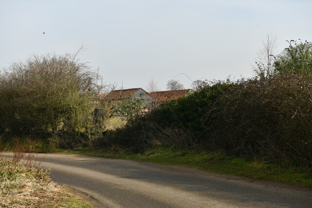
The Belt, Norfolk, also known as Wood or Forest Belt, is a picturesque area located in the county of Norfolk, England. Stretching over a vast expanse of land, it is renowned for its abundant woodland and natural beauty. The Belt is nestled between the bustling market town of Dereham and the charming village of Swanton Morley.
Covering an area of approximately 10 square miles, this woodland haven is a haven for nature lovers and outdoor enthusiasts alike. The Belt is home to a diverse range of flora and fauna, including ancient oak trees, vibrant wildflowers, and a variety of bird species. The peaceful atmosphere and tranquil surroundings make it a popular destination for those seeking solace and relaxation.
The Belt offers a myriad of recreational activities for visitors to indulge in. Hiking and walking trails crisscross the forest, allowing visitors to explore the area's natural wonders at their own pace. The forest also provides an ideal setting for birdwatching and wildlife spotting, with opportunities to catch sight of deer, rabbits, and even the occasional elusive fox.
For those with a penchant for history, The Belt boasts several archaeological sites of interest. Ancient burial mounds and remnants of settlements from the Iron Age have been discovered within the woodland, offering a glimpse into the area's rich past.
Overall, The Belt, Norfolk, is a captivating woodland retreat that offers a harmonious blend of natural beauty, recreational opportunities, and historical significance. Whether seeking a peaceful stroll through nature or an immersive exploration of Norfolk's heritage, The Belt is a destination that is sure to leave a lasting impression.
If you have any feedback on the listing, please let us know in the comments section below.
The Belt Images
Images are sourced within 2km of 52.782147/1.1466041 or Grid Reference TG1225. Thanks to Geograph Open Source API. All images are credited.


The Belt is located at Grid Ref: TG1225 (Lat: 52.782147, Lng: 1.1466041)
Administrative County: Norfolk
District: Broadland
Police Authority: Norfolk
What 3 Words
///boat.gosh.listen. Near Cawston, Norfolk
Nearby Locations
Related Wikis

Salle Park
Salle Park is a country house in Norfolk, England, near the village of Salle and about 10 miles (16 km) north-west of Norwich. The house is a Grade II...

Cawston railway station
Cawston was a railway station in Cawston, Norfolk. It was part of the Great Eastern Railway network for a large portion of its existence. It was on the...

Salle, Norfolk
Salle ( SAWL) is a small village and civil parish in the Broadland district, in the county of Norfolk, England. 1.5 miles (2.4 km) to the south is the...
Cawston, Norfolk
Cawston is a village and civil parish in the Broadland district of Norfolk, England. The village is approximately 11 miles (18 km) north of Norwich on...
Nearby Amenities
Located within 500m of 52.782147,1.1466041Have you been to The Belt?
Leave your review of The Belt below (or comments, questions and feedback).