Steggall's Wood

Wood, Forest in Suffolk Mid Suffolk

England

Steggall's Wood

Chandos Farm, Thornham Parva
Chandos Farm, Thornham Parva Credit: Chris Holifield

Steggall's Wood is a picturesque woodland located in the county of Suffolk, England. This enchanting forest covers an area of approximately 100 hectares and is nestled within the scenic countryside, making it a popular destination for nature lovers and outdoor enthusiasts.

The wood boasts a diverse range of tree species, including oak, beech, and birch, which create a captivating and ever-changing landscape throughout the year. The ancient trees stand tall and proud, providing a haven for an abundance of wildlife, including deer, squirrels, and a variety of bird species.

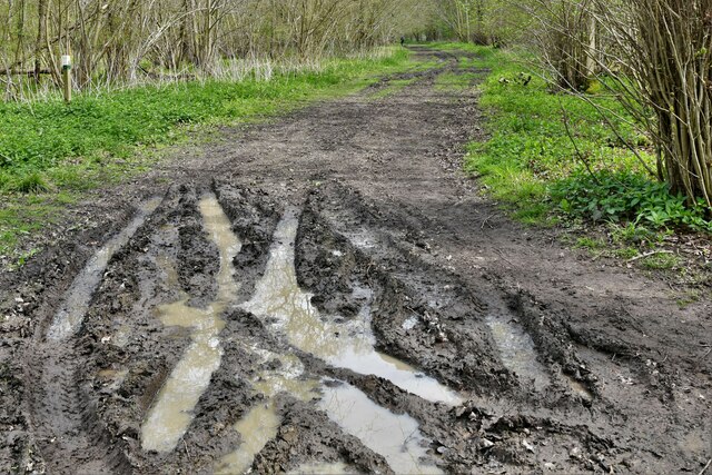
Visitors to Steggall's Wood can explore the numerous walking trails that wind their way through the forest, offering breathtaking views and an opportunity to immerse oneself in the tranquility of nature. The paths are well-maintained, making it accessible for all ages and fitness levels.

The wood is also home to a rich variety of flora, with carpets of bluebells and wildflowers adorning the forest floor during the spring months. This explosion of color creates a magical atmosphere, drawing in photographers and nature enthusiasts alike.

For those seeking a peaceful retreat, Steggall's Wood provides ample picnic spots and benches strategically placed to take advantage of the idyllic surroundings. The sound of bird song and the rustling of leaves in the gentle breeze add to the sense of serenity and escape from the hustle and bustle of everyday life.

Steggall's Wood truly offers a haven of natural beauty and tranquility, making it a must-visit destination for anyone seeking to reconnect with nature in the heart of Suffolk.

If you have any feedback on the listing, please let us know in the comments section below.

Steggall's Wood Images

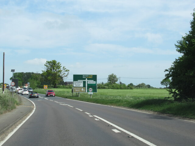
Images are sourced within 2km of 52.307707/1.1124323 or Grid Reference TM1272. Thanks to Geograph Open Source API. All images are credited.

Chandos Farm, Thornham Parva
A140 north approaching crossroads for Finningham and Thorndon
A140 north approaching B1117 junction
A140 north approaching new island at Yaxley
Thornham Walks: Track into various plantations
Thornham Walks, The Enchanted Wood: 'The Magic Faraway Tree'
Thornham Walks: Face on a tree stump
Thornham Walks: Track into the Connaught Plantation
Allan's Farmhouse <span class="nowrap"><a title="https://historicengland.org.uk/listing/the-list/list-entry/1032269?section=official-list-entry" rel="nofollow ugc noopener" href="https://historicengland.org.uk/listing/the-list/list-entry/1032269?section=official-list-entry">Link</a><img style="margin-left:2px;" alt="External link" title="External link - shift click to open in new window" src="https://s1.geograph.org.uk/img/external.png" width="10" height="10"/></span>
Allan's Farmhouse
Church of St Mary, Braiseworth <span class="nowrap"><a title="https://historicengland.org.uk/listing/the-list/list-entry/1032267?section=official-list-entry" rel="nofollow ugc noopener" href="https://historicengland.org.uk/listing/the-list/list-entry/1032267?section=official-list-entry">Link</a><img style="margin-left:2px;" alt="External link" title="External link - shift click to open in new window" src="https://s1.geograph.org.uk/img/external.png" width="10" height="10"/></span>
Church of St Mary, Braiseworth
Priory Farmhouse, Braiseworth <span class="nowrap"><a title="https://historicengland.org.uk/listing/the-list/list-entry/1180379?section=official-list-entry" rel="nofollow ugc noopener" href="https://historicengland.org.uk/listing/the-list/list-entry/1180379?section=official-list-entry">Link</a><img style="margin-left:2px;" alt="External link" title="External link - shift click to open in new window" src="https://s1.geograph.org.uk/img/external.png" width="10" height="10"/></span>
Priory Farmhouse, Braiseworth
Old Church Farmhouse, Braiseworth <span class="nowrap"><a title="https://historicengland.org.uk/listing/the-list/list-entry/1032275?section=official-list-entry" rel="nofollow ugc noopener" href="https://historicengland.org.uk/listing/the-list/list-entry/1032275?section=official-list-entry">Link</a><img style="margin-left:2px;" alt="External link" title="External link - shift click to open in new window" src="https://s1.geograph.org.uk/img/external.png" width="10" height="10"/></span>
Old Church Farmhouse, Braiseworth
Cows and calves in a field at Braiseworth
Former Church of St. Mary, Braiseworth <span class="nowrap"><a title="https://historicengland.org.uk/listing/the-list/list-entry/1032276?section=official-list-entry" rel="nofollow ugc noopener" href="https://historicengland.org.uk/listing/the-list/list-entry/1032276?section=official-list-entry">Link</a><img style="margin-left:2px;" alt="External link" title="External link - shift click to open in new window" src="https://s1.geograph.org.uk/img/external.png" width="10" height="10"/></span>
Former Church of St. Mary, Braiseworth
The Bull Auberge <span class="nowrap"><a title="https://historicengland.org.uk/listing/the-list/list-entry/1181752?section=official-list-entry" rel="nofollow ugc noopener" href="https://historicengland.org.uk/listing/the-list/list-entry/1181752?section=official-list-entry">Link</a><img style="margin-left:2px;" alt="External link" title="External link - shift click to open in new window" src="https://s1.geograph.org.uk/img/external.png" width="10" height="10"/></span>
The Bull Auberge
Tandem House
Tandem House
212 and 213 Bull Road, Thornham Parva <span class="nowrap"><a title="https://historicengland.org.uk/listing/the-list/list-entry/1181199" rel="nofollow ugc noopener" href="https://historicengland.org.uk/listing/the-list/list-entry/1181199">Link</a><img style="margin-left:2px;" alt="External link" title="External link - shift click to open in new window" src="https://s1.geograph.org.uk/img/external.png" width="10" height="10"/></span>
212 and 213 Bull Road, Thornham Parva
Church of St Mary, Thornham Parva <span class="nowrap"><a title="https://historicengland.org.uk/listing/the-list/list-entry/1285113?section=official-list-entry" rel="nofollow ugc noopener" href="https://historicengland.org.uk/listing/the-list/list-entry/1285113?section=official-list-entry">Link</a><img style="margin-left:2px;" alt="External link" title="External link - shift click to open in new window" src="https://s1.geograph.org.uk/img/external.png" width="10" height="10"/></span>
Church of St Mary, Thornham Parva
Show me another place!

Steggall's Wood is located at Grid Ref: TM1272 (Lat: 52.307707, Lng: 1.1124323)

Administrative County: Suffolk

District: Mid Suffolk

Police Authority: Suffolk

What 3 Words

///massaging.outsize.grows. Near Scole, Norfolk

Related Wikis

Major Farm Meadow

Major Farm Meadow is a 1.8-hectare (4.4-acre) biological Site of Special Scientific Interest south-west of Eye in Suffolk. This is one of the few surviving...

Pye Road

Pye Road is a Roman road running from the capital of the Iceni at Venta Icenorum (Caistor St Edmund near Norwich) to the original Roman provincial capital...

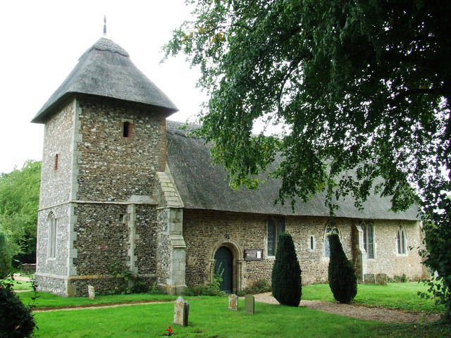
St Mary's Church, Thornham Parva

St Mary's Church is a medieval church in Thornham Parva, Suffolk, England. Much of the fabric dates from the 12th century, and it is a Grade I listed building...

Thornham Parva

Thornham Parva is a village and civil parish in the Mid Suffolk district of Suffolk in eastern England. Located to the north of sister village Thornham...

Have you been to Steggall's Wood?

Leave your review of Steggall's Wood below (or comments, questions and feedback).