Ian's Wood

Wood, Forest in Norfolk Broadland

England

Ian's Wood

Honingham: Blind Lane
Honingham: Blind Lane Credit: Michael Garlick

Ian's Wood is a charming forest located in Norfolk, England. It covers an area of approximately 50 acres and is known for its natural beauty and tranquility. The wood is named after Ian, a local resident who played a significant role in its conservation and management.

The wood is predominantly composed of a variety of native tree species, including oak, beech, birch, and ash. These trees provide a dense canopy that filters sunlight, creating a cool and shaded environment. The forest floor is covered in a thick layer of leaf litter, creating a rich habitat for a diverse range of plants and animals.

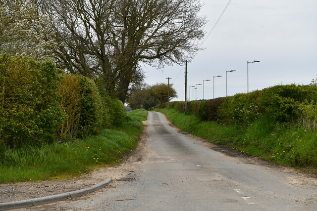
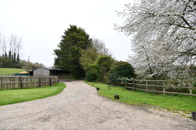
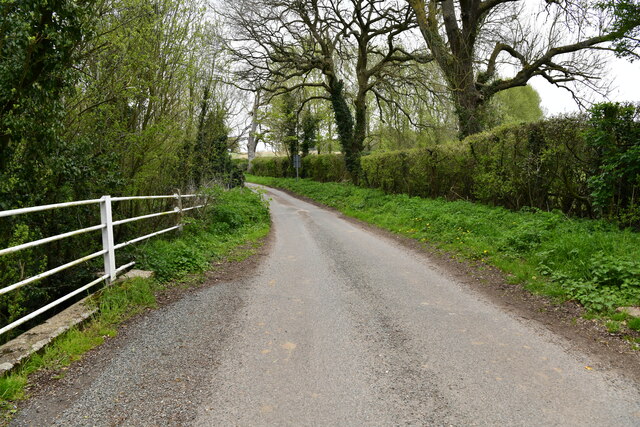
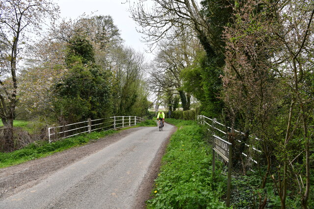
Walking through Ian's Wood offers visitors a chance to immerse themselves in nature. There are several well-maintained pathways that wind their way through the forest, allowing for easy exploration. Along these paths, visitors can encounter a plethora of wildlife, including squirrels, rabbits, and various bird species.

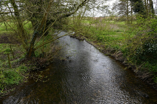
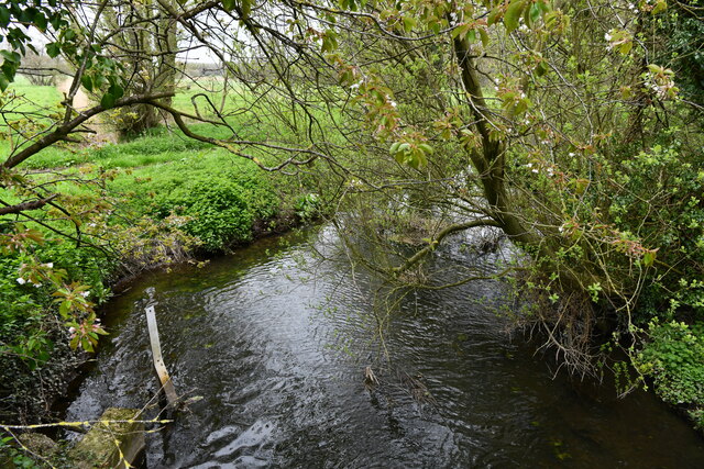
The wood is also home to a small stream that meanders through its heart. This babbling brook adds to the peaceful ambiance of the forest and provides a watering hole for the local wildlife.

Ian's Wood is a popular destination for nature lovers, hikers, and photographers alike. Its serene atmosphere and picturesque scenery make it an ideal spot for relaxation and recreation. Whether you're seeking a peaceful stroll or an opportunity to connect with nature, Ian's Wood offers a delightful experience for all.

If you have any feedback on the listing, please let us know in the comments section below.

Ian's Wood Images

Images are sourced within 2km of 52.648468/1.1178578 or Grid Reference TG1110. Thanks to Geograph Open Source API. All images are credited.

Honingham: Blind Lane
Easton: Food Enterprise Park
Honingham: Ian's Wood
Honingham: Car park for industrial estate
Barnham Broom: Track to Bickerston Cottage
Colton: Private farm access
Colton: 'The Old Post Office'
Colton: Church Lane
Colton: Church Lane
Colton: Crossroad
Colton: Crossroad
Colton: Colton Wood
Colton: Colton Wood
Colton: Barford Road
Barford: Track by the river
Barford: The River Yare from the road bridge over it
Barford: Bridge over the River Yare
Barford: The River Yare from the road bridge over it
Barford: Bridge over the River Yare
Barnham Broom Road Looking towards the A47.
Barnham Broom Road
Looking towards the A47.
An Artificial Lake Recently created alongside the road to Barnham Broom from the A47.
An Artificial Lake
Recently created alongside the road to Barnham Broom from the A47.
Show me another place!

Ian's Wood is located at Grid Ref: TG1110 (Lat: 52.648468, Lng: 1.1178578)

Administrative County: Norfolk

District: Broadland

Police Authority: Norfolk

What 3 Words

///glimmers.ghosts.strongman. Near Mattishall, Norfolk

Nearby Locations

Jane's Wood Ian's Wood

Related Wikis

Colton, Norfolk

Colton is a village and former civil parish, 8 miles (13 km) west of Norwich, now in the parish of Marlingford and Colton, in the South Norfolk district...

Marlingford and Colton

Marlingford and Colton, formerly Marlingford is a civil parish in the English county of Norfolk, made from the villages of Colton and Marlingford. It covers...

Honingham

Honingham is a village and civil parish in the English county of Norfolk, located 8 miles (13 km) to the west of Norwich along the A47 trunk road. It covers...

Honingham Hall

Honingham Hall was a large country house at Honingham in Norfolk. == History == The house was commissioned by Sir Thomas Richardson, Chief Justice of the...

Marlingford

Marlingford is a village and former civil parish, 6 miles (9.7 km) west of Norwich, now in the parish of Marlingford and Colton, in the South Norfolk district...

Easton, Norfolk

Easton is a village and civil parish in the English county of Norfolk. The village is located 6.2 miles (10.0 km) north-west of Norwich and 9 miles (14...

Barford, Norfolk

Barford is a village and civil parish in the English county of Norfolk, situated some 4 miles (6 km) north of Wymondham and 8 miles (13 km) west of Norwich...

East Tuddenham

East Tuddenham is a village in the English county of Norfolk. The village is located 5.6 miles (9.0 km) south-west of Dereham and 9.5 miles (15.3 km) north...

Nearby Amenities

Located within 500m of 52.648468,1.1178578
Colton
Place: village
Lat/Long: 52.6447396/1.1174555
village hall, adj
Naptan AtcoCode: 2900M021
Naptan Bearing: W
Naptan BusStopType: CUS
Naptan CommonName: village hall
Naptan Indicator: adj
Naptan Landmark: village hall
Naptan Locality: Colton
Naptan NaptanCode: nfodgdpt
Naptan ShortCommonName: village hall
Naptan Street: Norwich Road
Naptan Verified: no
Source: naptan_import
Lat/Long: 52.6453596/1.1184212
Faircroft, opp
Naptan AtcoCode: 2900M022
Naptan Bearing: N
Naptan BusStopType: CUS
Naptan CommonName: Faircroft
Naptan Indicator: opp
Naptan Locality: Colton
Naptan NaptanCode: nfodgdpw
Naptan Street: The Street
Naptan Verified: no
Source: naptan_import
Lat/Long: 52.6452317/1.1161055
village hall, opp
Naptan AtcoCode: 2900M023
Naptan Bearing: E
Naptan BusStopType: CUS
Naptan CommonName: village hall
Naptan Indicator: opp
Naptan Landmark: village hall
Naptan Locality: Colton
Naptan NaptanCode: nfodgdta
Naptan ShortCommonName: village hall
Naptan Street: Norwich Road
Naptan Verified: no
Source: naptan_import
Lat/Long: 52.6454274/1.1180948
Faircroft, adj
Naptan AtcoCode: 2900M026
Naptan Bearing: S
Naptan BusStopType: CUS
Naptan CommonName: Faircroft
Naptan Indicator: adj
Naptan Landmark: Faircroft
Naptan Locality: Colton
Naptan NaptanCode: nfodgdtj
Naptan Street: The Street
Naptan Verified: no
Source: naptan_import
Lat/Long: 52.6452606/1.1163737
Bench
Backrest: yes
Material: metal
Seats: 4
Lat/Long: 52.6454799/1.1164305
Waste Basket
Waste: dog_excrement
Lat/Long: 52.6454842/1.1165317
Post Box
Collection Times: Mo-Fr 17:15; Sa 10:45
Post Box Type: lamp
Ref: NR9 952
Royal Cypher: EIIR
Royal Cypher Wikidata: Q33102113
Lat/Long: 52.6454153/1.1183446
Board Type: notice
Information: board
Lat/Long: 52.6454833/1.1164844
Leisure: picnic_table
Lat/Long: 52.6451511/1.1184135
Defibrillator
Access: yes
Defibrillator Location: On outside wall of Colton Village Hall visible from road.
Emergency: defibrillator
Emergency Telephone Code: 999
Indoor: no
Opening Hours: 24/7
Operator: The Community Heartbeat Trust
Ref: CHT-10-316
Ref GB The Circuit: FE54B271-D547-463E-8FD0-B01F015DD2DC
Wheelchair: limited
Lat/Long: 52.6453031/1.1184154
Board Type: notice
Information: board
Tourism: information
Lat/Long: 52.6453043/1.1183574
Access: customers
Entrance: main
Wheelchair: yes
Lat/Long: 52.6453037/1.1183866
Leisure: playground
Lat/Long: 52.6450568/1.1184521
The data included in this document is from www.openstreetmap.org. The data is made available under ODbL.

Have you been to Ian's Wood?

Leave your review of Ian's Wood below (or comments, questions and feedback).