Mere Plantation

Wood, Forest in Suffolk Mid Suffolk

England

Mere Plantation

Bridleway towards Needham Market Looking south-west towards Creeting Hills.
Bridleway towards Needham Market Credit: Simon Mortimer

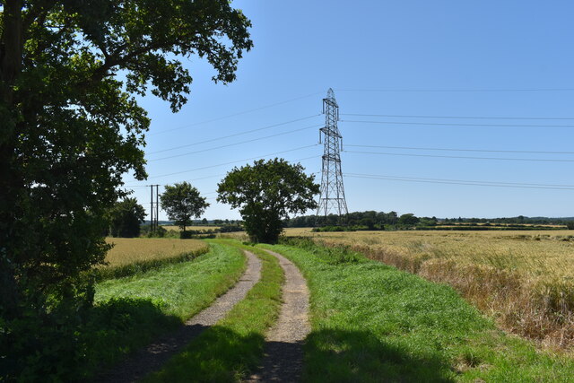
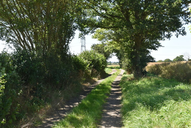
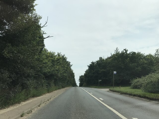
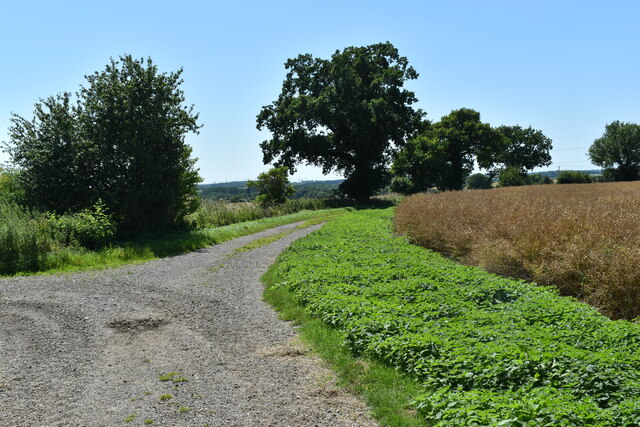
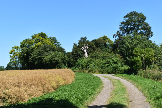
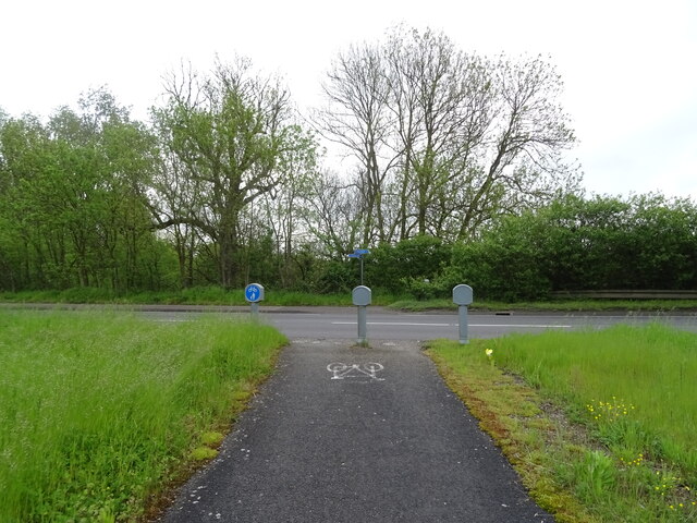
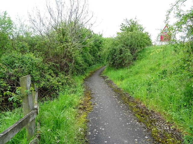
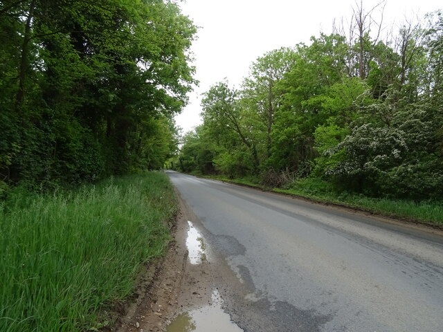
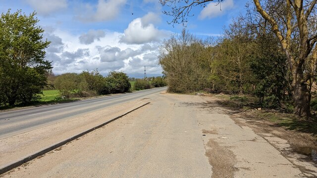
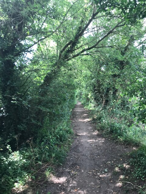
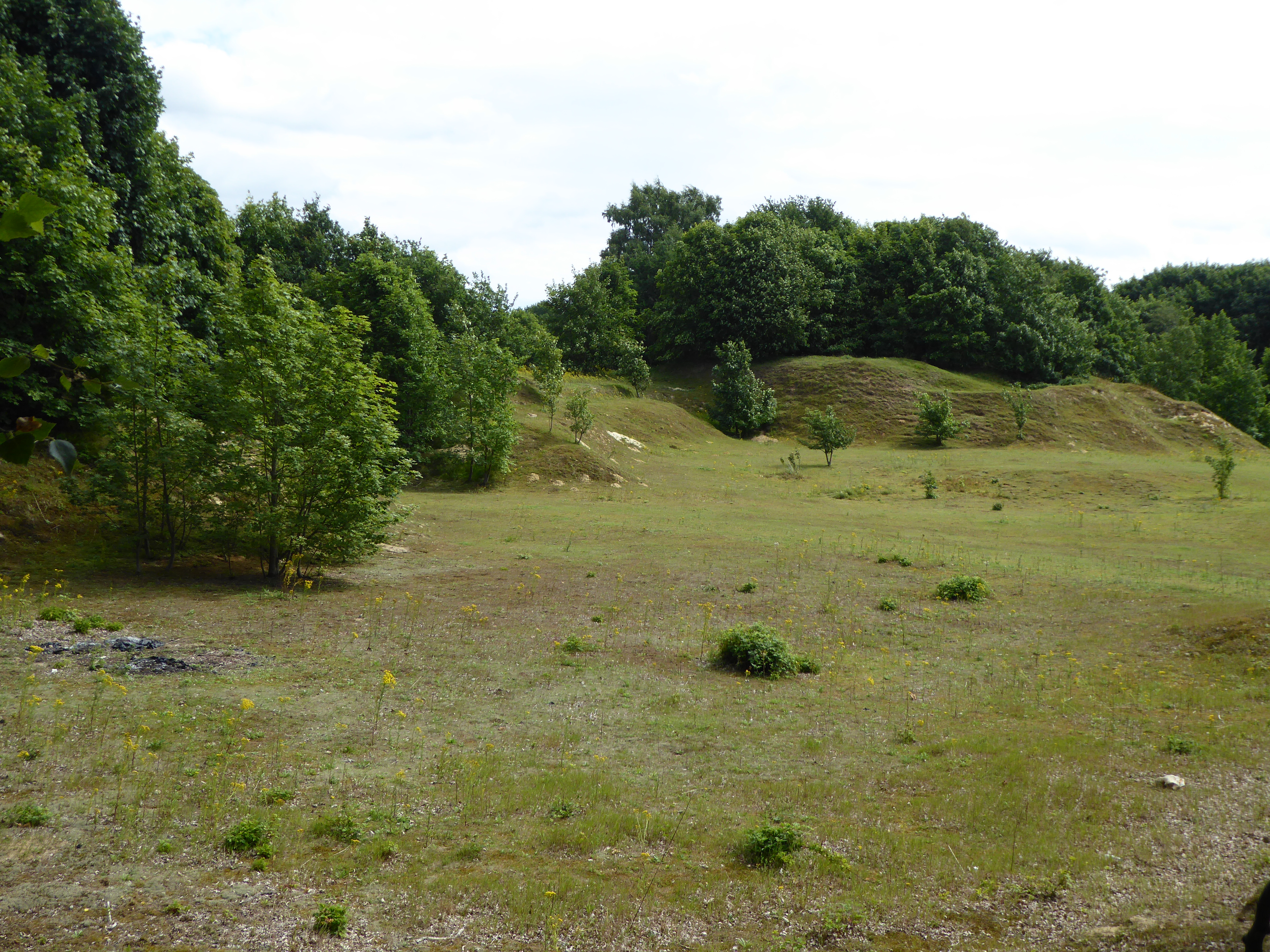
Mere Plantation is a scenic woodland located in Suffolk, England. Situated in the heart of the county, it covers an area of approximately 100 hectares and is renowned for its natural beauty and diverse range of plant and animal life. The plantation is part of a larger forested area and is bordered by a network of footpaths and trails, making it a popular destination for walkers, hikers, and nature enthusiasts.

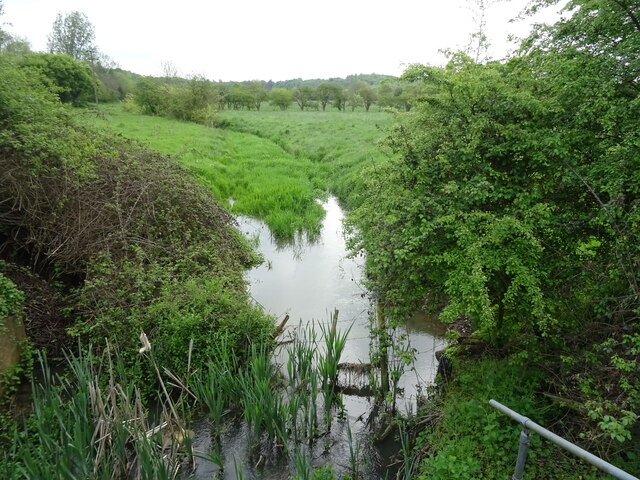
The woodland is characterized by its dense canopy of trees, predominantly consisting of native species such as oak, beech, and birch. These towering trees provide a habitat for a wide variety of wildlife, including deer, squirrels, and a plethora of bird species. Visitors to Mere Plantation can often spot buzzards soaring overhead or catch glimpses of rabbits darting through the undergrowth.

The plantation is also home to a rich diversity of plant life, with carpets of bluebells and primroses brightening the forest floor during springtime. In addition, ferns, mosses, and lichens thrive in the cool and moist conditions of the woodland, contributing to its enchanting atmosphere.

For those seeking a tranquil escape from the hustle and bustle of everyday life, Mere Plantation offers a peaceful retreat. The gentle rustling of leaves and the sweet scent of wildflowers provide a soothing backdrop to a leisurely stroll or a picnic amidst nature. Whether one wishes to immerse themselves in the tranquility of the forest or explore its hidden treasures, Mere Plantation is a captivating destination for all who appreciate the beauty of the natural world.

If you have any feedback on the listing, please let us know in the comments section below.

Mere Plantation Images

Images are sourced within 2km of 52.149922/1.0661592 or Grid Reference TM0954. Thanks to Geograph Open Source API. All images are credited.

Bridleway towards Needham Market Looking south-west towards Creeting Hills.
Bridleway towards Needham Market
Looking south-west towards Creeting Hills.
Bridleway towards Needham Market
Leaving Needham Market
Bridleway near Holt's Lane Looking south-west near the junction of the bridleway with Holt's Lane.
Bridleway near Holt's Lane
Looking south-west near the junction of the bridleway with Holt's Lane.
Bridleway near Holt's Lane Looking north-east towards the small plantation behind the Highwayman Inn.
Bridleway near Holt's Lane
Looking north-east towards the small plantation behind the Highwayman Inn.
Beacon Hill services Looking from the petrol station back along the entrance road; the motel is among trees to the left.
Beacon Hill services
Looking from the petrol station back along the entrance road; the motel is among trees to the left.
Beacon Hill services Looking from the petrol station back towards a small restaurant (the logos of Burger King and Greggs can just be made out) tucked inside the access road loop.
Beacon Hill services
Looking from the petrol station back towards a small restaurant (the logos of Burger King and Greggs can just be made out) tucked inside the access road loop.
A140 north at turning for B1078
A140 north at turning for Coddenham Green
National Cycle Route 51 Crossing the busy A140.
National Cycle Route 51
Crossing the busy A140.
Tributary of the River Gipping
National Cycle Route 51 Beside the A140 towards Ipswich.
National Cycle Route 51
Beside the A140 towards Ipswich.
Gatehouse to Shrubland Park
National Cycle Route 51 towards Ipswich
Lay-by on B1113 South of Needham Market
Needham Market FC
Needham Market FC
On The Causeway
On The Causeway
Field footpath
Field footpath
Show me another place!

Mere Plantation is located at Grid Ref: TM0954 (Lat: 52.149922, Lng: 1.0661592)

Administrative County: Suffolk

District: Mid Suffolk

Police Authority: Suffolk

What 3 Words

///matchbox.shelving.pass. Near Needham Market, Suffolk

Related Wikis

Needham Lake

Needham Lake is a 9.9 hectare Local Nature Reserve in Needham Market in Suffolk. It is owned and managed by Mid Suffolk District Council. It is a Regionally...

Needham Market railway station

Needham Market railway station is on the Great Eastern Main Line (GEML) in the East of England, serving the town of Needham Market, Suffolk. It is 77 miles...

Creeting St Mary Pits

Creeting St Mary Pits is a 5.4-hectare (13-acre) geological Site of Special Scientific Interest south Creeting St Mary in Suffolk, England. It is a Geological...

Creeting St Mary Windmill

Creeting St Mary Windmill is a Grade II listed dovecote at Creeting St Mary, Suffolk, England which has been restored. It was originally the body of a...

Darmsden

Darmsden is a hamlet and civil parish in the Mid Suffolk district of Suffolk, England. Located near the A14 road around 2 kilometres (1 mi) south of the...

Needham Market

Needham Market is a town in the Mid Suffolk district of Suffolk, England. Nearby villages include Barking, Darmsden, Badley and Creeting St Mary. The town...

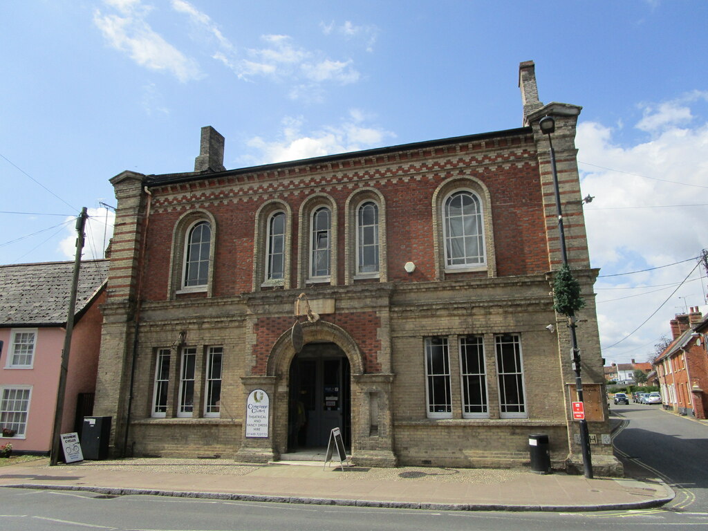
Old Town Hall, Needham Market

The Old Town Hall is a municipal building in the High Street in Needham Market, Suffolk, England. The building, which now accommodates an antiques centre...

Mid Suffolk

Mid Suffolk is a local government district in Suffolk, England. Its council was based in Needham Market until late 2017, and is currently sharing offices...

Nearby Amenities

Located within 500m of 52.149922,1.0661592
Bus Stop
Lion Barn Business Park
Bus: yes
Local Ref: adj
Naptan AtcoCode: 390040501
Naptan Bearing: SE
Naptan CommonName: Lion Barn Business Park
Naptan Landmark: Lion Barn Business Park
Naptan NaptanCode: sufgagmp
Naptan Street: B1113
Naptan Verified: no
Public Transport: platform
Source: naptan_import
Lat/Long: 52.1469517/1.0617657
Bus Stop
Lion Barn Business Park
Bus: yes
Local Ref: opp
Naptan AtcoCode: 390040502
Naptan Bearing: NW
Naptan CommonName: Lion Barn Business Park
Naptan Landmark: Lion Barn Business Park
Naptan NaptanCode: sufgagmt
Naptan Street: B1113
Naptan Verified: no
Public Transport: platform
Source: naptan_import
Lat/Long: 52.1468844/1.0616534
Jasper Lodge
Local Ref: adj
Naptan AtcoCode: 390040526
Naptan Bearing: SE
Naptan BusStopType: CUS
Naptan CommonName: Jasper Lodge
Naptan Landmark: Jasper Lodge
Naptan NaptanCode: sufgajag
Naptan Street: Flordon Road
Naptan Verified: no
Source: naptan_import
Lat/Long: 52.1537083/1.0659636
Jasper Lodge
Local Ref: opp
Naptan AtcoCode: 390040527
Naptan Bearing: NW
Naptan BusStopType: CUS
Naptan CommonName: Jasper Lodge
Naptan Landmark: Jasper Lodge
Naptan NaptanCode: sufgajaj
Naptan Street: Flordon Road
Naptan Verified: no
Source: naptan_import
Lat/Long: 52.1536829/1.0659034
Friends of the Lake
Artist Name: Ben Platt-Mills
Artwork Type: sculpture
Tourism: artwork
Lat/Long: 52.1509187/1.0606059
Power: pole
Lat/Long: 52.1512786/1.0615966
Lock: yes
Lat/Long: 52.150669/1.0623124
Lock: yes
Lat/Long: 52.1506887/1.0618697
Waterway: weir
Lat/Long: 52.1507844/1.0609184
Power: pole
Lat/Long: 52.1472293/1.0662317
Power: pole
Lat/Long: 52.1467166/1.0654847
Power: pole
Lat/Long: 52.1472853/1.0663149
Power: pole
Lat/Long: 52.1465578/1.0671437
Power: pole
Lat/Long: 52.1458385/1.0679376
Power: pole
Lat/Long: 52.1508805/1.0629434
Material: wood
Power: pole
Lat/Long: 52.152003/1.0606366
Veterinary
The Mustard Pot
Lat/Long: 52.1510744/1.0629868
Phone
Emergency: phone
Lat/Long: 52.1541688/1.0682031
Post Box
Operator: Royal Mail
Operator Wikidata: Q638098
Post Box Apertures: 2
Post Box Design: type_c
Post Box Type: pillar
Ref: IP6 8137;IP6 18137
Royal Cypher: EIIR
Royal Cypher Wikidata: Q33102113
Lat/Long: 52.1473146/1.0624974
Traffic Signals
Lat/Long: 52.146598/1.0627739
Traffic Signals
Traffic Signals: signal
Lat/Long: 52.1466622/1.062615
Access: private
Entrance: emergency
Lat/Long: 52.1474042/1.0636131
Street Lamp
Lat/Long: 52.1472426/1.0636662
Access: private
Entrance: service
Lat/Long: 52.1474052/1.0636826
Access: private
Entrance: main
Lat/Long: 52.1473846/1.0637295
Man Made: flagpole
Lat/Long: 52.1472049/1.0638134
Man Made: flagpole
Lat/Long: 52.1471949/1.0638405
Entrance: main
Lat/Long: 52.1472163/1.0640129
Access: private
Entrance: service
Lat/Long: 52.1470685/1.0643441
Access: private
Entrance: yes
Lat/Long: 52.1471986/1.0641524
Access: private
Entrance: service
Lat/Long: 52.1471464/1.064184
Access: private
Entrance: yes
Lat/Long: 52.1471041/1.0642709
Access: private
Entrance: main
Lat/Long: 52.1470439/1.0643947
Access: private
Entrance: emergency
Lat/Long: 52.1474237/1.0638983
Power: pole
Lat/Long: 52.1473438/1.0642544
Power: pole
Lat/Long: 52.1470457/1.0648611
Entrance: main
Lat/Long: 52.1466085/1.0649083
Entrance: service
Lat/Long: 52.1466793/1.0650938
Street Lamp
Lat/Long: 52.1467666/1.064616
Entrance: yes
Lat/Long: 52.1466506/1.0650493
Turning Circle
Lat/Long: 52.1490894/1.07238
Ncn Milepost: dudgeon
Note: Sustrans milepost for NCN 51, but NCN 51 in OSM doesn't go past it!
Lat/Long: 52.1503617/1.0594357
Bicycle Parking
Bicycle Parking: stands
Capacity: 10
Covered: no
Lat/Long: 52.1503901/1.0593405
Defibrillator
Defibrillator Location: On exterior wall of Needham Lake toilet block, facing the lake.
Emergency: defibrillator
Ref GB The Circuit: 28063AF2-3D69-47EA-A00C-AFEF00D3B6C4
Lat/Long: 52.1504197/1.0591929
Bicycle Repair Station
Service Bicycle Pump: yes
Service Bicycle Stand: yes
Service Bicycle Tools: yes
Lat/Long: 52.1513519/1.0614341
Bicycle Parking
Access: yes
Bicycle Parking: stands
Capacity: 16
Colour: silver
Covered: no
Fee: no
Supervised: no
Lat/Long: 52.151376/1.061407
Charging Station
Bicycle: no
Brand: evolt
Motorcar: yes
Operator: Mid Suffolk District Council
Scooter: no
Socket Chademo: 1
Socket Chademo Output: 50 kW
Socket Type1 Combo: 1
Socket Type1 Combo Output: 50 kW
Socket Type2 Cable: 1
Socket Type2 Cable Output: 43 kW
Truck: no
Lat/Long: 52.151457/1.0614024
Board Type: history
Information: board
Tourism: information
Lat/Long: 52.1507164/1.0620931
Bench
Backrest: yes
Material: stone
Seats: 12
Lat/Long: 52.1507287/1.0620616
Bicycle Rental
Website: https://eezybike.co.uk/
Lat/Long: 52.151336/1.0614493
Entrance: yes
Lat/Long: 52.1511089/1.0615279
Leisure: picnic_table
Material: wood
Lat/Long: 52.1510344/1.0618128
Leisure: picnic_table
Material: wood
Lat/Long: 52.1510789/1.0618617
Leisure: picnic_table
Material: wood
Lat/Long: 52.1509978/1.061497
Leisure: picnic_table
Material: wood
Lat/Long: 52.1509682/1.061568
Bench
Backrest: yes
Material: wood
Lat/Long: 52.1510064/1.0611385
Leisure: picnic_table
Material: wood
Lat/Long: 52.1515109/1.0606688
Leisure: picnic_table
Material: wood
Lat/Long: 52.1514533/1.0607345
Leisure: picnic_table
Material: wood
Lat/Long: 52.1513833/1.0608056
Leisure: picnic_table
Material: wood
Lat/Long: 52.151608/1.0607761
Leisure: picnic_table
Material: wood
Lat/Long: 52.1515413/1.0608003
Leisure: picnic_table
Material: wood
Lat/Long: 52.1514862/1.0608459
Leisure: picnic_table
Material: wood
Lat/Long: 52.1514302/1.0609203
Leisure: picnic_table
Material: wood
Lat/Long: 52.1513751/1.0610189
Leisure: picnic_table
Material: wood
Lat/Long: 52.1512344/1.061324
Leisure: picnic_table
Material: wood
Lat/Long: 52.1511809/1.0612153
Leisure: picnic_table
Material: wood
Lat/Long: 52.1512681/1.0612415
Leisure: picnic_table
Material: wood
Lat/Long: 52.1512286/1.0611583
The data included in this document is from www.openstreetmap.org. The data is made available under ODbL.

Have you been to Mere Plantation?

Leave your review of Mere Plantation below (or comments, questions and feedback).