The Oaks

Wood, Forest in Kent Canterbury

England

The Oaks

West Cliff Looking at houses on West Cliff.
West Cliff Credit: DS Pugh

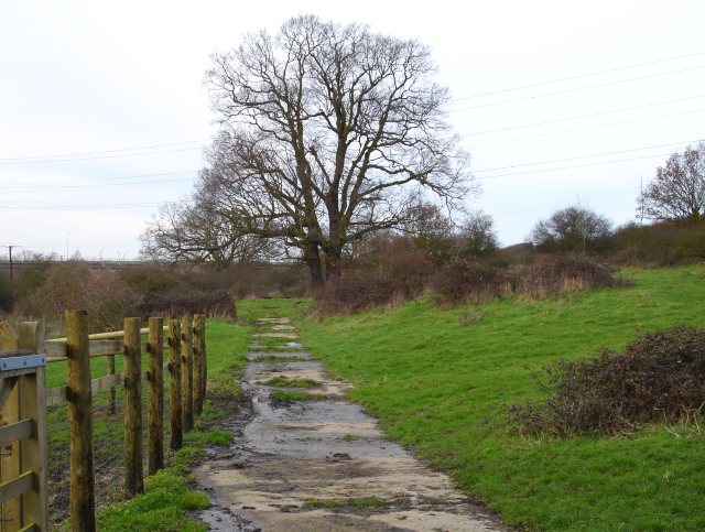
The Oaks, located in the county of Kent, England, is a scenic woodland area known for its beautiful oak trees and lush forest landscape. Situated in the southeastern part of the country, The Oaks is a popular destination for nature lovers and outdoor enthusiasts.

Covering an expansive area, The Oaks boasts an impressive collection of oak trees, which are known for their majestic presence and longevity. These trees provide a dense canopy, creating a serene and tranquil atmosphere for visitors to explore. The forest floor is covered with a diverse range of flora, including ferns, wildflowers, and mosses, adding to the enchanting ambiance of the area.

The Oaks offers a variety of walking trails and paths, allowing visitors to immerse themselves in the natural beauty of the surroundings. These trails wind through the forest, offering glimpses of wildlife such as deer, rabbits, and various bird species. The peacefulness of The Oaks makes it an ideal location for birdwatching and nature photography.

Aside from its natural beauty, The Oaks also has historical significance. It is believed that the forest has been in existence for centuries, and it has witnessed various historical events throughout the years. The area is dotted with ancient ruins and remnants of structures, serving as a reminder of the past.

In summary, The Oaks in Kent is a picturesque woodland area renowned for its oak trees, diverse wildlife, and peaceful atmosphere. Whether visitors are seeking a peaceful stroll, a chance to connect with nature, or a glimpse into the area's rich history, The Oaks offers something for everyone.

If you have any feedback on the listing, please let us know in the comments section below.

The Oaks Images

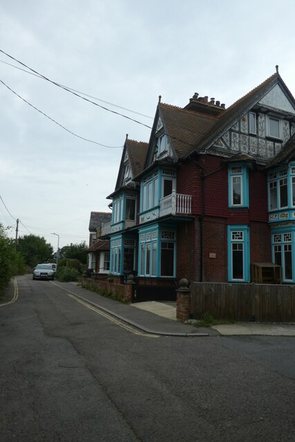
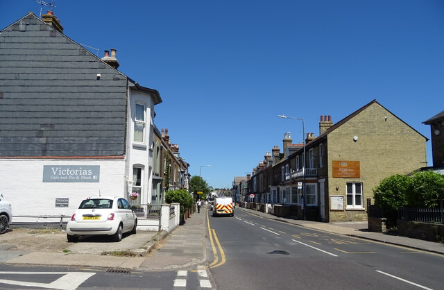
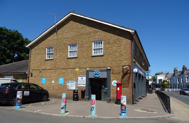
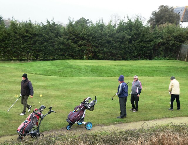
Images are sourced within 2km of 51.338585/1.0113328 or Grid Reference TR0964. Thanks to Geograph Open Source API. All images are credited.

West Cliff Looking at houses on West Cliff.
West Cliff
Looking at houses on West Cliff.
Old houses on Canterbury Road, Whitstable
Joy Lane, Whitstable
The Two Brewers, Whitstable On Canterbury Road.
See <a href="https://www.geograph.org.uk/photo/7223454">TR1065 : Sign for the Two Brewers, Whitstable</a> for sign.
The Two Brewers, Whitstable
On Canterbury Road. See TR1065 : Sign for the Two Brewers, Whitstable for sign.
Sign for the Two Brewers, Whitstable See <a href="https://www.geograph.org.uk/photo/7223451">TR1065 : The Two Brewers, Whitstable</a> for context.
Sign for the Two Brewers, Whitstable
Canterbury Road (B2205)
Clapboard houses on Canterbury Road
George V postbox on Canterbury Road, Whitstable Postbox No. CT5 92.
See <a href="https://www.geograph.org.uk/photo/7224136">TR1065 : Co-op on Canterbury Road, Whitstable</a> for context.
George V postbox on Canterbury Road, Whitstable
Postbox No. CT5 92. See TR1065 : Co-op on Canterbury Road, Whitstable for context.
Co-op on Canterbury Road, Whitstable Showing position of Postbox No. CT5 92.
See <a href="https://www.geograph.org.uk/photo/7224134">TR1065 : George V postbox on Canterbury Road, Whitstable</a> for postbox.
Co-op on Canterbury Road, Whitstable
Showing position of Postbox No. CT5 92. See TR1065 : George V postbox on Canterbury Road, Whitstable for postbox.
Former Toll House, B2205, Whitstable On the Junction with Joy Lane. This view is across Borstal Hill (B2205). The building has been known as "Tollgate Stores" at some point, but lacks a name currently. It served the Whitstable Turnpike Trust up to the mid 19ᵗʰ C.
A view of the property looking down Borstal Hill is <a href="https://www.geograph.org.uk/photo/5317123">TR1065 : Joy Lane at the junction of Canterbury Road</a>.

Grade II listed Nᴼ. 1084965 <span class="nowrap"><a title="https://historicengland.org.uk/listing/the-list/list-entry/1084965" rel="nofollow ugc noopener" href="https://historicengland.org.uk/listing/the-list/list-entry/1084965">Link</a><img style="margin-left:2px;" alt="External link" title="External link - shift click to open in new window" src="https://s1.geograph.org.uk/img/external.png" width="10" height="10"/></span>

Milestone Society National ID: KE.WHI
Former Toll House, B2205, Whitstable
On the Junction with Joy Lane. This view is across Borstal Hill (B2205). The building has been known as "Tollgate Stores" at some point, but lacks a name currently. It served the Whitstable Turnpike Trust up to the mid 19ᵗʰ C. A view of the property looking down Borstal Hill is TR1065 : Joy Lane at the junction of Canterbury Road. Grade II listed Nᴼ. 1084965 LinkExternal link Milestone Society National ID: KE.WHI
Whitstable and Seasalter Golf Club, Whitstable Island Wall in the background.
Whitstable and Seasalter Golf Club, Whitstable
Island Wall in the background.
West Cliff Footpath, Whitstable North of the railway line and south of Whitstable and Seasalter Golf Course.
West Cliff Footpath, Whitstable
North of the railway line and south of Whitstable and Seasalter Golf Course.
A seat for golf lovers, Whitstable A seat with a good view of Whitstable and Seasalter Golf course from West Cliff footpath.
A seat for golf lovers, Whitstable
A seat with a good view of Whitstable and Seasalter Golf course from West Cliff footpath.
Path across the golf course, Whitstable Running across the centre of Whitstable and Seasalter Golf Course between West Cliff and Island Wall.
Path across the golf course, Whitstable
Running across the centre of Whitstable and Seasalter Golf Course between West Cliff and Island Wall.
Whitstable and Seasalter Golf Course, Whitstable The crossing  point for golfers over the footpath that runs across the centre of the course.
Whitstable and Seasalter Golf Course, Whitstable
The crossing point for golfers over the footpath that runs across the centre of the course.
Golfers, Whitstable On the Whitstable and  Seasalter Golf Course.
Golfers, Whitstable
On the Whitstable and Seasalter Golf Course.
Golfers, Whitstable On the Whitstable and  Seasalter Golf Course.
Golfers, Whitstable
On the Whitstable and Seasalter Golf Course.
Footpath, Whitstable By the golf course, leading to Island Wall.
Footpath, Whitstable
By the golf course, leading to Island Wall.
Show me another place!

The Oaks is located at Grid Ref: TR0964 (Lat: 51.338585, Lng: 1.0113328)

Administrative County: Kent

District: Canterbury

Police Authority: Kent

What 3 Words

///homecare.annoys.besotted. Near Whitstable, Kent

Nearby Locations

The Oaks

Related Wikis

Foxes Cross Bottom

Foxes Cross Bottom is a 4-hectare (9.9-acre) Local Nature Reserve north-west of Whitstable in Kent. It is owned and managed by Canterbury City Council...

Duncan Down

Duncan Down is an open, public, area to the south west of Whitstable and is the largest village green in the United Kingdom. It is a 21 hectare (52 acre...

Black Mill, Whitstable

Black Mill, or Borstal Hill Mill is a smock mill in Whitstable, Kent, England that was built in 1815. It is now a part of a private residence at the end...

Seasalter

Seasalter is a village (and district council ward) in the Canterbury District of Kent, England. Seasalter is on the north coast of Kent, between the towns...

Nearby Amenities

Located within 500m of 51.338585,1.0113328
Motorway Junction
Clapham Hill
Lat/Long: 51.3371018/1.0048875
Crossing
Crossing Island: yes
Crossing Markings: yes
Crossing Signals: no
Tactile Paving: yes
Lat/Long: 51.3417328/1.0116872
Traffic Calming: table
Lat/Long: 51.341961/1.010555
Traffic Calming: table
Lat/Long: 51.3429872/1.01275
Mini Roundabout
Direction: clockwise
Lat/Long: 51.3426895/1.0125577
Traffic Calming: table
Lat/Long: 51.3422441/1.0115103
Mini Roundabout
Direction: clockwise
Lat/Long: 51.3420155/1.0089118
Post Box
Brand: Royal Mail
Brand Wikidata: Q638098
Collection Times: Mo-Fr 09:00; Sa 07:00
Operator: Royal Mail
Operator Wikidata: Q638098
Post Box Mounting: metal_post
Post Box Type: lamp
Postal Code: CT5
Ref: CT5 398
Royal Cypher: EIIR
Royal Cypher Wikidata: Q33102113
Source: survey
Lat/Long: 51.342771/1.0125112
Crossing
Crossing: unmarked
Tactile Paving: yes
Lat/Long: 51.3423123/1.0128031
Crossing
Crossing: unmarked
Tactile Paving: yes
Lat/Long: 51.3423283/1.0129814
Turning Circle
Lat/Long: 51.3403227/1.0072199
Turning Circle
Lat/Long: 51.3402629/1.007942
Traffic Calming: table
Lat/Long: 51.3414265/1.0082527
Traffic Calming: table
Lat/Long: 51.3413764/1.0084348
Give Way
Direction: forward
Lat/Long: 51.3380719/1.0067672
Motorway Junction
Lat/Long: 51.3384503/1.0072086
Crossing
Crossing: unmarked
Tactile Paving: yes
Lat/Long: 51.3419364/1.0130039
Crossing
Crossing: unmarked
Tactile Paving: yes
Lat/Long: 51.3419207/1.0128981
Bicycle Parking
Bicycle Parking: stands
Capacity: 12
Check Date Capacity: 2023-05-15
Covered: no
Source: survey
Lat/Long: 51.3408002/1.0116995
Bicycle Parking
Bicycle Parking: stands
Capacity: 12
Check Date Capacity: 2023-05-15
Covered: no
Source: survey
Lat/Long: 51.3407661/1.0129243
Bicycle Parking
Bicycle Parking: stands
Capacity: 6
Check Date: 2023-05-15
Covered: no
Lat/Long: 51.3418515/1.0135165
Bicycle Parking
Bicycle Parking: stands
Capacity: 10
Check Date Capacity: 2023-05-15
Covered: yes
Cyclestreets Id: 26742
Lat/Long: 51.3417223/1.0135341
Pharmacy
Estuary View Pharmacy
Lat/Long: 51.3417743/1.0133554
Barrier: swing_gate
Lat/Long: 51.3397355/1.0091422
Crossing
Crossing: unmarked
Tactile Paving: yes
Lat/Long: 51.3419522/1.0126819
Crossing
Crossing: unmarked
Tactile Paving: yes
Lat/Long: 51.3420203/1.0126469
Crossing
Crossing: uncontrolled
Crossing Island: yes
Tactile Paving: yes
Lat/Long: 51.3420237/1.0138819
Crossing
Crossing: unmarked
Tactile Paving: yes
Lat/Long: 51.3420546/1.0132827
Crossing
Crossing: unmarked
Tactile Paving: yes
Lat/Long: 51.3421381/1.0133114
Traffic Calming: table
Lat/Long: 51.3424138/1.0101
Give Way
Direction: forward
Lat/Long: 51.3394206/1.0081104
Crossing
Crossing: uncontrolled
Crossing Ref: zebra
Lat/Long: 51.3413343/1.012788
Communication Microwave: no
Communication Mobile Phone: yes
Man Made: mast
Operator: O2
Tower Type: communication
Lat/Long: 51.3407153/1.0141918
Gate
Barrier: kissing_gate
Bicycle: no
Foot: yes
Horse: no
Motor Vehicle: no
Lat/Long: 51.3398493/1.0130602
Barrier: kissing_gate
Lat/Long: 51.3367887/1.0082045
Barrier: kissing_gate
Lat/Long: 51.3354255/1.0089566
Barrier: kissing_gate
Lat/Long: 51.3388966/1.0102866
Barrier: kissing_gate
Lat/Long: 51.3388322/1.0084002
Communication Mobile Phone: yes
Man Made: mast
Operator: O2
Tower Type: communication
Lat/Long: 51.3373863/1.0139408
Crossing
Crossing: uncontrolled
Crossing Ref: zebra
Tactile Paving: yes
Lat/Long: 51.3412136/1.0130361
Crossing
Crossing: unmarked
Crossing Island: no
Kerb: lowered
Tactile Paving: yes
Lat/Long: 51.3419924/1.0160194
Entrance: main
Lat/Long: 51.3416677/1.0133262
Entrance: service
Lat/Long: 51.341404/1.0130469
Entrance: exit
Lat/Long: 51.3412528/1.016056
Entrance: main
Lat/Long: 51.3412541/1.0150359
Bicycle Parking
Bicycle Parking: stands
Capacity: 8
Covered: yes
Lat/Long: 51.3409987/1.016113
Bicycle Parking
Bicycle Parking: stands
Capacity: 8
Colour: silver
Covered: no
Cyclestreets Id: 200340
Material: metal
Lat/Long: 51.3412491/1.0153174
Bicycle Parking
Bicycle Parking: stands
Capacity: 16
Covered: no
Lat/Long: 51.3412645/1.0148336
Entrance: main
Lat/Long: 51.3412635/1.0146658
Entrance: main
Lat/Long: 51.3412476/1.0160393
Give Way
Direction: forward
Lat/Long: 51.3394851/1.0079319
Give Way
Direction: forward
Lat/Long: 51.3395534/1.0081581
Bus Stop
Estuary View Medical Centre
Bench: no
Bin: no
Bus: yes
Lit: yes
Naptan AtcoCode: 2400102664
Naptan Bearing: W
Naptan CommonName: Estuary View Medical Centre
Naptan Indicator: o/s
Naptan NaptanCode: kntjaptp
Naptan PlusbusZoneRef: HRNEBAY
Naptan Street: Thanet Way
Naptan Verified: no
Public Transport: platform
Shelter: yes
Surface: grass
Tactile Paving: no
Lat/Long: 51.341982/1.0134463
Crossing
Crossing: uncontrolled
Crossing Ref: zebra
Lat/Long: 51.3413567/1.0152372
Crossing
Crossing: uncontrolled
Crossing Ref: zebra
Tactile Paving: yes
Lat/Long: 51.3412926/1.0163571
Crossing
Crossing: uncontrolled
Crossing Ref: zebra
Tactile Paving: yes
Lat/Long: 51.3413432/1.0159994
Crossing
Crossing: uncontrolled
Crossing Ref: zebra
Tactile Paving: yes
Lat/Long: 51.3416245/1.0160232
Bicycle Parking
Bicycle Parking: stands
Capacity: 6
Covered: no
Lat/Long: 51.3412566/1.0166068
Generator Method: photovoltaic
Generator Solar Modules: 14
Generator Source: solar
Generator Type: solar_photovoltaic_panel
Location: roof
Power: generator
Lat/Long: 51.3423491/1.0086836
Generator Method: photovoltaic
Generator Orientation: 122
Generator Solar Modules: 4
Generator Source: solar
Generator Type: solar_photovoltaic_panel
Location: roof
Power: generator
Lat/Long: 51.3425057/1.0098222
Generator Method: photovoltaic
Generator Orientation: 302
Generator Solar Modules: 10
Generator Source: solar
Generator Type: solar_photovoltaic_panel
Location: roof
Power: generator
Lat/Long: 51.3425292/1.0097645
Generator Method: photovoltaic
Generator Orientation: 135
Generator Solar Modules: 14
Generator Source: solar
Generator Type: solar_photovoltaic_panel
Location: roof
Power: generator
Lat/Long: 51.3423541/1.0105155
Generator Method: photovoltaic
Generator Orientation: 160
Generator Solar Modules: 17
Generator Source: solar
Generator Type: solar_photovoltaic_panel
Location: roof
Power: generator
Lat/Long: 51.3421304/1.0121785
Mariner's View
Place: suburb
Lat/Long: 51.3422736/1.0092657
Grit Bin
Ref: CA-216
Lat/Long: 51.3419632/1.0138063
Generator Method: photovoltaic
Generator Solar Modules: 16
Generator Source: solar
Generator Type: solar_photovoltaic_panel
Location: roof
Power: generator
Lat/Long: 51.340635/1.0078488
Charging Station
Lat/Long: 51.3412901/1.0119358
Bicycle Parking
Bicycle Parking: stands
Capacity: 6
Colour: black
Covered: no
Cyclestreets Id: 201187
Material: metal
Lat/Long: 51.3414284/1.0122375
Entrance: main
Lat/Long: 51.34144/1.0122852
Generator Method: photovoltaic
Generator Source: solar
Generator Type: solar_photovoltaic_panel
Location: roof
Power: generator
Lat/Long: 51.3389201/1.0043022
Generator Method: photovoltaic
Generator Source: solar
Generator Type: solar_photovoltaic_panel
Location: roof
Power: generator
Lat/Long: 51.3389846/1.0048775
The data included in this document is from www.openstreetmap.org. The data is made available under ODbL.

Have you been to The Oaks?

Leave your review of The Oaks below (or comments, questions and feedback).