Capon Wood

Wood, Forest in Kent Ashford

England

Capon Wood

Richdore Road, Sole Street Like Minster, there are also two Sole Streets in Kent. This one is barely discernible and unlike the other one has no station.
Richdore Road, Sole Street Credit: David Howard

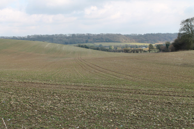
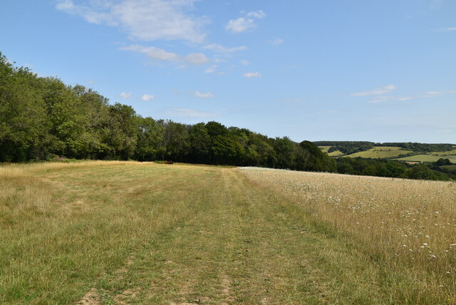
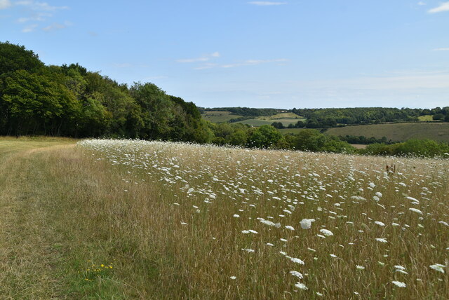
Capon Wood, located in Kent, England, is a serene and picturesque forest that spans an area of approximately 100 acres. It is situated near the village of Capel-le-Ferne, just a few miles south of the bustling city of Folkestone. The wood is a popular destination for nature lovers and outdoor enthusiasts, providing a tranquil escape from the fast-paced urban life.

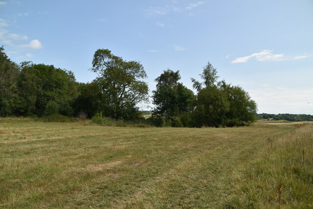
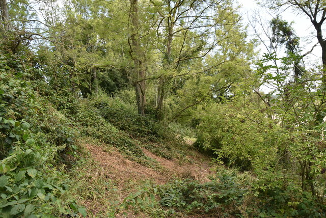
Capon Wood boasts a diverse range of flora and fauna, with ancient oak and beech trees dominating the landscape. The forest floor is adorned with a carpet of bluebells during the spring, creating a breathtaking sight for visitors. The woodland is also home to a variety of wildlife, including deer, foxes, badgers, and numerous species of birds.

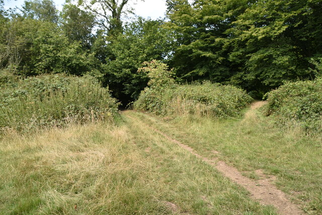
The wood offers a network of well-maintained footpaths and trails, allowing visitors to explore its beauty at their own pace. Hikers and walkers can choose from a range of routes, from short leisurely strolls to more challenging hikes. The wood is also a popular spot for picnickers and families, with designated areas providing ample space to relax and enjoy the surroundings.

Capon Wood is not only a haven for nature enthusiasts but also plays a vital role in the conservation of the local ecosystem. The forest is carefully managed to preserve its natural heritage, and ongoing initiatives are in place to protect and enhance its biodiversity.

Overall, Capon Wood in Kent offers a tranquil and enchanting experience for visitors, where they can immerse themselves in the beauty of nature and reconnect with the great outdoors.

If you have any feedback on the listing, please let us know in the comments section below.

Capon Wood Images

Images are sourced within 2km of 51.192366/0.9943271 or Grid Reference TR0947. Thanks to Geograph Open Source API. All images are credited.

Richdore Road, Sole Street Like Minster, there are also two Sole Streets in Kent. This one is barely discernible and unlike the other one has no station.
Richdore Road, Sole Street
Like Minster, there are also two Sole Streets in Kent. This one is barely discernible and unlike the other one has no station.
Road to Grandacre Farm
Junction of Woods Hill and Whiteacre Lane Heading towards Waltham.
Junction of Woods Hill and Whiteacre Lane
Heading towards Waltham.
Kake Street, Waltham Whence Kake?
Kake Street, Waltham
Whence Kake?
Junction of Richdore Road and Woods Hill
Unnamed Lane from Anvil Green
Field off Whiteacre Lane The first signs of growth are seen in this field.
Field off Whiteacre Lane
The first signs of growth are seen in this field.
Bend in lane through Doves Wood Although this looks like a junction on the map, it appears to be a bend to the right. confused further by fallen leaves on the road and a private track heading off left.
Bend in lane through Doves Wood
Although this looks like a junction on the map, it appears to be a bend to the right. confused further by fallen leaves on the road and a private track heading off left.
Stour Valley Walk The Stour Valley Walk is a 58 mile (93km) route through the Low Weald and North Downs, giving you access to some the most attractive parts of East Kent. Rolling grassland, woods, marshes, peat bog, orchards and picturesque villages make this a memorable journey which can be completed over a long weekend or in shorter sections. The symbol of the Stour Valley Walk is the heron.
See <span class="nowrap"><a title="http://www.kent.gov.uk/leisure-and-culture/explore-kent/walking/stour-valley-walk.htm" rel="nofollow ugc noopener" href="http://www.kent.gov.uk/leisure-and-culture/explore-kent/walking/stour-valley-walk.htm">Link</a><img style="margin-left:2px;" alt="External link" title="External link - shift click to open in new window" src="https://s1.geograph.org.uk/img/external.png" width="10" height="10"/></span> for more details.
Stour Valley Walk
The Stour Valley Walk is a 58 mile (93km) route through the Low Weald and North Downs, giving you access to some the most attractive parts of East Kent. Rolling grassland, woods, marshes, peat bog, orchards and picturesque villages make this a memorable journey which can be completed over a long weekend or in shorter sections. The symbol of the Stour Valley Walk is the heron. See LinkExternal link for more details.
Part of Marriage Wood A mainly Chestnut woodland located on the North Downs NE of Wye. The woodland has been extensively coppiced. It contains a Tumulus and the Stour Valley Walk passes through the woods.
Part of Marriage Wood
A mainly Chestnut woodland located on the North Downs NE of Wye. The woodland has been extensively coppiced. It contains a Tumulus and the Stour Valley Walk passes through the woods.
Gate, Stour Valley Walk The Stour Valley Walk is a 58 mile (93km) route through the Low Weald and North Downs, giving you access to some the most attractive parts of East Kent. Rolling grassland, woods, marshes, peat bog, orchards and picturesque villages make this a memorable journey which can be completed over a long weekend or in shorter sections. The symbol of the Stour Valley Walk is the heron.
See <span class="nowrap"><a title="http://www.kent.gov.uk/leisure-and-culture/explore-kent/walking/stour-valley-walk.htm" rel="nofollow ugc noopener" href="http://www.kent.gov.uk/leisure-and-culture/explore-kent/walking/stour-valley-walk.htm">Link</a><img style="margin-left:2px;" alt="External link" title="External link - shift click to open in new window" src="https://s1.geograph.org.uk/img/external.png" width="10" height="10"/></span> for more details.
Gate, Stour Valley Walk
The Stour Valley Walk is a 58 mile (93km) route through the Low Weald and North Downs, giving you access to some the most attractive parts of East Kent. Rolling grassland, woods, marshes, peat bog, orchards and picturesque villages make this a memorable journey which can be completed over a long weekend or in shorter sections. The symbol of the Stour Valley Walk is the heron. See LinkExternal link for more details.
Stour Valley Walk
Stour Valley Walk
Stour Valley Walk The Stour Valley Walk is a 58 mile (93km) route through the Low Weald and North Downs, giving you access to some the most attractive parts of East Kent. Rolling grassland, woods, marshes, peat bog, orchards and picturesque villages make this a memorable journey which can be completed over a long weekend or in shorter sections. The symbol of the Stour Valley Walk is the heron.
See <span class="nowrap"><a title="http://www.kent.gov.uk/leisure-and-culture/explore-kent/walking/stour-valley-walk.htm" rel="nofollow ugc noopener" href="http://www.kent.gov.uk/leisure-and-culture/explore-kent/walking/stour-valley-walk.htm">Link</a><img style="margin-left:2px;" alt="External link" title="External link - shift click to open in new window" src="https://s1.geograph.org.uk/img/external.png" width="10" height="10"/></span> for more details.
Stour Valley Walk
The Stour Valley Walk is a 58 mile (93km) route through the Low Weald and North Downs, giving you access to some the most attractive parts of East Kent. Rolling grassland, woods, marshes, peat bog, orchards and picturesque villages make this a memorable journey which can be completed over a long weekend or in shorter sections. The symbol of the Stour Valley Walk is the heron. See LinkExternal link for more details.
Spot the footpath
Spot the footpath
Meadow
Meadow
Footpath by Meadow
Footpath by Meadow
Wild flower meadow
Wild flower meadow
Footpath through woodland
Show me another place!

Capon Wood is located at Grid Ref: TR0947 (Lat: 51.192366, Lng: 0.9943271)

Administrative County: Kent

District: Ashford

Police Authority: Kent

What 3 Words

///lushly.managed.plots. Near Wye, Kent

Nearby Locations

Capon Wood

Related Wikis

Waltham, Kent

Waltham is a village and civil parish 7 miles (11 km) southwest of Canterbury in Kent, England. == History == The village was once associated with the...

Crundale, Kent

Crundale is a mostly rural village and civil parish in the Ashford District of Kent in southeast England. The village covers a section of one of the dual...

Shrub's Wood Long Barrow

Shrub's Wood Long Barrow is an unchambered long barrow located near to the village of Elmsted in the south-eastern English county of Kent. It was probably...

Anvil Green

Anvil Green is a small settlement located near Waltham in Kent, England, about nine miles (14.4 km) north east of Ashford. == External links == Media...

Nearby Amenities

Located within 500m of 51.192366,0.9943271
Barrier: stile
Lat/Long: 51.1905431/0.9893575
The data included in this document is from www.openstreetmap.org. The data is made available under ODbL.

Have you been to Capon Wood?

Leave your review of Capon Wood below (or comments, questions and feedback).