Church Wood

Wood, Forest in Kent Ashford

England

Church Wood

Richdore Road, Sole Street Like Minster, there are also two Sole Streets in Kent. This one is barely discernible and unlike the other one has no station.
Richdore Road, Sole Street Credit: David Howard

Church Wood is a charming woodland located in the county of Kent, England. Covering an area of approximately 50 acres, it is nestled near the village of Westwell, just a few miles from Ashford. The wood is part of the Kent Downs Area of Outstanding Natural Beauty, adding to its allure for nature enthusiasts and visitors seeking tranquility.

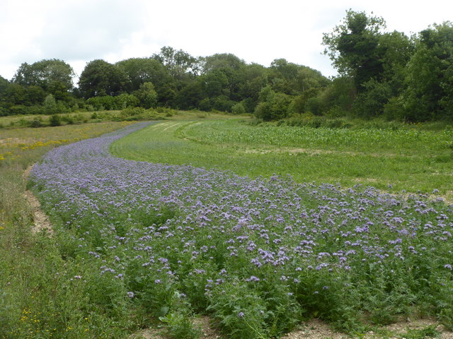
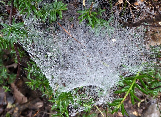
The woodland is primarily composed of native broadleaf trees, including oak, ash, beech, and birch, which create a dense canopy that provides shade and shelter for a variety of flora and fauna. Bluebells carpet the forest floor in spring, creating a breathtaking display of vibrant color. Additionally, the wood is home to a diverse range of bird species, such as woodpeckers, song thrushes, and tawny owls, making it a haven for birdwatchers.

A network of well-maintained footpaths weaves through Church Wood, allowing visitors to explore its beauty at their own pace. These paths lead to picturesque clearings, where benches are strategically placed, providing the perfect spot for a picnic or simply to soak in the serene atmosphere. The wood is also intersected by a small stream, further enhancing its natural charm.

Managed by a local conservation group, Church Wood is carefully preserved to protect its unique ecosystem. Regular maintenance activities, such as tree thinning and coppicing, are carried out to ensure the longevity and health of the wood.

Overall, Church Wood in Kent offers a delightful escape from the bustling modern world, inviting visitors to immerse themselves in the peacefulness and natural beauty of this enchanting forest.

If you have any feedback on the listing, please let us know in the comments section below.

Church Wood Images

Images are sourced within 2km of 51.201944/0.98173374 or Grid Reference TR0848. Thanks to Geograph Open Source API. All images are credited.

Richdore Road, Sole Street Like Minster, there are also two Sole Streets in Kent. This one is barely discernible and unlike the other one has no station.
Richdore Road, Sole Street
Like Minster, there are also two Sole Streets in Kent. This one is barely discernible and unlike the other one has no station.
Unnamed Lane from Anvil Green
Old pit at edge of woodland There were two or three hereabouts. They look like filled in bell-pits, most often found for extracting iron, but flints are more likely on this geology.
Old pit at edge of woodland
There were two or three hereabouts. They look like filled in bell-pits, most often found for extracting iron, but flints are more likely on this geology.
Penny Pot Lane, Sole Street Looking northwards from the hamlet of Sole Street with Eggringe Wood on the left.
Penny Pot Lane, Sole Street
Looking northwards from the hamlet of Sole Street with Eggringe Wood on the left.
Farmland near Godmersham This is a phacelia crop, a quick growing plant used as green manure. Happily, it also attracts bees and hoverflies.
Farmland near Godmersham
This is a phacelia crop, a quick growing plant used as green manure. Happily, it also attracts bees and hoverflies.
Swathe of phacelia near Godmersham A quick growing crop used as green manure. Happily, it also attracts bees and hover flies.
Swathe of phacelia near Godmersham
A quick growing crop used as green manure. Happily, it also attracts bees and hover flies.
Spider web in Eggringe Wood Next to a footpath running along the south west edge.
Spider web in Eggringe Wood
Next to a footpath running along the south west edge.
Parking area on Penny Pot lane For access to Denge Wood.
Parking area on Penny Pot lane
For access to Denge Wood.
Parking area on Penny Pot lane For access to Denge Wood.
Parking area on Penny Pot lane
For access to Denge Wood.
Denge Wood Denge Wood is a wood located 8 miles southwest of Canterbury in Kent, England. The wood is owned by the Forestry Commission and the Woodland Trust. Part of the wood is also privately owned. Much of Denge Wood is classified as ancient semi-natural woodland suggesting it has been in existence since at least 1600AD and probably longer. See <span class="nowrap"><a title="http://www.woodlandtrust.org.uk/en/our-woods/Pages/wood-details.aspx?wood=4021" rel="nofollow ugc noopener" href="http://www.woodlandtrust.org.uk/en/our-woods/Pages/wood-details.aspx?wood=4021">Link</a><img style="margin-left:2px;" alt="External link" title="External link - shift click to open in new window" src="https://s1.geograph.org.uk/img/external.png" width="10" height="10"/></span> for Woodland Trust website page. See also <span class="nowrap"><a title="http://www.forestry.gov.uk/pdf/se-casestudies-dengewood.pdf/$FILE/se-casestudies-dengewood.pdf" rel="nofollow ugc noopener" href="http://www.forestry.gov.uk/pdf/se-casestudies-dengewood.pdf/$FILE/se-casestudies-dengewood.pdf">Link</a><img style="margin-left:2px;" alt="External link" title="External link - shift click to open in new window" src="https://s1.geograph.org.uk/img/external.png" width="10" height="10"/></span>
for Forestry Commission website page.
Denge Wood
Denge Wood is a wood located 8 miles southwest of Canterbury in Kent, England. The wood is owned by the Forestry Commission and the Woodland Trust. Part of the wood is also privately owned. Much of Denge Wood is classified as ancient semi-natural woodland suggesting it has been in existence since at least 1600AD and probably longer. See LinkExternal link for Woodland Trust website page. See also LinkExternal link for Forestry Commission website page.
Stour Valley Walk The Stour Valley Walk is a 58 mile (93km) route through the Low Weald and North Downs, giving you access to some the most attractive parts of East Kent. Rolling grassland, woods, marshes, peat bog, orchards and picturesque villages make this a memorable journey which can be completed over a long weekend or in shorter sections. The symbol of the Stour Valley Walk is the heron.
See <span class="nowrap"><a title="http://www.kent.gov.uk/leisure-and-culture/explore-kent/walking/stour-valley-walk.htm" rel="nofollow ugc noopener" href="http://www.kent.gov.uk/leisure-and-culture/explore-kent/walking/stour-valley-walk.htm">Link</a><img style="margin-left:2px;" alt="External link" title="External link - shift click to open in new window" src="https://s1.geograph.org.uk/img/external.png" width="10" height="10"/></span> for more details.
Stour Valley Walk
The Stour Valley Walk is a 58 mile (93km) route through the Low Weald and North Downs, giving you access to some the most attractive parts of East Kent. Rolling grassland, woods, marshes, peat bog, orchards and picturesque villages make this a memorable journey which can be completed over a long weekend or in shorter sections. The symbol of the Stour Valley Walk is the heron. See LinkExternal link for more details.
Farmland near Eggarton Manor The North Downs are a ridge of chalk hills in south east England that stretch for 120 miles (190 km) from Farnham in Surrey to the White Cliffs of Dover in Kent. The North Downs lie within two Areas of Outstanding Natural Beauty (AONBs), the Surrey Hills and the Kent Downs. The North Downs Way National Trail runs along the North Downs from Farnham to Dover.

At its highest point, Botley Hill in Surrey is 882ft above sea level.

Extract from Wikipedia  <span class="nowrap"><a title="http://en.wikipedia.org/wiki/North_Downs" rel="nofollow ugc noopener" href="http://en.wikipedia.org/wiki/North_Downs">Link</a><img style="margin-left:2px;" alt="External link" title="External link - shift click to open in new window" src="https://s1.geograph.org.uk/img/external.png" width="10" height="10"/></span>
Farmland near Eggarton Manor
The North Downs are a ridge of chalk hills in south east England that stretch for 120 miles (190 km) from Farnham in Surrey to the White Cliffs of Dover in Kent. The North Downs lie within two Areas of Outstanding Natural Beauty (AONBs), the Surrey Hills and the Kent Downs. The North Downs Way National Trail runs along the North Downs from Farnham to Dover. At its highest point, Botley Hill in Surrey is 882ft above sea level. Extract from Wikipedia LinkExternal link
Stour Valley Walk The Stour Valley Walk is a 58 mile (93km) route through the Low Weald and North Downs, giving you access to some the most attractive parts of East Kent. Rolling grassland, woods, marshes, peat bog, orchards and picturesque villages make this a memorable journey which can be completed over a long weekend or in shorter sections. The symbol of the Stour Valley Walk is the heron.
See <span class="nowrap"><a title="http://www.kent.gov.uk/leisure-and-culture/explore-kent/walking/stour-valley-walk.htm" rel="nofollow ugc noopener" href="http://www.kent.gov.uk/leisure-and-culture/explore-kent/walking/stour-valley-walk.htm">Link</a><img style="margin-left:2px;" alt="External link" title="External link - shift click to open in new window" src="https://s1.geograph.org.uk/img/external.png" width="10" height="10"/></span> for more details.
Stour Valley Walk
The Stour Valley Walk is a 58 mile (93km) route through the Low Weald and North Downs, giving you access to some the most attractive parts of East Kent. Rolling grassland, woods, marshes, peat bog, orchards and picturesque villages make this a memorable journey which can be completed over a long weekend or in shorter sections. The symbol of the Stour Valley Walk is the heron. See LinkExternal link for more details.
Farmland on the North Downs The North Downs are a ridge of chalk hills in south east England that stretch for 120 miles (190 km) from Farnham in Surrey to the White Cliffs of Dover in Kent. The North Downs lie within two Areas of Outstanding Natural Beauty (AONBs), the Surrey Hills and the Kent Downs. The North Downs Way National Trail runs along the North Downs from Farnham to Dover.

At its highest point, Botley Hill in Surrey is 882ft above sea level.

Extract from Wikipedia  <span class="nowrap"><a title="http://en.wikipedia.org/wiki/North_Downs" rel="nofollow ugc noopener" href="http://en.wikipedia.org/wiki/North_Downs">Link</a><img style="margin-left:2px;" alt="External link" title="External link - shift click to open in new window" src="https://s1.geograph.org.uk/img/external.png" width="10" height="10"/></span>
Farmland on the North Downs
The North Downs are a ridge of chalk hills in south east England that stretch for 120 miles (190 km) from Farnham in Surrey to the White Cliffs of Dover in Kent. The North Downs lie within two Areas of Outstanding Natural Beauty (AONBs), the Surrey Hills and the Kent Downs. The North Downs Way National Trail runs along the North Downs from Farnham to Dover. At its highest point, Botley Hill in Surrey is 882ft above sea level. Extract from Wikipedia LinkExternal link
Stour Valley Walk to Eggarton Manor The Stour Valley Walk is a 58 mile (93km) route through the Low Weald and North Downs, giving you access to some the most attractive parts of East Kent. Rolling grassland, woods, marshes, peat bog, orchards and picturesque villages make this a memorable journey which can be completed over a long weekend or in shorter sections. The symbol of the Stour Valley Walk is the heron.
See <span class="nowrap"><a title="http://www.kent.gov.uk/leisure-and-culture/explore-kent/walking/stour-valley-walk.htm" rel="nofollow ugc noopener" href="http://www.kent.gov.uk/leisure-and-culture/explore-kent/walking/stour-valley-walk.htm">Link</a><img style="margin-left:2px;" alt="External link" title="External link - shift click to open in new window" src="https://s1.geograph.org.uk/img/external.png" width="10" height="10"/></span> for more details.
Stour Valley Walk to Eggarton Manor
The Stour Valley Walk is a 58 mile (93km) route through the Low Weald and North Downs, giving you access to some the most attractive parts of East Kent. Rolling grassland, woods, marshes, peat bog, orchards and picturesque villages make this a memorable journey which can be completed over a long weekend or in shorter sections. The symbol of the Stour Valley Walk is the heron. See LinkExternal link for more details.
Eggarton Manor
Eggarton Manor
Private , No entry!
Private , No entry!
Stour Valley Walk passing Eggarton Manor The Stour Valley Walk is a 58 mile (93km) route through the Low Weald and North Downs, giving you access to some the most attractive parts of East Kent. Rolling grassland, woods, marshes, peat bog, orchards and picturesque villages make this a memorable journey which can be completed over a long weekend or in shorter sections. The symbol of the Stour Valley Walk is the heron.
See <span class="nowrap"><a title="http://www.kent.gov.uk/leisure-and-culture/explore-kent/walking/stour-valley-walk.htm" rel="nofollow ugc noopener" href="http://www.kent.gov.uk/leisure-and-culture/explore-kent/walking/stour-valley-walk.htm">Link</a><img style="margin-left:2px;" alt="External link" title="External link - shift click to open in new window" src="https://s1.geograph.org.uk/img/external.png" width="10" height="10"/></span> for more details.
Stour Valley Walk passing Eggarton Manor
The Stour Valley Walk is a 58 mile (93km) route through the Low Weald and North Downs, giving you access to some the most attractive parts of East Kent. Rolling grassland, woods, marshes, peat bog, orchards and picturesque villages make this a memorable journey which can be completed over a long weekend or in shorter sections. The symbol of the Stour Valley Walk is the heron. See LinkExternal link for more details.
Show me another place!

Church Wood is located at Grid Ref: TR0848 (Lat: 51.201944, Lng: 0.98173374)

Administrative County: Kent

District: Ashford

Police Authority: Kent

What 3 Words

///aspect.womanly.tightest. Near Wye, Kent

Related Wikis

Crundale, Kent

Crundale is a mostly rural village and civil parish in the Ashford District of Kent in southeast England. The village covers a section of one of the dual...

Stour Valley Walk

The Stour Valley Walk is a recreational walking route that follows the River Stour, through the Low Weald and Kent Downs, from its source at Lenham to...

Anvil Green

Anvil Green is a small settlement located near Waltham in Kent, England, about nine miles (14.4 km) north east of Ashford. == External links == Media...

Godmersham

Godmersham is a village and civil parish in the Ashford District of Kent, England. The village straddles the Great Stour river where it cuts through the...

Olantigh

Olantigh is an English house 1 mile (1.6 km) north of Wye in the civil parish of Wye with Hinxhill.The garden terraces and towered stable block were Grade...

Waltham, Kent

Waltham is a village and civil parish 7 miles (11 km) southwest of Canterbury in Kent, England. == History == The village was once associated with the...

Bilting

Bilting is a hamlet within the civil parish of Godmersham in the Ashford District of Kent, England. It stretches along the A28 at the foot of the Godmersham...

Wye and Crundale Downs

Wye and Crundale Downs is a 358.3-hectare (885-acre) biological and geological Site of Special Scientific Interest in a number of separate areas east of...

Nearby Amenities

Located within 500m of 51.201944,0.98173374
Barrier: kissing_gate
Lat/Long: 51.204029/0.9769529
Barrier: stile
Source: survey
Lat/Long: 51.2008641/0.9822321
Barrier: stile
Lat/Long: 51.1984716/0.9835713
Barrier: kissing_gate
Bicycle: no
Foot: yes
Material: metal
Source: survey
Lat/Long: 51.2010639/0.9819983
Barrier: stile
Lat/Long: 51.2014484/0.979761
The data included in this document is from www.openstreetmap.org. The data is made available under ODbL.

Have you been to Church Wood?

Leave your review of Church Wood below (or comments, questions and feedback).