Scott's Hall Plantation

Wood, Forest in Kent Ashford

England

Scott's Hall Plantation

The Ridgeway, Smeeth
The Ridgeway, Smeeth Credit: Stacey Harris

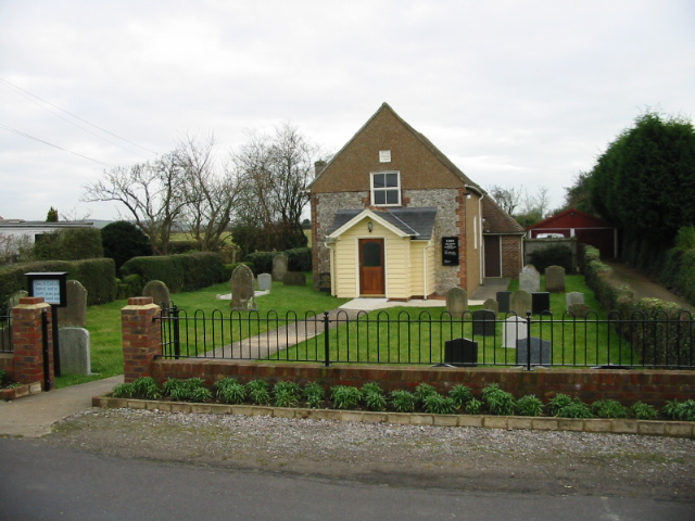
Scott's Hall Plantation is a historic estate located in the county of Kent, England. Situated in the picturesque Wood, Forest area, the plantation spans a vast area of land and is renowned for its natural beauty and rich history.

The origins of Scott's Hall Plantation can be traced back to the 14th century when it was owned by the influential Scott family. Over the years, the estate has seen several owners, each contributing to its development and preservation. Today, it stands as a testament to the architectural and cultural heritage of the region.

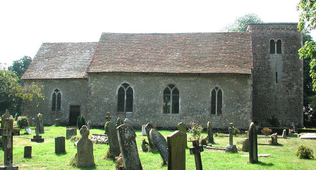
The plantation is characterized by its stunning woodland, which covers a significant portion of the estate. The dense forest is home to a diverse range of flora and fauna, making it a popular destination for nature enthusiasts and wildlife lovers. Visitors can explore the expansive network of walking trails that wind through the woodland, providing an opportunity to witness the beauty of the natural surroundings.

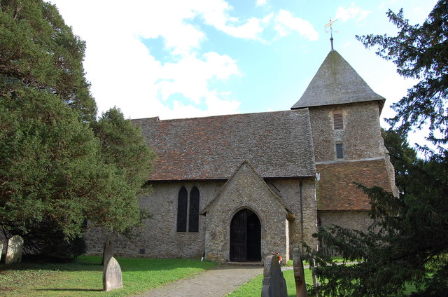
In addition to its natural attractions, Scott's Hall Plantation boasts a number of historic buildings. The main hall, which dates back to the 16th century, is a prime example of Elizabethan architecture and is open to the public for guided tours. The estate also features a charming garden, meticulously maintained and adorned with vibrant flowers and plants.

Scott's Hall Plantation offers a unique blend of natural wonders and historical significance. It is a place where visitors can immerse themselves in the beauty of the Wood, Forest area while also exploring the rich cultural heritage that has shaped the region throughout the centuries.

If you have any feedback on the listing, please let us know in the comments section below.

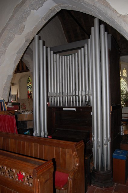
Scott's Hall Plantation Images

Images are sourced within 2km of 51.118374/0.9701304 or Grid Reference TR0739. Thanks to Geograph Open Source API. All images are credited.

The Ridgeway, Smeeth
Blue and White cafe, Mersham
Stock Lane, Smeeth
Stock Lane, Smeeth
A20 Hythe Road, Mersham
A20 Hythe Road, Smeeth
Bob Fisher's garage, Sellindge
Coopers Lane, Sellindge
A20 Sellindge
A20 Sellindge
Organ in St Mary's church, Sellindge Small one manual organ with pedals, possibly by Walker 1935. 8 stops.
Organ in St Mary's church, Sellindge
Small one manual organ with pedals, possibly by Walker 1935. 8 stops.
St Mary the Virgin Church, Sellindge Grade I listed. Late 11th C. onwards.Restored 19th C. There is an odd half-arch at the east end of the north aisle. There is a monument to Ralph Heyman, d. 1601.
St Mary the Virgin Church, Sellindge
Grade I listed. Late 11th C. onwards.Restored 19th C. There is an odd half-arch at the east end of the north aisle. There is a monument to Ralph Heyman, d. 1601.
Monument to Thomas Godfrey, Sellindge Church Died 1664
Monument to Thomas Godfrey, Sellindge Church
Died 1664
Farmland by the railway
East Stour Valley Backhouse Wood is in the distance.
East Stour Valley
Backhouse Wood is in the distance.
Pylon by Church Lane
M20 Motorway near Smeeth Looking towards Ashford.
This section of the motorway was built in the early 1980's
M20 Motorway near Smeeth
Looking towards Ashford. This section of the motorway was built in the early 1980's
High Speed 1 Railway towards Ashford The old, original line is behind.
High Speed 1 Railway towards Ashford
The old, original line is behind.
New and Old Railway Bridges High Speed 1 bridge with the original railway bridge behind.
New and Old Railway Bridges
High Speed 1 bridge with the original railway bridge behind.
St Mary's church, Smeeth Grade I listed
Nave and chancel are Norman, with north aisle and chapel 13th C. The porch was added in the 15th Century. The west tower was rebuilt in 1881 and vestry added.
The three bay north arcade is from 1200 the roof having 3 tall crown posts.
Chancel with Hagioscope to nave and Norman chancel arch. Some encaustic tiling on floor. Interesting monument to Priscilla and Mary Scott from 1654 with figures leaning on a  central desk.
There is a fine modern window in the south west part of nave by Alex Le Rossignal in 2000.
St Mary's church, Smeeth
Grade I listed Nave and chancel are Norman, with north aisle and chapel 13th C. The porch was added in the 15th Century. The west tower was rebuilt in 1881 and vestry added. The three bay north arcade is from 1200 the roof having 3 tall crown posts. Chancel with Hagioscope to nave and Norman chancel arch. Some encaustic tiling on floor. Interesting monument to Priscilla and Mary Scott from 1654 with figures leaning on a central desk. There is a fine modern window in the south west part of nave by Alex Le Rossignal in 2000.
Show me another place!

Scott's Hall Plantation is located at Grid Ref: TR0739 (Lat: 51.118374, Lng: 0.9701304)

Administrative County: Kent

District: Ashford

Police Authority: Kent

What 3 Words

///cocoons.trees.toddler. Near Lympne, Kent

Related Wikis

Scot's Hall

Scot's Hall (or Scott's Hall) was a country house in Smeeth, between Ashford and Folkestone in southeast England. It was the property of a gentry family...

Smeeth

Smeeth is a mostly agricultural land use village and civil parish, centred 4 miles (6.4 km) east of Ashford in the Ashford Borough of Kent, England....

Brabourne Lees

Brabourne Lees is a village in the civil parish of Brabourne, within the Ashford borough of Kent, England. The village (centre) is just under 5 miles...

Lilyvale, Kent

Lilyvale is a hamlet in the English county of Kent. It is located north of the A20 road, south east of the town of Ashford, near the village of Smeeth...

Nearby Amenities

Located within 500m of 51.118374,0.9701304
Turning Circle
Lat/Long: 51.1225293/0.9706595
Barrier: stile
Lat/Long: 51.1204972/0.9758257
Barrier: stile
Lat/Long: 51.1200556/0.9659195
Barrier: stile
Lat/Long: 51.1200116/0.9681416
Barrier: stile
Lat/Long: 51.120267/0.9718542
Barrier: stile
Lat/Long: 51.1202352/0.9733594
Barrier: stile
Lat/Long: 51.1157859/0.9749438
Barrier: stile
Lat/Long: 51.1186351/0.973212
Barrier: stile
Lat/Long: 51.1218529/0.9720891
Barrier: stile
Lat/Long: 51.1189829/0.9654159
Barrier: stile
Lat/Long: 51.1173321/0.9655229
Barrier: stile
Lat/Long: 51.1142504/0.9712376
Barrier: stile
Lat/Long: 51.1148496/0.9705027
Barrier: stile
Lat/Long: 51.121203/0.967614
Barrier: kissing_gate
Lat/Long: 51.121187/0.9675317
Barrier: kissing_gate
Lat/Long: 51.1208374/0.9675022
Generator Method: photovoltaic
Generator Orientation: ESE
Generator Output Electricity: yes
Generator Source: solar
Generator Type: solar_photovoltaic_panel
Location: roof
Power: generator
Lat/Long: 51.122714/0.9718759
Generator Method: photovoltaic
Generator Output Electricity: yes
Generator Source: solar
Generator Type: solar_photovoltaic_panel
Location: roof
Power: generator
Lat/Long: 51.122733/0.971311
Generator Method: photovoltaic
Generator Output Electricity: yes
Generator Source: solar
Generator Type: solar_photovoltaic_panel
Location: roof
Power: generator
Lat/Long: 51.1224653/0.970037
Generator Method: photovoltaic
Generator Output Electricity: yes
Generator Source: solar
Generator Type: solar_photovoltaic_panel
Location: roof
Power: generator
Lat/Long: 51.1224636/0.9701067
Generator Method: photovoltaic
Generator Output Electricity: yes
Generator Source: solar
Generator Type: solar_photovoltaic_panel
Location: roof
Power: generator
Lat/Long: 51.1223104/0.970552
Generator Method: photovoltaic
Generator Output Electricity: yes
Generator Source: solar
Generator Type: solar_photovoltaic_panel
Location: roof
Power: generator
Lat/Long: 51.1222953/0.9707424
The data included in this document is from www.openstreetmap.org. The data is made available under ODbL.

Have you been to Scott's Hall Plantation?

Leave your review of Scott's Hall Plantation below (or comments, questions and feedback).