Cherry Strips
Wood, Forest in Norfolk South Norfolk
England
Cherry Strips

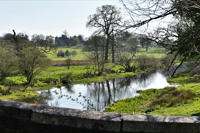
Cherry Strips, Norfolk is a picturesque woodland area located in the county of Norfolk, England. It is known for its beautiful cherry trees that adorn the landscape, creating a stunning sight during the spring and summer months when they are in full bloom. The woodland is spread across a vast area, providing a serene and tranquil environment for visitors to enjoy.
The forest is home to a diverse range of flora and fauna, making it an ideal destination for nature enthusiasts and wildlife lovers. Visitors can spot various species of birds, mammals, and insects as they explore the forest trails. The dense canopy of trees provides shade and shelter, creating a cool and refreshing atmosphere even on hot summer days.
Cherry Strips offers several well-maintained walking trails, allowing visitors to immerse themselves in the natural beauty of the surroundings. The paths are marked and easy to navigate, making it accessible for people of all ages and fitness levels. Along the way, there are numerous benches and picnic spots where visitors can rest and enjoy a packed lunch amidst the tranquil setting.
The woodland is also popular for its recreational activities such as cycling, horse riding, and nature photography. The scenic beauty and peaceful ambiance make it an ideal location for capturing stunning photographs of both the landscape and wildlife.
Cherry Strips, Norfolk is a hidden gem that offers a peaceful retreat away from the hustle and bustle of city life. Whether you are seeking solitude, a family outing, or an opportunity to connect with nature, this woodland area has something to offer for everyone.
If you have any feedback on the listing, please let us know in the comments section below.
Cherry Strips Images
Images are sourced within 2km of 52.599642/1.0624712 or Grid Reference TG0704. Thanks to Geograph Open Source API. All images are credited.


Cherry Strips is located at Grid Ref: TG0704 (Lat: 52.599642, Lng: 1.0624712)
Administrative County: Norfolk
District: South Norfolk
Police Authority: Norfolk
What 3 Words
///jolt.clutter.mixers. Near Hingham, Norfolk
Nearby Locations
Related Wikis
Kimberley, Norfolk
Kimberley is a village and civil parish in the South Norfolk district, in the county of Norfolk, England, situated about 3 miles (4.8 km) north-west of...
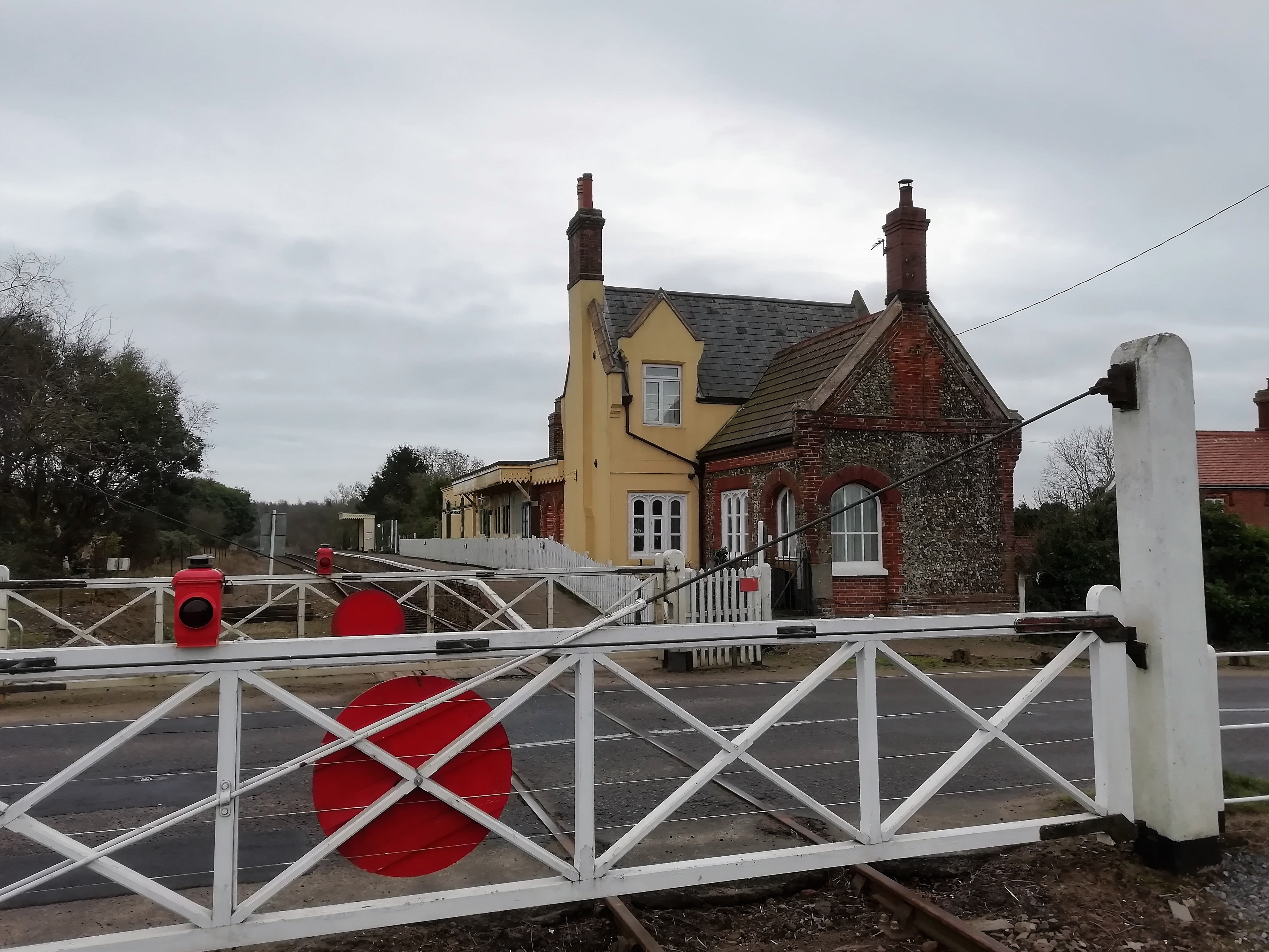
Kimberley Park railway station
Kimberley Park railway station is a railway station in the village of Kimberley in the English county of Norfolk. == History == The Wymondham-Dereham branch...

Carleton Forehoe
Carleton Forehoe is a village and former civil parish 9 miles (14 km) west of Norwich, now in the parish of Kimberley, in the South Norfolk district of...
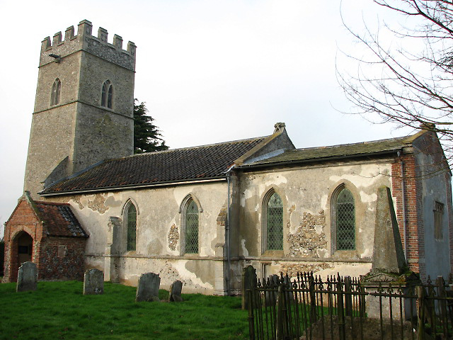
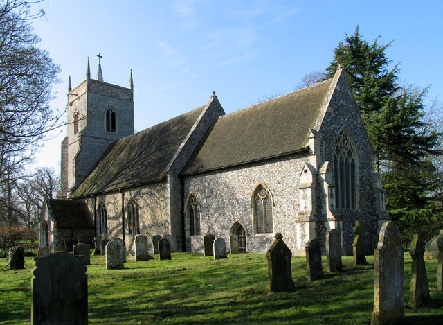
St Michael's Church, Coston
St Michael's Church is a redundant Anglican church in the hamlet of Coston, in the civil parish of Runhall, Norfolk, England. It is recorded in the National...
Nearby Amenities
Located within 500m of 52.599642,1.0624712Have you been to Cherry Strips?
Leave your review of Cherry Strips below (or comments, questions and feedback).