Ash Plantation

Wood, Forest in Suffolk Mid Suffolk

England

Ash Plantation

Barn, Colt Meadow Farm
Barn, Colt Meadow Farm Credit: JThomas

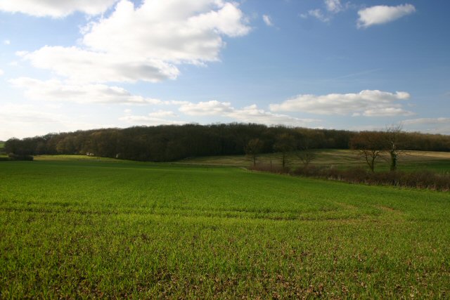
Ash Plantation is a picturesque woodland located in Suffolk, England. Spread over an area of approximately 100 hectares, it is a popular destination for nature lovers and outdoor enthusiasts. The plantation is predominantly composed of ash trees, which give it its name, although it also features a diverse range of other tree species such as oak, beech, and birch.

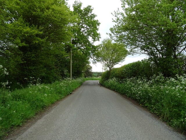
The woodland offers a serene and tranquil environment, making it an ideal spot for walking, hiking, and birdwatching. The well-maintained paths and trails wind their way through the plantation, allowing visitors to explore its natural beauty at their own pace. The dense canopy created by the trees provides shade on warm summer days, making it a pleasant place to seek respite from the heat.

Ash Plantation is not only home to a variety of flora, but it also provides a habitat for numerous wildlife species. Bird enthusiasts can spot a range of avian species, including woodpeckers, owls, and various songbirds. Additionally, the woodland is inhabited by mammals such as deer, foxes, and squirrels, adding to the diversity of the ecosystem.

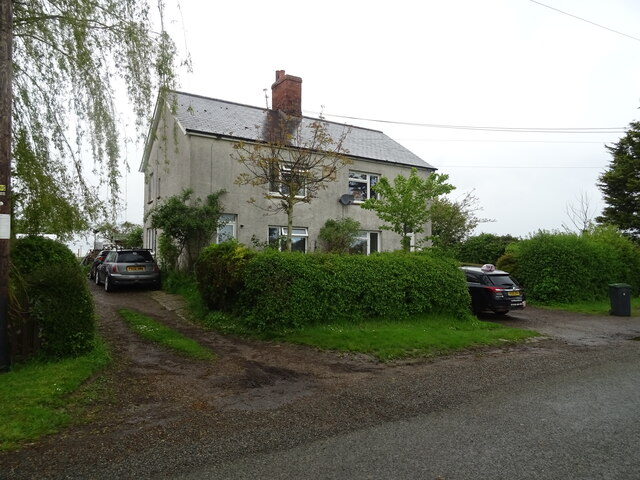
The plantation is easily accessible, with ample parking facilities available nearby. It is also equipped with picnic areas and benches, providing visitors with the opportunity to relax and enjoy a meal surrounded by nature. Ash Plantation is a true gem in Suffolk, offering a peaceful escape from the hustle and bustle of everyday life.

If you have any feedback on the listing, please let us know in the comments section below.

Ash Plantation Images

Images are sourced within 2km of 52.227015/1.0352093 or Grid Reference TM0763. Thanks to Geograph Open Source API. All images are credited.

Barn, Colt Meadow Farm
Farmland off Stonebridge Lane
Stonebridge Lane towards Old Newton
Farm buildings, Hill Farm
Cereal crop near Hill Farm
School Road, Old Newton
St Mary's Church, Old Newton
Thatched Cottage, Old Newton
Church Road, Old Newton
Crop field off Brown Street
Brown Street The road and the place.
Brown Street
The road and the place.
Footpath, Brown Street
Crop field, Brown Street
Brown Street The road and the place.
Brown Street
The road and the place.
Footpath to Gipping, Brown Street
Cottages, Gipping
Cottages, Gipping
Minor road into Gipping
Cereal crop and pylon
Show me another place!

Ash Plantation is located at Grid Ref: TM0763 (Lat: 52.227015, Lng: 1.0352093)

Administrative County: Suffolk

District: Mid Suffolk

Police Authority: Suffolk

What 3 Words

///nuggets.prop.stiletto. Near Bacton, Suffolk

Related Wikis

Gipping

Gipping is a village and civil parish in the Mid Suffolk district of Suffolk in eastern England. Located around three miles north north-east of Stowmarket...

Gipping Great Wood

Gipping Great Wood is a 25.9-hectare (64-acre) biological Site of Special Scientific Interest south of Gipping in Suffolk.This is an ancient coppice with...

Old Newton

Old Newton is a village in the Mid Suffolk district of Suffolk in eastern England. Located within the civil parish of Old Newton with Dagworth, the village...

Old Newton with Dagworth

Old Newton with Dagworth is a civil parish in the Mid Suffolk district of Suffolk in eastern England. The parish contains the village of Old Newton, as...

Nearby Amenities

Located within 500m of 52.227015,1.0352093
Tyrell Oak
Naptan AtcoCode: 390040075
Naptan Bearing: W
Naptan BusStopType: CUS
Naptan CommonName: Tyrell Oak
Naptan Indicator: opp
Naptan Landmark: Tyrell Oak
Naptan NaptanCode: sufatwpt
Naptan Street: Gipping Road
Naptan Verified: no
Source: naptan_import
Lat/Long: 52.2271768/1.0288515
Tyrell Oak
Naptan AtcoCode: 390040076
Naptan Bearing: E
Naptan BusStopType: CUS
Naptan CommonName: Tyrell Oak
Naptan Indicator: adj
Naptan Landmark: Tyrell Oak
Naptan NaptanCode: sufatwpw
Naptan Street: Gipping Road
Naptan Verified: no
Source: naptan_import
Lat/Long: 52.2272238/1.0288115
Generator Method: photovoltaic
Generator Output Electricity: yes
Generator Source: solar
Generator Type: solar_photovoltaic_panel
Location: roof
Power: generator
Lat/Long: 52.2295918/1.0327604
Generator Method: photovoltaic
Generator Output Electricity: yes
Generator Source: solar
Generator Type: solar_photovoltaic_panel
Location: roof
Power: generator
Lat/Long: 52.2273612/1.0280049
Generator Method: photovoltaic
Generator Output Electricity: yes
Generator Source: solar
Generator Type: solar_photovoltaic_panel
Location: roof
Power: generator
Lat/Long: 52.2276943/1.0287874
Board Title: Old Newton with Dagworth and Gipping Parish Council
Board Type: notice
Information: board
Tourism: information
Lat/Long: 52.227417/1.0288873
Post Box
Collection Times: Mo-Fr 16:30; Sa 08:00
Lat/Long: 52.2272901/1.029002
Waste Basket
Waste: dog_excrement
Lat/Long: 52.2272778/1.0290838
Power: pole
Lat/Long: 52.2306831/1.0311873
Power: pole
Lat/Long: 52.2302699/1.0310525
Power: pole
Lat/Long: 52.2298251/1.0309298
Power: pole
Lat/Long: 52.2282693/1.030445
Power: pole
Lat/Long: 52.2290008/1.0306683
Power: pole
Lat/Long: 52.2293918/1.0307837
Power: pole
Lat/Long: 52.2293988/1.0298341
The data included in this document is from www.openstreetmap.org. The data is made available under ODbL.

Have you been to Ash Plantation?

Leave your review of Ash Plantation below (or comments, questions and feedback).