Thread Wood

Wood, Forest in Kent Swale

England

Thread Wood

Hop fields, Boughton-under-Blean Situated on the south side of the A2 road from Faversham to Canterbury. It is now hop picking time and Faversham Hop Festival is about to begin.
Hop fields, Boughton-under-Blean Credit: pam fray

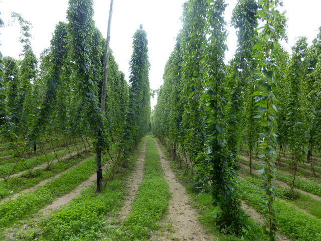
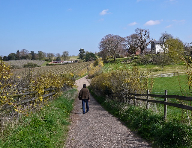
Thread Wood is a picturesque forest located in the county of Kent, England. Situated in the southeastern part of the country, it covers an area of approximately 150 acres and is known for its dense woodland and diverse array of flora and fauna.

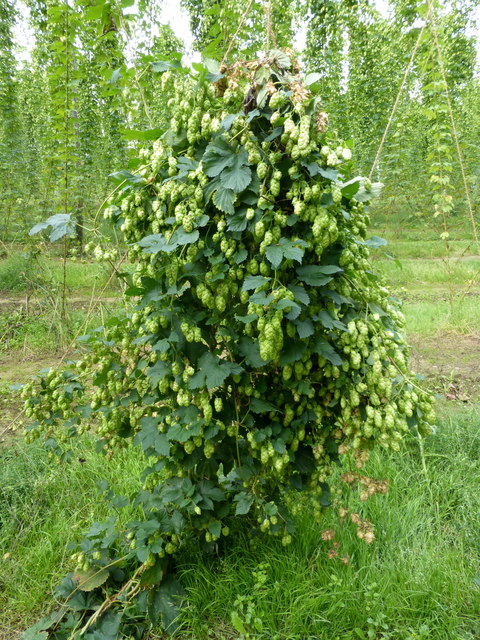
The woodland is predominantly made up of a mixture of deciduous and coniferous trees, creating a rich tapestry of colors throughout the year. Oak, beech, and birch trees are commonly found, along with a variety of pine species. The forest floor is covered in a thick carpet of mosses, ferns, and wildflowers, adding to the natural beauty of the area.

Thread Wood is a popular destination for nature enthusiasts, hikers, and birdwatchers. The forest is home to a wide range of wildlife, including deer, squirrels, foxes, and various species of birds. Birdwatchers can spot native species such as woodpeckers, owls, and thrushes, as well as migratory birds during certain times of the year.

Trails and footpaths crisscross the woodland, providing visitors with the opportunity to explore its beauty. These paths are well-maintained and offer a peaceful and tranquil setting for those seeking a break from the hustle and bustle of everyday life.

Thread Wood is also a designated Site of Special Scientific Interest (SSSI), recognizing its importance for wildlife conservation and ecological diversity. The forest is actively managed to ensure the preservation of its natural habitats and the sustainability of its ecosystem.

In summary, Thread Wood in Kent offers visitors a chance to immerse themselves in the beauty of nature. With its stunning woodlands, diverse wildlife, and well-maintained trails, it is a haven for outdoor enthusiasts and a valuable asset to the local ecosystem.

If you have any feedback on the listing, please let us know in the comments section below.

Thread Wood Images

Images are sourced within 2km of 51.300634/0.96923232 or Grid Reference TR0759. Thanks to Geograph Open Source API. All images are credited.

Hop fields, Boughton-under-Blean Situated on the south side of the A2 road from Faversham to Canterbury. It is now hop picking time and Faversham Hop Festival is about to begin.
Hop fields, Boughton-under-Blean
Situated on the south side of the A2 road from Faversham to Canterbury. It is now hop picking time and Faversham Hop Festival is about to begin.
Hops in a field in Boughton-under-Blean Situated on the south side of the A2 road from Faversham to Canterbury. It is now hop picking time and Faversham Hop Festival is about to begin.
Hops in a field in Boughton-under-Blean
Situated on the south side of the A2 road from Faversham to Canterbury. It is now hop picking time and Faversham Hop Festival is about to begin.
Hop picking, modern style. Boughton-under-Blean Situated on the south side of the A2 road from Faversham to Canterbury. Hop picking is now under way and Faversham Hop Festival is about to begin.
Hop picking, modern style. Boughton-under-Blean
Situated on the south side of the A2 road from Faversham to Canterbury. Hop picking is now under way and Faversham Hop Festival is about to begin.
Footbridge over the A2 Boughton bypass Looking north towards Boughton Street.
Footbridge over the A2 Boughton bypass
Looking north towards Boughton Street.
'The Bounds' From Bounds Lane
'The Bounds'
From Bounds Lane
Ordnance Survey Flush Bracket S6173 This can be found on the roadside wall of the former primary school in Dunkirk.
For more detail see : <span class="nowrap"><a title="http://www.bench-marks.org.uk/bm19720" rel="nofollow ugc noopener" href="http://www.bench-marks.org.uk/bm19720">Link</a><img style="margin-left:2px;" alt="External link" title="External link - shift click to open in new window" src="https://s1.geograph.org.uk/img/external.png" width="10" height="10"/></span>
Ordnance Survey Flush Bracket S6173
This can be found on the roadside wall of the former primary school in Dunkirk. For more detail see : LinkExternal link
Ordnance Survey Flush Bracket S6174 This can be found on the wall of the Primary School in Boughton Street.
For more detail see : <span class="nowrap"><a title="http://www.bench-marks.org.uk/bm19721" rel="nofollow ugc noopener" href="http://www.bench-marks.org.uk/bm19721">Link</a><img style="margin-left:2px;" alt="External link" title="External link - shift click to open in new window" src="https://s1.geograph.org.uk/img/external.png" width="10" height="10"/></span>
Ordnance Survey Flush Bracket S6174
This can be found on the wall of the Primary School in Boughton Street. For more detail see : LinkExternal link
Ordnance Survey Cut Mark with Bolt This can be found on the roadside wall of a former Chapel building in The Street, Boughton Street.
For more detail see : <span class="nowrap"><a title="http://www.bench-marks.org.uk/bm29610" rel="nofollow ugc noopener" href="http://www.bench-marks.org.uk/bm29610">Link</a><img style="margin-left:2px;" alt="External link" title="External link - shift click to open in new window" src="https://s1.geograph.org.uk/img/external.png" width="10" height="10"/></span>
Ordnance Survey Cut Mark with Bolt
This can be found on the roadside wall of a former Chapel building in The Street, Boughton Street. For more detail see : LinkExternal link
The Street in Boughton Street Looking eastward.
The Street in Boughton Street
Looking eastward.
Hops and Oast in Bull Lane
Verge by Horselees Road, Boughton-under-Blean
Horselees Road, Boughton-under-Blean Going under the A2
Horselees Road, Boughton-under-Blean
Going under the A2
Horselees Road, Boughton Street
The Street, Boughton Street
Old Bakery Mews, Broughton Street The OS map says Broughton Street while the A-Z says Boughton-under-Blean. I will go with the OS map as these are posted on it but mention the other for reference.
Old Bakery Mews, Broughton Street
The OS map says Broughton Street while the A-Z says Boughton-under-Blean. I will go with the OS map as these are posted on it but mention the other for reference.
Bull Lane, Broughton Street
Mount Ephraim Gardens The house was originally built in 1695, then rebuilt in 1878 and then extended in 1913. The gardens were laid out in the Edwardian era, but after wartime neglect (when most adult men were enlisted in wartime services) were substantially restored from the early 1950s. See <span class="nowrap"><a title="http://www.mountephraimgardens.co.uk/the-gardens/" rel="nofollow ugc noopener" href="http://www.mountephraimgardens.co.uk/the-gardens/">Link</a><img style="margin-left:2px;" alt="External link" title="External link - shift click to open in new window" src="https://s1.geograph.org.uk/img/external.png" width="10" height="10"/></span>  for more information.
Mount Ephraim Gardens
The house was originally built in 1695, then rebuilt in 1878 and then extended in 1913. The gardens were laid out in the Edwardian era, but after wartime neglect (when most adult men were enlisted in wartime services) were substantially restored from the early 1950s. See LinkExternal link for more information.
View from the tea room at Mount Ephraim Gardens The house was originally built in 1695, then rebuilt in 1878 and then extended in 1913. The gardens were laid out in the Edwardian era, but after wartime neglect (when most adult men were enlisted in wartime services) were substantially restored from the early 1950s. See <span class="nowrap"><a title="http://www.mountephraimgardens.co.uk/the-gardens/" rel="nofollow ugc noopener" href="http://www.mountephraimgardens.co.uk/the-gardens/">Link</a><img style="margin-left:2px;" alt="External link" title="External link - shift click to open in new window" src="https://s1.geograph.org.uk/img/external.png" width="10" height="10"/></span>  for more information.
View from the tea room at Mount Ephraim Gardens
The house was originally built in 1695, then rebuilt in 1878 and then extended in 1913. The gardens were laid out in the Edwardian era, but after wartime neglect (when most adult men were enlisted in wartime services) were substantially restored from the early 1950s. See LinkExternal link for more information.
Show me another place!

Thread Wood is located at Grid Ref: TR0759 (Lat: 51.300634, Lng: 0.96923232)

Administrative County: Kent

District: Swale

Police Authority: Kent

What 3 Words

///slightly.templates.strategy. Near Blean, Kent

Related Wikis

Mount Ephraim Gardens

Mount Ephraim Gardens is an Edwardian terraced gardens located at Hernhill, near Faversham, in the English county of Kent. == History == The gardens are...

Hernhill

Hernhill is a village and civil parish between Faversham and Canterbury in southeast England. The parish includes the hamlets of Crockham, Dargate, The...

Boughton under Blean

Boughton under Blean is a village and civil parish between Faversham and Canterbury in south-east England. "Boughton under Blean" technically refers only...

Staplestreet

Staplestreet is a village near the village of Boughton Street, in the Swale District of the English county of Kent. It is east of the town of Faversham...

Dunkirk, Kent

Dunkirk is a village and civil parish between Faversham and Canterbury in southeast England. It lies on the Canterbury Road between Boughton under Blean...

Battle of Bossenden Wood

The Battle of Bossenden Wood took place on 31 May 1838 near Hernhill in Kent; it has been called the last battle on English soil. The battle was fought...

Goodnestone, Swale

Goodnestone is a village and former civil parish, now in the parish of Graveney with Goodnestone, in the Swale district of Kent, England. The village is...

Oversland

Oversland is a settlement in the Swale district of Kent, England. It is located about 1 mile (1.6 km) to the west of Selling and is situated near Selling...

Nearby Amenities

Located within 500m of 51.300634,0.96923232
Turning Loop
Lat/Long: 51.3031225/0.9712315
The data included in this document is from www.openstreetmap.org. The data is made available under ODbL.

Have you been to Thread Wood?

Leave your review of Thread Wood below (or comments, questions and feedback).