The Belt

Wood, Forest in Essex Tendring

England

The Belt

Squeezed Saltmarsh This is an example of coastal squeeze where the natural saltmarsh is squeezed against the sea wall. The outer edge is subject to erosion creating a <a href="https://www.geograph.org.uk/photo/7542909">TM0616 : Mud Cliffs</a>. As the sea level rises the salt marsh habitat will vanish unless there is some managed retreat.
Squeezed Saltmarsh Credit: Glyn Baker

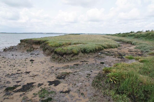
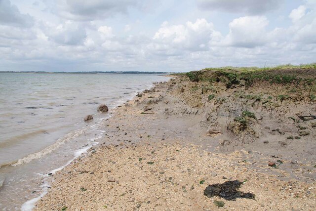
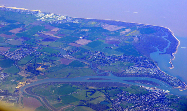
The Belt, Essex (Wood, Forest) is a picturesque and serene area located in Essex, England. It is situated within the larger Epping Forest district and covers an approximate area of 10 square kilometers. The Belt is renowned for its dense woodlands, making it a popular destination for nature lovers, hikers, and outdoor enthusiasts.

The woodlands of The Belt are primarily composed of native trees such as oak, beech, and birch, creating a vibrant and diverse ecosystem. The area is also home to a variety of wildlife, including deer, foxes, and various bird species, providing ample opportunities for wildlife spotting and birdwatching.

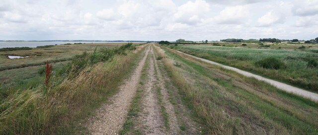
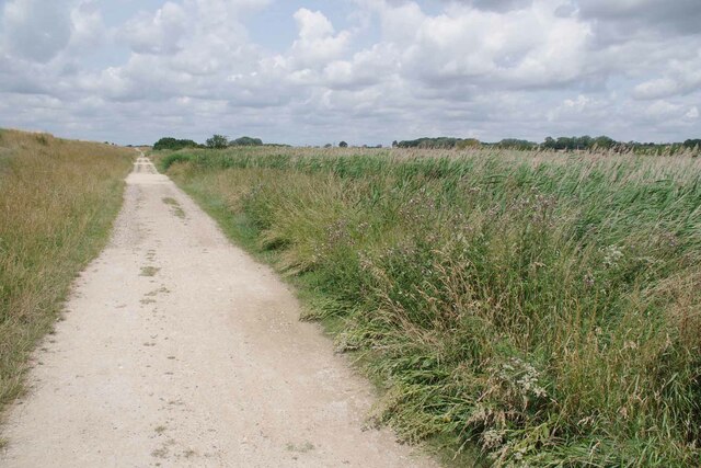
Trails and footpaths crisscross the woodlands, allowing visitors to explore the area and immerse themselves in its natural beauty. The well-maintained paths cater to both leisurely strolls and more challenging hikes, accommodating visitors of all ages and fitness levels.

In addition to its natural wonders, The Belt boasts a rich history. It has been inhabited since ancient times, with evidence of Roman and Saxon settlements in the area. The remnants of old buildings and structures can still be seen, adding a touch of mystery and intrigue to the surroundings.

The Belt is easily accessible by car and public transportation, with ample parking facilities and bus routes connecting it to nearby towns and cities. It offers a peaceful escape from the hustle and bustle of urban life, providing visitors with a tranquil retreat in the heart of nature.

If you have any feedback on the listing, please let us know in the comments section below.

The Belt Images

Images are sourced within 2km of 51.82647/1.0034018 or Grid Reference TM0718. Thanks to Geograph Open Source API. All images are credited.

Squeezed Saltmarsh This is an example of coastal squeeze where the natural saltmarsh is squeezed against the sea wall. The outer edge is subject to erosion creating a <a href="https://www.geograph.org.uk/photo/7542909">TM0616 : Mud Cliffs</a>. As the sea level rises the salt marsh habitat will vanish unless there is some managed retreat.
Squeezed Saltmarsh
This is an example of coastal squeeze where the natural saltmarsh is squeezed against the sea wall. The outer edge is subject to erosion creating a TM0616 : Mud Cliffs. As the sea level rises the salt marsh habitat will vanish unless there is some managed retreat.
Mud Cliffs Here the saltmarsh is eroding away due to coastal squeeze see <a href="https://www.geograph.org.uk/photo/7542906">TM0616 : Squeezed Saltmarsh</a>.
Mud Cliffs
Here the saltmarsh is eroding away due to coastal squeeze see TM0616 : Squeezed Saltmarsh.
Footpath 34 Panorama Part of the Colne Estuary National Nature Reserve. The coastal grazing marsh to the right is of particular value to birds on migration.
Footpath 34 Panorama
Part of the Colne Estuary National Nature Reserve. The coastal grazing marsh to the right is of particular value to birds on migration.
Track by the Sea Wall Looking towards Alresford; this track runs in the lea of the sea wall.
Track by the Sea Wall
Looking towards Alresford; this track runs in the lea of the sea wall.
Brightlingsea and Point Clear Bay from the air With the North Sea coast and part of Clacton in the distance. Viewed from a Prague bound flight from Heathrow.
Brightlingsea and Point Clear Bay from the air
With the North Sea coast and part of Clacton in the distance. Viewed from a Prague bound flight from Heathrow.
Sand Quarry in Ford Lane On the way to the ford across Alresford Creek
Sand Quarry in Ford Lane
On the way to the ford across Alresford Creek
Across Alresford Creek I wouldn't fancy fording here!!
Across Alresford Creek
I wouldn't fancy fording here!!
Olde Forge, Brightlingsea
Thorrington Tide Mill - Breastshot Wheel The wheel seen here still works but it can't grind flour due to an accident a few years ago (see below).
Thorrington Tide Mill - Breastshot Wheel
The wheel seen here still works but it can't grind flour due to an accident a few years ago (see below).
Thorrington Tide Mill Open today, the fourth Sunday of the month.
Thorrington Tide Mill
Open today, the fourth Sunday of the month.
Thorrington Tide Mill The tide mill, grain went up through the lucum, flour went out via a shoot from door in the middle of the mill. This shoot went onto a barge ready for London. Horse manure was brought in from London and flour went out. Hygienic or what!
Thorrington Tide Mill
The tide mill, grain went up through the lucum, flour went out via a shoot from door in the middle of the mill. This shoot went onto a barge ready for London. Horse manure was brought in from London and flour went out. Hygienic or what!
Thorrington Tide Mill The tide mill in Essex.
Thorrington Tide Mill
The tide mill in Essex.
Thorrington Tide Mill The mill with its breastshot wheel.
Thorrington Tide Mill
The mill with its breastshot wheel.
Mill Pond The pond used to be filled with  brackish water from the tide however now it is used for irrigation, refilled via Tenpenny brook.
Mill Pond
The pond used to be filled with brackish water from the tide however now it is used for irrigation, refilled via Tenpenny brook.
Thorrington Tide Mill - Breastshot Wheel The wheel is seen here, in working order.
Thorrington Tide Mill - Breastshot Wheel
The wheel is seen here, in working order.
Thorrington Tide Mill - Breastshot Wheel The breatshot wheel.
Thorrington Tide Mill - Breastshot Wheel
The breatshot wheel.
Thorrington Tide Mill - External Drive The external drive for the mill, ran via a portable steam engine. it drove one set of stones.
Thorrington Tide Mill - External Drive
The external drive for the mill, ran via a portable steam engine. it drove one set of stones.
Alresford Creek See also <a href="https://www.geograph.org.uk/photo/1471107">TM0819 : Alresford Creek</a>
The tidal channel was last dredged in the 1920s I think.
Alresford Creek
See also TM0819 : Alresford Creek The tidal channel was last dredged in the 1920s I think.
Show me another place!

The Belt is located at Grid Ref: TM0718 (Lat: 51.82647, Lng: 1.0034018)

Administrative County: Essex

District: Tendring

Police Authority: Essex

What 3 Words

///partly.zoom.saloons. Near Brightlingsea, Essex

Related Wikis

Brightlingsea Regent F.C.

Brightlingsea Regent Football Club is an English football club based in Brightlingsea, Essex. Formed by a merger of Brightlingsea United and Regent Park...

Brightlingsea railway station

Brightlingsea railway station was located in Brightlingsea, Essex. It was on the single track branch line of the Wivenhoe and Brightlingsea Railway which...

Fingringhoe Wick

Fingringhoe Wick is a 48.6-hectare (120-acre) nature reserve in Fingringhoe in Essex. It is managed by the Essex Wildlife Trust, which runs a visitor centre...

Colne Estuary

Colne Estuary is a 2915 hectare biological and geological Site of Special Scientific Interest near Brightlingsea in Essex. It is also a Nature Conservation...

Alresford, Essex

Alresford ( or ) is a village and electoral ward in Essex, England. It is centred 9 km (5.6 mi) southeast of Colchester and is 39 km (24 mi) northeast...

Brightlingsea

Brightlingsea () is a coastal town and an electoral ward in the Tendring district of Essex, England. It is situated between Colchester and Clacton-on-Sea...

Battle of Brightlingsea

The Battle of Brightlingsea refers to a series of protests by animal rights supporters held in Brightlingsea, England, between 16 January and 30 October...

Brightlingsea Station

Brighlingsea Naval Base was an installation of the British Royal Navy located at Brightlingsea, Essex, on the East Coast of England. In both wars it was...

Have you been to The Belt?

Leave your review of The Belt below (or comments, questions and feedback).