Cudmore Grove

Wood, Forest in Essex Colchester

England

Cudmore Grove

St. Edmund Church, East Mersea <span class="nowrap"><a title="https://en.wikipedia.org/wiki/East_Mersea" rel="nofollow ugc noopener" href="https://en.wikipedia.org/wiki/East_Mersea">Link</a><img style="margin-left:2px;" alt="External link" title="External link - shift click to open in new window" src="https://s1.geograph.org.uk/img/external.png" width="10" height="10"/></span>
St. Edmund Church, East Mersea Credit: PAUL FARMER

Cudmore Grove, located in Essex, England, is a charming woodland forest that offers a serene escape from the bustling city life. Spanning approximately 50 hectares, this picturesque area is nestled along the coast of the Blackwater Estuary, providing visitors with breathtaking views of the surrounding landscape.

The forest is predominantly composed of deciduous trees, including oak, birch, and beech, which create a dense canopy and provide ample shade during the summer months. The forest floor is enriched with a diverse array of wildflowers, making it a haven for nature enthusiasts and botanists alike.

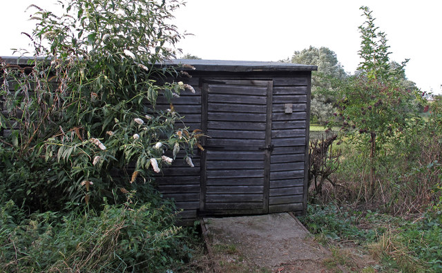
Cudmore Grove offers various amenities and activities to cater to visitors of all ages. There are well-maintained walking trails that wind through the forest, allowing visitors to immerse themselves in the natural beauty of the area. Additionally, the forest is equipped with picnic areas, making it an ideal spot for families and friends to enjoy a leisurely outdoor meal.

For those interested in history, Cudmore Grove boasts a rich heritage. The area was once home to a World War II coastal defense battery, and remnants of the fortifications can still be seen today. The site also offers educational opportunities, with information boards dotted throughout the forest, offering insights into the local wildlife and history.

Cudmore Grove is easily accessible, with ample parking available for visitors. Whether you are seeking a peaceful stroll through nature, a family picnic, or a chance to explore the region's history, Cudmore Grove is a must-visit destination in Essex.

If you have any feedback on the listing, please let us know in the comments section below.

Cudmore Grove Images

Images are sourced within 2km of 51.790503/0.99390381 or Grid Reference TM0614. Thanks to Geograph Open Source API. All images are credited.

St. Edmund Church, East Mersea <span class="nowrap"><a title="https://en.wikipedia.org/wiki/East_Mersea" rel="nofollow ugc noopener" href="https://en.wikipedia.org/wiki/East_Mersea">Link</a><img style="margin-left:2px;" alt="External link" title="External link - shift click to open in new window" src="https://s1.geograph.org.uk/img/external.png" width="10" height="10"/></span>
St. Edmund Church, East Mersea
East Mersea Rain Cloud Rain was coming up in pulses from the south west and this black cloud, heavy with rain, crossed the estuary to land on Brightlingsea. The photo I think shows a nice contrast between the sandy beach and the dark cloud divided by the line of gorse.
East Mersea Rain Cloud
Rain was coming up in pulses from the south west and this black cloud, heavy with rain, crossed the estuary to land on Brightlingsea. The photo I think shows a nice contrast between the sandy beach and the dark cloud divided by the line of gorse.
Sand Martin Holes It has been a few years since I have seen any <a href="https://www.geograph.org.uk/photo/2380169">TM0614 : Sand Martins</a> nesting in the cliffs at Cudmore Grove country park but 2001 seems to be a good year for them.
Sand Martin Holes
It has been a few years since I have seen any TM0614 : Sand Martins nesting in the cliffs at Cudmore Grove country park but 2001 seems to be a good year for them.
Sand Martins There was quite a flock around these <a href="https://www.geograph.org.uk/photo/2380162">TM0614 : Sand Martin Holes</a>
Sand Martins
There was quite a flock around these TM0614 : Sand Martin Holes
Something to Crow About? Someone sorts out a new flag each year at East Mersea see <a href="https://www.geograph.org.uk/photo/272130">TM0614 : Colne View</a> and <a href="https://www.geograph.org.uk/photo/219298">TM0614 : Moonscape and Mersea Mud</a>
Something to Crow About?
Someone sorts out a new flag each year at East Mersea see TM0614 : Colne View and TM0614 : Moonscape and Mersea Mud
East Mersea Mudflats Looking across the Colne Estuary towards Colne Point. A few feet from here I found  a WW2 relic in the shape of a spent shell case of a 1/2 inch calibre machine gun round. Most probably it was left over from a gun test of a U.S bomber heading for a raid over Europe. However it didn't look like it had been washed by 48,000 tides. Doubtless it had been buried and had recently surfaced again. I got very muddy boots getting to this point!
East Mersea Mudflats
Looking across the Colne Estuary towards Colne Point. A few feet from here I found a WW2 relic in the shape of a spent shell case of a 1/2 inch calibre machine gun round. Most probably it was left over from a gun test of a U.S bomber heading for a raid over Europe. However it didn't look like it had been washed by 48,000 tides. Doubtless it had been buried and had recently surfaced again. I got very muddy boots getting to this point!
Mudflats East Mersea A typical scene of Mersea-on-Mud. Before it was subsumed into Colchester's administration Mersea's political body was Mersea Urban District council {M.U.D}!
Mudflats East Mersea
A typical scene of Mersea-on-Mud. Before it was subsumed into Colchester's administration Mersea's political body was Mersea Urban District council {M.U.D}!
Towards Sandy Point Mud glorious mud on East Mersea Flats.
Towards Sandy Point
Mud glorious mud on East Mersea Flats.
Gunfleet Construction Barge One of the barges used on the construction of the <a href="https://www.geograph.org.uk/photo/1431210">TM2008 : Gunfleet Sands Wind Farm</a> the yellow pillars are the bases for the turbines.
Gunfleet Construction Barge
One of the barges used on the construction of the TM2008 : Gunfleet Sands Wind Farm the yellow pillars are the bases for the turbines.
Tug & Pontoon for Gunfleet Construction The tug is the Gray Test <span class="nowrap"><a title="http://www.simplonpc.co.uk/Harwich-Tugs.html#anchor187029" rel="nofollow ugc noopener" href="http://www.simplonpc.co.uk/Harwich-Tugs.html#anchor187029">Link</a><img style="margin-left:2px;" alt="External link" title="External link - shift click to open in new window" src="https://s1.geograph.org.uk/img/external.png" width="10" height="10"/></span>
from Felixstowe employed on the construction of <a href="https://www.geograph.org.uk/photo/1431210">TM2008 : Gunfleet Sands Wind Farm</a>.
Tug & Pontoon for Gunfleet Construction
The tug is the Gray Test LinkExternal link from Felixstowe employed on the construction of TM2008 : Gunfleet Sands Wind Farm.
Mersea Island Mersea Island and Brightlingsea Reach at sunset as seen from Point Clear.
Mersea Island
Mersea Island and Brightlingsea Reach at sunset as seen from Point Clear.
Gravel strata in cliffs Cliffs at Cudmore Grove Country Park, East Mersea.

According to the Essex RIGS Group <span class="nowrap"><a title="http://www.essexwt.org.uk/geology/sites.htm" rel="nofollow ugc noopener" href="http://www.essexwt.org.uk/geology/sites.htm">Link</a><img style="margin-left:2px;" alt="External link" title="External link - shift click to open in new window" src="https://s1.geograph.org.uk/img/external.png" width="10" height="10"/></span> :The cliffs at Cudmore Grove provide superb exposures of Thames/Medway gravels laid down during the Hoxnian interglacial stage when monkeys, bears and early man lived in Essex.
Gravel strata in cliffs
Cliffs at Cudmore Grove Country Park, East Mersea. According to the Essex RIGS Group LinkExternal link :The cliffs at Cudmore Grove provide superb exposures of Thames/Medway gravels laid down during the Hoxnian interglacial stage when monkeys, bears and early man lived in Essex.
Kites above the pillbox Cudmore Grove is found at the eastern end of
Mersea Island next to the Colne estuary.

Essex County Council purchased Cudmore Grove, 
in 1974 to preserve a piece of Essex for people to
enjoy. The Country Parks Rangers now manage
the land for countryside recreation, wildlife and
historical interest.

For more information see <span class="nowrap"><a title="http://www.visitparks.co.uk/placestovisit/cudmorecountrypark.php" rel="nofollow ugc noopener" href="http://www.visitparks.co.uk/placestovisit/cudmorecountrypark.php">Link</a><img style="margin-left:2px;" alt="External link" title="External link - shift click to open in new window" src="https://s1.geograph.org.uk/img/external.png" width="10" height="10"/></span>
Kites above the pillbox
Cudmore Grove is found at the eastern end of Mersea Island next to the Colne estuary. Essex County Council purchased Cudmore Grove, in 1974 to preserve a piece of Essex for people to enjoy. The Country Parks Rangers now manage the land for countryside recreation, wildlife and historical interest. For more information see LinkExternal link
Path behind the sea wall Cudmore Grove is found at the eastern end of
Mersea Island next to the Colne estuary.

Essex County Council purchased Cudmore Grove, 
in 1974 to preserve a piece of Essex for people to
enjoy. The Country Parks Rangers now manage
the land for countryside recreation, wildlife and
historical interest.

For more information see <span class="nowrap"><a title="http://www.visitparks.co.uk/placestovisit/cudmorecountrypark.php" rel="nofollow ugc noopener" href="http://www.visitparks.co.uk/placestovisit/cudmorecountrypark.php">Link</a><img style="margin-left:2px;" alt="External link" title="External link - shift click to open in new window" src="https://s1.geograph.org.uk/img/external.png" width="10" height="10"/></span>
Path behind the sea wall
Cudmore Grove is found at the eastern end of Mersea Island next to the Colne estuary. Essex County Council purchased Cudmore Grove, in 1974 to preserve a piece of Essex for people to enjoy. The Country Parks Rangers now manage the land for countryside recreation, wildlife and historical interest. For more information see LinkExternal link
Borrow dyke A borrow dyke is created when digging out soil alongside the sea defence and placing it along the edge of the tidal waterside to make the raised seawall known as a "dyke”. The void left by digging out the soil to make the defensive dyke is called a “borrow dyke”. Borrow dykes are often brackish with fresh water from the surrounding area mixing with seawater which seeps through the dyke.
Borrow dyke
A borrow dyke is created when digging out soil alongside the sea defence and placing it along the edge of the tidal waterside to make the raised seawall known as a "dyke”. The void left by digging out the soil to make the defensive dyke is called a “borrow dyke”. Borrow dykes are often brackish with fresh water from the surrounding area mixing with seawater which seeps through the dyke.
Path through the wooded boundary This path, which leads to a bird hide <a title="https://www.geograph.org.uk/photo/3123480" href="https://www.geograph.org.uk/photo/3123480">Link</a> , runs through a small wooded boundary on the north of Cudmore Grove Country Park.
Path through the wooded boundary
This path, which leads to a bird hide Link , runs through a small wooded boundary on the north of Cudmore Grove Country Park.
View from bird hide Looking past pond towards the beach from the bird hide <a title="https://www.geograph.org.uk/photo/3123480" href="https://www.geograph.org.uk/photo/3123480">Link</a> .
View from bird hide
Looking past pond towards the beach from the bird hide Link .
Entrance to bird hide You can get to the bird hide from this <a title="https://www.geograph.org.uk/photo/3123474" href="https://www.geograph.org.uk/photo/3123474">Link</a> path

For a view from the hide see <a title="https://www.geograph.org.uk/photo/3123477" href="https://www.geograph.org.uk/photo/3123477">Link</a>
Entrance to bird hide
You can get to the bird hide from this Link path For a view from the hide see Link
Show me another place!

Cudmore Grove is located at Grid Ref: TM0614 (Lat: 51.790503, Lng: 0.99390381)

Administrative County: Essex

District: Colchester

Police Authority: Essex

What 3 Words

///roosters.drivers.purest. Near Brightlingsea, Essex

Nearby Locations

Cudmore Grove

Related Wikis

East Mersea

East Mersea is a village and civil parish on Mersea Island in the City of Colchester district of Essex, England. It was historically referred to as Mersea...

Mersea Fort

Mersea Fort, also known as Cudmore Grove Blockhouse, was an artillery fort established by Henry VIII on the East Mersea coast in 1543. It formed part of...

River Colne, Essex

The River Colne ( or ) is a small river that runs through Essex, England and passes through Colchester. It is not a tributary of any other river, instead...

Colne Estuary

Colne Estuary is a 2915 hectare biological and geological Site of Special Scientific Interest near Brightlingsea in Essex. It is also a Nature Conservation...

Nearby Amenities

Located within 500m of 51.790503,0.99390381
Source: PGS
Lat/Long: 51.7928116/0.9996164
Source: PGS
Lat/Long: 51.7924108/0.9986744
Source: PGS
Lat/Long: 51.7916177/0.9971348
Source: PGS
Lat/Long: 51.790984/0.9954826
Source: PGS
Lat/Long: 51.7907146/0.9951457
Source: PGS
Lat/Long: 51.7902972/0.9947026
Source: PGS
Lat/Long: 51.7896601/0.9933153
Source: PGS
Lat/Long: 51.7893283/0.9922854
Source: PGS
Lat/Long: 51.7889566/0.9911213
Source: PGS
Lat/Long: 51.7880568/0.9895651
Source: PGS
Lat/Long: 51.7877024/0.9888146
Bunker Type: pillbox
Created By: Potlatch 0.8b
Military: bunker
Lat/Long: 51.7926992/0.9965437
Bench
Lat/Long: 51.7917193/0.9927729
Bench
Lat/Long: 51.7915557/0.9929064
Bench
Lat/Long: 51.79156/0.9930733
Bench
Lat/Long: 51.791507/0.9930733
Bench
Lat/Long: 51.7927642/0.9978844
Bench
Lat/Long: 51.7936507/0.996597
Bench
Lat/Long: 51.7932261/0.9968029
Toilets
Lat/Long: 51.7916909/0.9926506
Bench
Lat/Long: 51.7927201/0.9953621
Bench
Lat/Long: 51.7927095/0.9945553
Mersea Island Holiday Park
Tourism: caravan_site
Website: https://www.awayresorts.co.uk/mersea-island/
Lat/Long: 51.7903908/0.9882198
Bus Stop
Cudmore Grove Country Park
Naptan AtcoCode: 150014013999
Naptan BusStopType: CUS
Naptan NaptanCode: esxjptmg
Naptan Verified: no
Public Transport: platform
Source: naptan
Lat/Long: 51.7917571/0.9927396
Information: board
Tourism: information
Lat/Long: 51.7932421/0.9993529
Defibrillator
Access: yes
Defibrillator Location: to left hand side of building at corner nearest car park, viewed from entering car park
Emergency: defibrillator
Indoor: no
Ref GB The Circuit: A0B27A0C-F57F-4F17-9809-AD8000E1A609
Lat/Long: 51.7916579/0.9928181
The data included in this document is from www.openstreetmap.org. The data is made available under ODbL.

Have you been to Cudmore Grove?

Leave your review of Cudmore Grove below (or comments, questions and feedback).