Beech Walk

Wood, Forest in Norfolk Breckland

England

Beech Walk

Low Farm Vernacular farm buildings at Low Farm
Low Farm Credit: P Gaskell

Beech Walk is a picturesque woodland located in Norfolk, England. Covering an area of approximately 50 acres, it is renowned for its breathtaking beauty and tranquil atmosphere. The woodland primarily consists of beech trees, which tower above the forest floor, creating a dense canopy that provides shade and a sense of seclusion.

The tall, straight trunks of the beech trees form a natural corridor, aptly named Beech Walk, which stretches for about a mile through the heart of the forest. This enchanting pathway is a popular destination for nature lovers, hikers, and photographers alike.

The forest floor of Beech Walk is adorned with a rich carpet of ferns, bluebells, and other wildflowers, creating a vibrant and colorful display during the spring and summer months. The diverse range of flora and fauna found within the woodland provides a haven for various wildlife, including birds, squirrels, and deer, making it an excellent spot for wildlife enthusiasts.

Visitors to Beech Walk can enjoy a peaceful and serene experience as they meander along the well-maintained trails that wind through the forest. Along the way, benches and picnic areas are strategically placed, allowing visitors to rest and take in the breathtaking surroundings.

Beech Walk is a popular destination for nature walks, family outings, and photography enthusiasts who are drawn to its natural beauty. Its accessibility and well-marked paths make it suitable for visitors of all ages and abilities. Whether one seeks solitude amidst nature or a place to connect with family and friends, Beech Walk offers a truly memorable experience in the heart of Norfolk.

If you have any feedback on the listing, please let us know in the comments section below.

Beech Walk Images

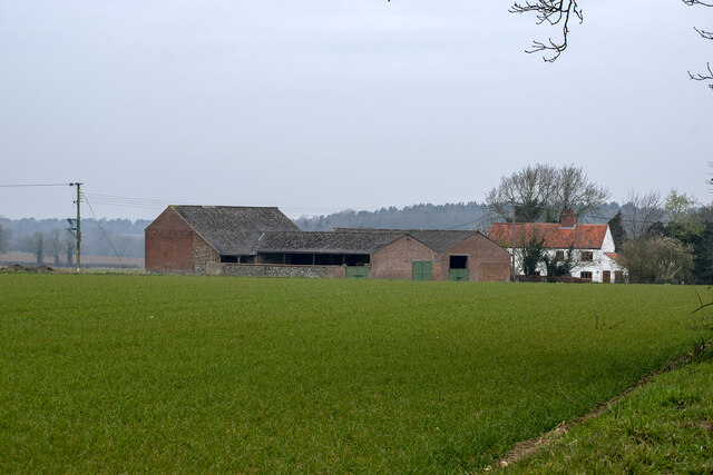
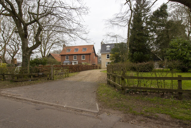
Images are sourced within 2km of 52.714814/1.0388171 or Grid Reference TG0517. Thanks to Geograph Open Source API. All images are credited.

Low Farm Vernacular farm buildings at Low Farm
Low Farm
Vernacular farm buildings at Low Farm
Three Bridges Farm Entrance to Three Bridges Farm
Three Bridges Farm
Entrance to Three Bridges Farm
Houses in Lyng Houses off Elsing Road
Houses in Lyng
Houses off Elsing Road
Elsing Lodge Plantation Wall by Elsing Lodge Plantation
Elsing Lodge Plantation
Wall by Elsing Lodge Plantation
Elsing Hall: The moat
Elsing Hall: Northern aspect
Elsing Hall and Gardens: Greenhouse with peonies within a box surround
Elsing Hall and Gardens: Blossom of the Judas Tree (Cercis siliquestrum)
Elsing Hall and Gardens: Water pump
Elsing Hall and Gardens: The moat
Elsing Hall and Gardens: An avenue of hornbeam trees
Elsing Hall and Gardens: Topiary Garden
Elsing Hall and Gardens: Water supply for the moat
Elsing Hall and Gardens: Mexican fleabane 'Erigeron karvinskianus'
Elsing Hall and Gardens: Garden sculpture
Elsing Hall and Gardens: The moat
Show me another place!

Beech Walk is located at Grid Ref: TG0517 (Lat: 52.714814, Lng: 1.0388171)

Administrative County: Norfolk

District: Breckland

Police Authority: Norfolk

What 3 Words

///announce.proudest.sublime. Near Mattishall, Norfolk

Related Wikis

Elsing

Elsing is a village and civil parish in the English county of Norfolk. The village is located 4.2 miles (6.8 km) north-east of Dereham and 12 miles (19...

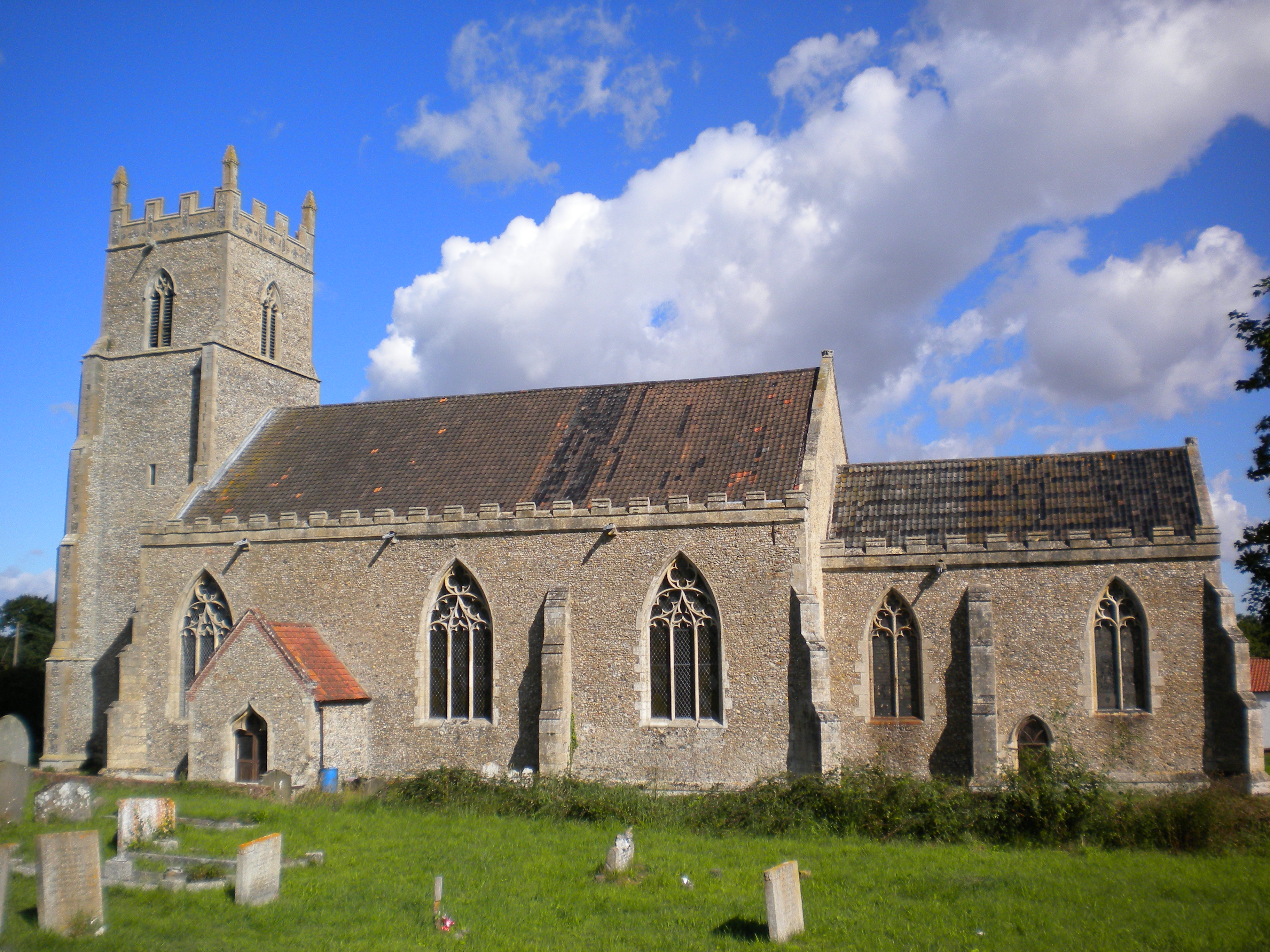
St Mary's Church, Elsing

St Mary's is an Anglican parish church in Elsing, a small village and civil parish in the Breckland district of Norfolk, England. The 14th-century church...

Lyng, Norfolk

Lyng is a village and civil parish in the English county of Norfolk. It is situated on the River Wensum, some 10 km (6.2 mi) north-east of the town of...

Sparham Pools

Sparham Pools is a 12.2-hectare (30-acre) nature reserve south of Sparham in Norfolk. It is leased and managed by the Norfolk Wildlife Trust.These former...
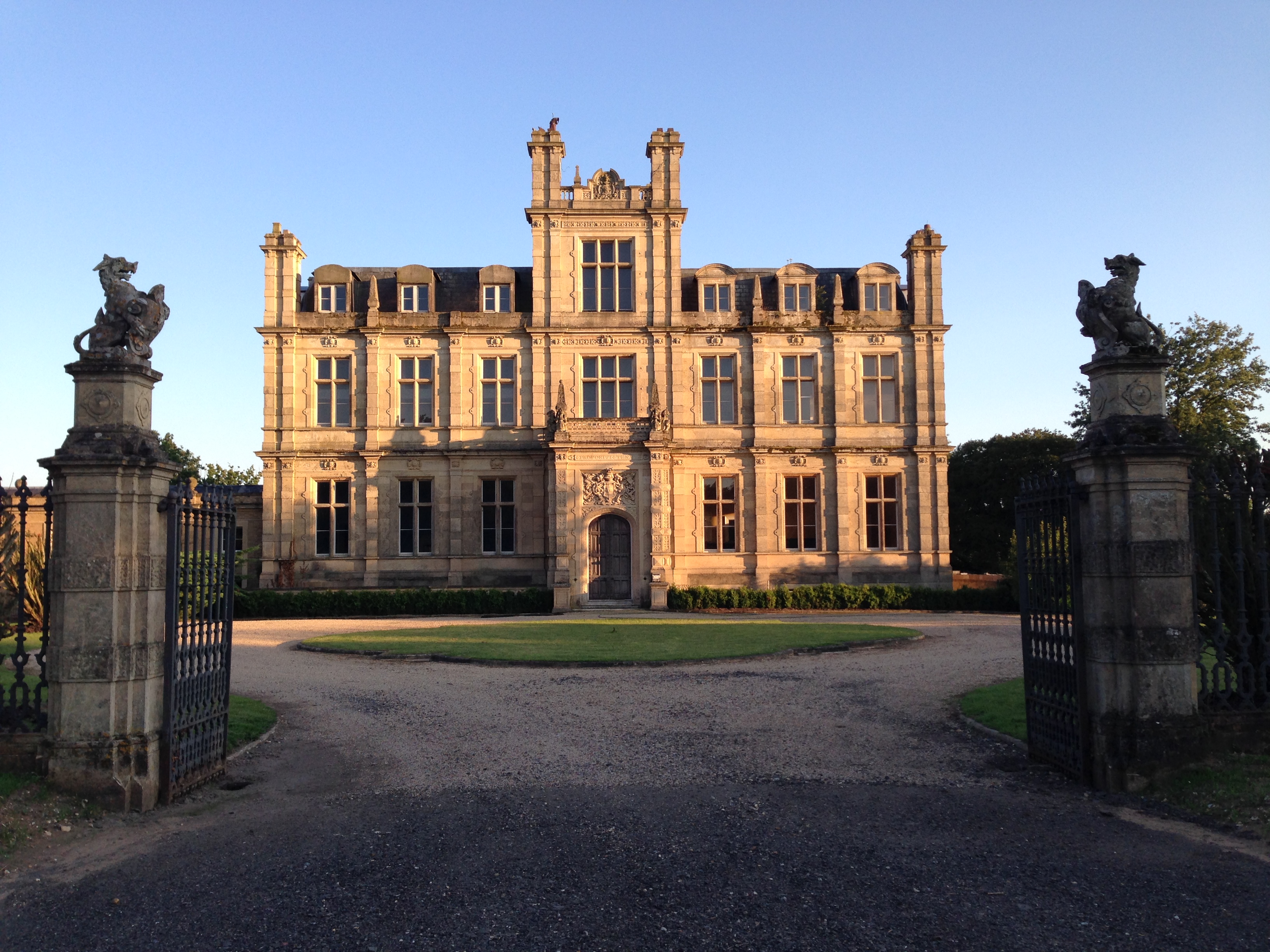
Bylaugh Hall

Bylaugh Hall, also known as Bylaugh Park, is a country house situated in the parish of Bylaugh in Norfolk, England. == History == The estate was acquired...

Bylaugh

Bylaugh is a civil parish in Norfolk, England 4.5 miles (7.2 km) north-east of East Dereham and 13.5 miles (21.7 km) WNW of Norwich. For the purposes...

A1067 road

The A1067 is an English A road entirely in the county of Norfolk. It runs from Fakenham Northern By-Pass (A148) to Norwich inner ring road (A147). �...

Sparham

Sparham is a village and civil parish in Norfolk, England. It covers an area of 7.22 km2 (2.79 sq mi) and had a population of 291 in 109 households at...

Nearby Amenities

Located within 500m of 52.714814,1.0388171
Heath Road, adj
Naptan AtcoCode: 2900E081
Naptan Bearing: S
Naptan BusStopType: CUS
Naptan CommonName: Heath Road
Naptan Indicator: adj
Naptan Locality: Elsing
Naptan NaptanCode: nfoapdgp
Naptan Street: Rectory Road
Naptan Verified: no
Source: naptan_import
Lat/Long: 52.71139/1.0381042
Heath Road, opp
Alt Name: Elsing- Village opp Lyng Turn
Naptan AltCommonName: Elsing- Village opp Lyng Turn
Naptan AtcoCode: 2900E084
Naptan Bearing: N
Naptan BusStopType: CUS
Naptan CommonName: Heath Road
Naptan Indicator: opp
Naptan Locality: Elsing
Naptan NaptanCode: nfoapdja
Naptan Street: Rectory Road
Naptan Verified: no
Source: naptan_import
Lat/Long: 52.7114869/1.0378296
Bus Stop
Elsing Road, adj
Naptan AtcoCode: 2900E087
Naptan Bearing: E
Naptan BusStopType: CUS
Naptan CommonName: Elsing Road
Naptan Indicator: adj
Naptan Locality: Elsing
Naptan NaptanCode: nfogpgda
Naptan Street: Mill Street
Naptan Verified: no
Source: naptan_import
Lat/Long: 52.7185143/1.0359338
Bus Stop
Mill Street, adj
Naptan AtcoCode: 2900E088
Naptan Bearing: W
Naptan BusStopType: CUS
Naptan CommonName: Mill Street
Naptan Indicator: adj
Naptan Locality: Elsing
Naptan NaptanCode: nfogpgaw
Naptan Street: Mill Street
Naptan Verified: no
Source: naptan_import
Lat/Long: 52.7184331/1.035943
Elsing
Place: village
Source: OS_OpenData _StreetView
Website: https://sites.google.com/site/elsingvillagehall/home
Wikidata: Q1971997
Wikipedia: en:Elsing
Lat/Long: 52.7103929/1.0389018
Post Box
Collection Times: Mo-Fr 09:00; Sa 07:00
Post Box Type: wall
Ref: NR20 2009D
Royal Cypher: EVIIR
Royal Cypher Wikidata: Q33102324
Lat/Long: 52.7115371/1.0378361
Post Box
Collection Times: Mo-Fr 16:45; Sa 09:30
Post Box Type: wall
Ref: NR20 2011
Royal Cypher: VR
Royal Cypher Wikidata: Q33102356
Lat/Long: 52.7184572/1.0354168
Power: pole
Lat/Long: 52.7145575/1.0327806
Power: pole
Lat/Long: 52.7150921/1.0342505
Power: pole
Lat/Long: 52.7158086/1.0357981
Power: pole
Lat/Long: 52.7166332/1.0374946
Power: pole
Lat/Long: 52.7174366/1.0391964
Power: pole
Lat/Long: 52.7182196/1.0407175
Defibrillator
Access: yes
Booth: K6
Colour: red
Covered: booth
Defibrillator Location: Inside the Red Phone Box
Disused Amenity: telephone
Emergency: defibrillator
Man Made: telephone_box
Opening Hours: 24/7
Operator: Elsing Parish Council
Wheelchair: no
Lat/Long: 52.7118329/1.0378707
Give Way
Lat/Long: 52.7185138/1.0353421
Telephone
Booth: K6
Covered: booth
Man Made: telephone_box
Lat/Long: 52.7183991/1.0358732
The data included in this document is from www.openstreetmap.org. The data is made available under ODbL.

Have you been to Beech Walk?

Leave your review of Beech Walk below (or comments, questions and feedback).