Foston

Settlement in Lincolnshire South Kesteven

England

Foston

Stonepit Lane A bridleway, part of the Viking Way.
Stonepit Lane Credit: Jonathan Thacker

Foston is a small village located in the county of Lincolnshire, England. Situated approximately 8 miles southwest of the city of Lincoln, Foston is part of the South Kesteven district. The village is surrounded by picturesque countryside, offering residents and visitors a peaceful and idyllic setting.

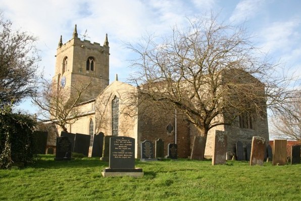
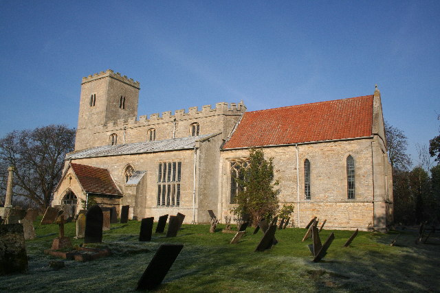
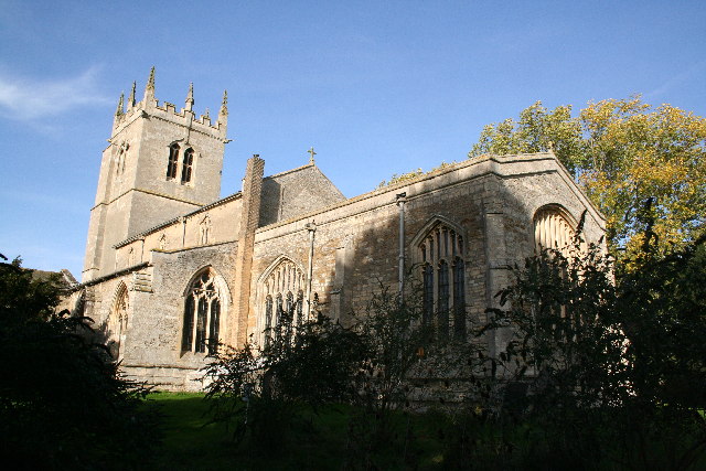
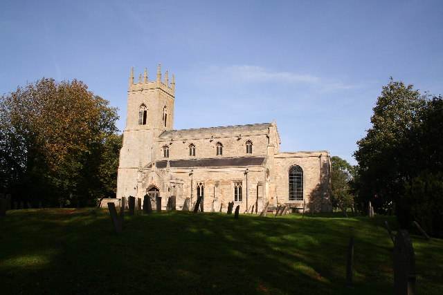
Foston itself is a close-knit community with a population of around 400 people. It has a rich history, dating back to medieval times, and is known for its charming traditional architecture. The village features a mix of stone and brick buildings, including quaint cottages and a beautiful 13th-century church, St. Bartholomew's.

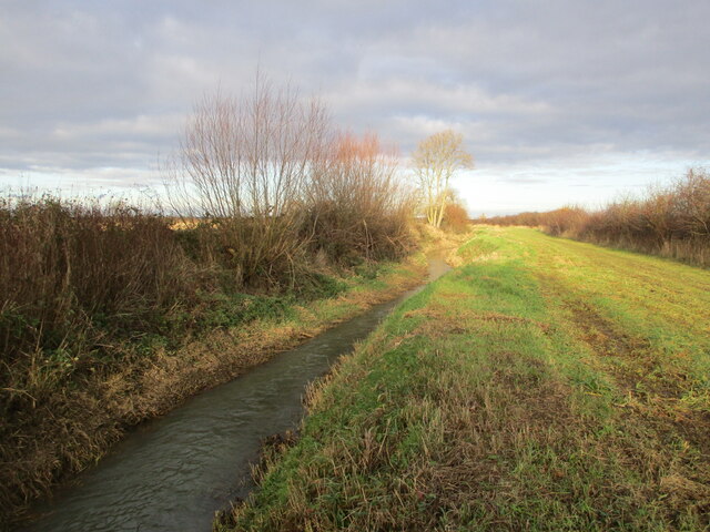
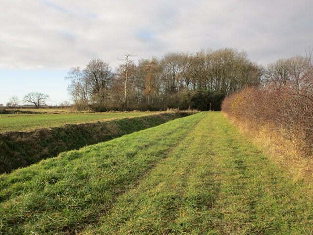
The local economy is primarily driven by agriculture, with farming being the main industry in the area. The fertile soil of the surrounding farmlands supports the growth of crops such as wheat, barley, and vegetables. This agricultural heritage is still visible today, with several working farms scattered throughout the village and the surrounding countryside.

Foston offers limited amenities, including a village hall, a primary school, and a local pub, providing a central gathering place for residents to socialize. The village is well-connected to nearby towns and cities via road links, making it easily accessible for commuters and visitors alike.

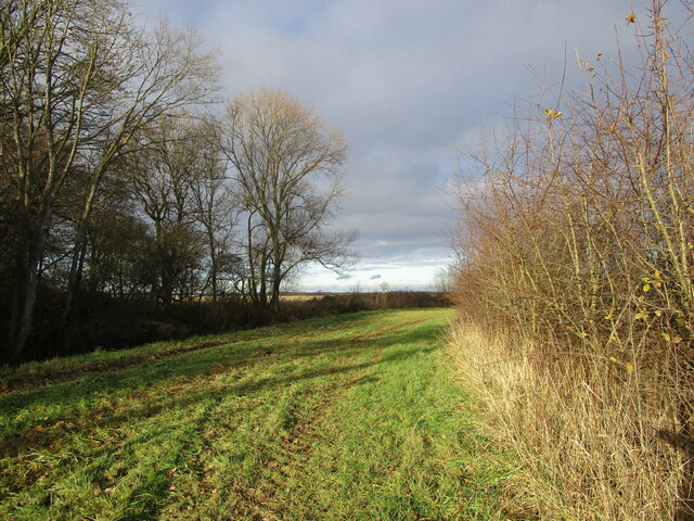
For those seeking recreational activities, Foston benefits from its proximity to the Lincolnshire Wolds, an Area of Outstanding Natural Beauty. This offers opportunities for outdoor pursuits such as hiking, cycling, and wildlife spotting, making Foston an attractive destination for nature enthusiasts.

In conclusion, Foston is a charming and historic village, nestled in the beautiful Lincolnshire countryside. Its strong sense of community, picturesque surroundings, and agricultural heritage make it an appealing place to live or visit.

If you have any feedback on the listing, please let us know in the comments section below.

Foston Images

Images are sourced within 2km of 52.976382/-0.72241206 or Grid Reference SK8542. Thanks to Geograph Open Source API. All images are credited.

Stonepit Lane A bridleway, part of the Viking Way.
Stonepit Lane
A bridleway, part of the Viking Way.
Bridleway alongside Foston Beck
Bridleway and Foston Beck
Bridleway approaching Foston Beck Foston Beck crosses the picture in front of the small wooded area.
Bridleway approaching Foston Beck
Foston Beck crosses the picture in front of the small wooded area.
Renard, Foston Two caottages now one house <span class="nowrap"><a title="https://historicengland.org.uk/listing/the-list/list-entry/1360063?section=official-list-entry" rel="nofollow ugc noopener" href="https://historicengland.org.uk/listing/the-list/list-entry/1360063?section=official-list-entry">Link</a><img style="margin-left:2px;" alt="External link" title="External link - shift click to open in new window" src="https://s1.geograph.org.uk/img/external.png" width="10" height="10"/></span>
Renard, Foston
Two caottages now one house LinkExternal link
The Old Hall, Foston Dated 1647 but altered <span class="nowrap"><a title="https://historicengland.org.uk/listing/the-list/list-entry/1062878?section=official-list-entry" rel="nofollow ugc noopener" href="https://historicengland.org.uk/listing/the-list/list-entry/1062878?section=official-list-entry">Link</a><img style="margin-left:2px;" alt="External link" title="External link - shift click to open in new window" src="https://s1.geograph.org.uk/img/external.png" width="10" height="10"/></span>
The Old Hall, Foston
Dated 1647 but altered LinkExternal link
Footpath to Westborough Across a succession of muddy fields.
Footpath to Westborough
Across a succession of muddy fields.
Development in Church Street, Foston
Foston Village Hall
Foston Village Hall
Bridleway to Marston Part of the Viking Way.
Bridleway to Marston
Part of the Viking Way.
Autumn sown crop and farm buildings at The Deauvilles
Autumn sown crop between Foston and Westborough
Hedge between two fields off Fallow Lane
Farm buildings at The Deauvilles
The Malting House A building of two ages but three types of stone.
The Malting House
A building of two ages but three types of stone.
Cottages, Goosegate Lane, Foston
Top Farm, Foston Large house in a sort of Neo Queen Anne style.
Top Farm, Foston
Large house in a sort of Neo Queen Anne style.
Chapel Lane, Foston A private farm road but also a permissive footpath.
Chapel Lane, Foston
A private farm road but also a permissive footpath.
Show me another place!

Foston is located at Grid Ref: SK8542 (Lat: 52.976382, Lng: -0.72241206)

Division: Parts of Kesteven

Administrative County: Lincolnshire

District: South Kesteven

Police Authority: Lincolnshire

What 3 Words

///together.reason.comforted. Near Long Bennington, Lincolnshire

Nearby Locations

Foston

Related Wikis

Foston, Lincolnshire

Foston is a village and a civil parish in the South Kesteven district of Lincolnshire, England. The village is situated 5 miles (8 km) northwest of Grantham...

Long Bennington Priory

Long Bennington Priory was a priory in Lincolnshire, England. The church at Long Bennington was granted by Ralf de Fougères, to the Cistercian abbey of...

East Midlands

The East Midlands is one of nine official regions of England at the first level of ITL for statistical purposes. It comprises the eastern half of the area...

Westborough, Lincolnshire

Westborough is a village in the South Kesteven district of Lincolnshire, England. It is situated 1 mile (1.6 km) east from the A1 road and Long Bennington...

Allington, Lincolnshire

Allington is a village and civil parish in the South Kesteven district of Lincolnshire, England, 3 miles (5 km) north-west of Grantham. The 2001 census...

Long Bennington

Long Bennington is a linear village and civil parish in South Kesteven district of Lincolnshire, England, just off the A1 road, 7 miles (11 km) north of...

Hougham, Lincolnshire

Hougham () is a village and civil parish in the South Kesteven district of Lincolnshire, England, 6 miles (10 km) north from Grantham. The village of Marston...

Marston, Lincolnshire

Marston is a village and civil parish in the South Kesteven district of Lincolnshire, England. The population of the civil parish at the 2011 census was...

Nearby Amenities

Located within 500m of 52.976382,-0.72241206
Foston
Is In: Lincolnshire, England, UK
Place: village
Source: NPE
Lat/Long: 52.9766063/-0.7229387
Fuel
MRH Retail Foston
Addr Postcode: NG32 2LD
Addr Street: A1 North Bound
Addr Town: Foston, Grantham
Brand: JET
Brand Wikidata: Q568940
Operator: Malthurst Petroleum
Phone: +44 1400 283800
Lat/Long: 52.9723268/-0.7242729
Crossing
Crossing: unmarked
Crossing Island: no
Crossing Markings: no
Tactile Paving: no
Lat/Long: 52.9720209/-0.7222002
Bus Stop
Chapel Lane
Bus: yes
Naptan AtcoCode: 270000008560
Naptan Bearing: N
Naptan CommonName: Chapel Lane
Naptan Indicator: N - bound
Naptan Landmark: Chapel Lane
Naptan NaptanCode: lingtgma
Naptan Street: Main Street
Naptan Verified: no
Public Transport: platform
Source: naptan_import
Lat/Long: 52.9759195/-0.7233542
Bus Stop
Chapel Lane
Bench: no
Bus: yes
Covered: no
Naptan AtcoCode: 2700LF002334
Naptan Bearing: S
Naptan CommonName: Chapel Lane
Naptan Indicator: S - bound
Naptan Landmark: Chapel Lane
Naptan NaptanCode: linaptmw
Naptan Street: Main Street
Naptan Verified: no
Public Transport: platform
Shelter: no
Source: naptan_import
Lat/Long: 52.9761235/-0.723095
Source: OS_OpenData_StreetView
Tourism: caravan_site
Lat/Long: 52.9766008/-0.7269315
Material: wood
Power: pole
Lat/Long: 52.97296/-0.7268409
Applethorns Farm
Place: farm
Source: Bing
Lat/Long: 52.9804384/-0.7192635
Church Farm
Place: farm
Source: Bing
Lat/Long: 52.9776188/-0.7236209
Coach House Farm
Place: farm
Source: Bing
Lat/Long: 52.9786966/-0.7189019
Goose Gate Farm
Place: farm
Source: Bing
Lat/Long: 52.9778365/-0.7186487
Highfield Farm
Place: farm
Source: Bing
Lat/Long: 52.9795675/-0.720728
Manor House Farm
Place: farm
Source: Bing
Lat/Long: 52.9736014/-0.7233859
Top Farm
Place: farm
Source: Bing
Lat/Long: 52.9772378/-0.719824
Power: pole
Lat/Long: 52.9769357/-0.7261866
Material: wood
Power: pole
Lat/Long: 52.9738403/-0.7271522
Power: pole
Lat/Long: 52.9744557/-0.7274044
Power: pole
Lat/Long: 52.9751001/-0.7271066
Power: pole
Lat/Long: 52.9759295/-0.7267271
Material: wood
Power: pole
Lat/Long: 52.9774937/-0.7274982
Material: wood
Power: pole
Lat/Long: 52.9782681/-0.72826
Crossing
Crossing: unmarked
Crossing Island: no
Crossing Markings: no
Tactile Paving: no
Lat/Long: 52.9720855/-0.7221677
Crossing
Crossing: unmarked
Crossing Island: no
Crossing Markings: no
Tactile Paving: no
Lat/Long: 52.9720219/-0.722654
Generator Method: photovoltaic
Generator Output Electricity: yes
Generator Source: solar
Generator Type: solar_photovoltaic_panel
Location: roof
Power: generator
Lat/Long: 52.9798712/-0.7201852
Generator Method: photovoltaic
Generator Output Electricity: yes
Generator Source: solar
Generator Type: solar_photovoltaic_panel
Location: roof
Power: generator
Lat/Long: 52.9779817/-0.7210542
Generator Method: photovoltaic
Generator Output Electricity: yes
Generator Source: solar
Generator Type: solar_photovoltaic_panel
Location: roof
Power: generator
Lat/Long: 52.9781965/-0.72217
Generator Method: photovoltaic
Generator Output Electricity: yes
Generator Source: solar
Generator Type: solar_photovoltaic_panel
Location: roof
Power: generator
Lat/Long: 52.9786713/-0.7218026
Generator Method: photovoltaic
Generator Output Electricity: yes
Generator Source: solar
Generator Type: solar_photovoltaic_panel
Location: roof
Power: generator
Lat/Long: 52.9764248/-0.7246457
Generator Method: photovoltaic
Generator Output Electricity: yes
Generator Source: solar
Generator Type: solar_photovoltaic_panel
Location: roof
Power: generator
Lat/Long: 52.9760097/-0.7199009
Generator Method: photovoltaic
Generator Output Electricity: yes
Generator Source: solar
Generator Type: solar_photovoltaic_panel
Location: roof
Power: generator
Lat/Long: 52.9764829/-0.7208531
Telephone
Defibrillator
Booth: KX300
Covered: booth
Defibrillator Location: inside phone box, Main Street, Foaton
Emergency: defibrillator
Man Made: telephone_box
Lat/Long: 52.9755176/-0.7233884
Post Box
Post Box Type: pillar
Royal Cypher: EIIR
Royal Cypher Wikidata: Q33102113
Lat/Long: 52.975499/-0.7234166
Advertising: board
Lat/Long: 52.9754744/-0.7234287
Foston Service Station
Addr City: Foston
Addr Postcode: NG32 2JS
Addr Street: Great North Road
Brand: Londis
Brand Wikidata: Q21008564
Fhrs Authority: South Kesteven
Fhrs Id: 237616
Fhrs Local Authority Id: 4572
Operator: Motor Fuel Group
Operator Website: https://www.motorfuelgroup.com/locations/foston-fs852/
Operator Wikidata: Q107271358
Shop: convenience
Lat/Long: 52.9723228/-0.7244137
The data included in this document is from www.openstreetmap.org. The data is made available under ODbL.

Have you been to Foston?

Leave your review of Foston below (or comments, questions and feedback).