Ash Plantation

Wood, Forest in Suffolk Mid Suffolk

England

Ash Plantation

Avenue, Harleston Green
Avenue, Harleston Green Credit: Jonathan Thacker

Ash Plantation is a picturesque woodland located in Suffolk, England. Covering an area of approximately 100 acres, it is known for its lush greenery and diverse range of tree species. The plantation primarily consists of ash trees, which give it its name, but also includes oak, beech, and birch trees, adding to the beauty and variety of the forest.

The woodland is a popular destination for nature enthusiasts and hikers, offering a tranquil escape from the hustle and bustle of everyday life. The well-maintained paths and trails allow visitors to explore the plantation at their own pace, immersing themselves in the serene surroundings. The peaceful atmosphere is enhanced by the sounds of birdsong and the occasional rustle of leaves as wildlife roam freely throughout the area.

The plantation is also home to a rich array of flora and fauna. Wildflowers such as bluebells and primroses bloom in the spring, creating a colorful carpet on the forest floor. Various species of birds, including woodpeckers and owls, can be spotted among the branches, while squirrels and rabbits dart through the undergrowth.

Ash Plantation is not only a haven for nature lovers but also serves as an important ecological site. It acts as a habitat for numerous species, contributing to the biodiversity of the region. The trees also play a vital role in carbon sequestration, helping to combat climate change.

Overall, Ash Plantation offers a serene and enchanting woodland experience, providing visitors with a chance to connect with nature and appreciate the beauty of Suffolk's countryside.

If you have any feedback on the listing, please let us know in the comments section below.

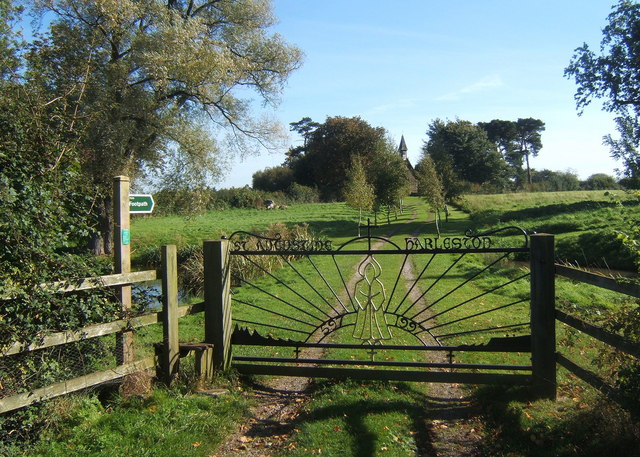
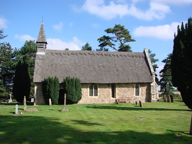
Ash Plantation Images

Images are sourced within 2km of 52.18944/0.95876637 or Grid Reference TM0258. Thanks to Geograph Open Source API. All images are credited.

Avenue, Harleston Green
Harleston Green
Harleston Green
St Augustine's, Harleston St Augustine's is a quaint Church located on a small hill some distance from the Village of Harleston. The Church clearly has been a family Church as there is still a mown path through the grass fields from the Church to Harleston Hall a couple of hundred yards away. 

The approach to the Church is along a picturesque gravelled driveway for a couple of hundred yards up a small slope. The bottom of the Drive is surrounded by a couple of pleasant ponds.
St Augustine's, Harleston
St Augustine's is a quaint Church located on a small hill some distance from the Village of Harleston. The Church clearly has been a family Church as there is still a mown path through the grass fields from the Church to Harleston Hall a couple of hundred yards away. The approach to the Church is along a picturesque gravelled driveway for a couple of hundred yards up a small slope. The bottom of the Drive is surrounded by a couple of pleasant ponds.
Haughley Road north of Harleston
Gateway to St Augustine's Church, Harleston The church is among the trees some distance from the lane.
Gateway to St Augustine's Church, Harleston
The church is among the trees some distance from the lane.
Stile and gateway for track to Harleston Church There are ponds either side of the track at the start.  The whole approach to the church is most attractive.
Stile and gateway for track to Harleston Church
There are ponds either side of the track at the start. The whole approach to the church is most attractive.
Track towards the lane from Harleston Church Birch trees have been planted.
Track towards the lane from Harleston Church
Birch trees have been planted.
St Augustine's Church, Harleston A lovely little thatched church in a fine setting.
St Augustine's Church, Harleston
A lovely little thatched church in a fine setting.
Churchyard at Harleston With the east end of the church in view.
Churchyard at Harleston
With the east end of the church in view.
Footpath towards Harleston Church A wide green path between high hedges.
Footpath towards Harleston Church
A wide green path between high hedges.
Village scene, Harleston This corner marks the end of Forest Road, with Haughley Road curving right.  There is a left turn for Cutlers Lane.
Village scene, Harleston
This corner marks the end of Forest Road, with Haughley Road curving right. There is a left turn for Cutlers Lane.
Haughley Road towards Harleston The church is by the pine trees in the left background.
Haughley Road towards Harleston
The church is by the pine trees in the left background.
Winter view south from new roundabout Snowy fields near the western edge of Stowmarket from the new junction on the A14.
Winter view south from new roundabout
Snowy fields near the western edge of Stowmarket from the new junction on the A14.
Country view from the new junction Looking across the open fields towards Northfield Wood in the next square. The double fence line suggests a new path has been created.  Seen on a day with plenty of lying snow.
Country view from the new junction
Looking across the open fields towards Northfield Wood in the next square. The double fence line suggests a new path has been created. Seen on a day with plenty of lying snow.
Harleston St Augustine’s church This is the image of what most small Norman parish churches must have looked like when they were first built. Thatched and towerless with, perhaps, a bellcote atop the apex of the roof. The windows however would have been much smaller or even non-existent. The plain Norman doorway is shielded by a pair of Irish yew trees growing far too close to the wall. It wouldn’t surprise me to find the nave floor being pushed upwards by the roots next time I visit. On the north wall, another Norman door has been filled in. Inside the nave, the screen is 14th c. and is typical of the period. Most of the remaining interior features are Victorian, including the lovely carved angels, looking just like fairies.
Harleston St Augustine’s church
This is the image of what most small Norman parish churches must have looked like when they were first built. Thatched and towerless with, perhaps, a bellcote atop the apex of the roof. The windows however would have been much smaller or even non-existent. The plain Norman doorway is shielded by a pair of Irish yew trees growing far too close to the wall. It wouldn’t surprise me to find the nave floor being pushed upwards by the roots next time I visit. On the north wall, another Norman door has been filled in. Inside the nave, the screen is 14th c. and is typical of the period. Most of the remaining interior features are Victorian, including the lovely carved angels, looking just like fairies.
The Old Vicarage, Great Finborough
Houses on Onehouse Road
Onehouse Road heading west
Show me another place!

Ash Plantation is located at Grid Ref: TM0258 (Lat: 52.18944, Lng: 0.95876637)

Administrative County: Suffolk

District: Mid Suffolk

Police Authority: Suffolk

What 3 Words

///apples.lines.truckload. Near Stowmarket, Suffolk

Related Wikis

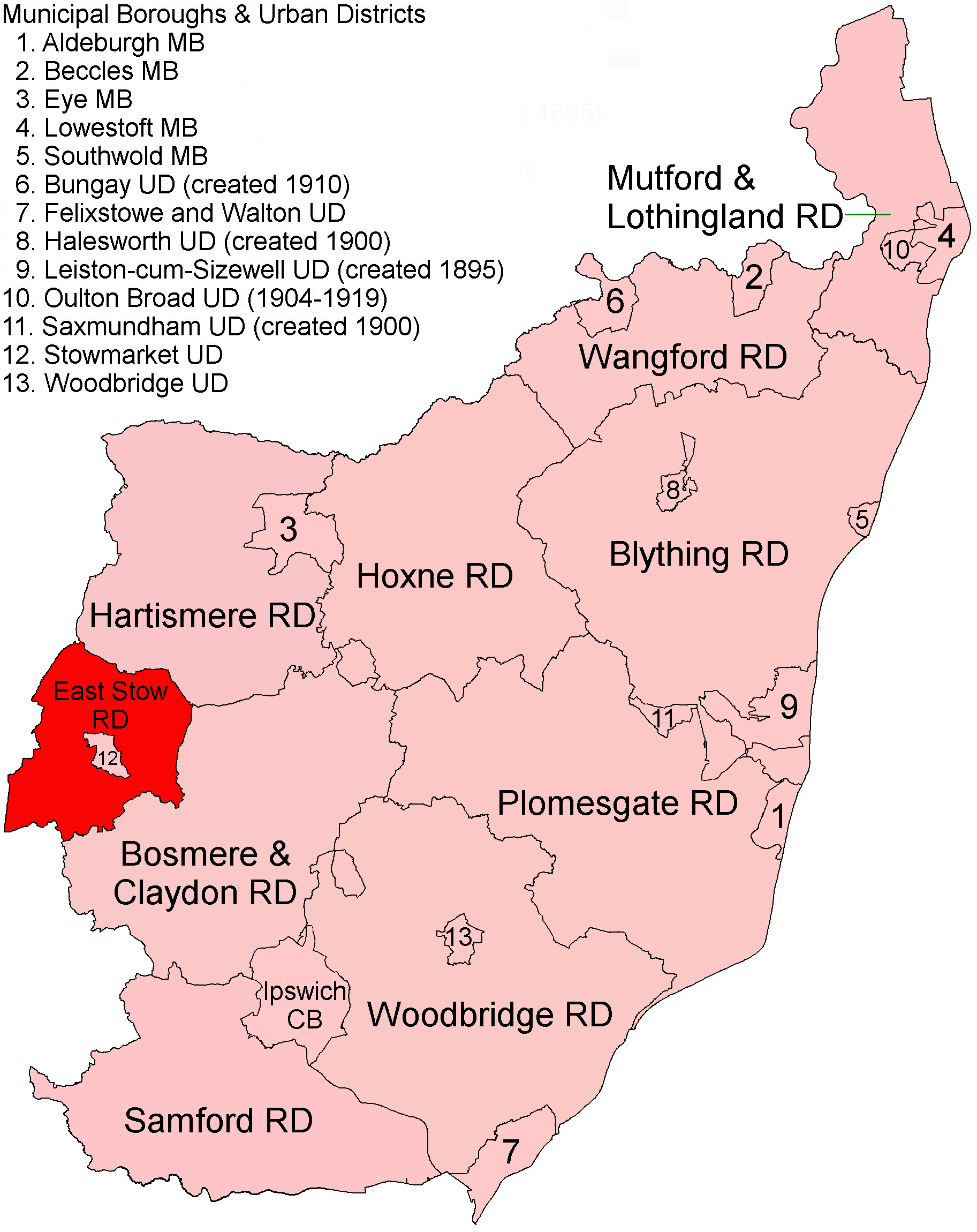
East Stow Rural District

East Stow was a rural district in East Suffolk, England from 1894 to 1934. It was created under the Local Government Act 1894, from the part of the Stow...

Onehouse

Onehouse is a small village in the English county of Suffolk, about 3 miles west from the centre of Stowmarket near to the Golf Club. The population of...

Finborough School

Finborough School is a co-educational independent school. It is situated in and around Finborough Hall, in the village of Great Finborough, near Stowmarket...

Finborough Hall

Finborough Hall is a Grade II listed stucco-faced Tuscan-style country house in Great Finborough, Suffolk, England. The grounds were originally purchased...

Nearby Amenities

Located within 500m of 52.18944,0.95876637
Shepherd and Dog
Naptan AtcoCode: 390040703
Naptan Bearing: NE
Naptan BusStopType: CUS
Naptan CommonName: Shepherd and Dog
Naptan Indicator: o/s
Naptan Landmark: Shepherd and Dog
Naptan NaptanCode: sufgatmj
Naptan Street: Finborough Road
Naptan Verified: no
Source: naptan_import
Lat/Long: 52.189149/0.9637899
Shepherd and Dog
Naptan AtcoCode: 390040704
Naptan Bearing: S
Naptan BusStopType: CUS
Naptan CommonName: Shepherd and Dog
Naptan Indicator: opp
Naptan Landmark: Shepherd and Dog
Naptan NaptanCode: sufgatmp
Naptan Street: Finborough Road
Naptan Verified: no
Source: naptan_import
Lat/Long: 52.1890279/0.9639574
Power: pole
Lat/Long: 52.1929317/0.9631578
Noexit: yes
Lat/Long: 52.1897421/0.9613481
Noexit: yes
Lat/Long: 52.1886702/0.9632925
Turning Circle
Lat/Long: 52.1891157/0.9631504
Noexit: yes
Lat/Long: 52.1897307/0.9633697
The data included in this document is from www.openstreetmap.org. The data is made available under ODbL.

Have you been to Ash Plantation?

Leave your review of Ash Plantation below (or comments, questions and feedback).