Haberdashers' Wood
Wood, Forest in Kent Ashford
England
Haberdashers' Wood

Haberdashers' Wood, located in Kent, is a picturesque woodland area known for its natural beauty and rich biodiversity. Spanning over a vast area, this forest is a popular destination for nature enthusiasts and hikers alike.
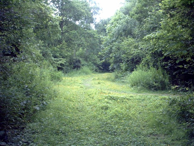
The woodland is characterized by its dense canopy of towering oak, beech, and ash trees that provide a haven for various species of birds, mammals, and insects. The forest floor is adorned with a diverse array of wildflowers, ferns, and mosses, creating a vibrant and colorful landscape throughout the year.
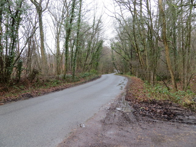
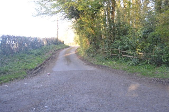
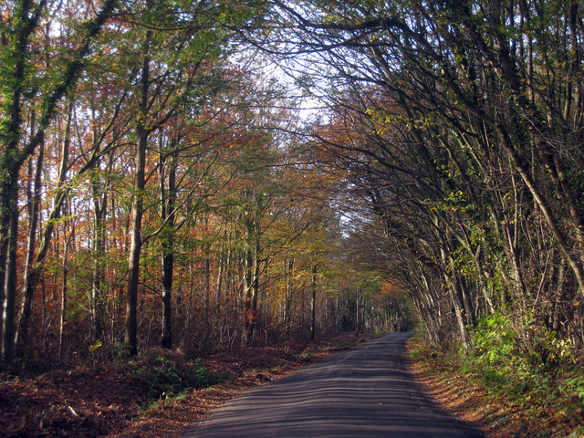
Haberdashers' Wood offers numerous walking trails and paths that wind through its enchanting surroundings. These trails provide visitors with opportunities to explore the forest's hidden gems, including secluded ponds, ancient ruins, and stunning viewpoints.
The woodland is home to a rich variety of wildlife, including deer, foxes, badgers, and a myriad of bird species. It is not uncommon to spot woodpeckers, owls, and songbirds while exploring the forest. Additionally, the woodland is a haven for butterflies, bees, and other pollinators, making it an important ecological hub.
Haberdashers' Wood is well-maintained, with designated picnic areas and benches scattered throughout, allowing visitors to relax and enjoy the serene atmosphere. The forest is also known for its educational programs and nature workshops, which aim to foster environmental awareness and appreciation.
Overall, Haberdashers' Wood is a must-visit destination for nature lovers seeking tranquility and an opportunity to immerse themselves in the beauty of Kent's natural landscapes.
If you have any feedback on the listing, please let us know in the comments section below.
Haberdashers' Wood Images
Images are sourced within 2km of 51.083951/0.85726472 or Grid Reference TR0035. Thanks to Geograph Open Source API. All images are credited.


Haberdashers' Wood is located at Grid Ref: TR0035 (Lat: 51.083951, Lng: 0.85726472)
Administrative County: Kent
District: Ashford
Police Authority: Kent
What 3 Words
///button.freshest.picnic. Near Shadoxhurst, Kent
Nearby Locations
Related Wikis

Bromley Green
Bromley Green is a hamlet near Ashford in Kent, England.
Ham Street Woods
Ham Street Woods is a 175.2-hectare (433-acre) biological Site of Special Scientific Interest south of Ashford in Kent. It is a Nature Conservation Review...

Ham Street railway station
Ham Street railway station is a Grade II listed stop on the Marshlink line in the village of Hamstreet, Kent, between Ashford International and Hastings...
Orlestone Forest
Orlestone Forest is a 347.6-hectare (859-acre) biological Site of Special Scientific Interest south of Ashford in Kent. It is a Nature Conservation Review...
Orlestone
Orlestone is a mid-sized civil parish in Ashford District, Kent, England, with a population of 1,407. The centre of the parish is Hamstreet village which...

Hamstreet
Hamstreet is a village in Kent, in South East England. The village is located 6 miles (10 km) south of Ashford on the A2070, the main road between Ashford...
Ruckinge
Ruckinge is a village and civil parish in south Kent centred 5.5 miles (8.9 km) south of Ashford on the B2067 Hamstreet to Hythe road, with two settled...
Ashford United F.C.
Ashford United F.C. are an English football club based in Ashford, Kent. The 'new' United was formed in 2011, resurrecting the name used by the town's...
Related Videos

15s Travel English Woodlands👀 Hiking Through The Local Reserve #ytshorts #livingabroad #hiking
Expat American is living is a small village in South East England. Husband took her on a walk. Here is a glimpse at some beautiful ...

The end of the Greensand Way - Matt's Walks - Ep.9
Some of you will know that I have done part of the Greensand Way in Surrey with Richard Vobes, the Bald Explorer - latest video ...

Moving to England 🇺🇸🏴Living A Brit Life🏡Our New Home! #ytshorts #villagelife #expat
Take a look at the new Village we are currently living in while we get settled in England since our move from the United States.

thomas Smith cyclone
thomas Smith cyclone one of the oldest twisters on the UK 1 of 3 in the UK to be visiting isle of sheppey.
Nearby Amenities
Located within 500m of 51.083951,0.85726472Have you been to Haberdashers' Wood?
Leave your review of Haberdashers' Wood below (or comments, questions and feedback).